The Unseen Origins of Ocean's Fury: A Deep Dive into Aseismic Tsunami Generation
The world often associates the terrifying power of a tsunami with the violent shaking of a massive earthquake. This archetypal image, of the seafloor rupturing and displacing colossal volumes of water, is indeed the most common trigger for these destructive waves. Yet, the ocean holds other, more cryptic mechanisms for unleashing tsunamis—sources that are not born from the tell-tale seismic waves of a rupturing fault. These are the aseismic tsunamis, generated by forces that are often hidden beneath the waves or in the very air above them. Understanding these phenomena is a critical frontier in ocean science, a field where marine geophysics provides the essential tools to probe the depths and uncover the mechanics of these silent, but no less deadly, maritime threats.
Marine geophysics is the discipline of exploring the solid earth beneath the oceans, using the principles of physics to map its structure, composition, and dynamic processes. It employs an array of sophisticated techniques—from sound waves that paint a picture of the seafloor and the sediments below, to precise measurements of gravity and magnetism that reveal the secrets of the oceanic crust. This powerful toolkit is indispensable for deciphering the origins of aseismic tsunamis, which are primarily generated by three distinct, yet sometimes interconnected, natural processes: catastrophic submarine landslides, explosive volcanic activity, and peculiar atmospheric events. By peeling back the layers of the ocean, both literally and figuratively, we can begin to comprehend the immense forces at play in the generation of these non-seismic waves.
When the Seafloor Gives Way: The Mechanics of Landslide-Generated Tsunamis
One of the most potent and hazardous sources of aseismic tsunamis is the submarine landslide. These events involve the failure and downslope movement of vast quantities of sediment and rock, displacing water on a scale capable of generating devastating waves. Unlike the sudden, widespread vertical lift of an earthquake, a landslide generates a tsunami through a more complex, dynamic interaction between the moving mass and the water column. The characteristics of the resulting tsunami are intimately linked to the properties of the landslide itself, including its volume, speed, acceleration, and the water depth in which it occurs.
The Birth of a Wave: From Slope Failure to Tsunami
The process begins when a segment of the seafloor becomes unstable. This instability can be preconditioned by several factors. Weak geological layers, often composed of soft, under-consolidated clays, can act as a sliding plane. Rapid sedimentation, particularly at the mouths of major rivers or along continental margins, can lead to the buildup of high pore pressure within the sediment layers, effectively reducing their shear strength and making them prone to failure. While these conditions can lead to spontaneous failure, an external trigger is often the final push. Earthquakes, even those not large enough to generate a significant seismic tsunami on their own, are a very common trigger for submarine landslides. The ground shaking can be enough to liquefy susceptible sediment layers or simply overcome the frictional resistance holding the slope in place.
Once failure occurs, the landslide mass begins to accelerate downslope. It is this movement that transfers energy to the overlying water. The process can be visualized in two main ways:
- Submarine Landslides: For a landslide that occurs entirely underwater, the moving mass acts like a piston, pushing water ahead of it and creating a depression in the water surface behind it. This creates an initial wave crest and trough. The initial acceleration and the maximum velocity of the slide are critical parameters; a faster, more rapidly accelerating landslide will transfer energy to the water more efficiently, creating a larger initial wave.
- Subaerial Landslides: In some of the most dramatic cases, a landslide can begin above sea level—a collapsing mountainside or coastal cliff, for example—and plunge into the water. This impact creates a powerful splash, displacing a massive amount of water in a very short time and generating an exceptionally large local tsunami.
The nature of the landslide material itself plays a crucial role. A coherent, solid block (a slump) will behave differently from a fluid, disintegrating debris flow. Softer, more fluid materials are more likely to travel long distances and evolve into other flow types like turbidity currents, while stiffer, more cohesive slides may travel shorter distances.
The Tale of Two Tsunamis: Near-Field vs. Far-Field Effects
A key distinction between landslide-generated tsunamis and their seismic counterparts is their propagation characteristics. Landslide tsunamis are notorious for producing extremely high waves in the immediate vicinity of the source—the near-field. However, they are generally characterized by shorter wavelengths compared to the basin-spanning waves of a great subduction zone earthquake.
This shorter wavelength means their energy tends to disperse more rapidly as they travel across the open ocean. Consequently, landslide tsunamis are often a more localized, though exceptionally intense, hazard. They may pose an extreme threat to nearby coastlines, arriving within minutes with little to no warning, but have a much more limited impact on distant shores.
Case Studies Engraved in the Landscape
Lituya Bay, Alaska (1958): A World Record WaveThe 1958 Lituya Bay event is a textbook example of a tsunami generated by a subaerial landslide with catastrophic local impact. On July 10, a magnitude 7.8 earthquake on the Fairweather Fault, located nearby, triggered a massive rockfall at the head of the bay. An estimated 90 million tons of rock plunged into the narrow inlet, generating a wave of almost unbelievable proportions. The water surged up the opposite headland to a staggering height of 524 meters (1,720 feet), scouring the hillside clean of all trees and soil. This remains the highest tsunami run-up ever recorded. Further down the bay, the main wave, still tens of meters high, sank two fishing boats, tragically killing two people. The Lituya Bay event is a stark reminder of the immense power of impact-generated tsunamis in confined geographic settings.
Papua New Guinea (1998): A Deadly Submarine SlumpThe 1998 Papua New Guinea (PNG) tsunami tragically shifted the scientific understanding of the hazard posed by submarine landslides. For years, the tsunamigenic potential of underwater slides was considered relatively minor. That changed on July 17, when a magnitude 7.0 earthquake occurred offshore of northern Papua New Guinea. The earthquake itself was not of a type or magnitude expected to generate a large tsunami. Yet, about 20 minutes later, a series of three devastating waves, with heights up to 15 meters, struck a 30-kilometer stretch of coastline, killing over 2,200 people.
Initial confusion over the tsunami's origin led to intensive post-event marine geophysical surveys. These surveys, using tools like multibeam bathymetry and seismic reflection, revealed the true culprit: a large submarine slump on the seabed that had been triggered by the earthquake. The data allowed scientists to model the tsunami's generation and propagation, confirming that the landslide, not the earthquake directly, was responsible for the deadly waves. The PNG event was a turning point, proving that submarine landslides could generate catastrophic, fatal tsunamis and highlighting the critical need to map and understand these offshore hazards.
The Storegga Slides, Norway (approx. 8,200 years ago): A Prehistoric Mega-EventOff the coast of Norway lies the scar of one of the largest submarine landslides ever discovered: the Storegga Slide. Occurring roughly 8,200 years ago, this series of massive slides involved an estimated 2,400 cubic kilometers of sediment. The collapse triggered a massive tsunami that left a distinct sedimentary layer across the North Atlantic, from the coasts of Norway and Scotland (where run-up heights are estimated to have reached 20 meters) to Greenland. Researchers studying the deposits from the Storegga tsunami have been able to reconstruct the event's scale and impact, providing a crucial analogue for understanding the potential hazard from other large-scale submarine landslides around the world.
Fire Meets Water: The Diverse Mechanisms of Volcanic Tsunamis
Volcanoes, particularly those in or near bodies of water, are another formidable source of aseismic tsunamis. Their eruptive power and inherent instability can displace water through a variety of dramatic and violent mechanisms. These volcanogenic tsunamis account for a significant percentage of all volcano-related fatalities and are characterized by their often sudden, unpredictable nature. The primary ways a volcano can generate a tsunami include the collapse of an unstable flank, the entry of pyroclastic flows into the sea, the explosive collapse of a caldera, and powerful underwater explosions.
When Mountains Fall: Flank Collapse Tsunamis
Many volcanic islands are inherently unstable structures, built up layer by layer from lava and loose pyroclastic material. The flanks of these volcanoes can become weakened over time by factors such as hydrothermal alteration, the intrusion of magma, or simply the pull of gravity on their steep slopes. The failure of a volcanic flank can result in a massive landslide, which behaves much like the submarine landslides described earlier, but often with the added energy of a subaerial component.
Anak Krakatau, Indonesia (2018): A Modern TragedyThe December 22, 2018, collapse of the Anak Krakatau volcano in Indonesia is a devastating modern example of a flank collapse tsunami. Following a period of eruption, the southwestern flank of the volcano collapsed into the Sunda Strait. This failure, involving an estimated volume of over 0.2 cubic kilometers of rock, generated a tsunami that struck the coastlines of Java and Sumatra with little to no warning, as the event did not produce a significant seismic signal that would trigger conventional earthquake-based tsunami warning systems. The waves, which arrived in as little as 30 minutes, caused over 430 fatalities and widespread destruction. Subsequent marine geophysical surveys helped map the collapse scar and the extensive landslide deposit on the seafloor, providing crucial data for understanding and modeling the event.
The Cumbre Vieja, La Palma: A Future Hazard?The potential for a future flank collapse at the Cumbre Vieja volcano on La Palma in the Canary Islands has been a subject of considerable scientific debate. Research has suggested that a future eruption could destabilize the volcano's western flank, potentially sending a massive block of rock into the Atlantic Ocean. While the probability of a worst-case, single-event mega-collapse is considered very low, even smaller, more likely collapse scenarios could generate significant tsunamis with the potential to impact not only the nearby African coast but also, to a lesser extent, coastlines as far away as North and South America and Europe. This scenario highlights the importance of using geophysical monitoring to understand the stability of volcanic edifices.
When Fire Flows into the Sea: Pyroclastic Flow Tsunamis
Pyroclastic flows are one of the most dangerous volcanic hazards on land. They are superheated, fast-moving currents of rock, ash, and gas that hug the ground as they race away from a volcano. When a coastal or island volcano erupts, these flows can pour directly into the ocean. The rapid entry of this dense material into the water displaces it and can generate significant tsunamis. The energy transfer from the flow to the water is a complex process, influenced by the flow's volume, velocity, density, and temperature. Experimental studies, some using hot ash and granular flows in water tanks, have shown that the dense, basal portion of a pyroclastic flow is most effective at generating coherent waves, while steam explosions at the interface can also contribute.
The Collapse of a Giant: Caldera Collapse Tsunamis
Some of the most powerful volcanic eruptions in history are "caldera-forming" eruptions. These occur when a massive volume of magma is violently expelled from a volcano's magma chamber, leaving the structure above it unsupported. The subsequent collapse of the volcanic edifice into the now-empty chamber creates a large depression known as a caldera. If this occurs at an island or coastal volcano, the sudden, large-scale subsidence of the seafloor can displace a colossal volume of water, generating a catastrophic tsunami.
Krakatoa, Indonesia (1883): The Archetypal Volcanic TsunamiThe 1883 eruption of Krakatoa is perhaps the most famous and devastating example of a volcanogenic tsunami in recorded history. The eruption culminated on August 27th with a series of four gigantic explosions that were heard thousands of kilometers away. These explosions, coupled with the collapse of about two-thirds of the island into a submarine caldera, generated a series of tsunami waves that reached heights of up to 40 meters (130 feet) in the Sunda Strait. The waves obliterated 165 coastal villages on the islands of Java and Sumatra, resulting in the deaths of an estimated 36,000 people. The event was a complex combination of mechanisms, with both pyroclastic flows entering the sea and the caldera collapse itself contributing to the tsunami's immense destructive power.
Santorini, Greece (c. 1600 BCE): The Minoan EruptionThe Late Bronze Age eruption of the Thera volcano, which created the modern-day caldera of Santorini, was one of the largest volcanic events in the last 10,000 years. The eruption generated a major tsunami that left deposits across the eastern Mediterranean, impacting the northern coast of Crete, the heart of the Minoan civilization. For many years, it was assumed that the primary tsunami-generating mechanism was the caldera collapse. However, more recent marine geophysical research, including seismic and bathymetric studies, has shown that the caldera was likely not connected to the sea during the main collapse phase. This suggests that while the collapse was catastrophic, it may not have been the main source of the waves. Instead, the entry of massive volumes of pyroclastic flows into the sea during the eruption's climax is now thought to be the principal mechanism for the tsunami that so profoundly affected the region. This reinterpretation showcases how marine geophysics can refine our understanding of ancient cataclysms.
Explosions and Shockwaves: Other Volcanic Mechanisms
Beyond collapses and flows, volcanoes have other ways to stir the seas. Powerful submarine explosions can directly displace water, creating waves. While many such explosions are too deep or small to have a significant effect, some, like the 1996 eruption at Karymsky Lake in Russia, have generated notable tsunamis.
A rarer and more far-reaching mechanism involves atmospheric shockwaves. A sufficiently powerful volcanic explosion can generate a pressure wave in the atmosphere that travels at or near the speed of sound. As this pressure wave moves over the ocean, it can continuously push down on the water surface, creating a wave that travels with it. The 2022 eruption of the Hunga Tonga–Hunga Haʻapai volcano provided a spectacular modern example. The explosion generated an atmospheric Lamb wave that propagated around the globe, generating a measurable tsunami in ocean basins far from the volcano, including the Pacific, Atlantic, and Caribbean. This event demonstrated a mechanism for global tsunami propagation that does not rely on the ocean wave traveling from the source.
Waves from the Sky: The Curious Case of Meteotsunamis
The third and perhaps most enigmatic category of aseismic tsunamis are those generated not by geological events, but by meteorological ones. A meteotsunami is a tsunami-like wave that is driven by a rapid change in atmospheric pressure. These events are triggered by fast-moving weather systems, such as squall lines, thunderstorms, and atmospheric gravity waves. While the initial wave created by the pressure drop might only be a few centimeters high, a series of resonance effects can amplify it to destructive, and sometimes deadly, heights.
The Recipe for a Meteotsunami: Resonance is Key
The generation and amplification of a meteotsunami is a multi-stage process that requires a near-perfect alignment of atmospheric and oceanic conditions.
- Generation by Atmospheric Disturbance: The process begins with a fast-moving atmospheric disturbance that causes a rapid change in barometric pressure over the water. This pressure change directly depresses or raises the sea surface, creating an initial long-wavelength wave.
- Proudman Resonance: The first and most critical stage of amplification is known as Proudman resonance. This occurs when the speed of the atmospheric disturbance matches the speed of the long ocean waves it is generating (the shallow-water wave speed, which is dependent on water depth). When this happens, energy is continuously and efficiently fed from the atmosphere into the ocean wave, causing its amplitude to grow steadily as it propagates. This is why meteotsunamis are most common over continental shelves, where the water depth is just right for the ocean wave speed to match typical storm speeds.
- Topographic and Harbor Resonance: As the meteotsunami approaches the coast, its height can be further magnified by the shape of the seafloor and coastline. Wave shoaling, the same process that causes all waves to grow taller in shallower water, plays a role. More importantly, if the period of the incoming meteotsunami matches the natural resonant period of a semi-enclosed body of water, such as a bay, harbor, or inlet, the wave can be dramatically amplified, a phenomenon known as harbor resonance. A harbor can act like a bathtub, with the incoming wave causing the water to slosh back and forth, reaching heights far greater than the wave in the open ocean.
A Global Phenomenon with Local Names
Meteotsunamis occur all over the world and are common enough in some places to have local names. In the Balearic Islands of Spain, they are known as "rissaga." In the Adriatic Sea, particularly on the coast of Croatia, they are called "šćiga." In Japan's Nagasaki Bay, the phenomenon is known as "abiki." These events have also been documented extensively along the U.S. East Coast and in the Great Lakes, where they are surprisingly frequent, with over 100 events recorded per year, though most are small.
Notable case studies include a 1954 event in Chicago that swept seven people to their deaths from piers, and a 1979 event in Nagasaki Bay that reached a height of 5 meters and caused three fatalities. These examples demonstrate that while they may lack the basin-wide destructive power of a major seismic tsunami, meteotsunamis are a significant and often underestimated local hazard.
The Geophysicist's Toolkit: Detecting and Analyzing Aseismic Sources
Marine geophysics provides an indispensable suite of tools for both identifying the sources of past aseismic tsunamis and monitoring for future threats. These techniques allow scientists to peer through the water column and into the seafloor to map structures, characterize sediments, and detect the subtle changes that can precede or follow a tsunamigenic event.
Mapping the Seafloor and Subsurface
- Multibeam Bathymetry: This is one of the most fundamental tools in marine geophysics. Hull-mounted sonar systems send out a wide, fan-shaped array of sound pulses to map the depth and shape of the seafloor in high resolution. For aseismic tsunami research, multibeam bathymetry is crucial for identifying the characteristic scars of submarine landslides, mapping the vast deposits of collapse material, and detailing the complex morphology of volcanic islands and their submerged flanks. By comparing surveys taken at different times (repeat bathymetry), scientists can detect changes in the seafloor, such as the initial stages of a slow-moving landslide.
- Seismic Reflection Profiling: To see beneath the seafloor, geophysicists use seismic reflection. This technique involves sending lower-frequency sound waves into the earth that can penetrate sediment layers. The reflected waves are recorded by towed arrays of hydrophones, creating a cross-sectional image of the subsurface stratigraphy. This is vital for identifying weak sediment layers prone to failure, mapping the internal structure of landslide deposits (known as Mass Transport Deposits), and understanding the tectonic and volcanic structures that control slope stability.
- Side-Scan Sonar: This technique provides high-resolution images of the texture and character of the seafloor. Towed instruments, often called "towfish," emit sonar beams to the side to create a detailed acoustic picture. It is excellent for mapping the fine details of landslide deposits, such as debris fields, flow lines, and large individual blocks that would be difficult to resolve with ship-mounted bathymetry alone.
Real-Time Monitoring and Direct Observation
- Ocean Bottom Pressure (OBP) Sensors: These are the workhorses of modern tsunami detection. Instruments like those used in the DART (Deep-ocean Assessment and Reporting of Tsunamis) system are placed on the seafloor and can detect minute changes in the pressure of the overlying water column—as small as one centimeter in thousands of meters of water. When a tsunami wave passes overhead, the sensor detects the change in pressure, and this data is transmitted acoustically to a surface buoy, which then relays it via satellite to warning centers in real-time. While designed primarily for seismic tsunamis, these sensors are equally capable of detecting the waves from landslides, volcanic collapses, and large meteotsunamis that pass over them.
- GPS and Satellite Altimetry: Satellites provide a powerful, large-scale view of the ocean. Satellite altimetry measures the sea surface height directly, and while the chances of a satellite passing over a tsunami at the right time are low, it can provide valuable data on wave height when it does. More recently, scientists have developed groundbreaking techniques using the Global Navigation Satellite System (GNSS), which includes GPS. These methods can detect tsunamis in two ways:
1. Coastal GPS Stations: High-precision GPS stations on land can measure the ground displacement from a volcanic flank that is starting to move or the subsidence from a caldera collapse.
2. Ionospheric Disturbance: In a remarkable example of Earth systems science, the passage of a tsunami wave creates a subtle atmospheric gravity wave that propagates all the way up to the ionosphere (the electrically charged upper atmosphere). This disturbance alters the density of electrons, which in turn affects the radio signals traveling from GPS satellites to ground receivers. By analyzing these signal distortions, scientists can detect the signature of a tsunami propagating across the ocean below, often providing a faster warning for distant locations than the ocean wave itself can deliver. This technique is particularly promising for detecting tsunamis from non-seismic sources like volcanoes and landslides.
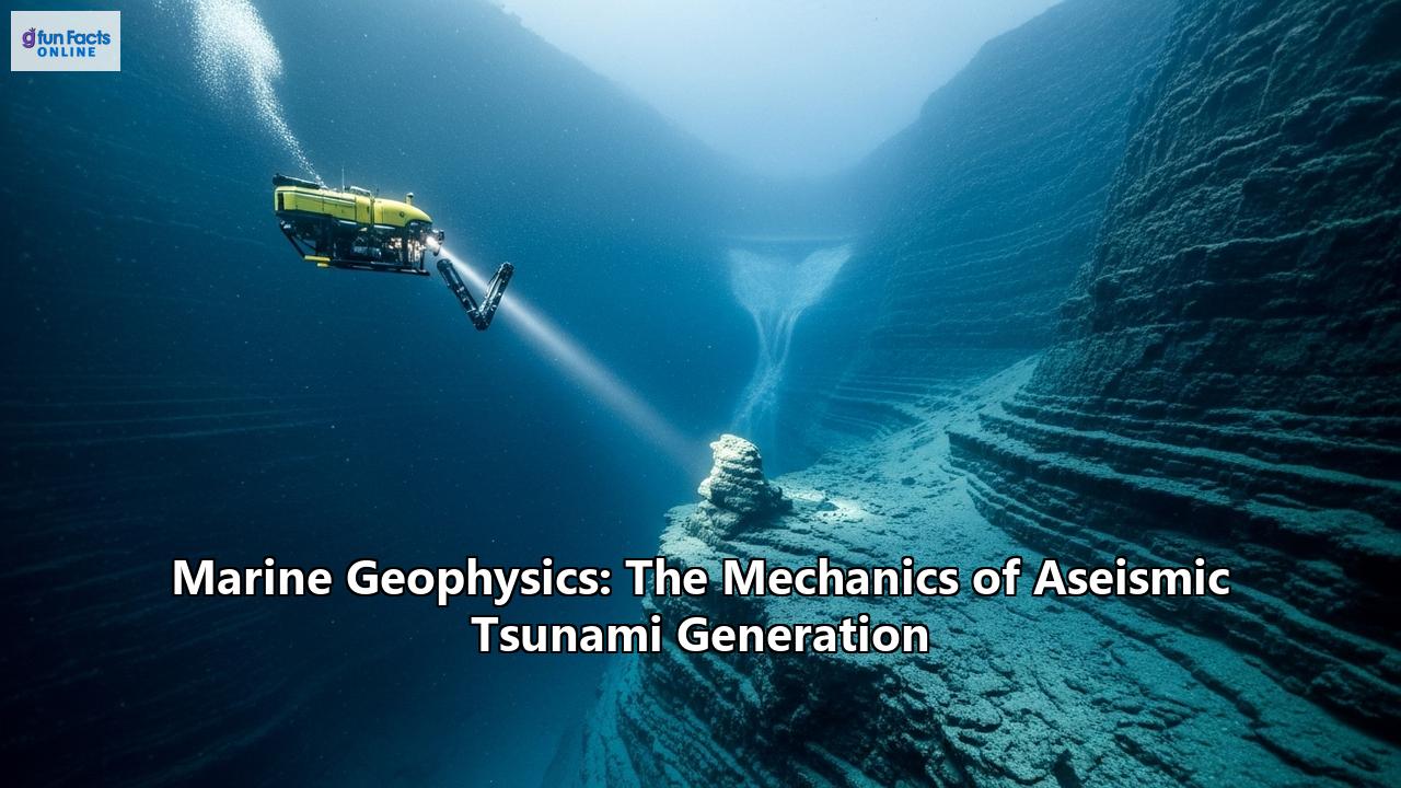
- AUVs and ROVs: Autonomous Underwater Vehicles (AUVs) and Remotely Operated Vehicles (ROVs) are essential for close-up investigation. AUVs are untethered, pre-programmed robots that can conduct detailed, high-resolution mapping missions in hazardous or difficult-to-reach areas, bridging the resolution gap between ship-based surveys and direct observation. ROVs are tethered to a ship and controlled by an operator, allowing for direct visual inspection, sample collection with robotic arms, and the deployment of specific sensors in key locations. They are invaluable for ground-truthing geophysical data, for example, by visually confirming the nature of a landslide scar or sampling the rocks from a volcanic collapse deposit.
A Future of Integrated Warning Systems
The study of aseismic tsunamis reveals a complex and multifaceted world of marine geohazards. From the silent, creeping failure of a continental slope to the explosive fury of a collapsing volcano and the subtle but powerful resonance of an atmospheric disturbance, the ocean has many ways to generate destructive waves beyond the familiar mechanism of an earthquake.
Marine geophysics is the key to unlocking the secrets of these events. By mapping the seafloor, imaging the subsurface, and monitoring the ocean and atmosphere in real-time, scientists can identify areas at risk, reconstruct past events to understand their frequency and magnitude, and develop more robust and comprehensive warning systems. The future of tsunami safety lies not just in detecting earthquakes, but in an integrated approach that leverages the full spectrum of geophysical tools—from seafloor pressure sensors and seismic stations to GPS satellites in the sky—to watch for the varied and often unseen triggers of the ocean's fury. Only through this deep, multidisciplinary understanding can we hope to better protect our vulnerable coastal communities from all the sources of a tsunami's might.
Reference:
- https://www.tsunami.noaa.gov/pmel-theme/tsunami-detection
- https://nhess.copernicus.org/articles/25/1169/2025/
- https://www.mdpi.com/2072-4292/14/18/4605
- https://www.researchgate.net/publication/342965816_On_the_possibility_of_seismic_recording_of_meteotsunamis
- https://www.sonardyne.com/product/tsunami-detection-system/
- https://www.mdpi.com/2077-1312/10/11/1728
- https://www.sciencedaily.com/releases/2010/05/100505102607.htm
- https://www.researchgate.net/publication/318602828_Submarine_Landslides
- https://oceanservice.noaa.gov/facts/auv-rov.html
- https://www.oceansciencetechnology.com/news/tsunami-early-warning-sensor-network-upgraded/
- https://blazingprojects.com/undergraduate_projects/detail.php?dept=Geophysics&id=33653
- https://www.ncei.noaa.gov/sites/default/files/2021-10/OceanGlobe_chapter2.pdf
- https://www.researchgate.net/figure/Reflection-seismic-profiles-obtained-in-the-central-part-of-tsunami-source-area-line_fig3_256694990
- https://www.unisdr.org/files/66779_flabrequeglobalnavigationsatellites.pdf
- https://www.mdpi.com/2072-4292/15/16/3939
- https://www.usgs.gov/data/a-bathymetric-terrain-model-multibeam-sonar-data-collected-between-2005-and-2018-along-queen
- https://events.ecmwf.int/event/427/contributions/4936/attachments/2892/4957/Coupling-WS_Makrygianni.pdf
- https://www.researchgate.net/publication/318602642_ROVs_and_AUVs
- https://www.nasa.gov/centers-and-facilities/jpl/nasa-researchers-detect-tsunamis-by-their-rumble-in-the-atmosphere-2/
- https://repository.library.noaa.gov/view/noaa/28470/noaa_28470_DS1.pdf
- https://www.ucl.ac.uk/news/2022/apr/space-based-system-using-gps-satellites-could-warn-incoming-tsunamis
- https://pubs.usgs.gov/of/2010/1239/of2010-1239.pdf
- https://nhess.copernicus.org/articles/25/1169/2025/nhess-25-1169-2025.pdf
- https://orbi.uliege.be/bitstream/2268/259998/1/EGU21-7951-print.pdf
- https://epic.awi.de/id/eprint/45085/
- https://environment.data.gov.uk/dataset/5fa53736-11f5-417b-b160-9ac98bd012f5
- https://hub.arcgis.com/maps/noaa::multibeam-bathymetry-mosaic-shaded-relief-visualization/about
- https://www.youtube.com/watch?v=zhiKuE6wt-E
- https://www.ipgp.fr/en/news-and-agenda/news/a-better-anticipation-of-tsunamis-thanks-to-gps-satellites/
- https://arxiv.org/pdf/2402.00004
- https://core.ac.uk/download/pdf/19963755.pdf