The wind does not blow in a straight line. It curls, eddies, and spirals, wrapping the globe in a chaotic fluid embrace that has baffled scientists for centuries. For the last seventy years, humanity’s best attempt to predict this chaos has been to force it into a grid—to divide the sky into millions of little boxes and solve complex calculus equations for each one. This method, known as Numerical Weather Prediction (NWP), is a triumph of the 20th century. It requires supercomputers the size of warehouses, consumes enough electricity to power small cities, and yet, when the atmosphere truly convulses—when a "bomb cyclone" detonates in the Atlantic or a heat dome settles over the Pacific Northwest—these boxes sometimes fail to capture the fury.
But in the quiet server rooms of Mountain View, Shenzhen, and Santa Clara, a new approach has emerged, one that ignores the boxes and abandons the physics equations. It treats the atmosphere not as a fluid dynamics problem to be solved, but as a graph to be learned.
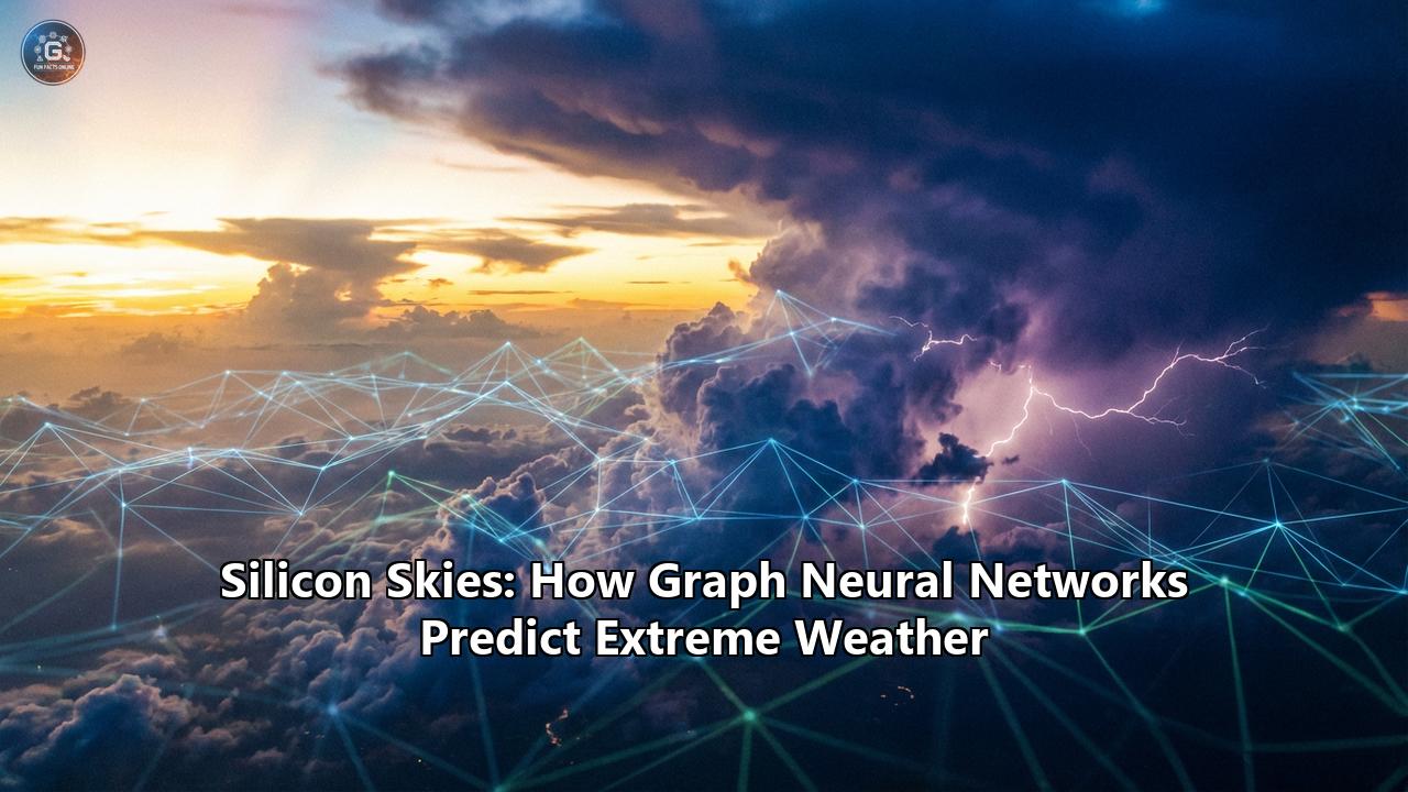
This is the story of "Silicon Skies"—the era of Graph Neural Networks (GNNs) and Generative Diffusion, where artificial intelligence has learned to predict the weather not by understanding the laws of physics, but by observing the patterns of the past. It is a shift that recently saw an AI model predict the landfall of Hurricane Beryl in Texas days before traditional supercomputers, a feat that signals the biggest revolution in meteorology since the invention of the satellite.
In this exploration, we will descend from the exosphere to the surface, unraveling the mathematics of the graph, the history of the forecast, and the future where your weather report is hallucinated by a silicon brain—with terrifying accuracy.
Part I: The Cathedral of Calculation
From Forecast Factories to SupercomputersTo understand why Graph Neural Networks are such a radical departure, we must first appreciate the "Cathedral" they are attempting to replace. The modern weather forecast is arguably the most complex software ever written. It is built on the Navier-Stokes equations, a set of partial differential equations that describe how fluids like air and water move.
In 1922, the British mathematician Lewis Fry Richardson published Weather Prediction by Numerical Process. He imagined a "Forecast Factory"—a vast hall filled with 64,000 human "computers," each responsible for calculating the weather for a specific patch of the globe. A conductor in a central pulpit would coordinate their calculations, shining a beam of light to signal when to pass their results to their neighbors. Richardson’s vision was impossible in his time; his own attempt to calculate the pressure change over Europe for a single six-hour period took him six weeks by hand. The result was wildly wrong.
But the logic was sound. When the first electronic computer, ENIAC, was fired up in the 1940s, weather forecasting was one of its first jobs. The principle remained the same as Richardson’s factory: divide the atmosphere into a 3D grid (latitude, longitude, and altitude). For every time step (say, 10 minutes), calculate how the air in one box flows into its neighbors based on the laws of thermodynamics and fluid motion.
The Grid ProblemThis method, while effective, has a fundamental geometric flaw. The Earth is a sphere (roughly), but computers prefer squares. Mapping a square grid onto a round planet creates distortions, particularly at the poles where the grid lines converge. To maintain stability, traditional models have to perform complex mathematical gymnastics to filter out "polar singularities."
Furthermore, the atmosphere is continuous, but the grid is discrete. If a thunderstorm is smaller than the grid box (say, 25 kilometers wide), the model literally cannot "see" it. It has to approximate the storm using "parameterizations"—simplified rules of thumb. This is why forecasts for localized extreme events, like flash floods or tornadoes, have historically been so difficult.
And then there is the "Butterfly Effect." The atmosphere is a chaotic system, meaning tiny errors in the initial data grow exponentially over time. To combat this, meteorologists run "ensembles"—running the model 50 times with slightly different starting conditions to see the range of possibilities. This requires immense computational power. The European Centre for Medium-Range Weather Forecasts (ECMWF), the gold standard of global forecasting, runs its "Integrated Forecasting System" (IFS) on a supercomputer complex in Bologna, Italy, that performs quadrillions of calculations per second. It is a marvel of brute force.
Enter the Neural Network.
Part II: The Graph Revolution
Why the Earth is a Graph, Not a GridAround 2022, researchers at NVIDIA, Google DeepMind, and Huawei Cloud began asking a provocative question: Do we actually need to solve the Navier-Stokes equations?
The equations are just a mathematical description of physics. If a machine learning model could look at 40 years of historical weather data (the "ground truth" of what actually happened), could it not simply learn the physics on its own?
Early attempts used Convolutional Neural Networks (CNNs), the same AI architecture used for facial recognition. CNNs are great at finding patterns in images, and you can treat a weather map like an image. But CNNs, like traditional models, struggle with the spherical geometry of the Earth. A square filter sliding over a map of Antarctica sees a very different reality than one sliding over the equator.
The breakthrough came with Graph Neural Networks (GNNs).
A "graph" in mathematics is a set of nodes connected by edges. Think of a social network: you are a node, your friends are nodes, and your friendships are the edges. Information flows along these edges.
GNNs are the perfect architecture for a planet. Instead of a distorted rectangular grid, you can tile the Earth with an icosahedron—a shape made of 20 triangles, like a 20-sided die. You can refine this mesh, dividing the triangles into smaller and smaller triangles until you have a geodesic grid that covers the globe with uniform density.
Nodes and Edges: The Message Passing MechanismIn a model like Google DeepMind's GraphCast, the atmosphere is represented by a mesh of over 1 million nodes.
- The Node: Each node represents a specific location in the 3D atmosphere. It holds a vector of data: temperature, pressure, humidity, wind speed, and wind direction at various altitudes.
- The Edge: The edges connect a node to its neighbors. They represent the spatial relationships—how air pressure in London affects the wind in Paris.
The magic happens in a process called Message Passing.
- Encoder: The model takes the current state of the weather (from satellite and sensor data) and maps it onto the graph nodes.
- Processor: This is the "brain." For a set number of steps, every node sends a "message" to its neighbors. The message contains information about its current state. A node receives messages from its neighbors, aggregates them, and updates its own state using a learned neural network function.
Analogy: Imagine the "Forecast Factory" again. But instead of solving a physics equation, the human computers just shout their weather readings to their neighbors. After hearing what the neighbors are shouting, they intuitively guess what their own weather will be in the next hour, based on years of training.
- Decoder: After several rounds of message passing (allowing information to travel across the globe), the graph is converted back into a weather map.
The most staggering difference is speed. A traditional 10-day forecast on the ECMWF supercomputer takes about an hour of crunching on thousands of processors.
GraphCast, running on a single Google TPU (Tensor Processing Unit) v4 chip, can generate the same 10-day forecast in under 60 minutes? No. Under 60 seconds.
It is a speedup of thousands of times. It allows forecasts to be run on a laptop (once trained). It democratizes access to high-end meteorology. But speed is nothing without accuracy.
Part III: The Blur and the Sharpness
From Determinism to DiffusionWhen GraphCast and its peers (like Huawei’s Pangu-Weather and NVIDIA’s FourCastNet) were released in 2022-2023, they shocked the meteorological world. They beat the ECMWF’s IFS model on "scorecards"—metrics like Root Mean Squared Error (RMSE) for temperature and pressure.
But there was a catch.
These early GNN models were "deterministic." They were trained to minimize error. In the chaotic world of weather, the safest way to minimize the average error is to predict the average outcome. If a model isn't sure if a storm will hit New York or Boston, it might predict a weak storm in the middle.
This led to the "Blurring Effect." As the forecast looked further into the future (7 to 10 days out), the predicted weather maps became smooth and featureless. The highs weren't high enough, the lows weren't low enough. The extreme events—the very things that kill people and destroy property—were being washed out.
This is a fatal flaw for predicting extremes. A "smooth" hurricane is just a rainy day. A "smooth" heatwave is just a warm afternoon.
Enter GenCast and the Diffusion RevolutionIn late 2024 and entering 2025, the narrative shifted again. DeepMind unveiled GenCast, and researchers in China introduced FuXi-Extreme. These models moved from deterministic regression to Probabilistic Generative AI.
They use Diffusion Models—the exact same technology behind image generators like Midjourney or DALL-E.
Think of how an AI generates an image of a cat. It starts with static noise (random pixels) and slowly refines it, step by step, until a sharp, clear cat emerges.
GenCast does this for weather. It starts with random noise and conditions it on the current state of the atmosphere. It then "denoises" the field to generate a plausible future weather map.
Because it includes a random element (the initial noise), you can run it 50 times and get 50 different, sharp, highly detailed futures. This is an Ensemble.
- Run 1 shows the hurricane hitting Houston.
- Run 2 shows it hitting Galveston.
- Run 3 shows it curving into Louisiana.
Unlike the "blurry" average of GraphCast, each of these GenCast predictions is physically realistic and retains the sharp gradients of extreme weather. By looking at all 50, meteorologists can say, "There is a 70% chance of landfall in Texas," without losing the intensity of the storm.
The FuXi-Extreme ApproachSimilarly, the FuXi-Extreme model uses a "Cascade" approach. It has a standard model that predicts the general flow, and then a dedicated diffusion module that effectively "super-resolves" the forecast, adding back the chaotic, high-frequency details (like intense rain bands) that standard models smooth out.
This shift from "predicting the mean" to "generating the distribution" is what finally allowed AI to conquer extreme weather.
Part IV: The Case of Hurricane Beryl
July 2024: The Turing Test for WeatherIn July 2024, the meteorological community witnessed a watershed moment. Hurricane Beryl was churning through the Caribbean, the earliest Category 5 storm on record. As it entered the Gulf of Mexico, the question was: Where will it go?
Traditional physics-based models (like the American GFS and the European ECMWF) were struggling. The physics of the Gulf were complex—warm water eddies, wind shear, and high-pressure ridges were interacting in ways that made the equations unstable. Some operational runs suggested a landfall in northern Mexico; others were unsure.
But the AI models, specifically GraphCast and the new experimental generative versions, saw something else.
Days before the traditional models locked on, the AI systems began consistently signaling a sharp northward turn. They identified a weakness in the subtropical ridge that the physics models were slower to catch.
GraphCast predicted a landfall in Texas, near Matagorda, almost 9 days in advance.It wasn't just a lucky guess. The AI models held this track consistency while the traditional models wobbled. When Beryl did indeed slam into Texas, cutting power to millions in Houston, the post-mortem analysis was stark. The AI had provided a signal that was hours, sometimes days, faster than the supercomputers.
It was the moment the "Black Box" became a crystal ball.
The European HeatwavesThe success wasn't limited to tropical cyclones. In the summer of 2024 and 2025, Europe faced blistering heatwaves. Predicting the onset of a heatwave is relatively easy, but predicting its persistence—how long the "blocking high" will stay parked over Paris or Rome—is notoriously hard for physics models.
Newer AI architectures, specifically those designed for "Sub-seasonal to Seasonal" (S2S) forecasting, demonstrated an uncanny ability to recognize the "teleconnections"—the hidden links between ocean temperatures in the Pacific and pressure patterns over Europe weeks later. AI models provided warnings of the extended duration of the heat up to seven weeks in advance, allowing energy grids to prepare for the cooling load.
Part V: Under the Hood of the Future
How the New Systems WorkTo truly grasp "Silicon Skies," we need to look at the anatomy of these systems. They are not just "smart software"; they represent a fundamental change in the scientific method.
1. The Training Data: ERA5Every major AI weather model is trained on ERA5. This is a dataset produced by the ECMWF, often called "The Map of All Things." It is a reanalysis—a historical reconstruction of the weather for every hour of every day from 1940 to the present. It combines satellite data, weather balloon readings, buoy data, and ship logs into a consistent global history.
The AI "reads" ERA5 like a history book. It memorizes that when pressure drops here and wind shifts there, a storm usually forms there 12 hours later. It doesn't know why (Coriolis effect, latent heat release), but it knows what happens.
2. The Architecture: Encoder-Processor-Decoder- The Mesh: The globe is divided into a multi-scale icosahedral grid. This allows the model to handle long-range dependencies. A butterfly flapping its wings in Brazil (a node disturbance) can propagate messages across the graph to influence a tornado in Texas.
- 3D Representation: The atmosphere is not a flat sheet. These models predict variables at 13 or 37 vertical pressure levels (isobars). They are modeling the full volume of the sky.
- Traditional: The ECMWF supercomputer uses hundreds of thousands of CPU cores. It solves equations sequentially. It burns megawatts of power.
- AI: The inference (making a prediction) runs on GPUs or TPUs (Tensor Processing Units). These chips are designed for parallel matrix multiplication. A GenCast forecast uses a fraction of a kilowatt-hour of energy. This efficiency is critical in a warming world—we are no longer burning carbon to predict the carbon cycle.
The biggest criticism of AI models is that they are not "physics-constrained." They can, in theory, violate the laws of conservation of mass or energy. They could predict wind appearing out of nowhere without a pressure gradient.
However, it turns out that with enough data, the AI learns to conserve energy, because the training data (ERA5) conserves energy. It learns the laws of physics implicitly.
Newer "Hybrid" models, like NeuralGCM, bridge the gap. They use a differentiable physics solver for the large-scale fluid motion (which we understand well) and a small neural network to handle the "physics we don't understand well" (like cloud formation and turbulence).
Part VI: The Human Forecast
What Happens to the Meteorologists?If an AI can predict the weather in 1 minute with 99% accuracy, do we still need meteorologists?
The answer is a resounding yes, but their role is changing.
The End of the "Model Hugger"In the past, a forecaster's skill was in knowing the biases of the different physics models. "The GFS always overdoes the cold air in the Rockies," or "The Euro model is too slow with hurricanes." They would manually adjust the forecast based on this intuition.
With AI, the biases are different and more opaque. The forecaster is no longer tweaking the raw data.
The Rise of the Risk CommunicatorThe output of a model like GenCast is not a single map; it is a probability distribution. It says: "There is a 30% chance of 50mm of rain, and a 5% chance of 500mm."
The machine cannot decide if a city should be evacuated. That is a human decision based on risk tolerance. The meteorologist becomes a translator—taking the "probabilistic Silicon Sky" and converting it into actionable advice for the public. "The most likely outcome is rain, but the worst-case scenario is catastrophic flooding, so prepare for the worst."
The Democratization of ForecastingBecause these models can run on a single GPU, high-end forecasting is no longer the monopoly of rich nations with supercomputers. A startup in Kenya or a research lab in Bangladesh can now download the pre-trained GraphCast or GenCast weights and run state-of-the-art forecasts for their local region on a standard gaming PC. This is a massive leap for climate justice, putting the best predictive tools in the hands of the regions most vulnerable to extreme weather.
Conclusion: The Symbiosis
We are not abandoning the equations. We are simply teaching the machines to read them.
The future of weather forecasting is not AI replacing physics, but AI accelerating* it. The ERA5 data that trains the AI is generated by physics models. The hybrid systems of the future will use physics to ensure consistency and AI to provide speed and pattern recognition.
As the climate warms, the atmosphere is entering a state of higher energy and higher chaos. The "old" weather patterns are breaking down. But "Silicon Skies" offer hope. By ingesting the entire history of the atmosphere, these Graph Neural Networks have extracted the deep, hidden rhythms of our planet—rhythms too complex for any human to see, and too computationally expensive for any equation to solve.
In 2026, when you check your phone to see if it will rain, you are not looking at a calculation. You are looking at a hallucination—a dream of the future dreamed by a silicon brain that has watched the wind blow for a hundred years, and knows exactly where it will go next.
This is the new age of meteorology. The boxes are gone. The graph is alive. And the forecast has never been clearer.
Reference:
- https://thenextweb.com/news/google-deepminds-new-ai-weather-forecaster-gencast
- https://the-decoder.com/deepminds-gencast-ai-beats-traditional-weather-forecasting-for-the-first-time/
- https://www.wwltv.com/article/tech/science/gencast-ai-weather-model-google-deepmind/289-05401904-d03e-43a8-ae13-6c53bdce1c16
- https://www.theguardian.com/science/2024/dec/04/google-deepmind-predicts-weather-more-accurately-than-leading-system
- https://www.semanticscholar.org/paper/FuXi-Extreme%3A-Improving-extreme-rainfall-and-wind-Zhong-Chen/80058584eb02a1f44e027a49bc45dbd76880c189
- https://www.earth.com/news/gencast-new-ai-model-is-redefining-weather-forecasting/
- https://onyxaero.com/news/probabilistic-weather-forecasting-with-machine-learning/
- https://odsc.medium.com/google-deepminds-gencast-ai-revolutionizes-weather-forecasting-c1b887750887
- https://github.com/google-deepmind/graphcast
- https://www.carriermanagement.com/news/2024/11/20/268791.htm
- https://deepmind.google/blog/gencast-predicts-weather-and-the-risks-of-extreme-conditions-with-sota-accuracy/
- https://www.oreateai.com/blog/mindspore-ai-scientific-computing-series-analysis-of-fuxi-meteorological-large-model-technology/5e8810471e0b7d30106d0763a3b82840
- https://www.thestreet.com/technology/ai-plays-expanding-role-in-predicting-natural-disasters
- https://time.com/7081372/ai-hurricane-forecasting/
- https://ca.news.yahoo.com/ai-now-forecast-european-heatwaves-143330217.html
- https://earth.org/europes-new-ai-weather-forecasting-model-up-to-20-more-accurate-than-conventional-methods/
- https://arxiv.org/html/2511.17176v1