In an era where a simple tap on a smartphone can pinpoint our location on a map with astonishing accuracy, it's easy to take for granted the intricate web of science and technology that makes this possible. The Global Positioning System (GPS), and the broader ecosystem of Global Navigation Satellite Systems (GNSS), represents one of the most significant technological achievements of the modern age. It's a system that has not only revolutionized how we navigate our world but has also become an invisible, yet indispensable, part of our global infrastructure, underpinning everything from financial transactions to disaster relief efforts. This article delves into the fascinating science behind pinpoint global navigation, exploring the journey from the foundational principles of GPS to the advanced, multi-constellation systems of today and the exciting future that lies beyond.
The Genesis of a Revolution: A Brief History of GPS
The story of GPS begins not on Earth, but in space, with the dawn of the satellite era. When the Soviet Union launched Sputnik 1 in 1957, scientists at the Johns Hopkins Applied Physics Laboratory made a groundbreaking discovery. They noticed that they could track the satellite's orbit by analyzing the Doppler effect—the change in frequency of its radio signals as it moved towards or away from them. This observation sparked a revolutionary idea: if a satellite's position could be determined from the ground by measuring the Doppler shift of its signals, then the reverse must also be true. A receiver on the ground could determine its own location by measuring the signals from satellites with known positions.
This principle laid the groundwork for the first satellite navigation system, the U.S. Navy's Transit system, which became operational in the mid-1960s. Designed to track submarines carrying nuclear missiles, the Transit system used a constellation of six satellites to provide a position fix, albeit with some limitations. It was a significant step forward, but the military sought a more robust and responsive system.
In 1973, the U.S. Department of Defense initiated the GPS project, aiming to create a unified, high-performance satellite navigation system that would overcome the limitations of its predecessors. The first prototype satellite, NAVSTAR 1, was launched in 1978, and the full constellation of 24 satellites became operational in 1993. Initially, the most accurate GPS signals were reserved for military use, with a less precise signal available to civilians. This policy, known as Selective Availability, was ended in 2000, opening the floodgates for a torrent of civilian and commercial applications that have since reshaped our world.
The Science of Pinpoint Accuracy: How GPS Works
At its core, GPS is a marvel of physics and engineering, a system built on three essential segments: the space segment, the control segment, and the user segment.
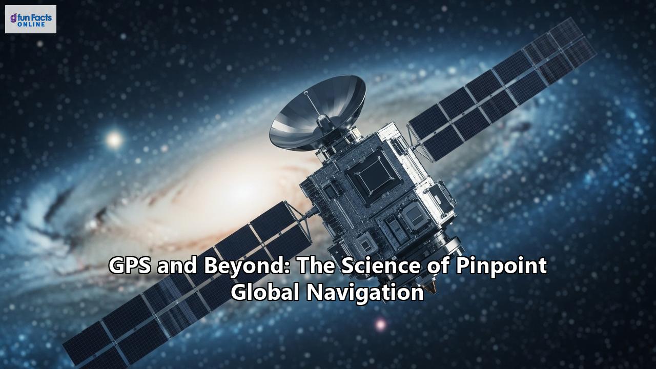
- The Space Segment: This consists of a constellation of more than 30 satellites orbiting the Earth at an altitude of about 20,200 kilometers (12,550 miles). These satellites are arranged in six orbital planes, ensuring that at least four satellites are visible from almost any point on Earth at any given time. Each satellite continuously broadcasts a navigation message that contains its precise orbital location (ephemeris), its system time, and the status of the entire satellite constellation (almanac).
- The Control Segment: This is a global network of ground facilities that track the GPS satellites, monitor their transmissions, analyze their data, and upload corrections and new information to the satellites. This ensures the accuracy of the satellites' orbital and clock data, which is fundamental to the system's performance.
- The User Segment: This consists of the billions of GPS receivers in our smartphones, cars, airplanes, and a vast array of other devices. These receivers detect, decode, and process the signals from the GPS satellites to calculate their precise position, velocity, and time.
The fundamental principle behind GPS positioning is trilateration. Imagine you are lost, but you know your distance from three known landmarks. You could draw a circle around each landmark with a radius equal to your distance from it. The point where the three circles intersect is your location.
GPS works in a similar way, but in three dimensions. A GPS receiver measures its distance from a satellite by calculating the time it takes for the satellite's signal to travel to the receiver. Since the signal travels at the speed of light, this time measurement can be converted into a distance.
With the distance to one satellite, the receiver knows it is located somewhere on the surface of a sphere with the satellite at its center. With a second satellite, the receiver's location is narrowed down to the intersection of two spheres, which is a circle. A third satellite provides a third sphere, and its intersection with the circle from the first two satellites results in two possible points. Usually, one of these points is a ridiculous location (e.g., in space or deep inside the Earth), so the receiver can determine its correct position.
However, there's a catch. This method relies on incredibly precise timing. The clocks on the satellites and the clock in the receiver must be perfectly synchronized. This is where a fourth satellite comes in. By measuring the signal from a fourth satellite, the receiver can solve for a fourth variable: the receiver's own clock error. This eliminates the need for the receiver to have its own atomic clock, which would be far too expensive and bulky for most applications. Thus, with four or more satellites, a GPS receiver can determine its latitude, longitude, altitude, and the precise time.
The Unseen Forces: Atomic Clocks and Relativity
The incredible accuracy of GPS is made possible by two key scientific concepts: atomic clocks and Einstein's theory of relativity.
Atomic Clocks: The Heartbeat of GPSEach GPS satellite is equipped with multiple atomic clocks, which are the most accurate timekeeping devices ever created. These clocks don't rely on the oscillations of a crystal, like a quartz watch, but on the incredibly stable and predictable vibrations of atoms, such as cesium or rubidium. The frequency of these vibrations is so constant that an atomic clock might only lose or gain a second over millions of years.
This extraordinary precision is absolutely critical for GPS. A timing error of just one nanosecond (a billionth of a second) can translate into a position error of about 30 centimeters (one foot). By providing a highly accurate time reference, the atomic clocks on the satellites allow for the precise measurement of the signal travel time, which is the foundation of trilateration.
Einstein's Relativity: A Necessary CorrectionThe theory of relativity, developed by Albert Einstein in the early 20th century, describes how gravity and motion can affect time and space. It might seem like an abstract concept, but without accounting for its effects, GPS would be hopelessly inaccurate.
There are two aspects of relativity that are particularly relevant to GPS:
- Special Relativity: This theory states that time slows down for an object that is in motion. The GPS satellites are moving at about 14,000 kilometers per hour. This high speed means that the atomic clocks on the satellites tick slightly slower than clocks on Earth.
- General Relativity: This theory predicts that gravity also affects time. The satellites are in a weaker gravitational field than we are on Earth's surface. This means that the clocks on the satellites tick slightly faster than clocks on the ground.
When these two effects are combined, the net result is that the clocks on the GPS satellites run faster than the clocks on Earth by about 38 microseconds per day. This might not seem like much, but if left uncorrected, it would cause a positioning error of about 10 kilometers per day to accumulate. To counteract this, the GPS system is designed to account for these relativistic effects, ensuring that the timing information transmitted by the satellites is accurate from the perspective of a receiver on the ground.
The Language of the Satellites: Deconstructing the GPS Signal
The signal broadcast by a GPS satellite is not a simple tone. It's a complex stream of information that contains everything a receiver needs to determine its position. The signal is composed of three main components:
- Carrier Wave: This is the high-frequency radio wave that carries the other two components of the signal. GPS satellites transmit on multiple frequencies, such as L1, L2, and L5.
- Pseudorandom Code: This is a complex digital code that appears to be random but is actually a precisely defined sequence of ones and zeros. Each satellite has its own unique pseudorandom code, which allows the receiver to distinguish between the signals from different satellites. The receiver can also use the pseudorandom code to calculate the signal's travel time by comparing the received code with a locally generated replica.
- Navigation Message: This is a low-frequency data stream that is modulated onto the carrier wave. The navigation message contains crucial information, including:
Ephemeris Data: This is the precise orbital information for the transmitting satellite. It tells the receiver exactly where the satellite is in space at any given time. Ephemeris data is valid for a few hours and is broadcast every 30 seconds.
Almanac Data: This is a less precise set of orbital information for all the satellites in the constellation. It helps the receiver to quickly determine which satellites should be visible in the sky. The complete almanac takes 12.5 minutes to transmit.
Satellite Clock Corrections: This information allows the receiver to correct for any slight deviations in the satellite's atomic clock.
Ionospheric Data: This data helps the receiver to model and correct for delays in the signal as it passes through the Earth's ionosphere.
Beyond GPS: The Global Family of Navigation Systems
While GPS was the first and remains the most widely known GNSS, it is no longer the only player in the game. Several other countries and regions have developed their own satellite navigation systems, creating a truly global and interoperable network.
GLONASS: The Russian CounterpartThe Global Navigation Satellite System (GLONASS) is Russia's global navigation system. Development began in the Soviet Union in 1976, and the system became fully operational in 1995. After a period of decline in the late 1990s, the Russian government has invested heavily in modernizing the system, and it now offers global coverage with a full constellation of 24 operational satellites.
One of the key differences between GLONASS and GPS is the signal structure. While GPS uses code-division multiple access (CDMA), where all satellites transmit on the same frequencies but with different codes, GLONASS uses frequency-division multiple access (FDMA), where each satellite transmits on a slightly different frequency. GLONASS's orbital inclination also provides better coverage at high latitudes, making it particularly useful in polar regions.
Galileo: Europe's Civilian-Controlled SystemGalileo is the European Union's global navigation satellite system, designed to be independent of the military-controlled GPS and GLONASS. It is under civilian control and offers a range of services, including a free and open service, a high-accuracy service, a public regulated service for government-authorized users, and a search and rescue service.
Galileo is designed to be fully interoperable with GPS, and its satellites broadcast signals on multiple frequencies, which can help to improve accuracy and reliability, especially in challenging environments like urban canyons. The Galileo constellation consists of 24 operational satellites plus spares, and it is known for its high accuracy, with the potential for meter-level positioning for its open service and even greater precision for its commercial services.
BeiDou: China's Global AmbitionThe BeiDou Navigation Satellite System (BDS) is China's global navigation system. It was developed in three phases, starting with a regional system in the early 2000s and culminating in a global system that became fully operational in 2020. The BeiDou constellation is unique in that it includes satellites in geostationary orbit (GEO), inclined geosynchronous orbit (IGSO), and medium Earth orbit (MEO). This hybrid constellation provides enhanced coverage and accuracy over the Asia-Pacific region.
BeiDou offers a range of services, including an open service with positioning accuracy of around 10 meters, as well as more precise services for authorized users. It also features a short message communication service, which allows users to send and receive short messages, a capability not found in other global systems.
Regional Systems: Enhancing Local CoverageIn addition to the global systems, several countries have developed regional navigation satellite systems (RNSS) to enhance coverage and accuracy over their specific territories.
- NavIC (Navigation with Indian Constellation): Developed by the Indian Space Research Organisation (ISRO), NavIC is an autonomous regional system that provides positioning services over India and the surrounding region. It consists of a constellation of seven satellites in geostationary and geosynchronous orbits.
- QZSS (Quasi-Zenith Satellite System): This is a Japanese regional system that is designed to augment GPS signals over Japan and the Asia-Oceania region. Its satellites are in a unique "quasi-zenith" orbit that keeps them high in the sky over Japan, which is particularly beneficial in urban areas with tall buildings that can block signals from lower-elevation satellites.
The proliferation of GNSS has led to the development of multi-constellation receivers, which can track and use signals from multiple satellite systems simultaneously. This has several significant advantages:
- Increased Satellite Availability: With more satellites in view, a receiver can get a position fix more quickly and reliably, especially in challenging environments like urban canyons, dense forests, or mountainous terrain where the view of the sky is obstructed.
- Improved Accuracy and Robustness: A larger number of satellites allows for better geometric distribution, which can improve the accuracy of the position calculation. It also makes the system more robust against interference and spoofing.
- Enhanced Integrity: The ability to cross-check signals from different systems improves the integrity of the positioning solution, which is crucial for safety-critical applications like aviation.
Achieving Centimeter-Level Precision: The Role of Augmentation Systems
While standard GNSS can provide meter-level accuracy, many applications, such as surveying, precision agriculture, and autonomous driving, require much higher precision. This is where augmentation systems come in. These systems improve the accuracy, integrity, and availability of GNSS by providing corrections for various sources of error.
Satellite-Based Augmentation Systems (SBAS)SBAS are regional systems that use a network of ground reference stations to monitor the GNSS satellites. These stations calculate corrections for satellite orbit and clock errors, as well as for atmospheric delays. The corrections are then broadcast to users via geostationary satellites.
SBAS not only improves accuracy to the meter level or better but also provides integrity information, which is a measure of the trust that can be placed in the signal. This is vital for safety-of-life applications like aviation. Prominent SBAS include the Wide Area Augmentation System (WAAS) in North America, the European Geostationary Navigation Overlay Service (EGNOS) in Europe, and the GPS-Aided GEO Augmented Navigation (GAGAN) in India.
Ground-Based Augmentation Systems (GBAS)GBAS is a more localized system that provides even greater accuracy than SBAS, but over a smaller area, typically around an airport. It uses ground-based transmitters to broadcast differential corrections to aircraft, enabling high-precision approaches and landings. GBAS is a key technology for the modernization of air traffic management systems and is seen as a replacement for the traditional Instrument Landing System (ILS).
Real-Time Kinematic (RTK)For applications that require centimeter-level accuracy, Real-Time Kinematic (RTK) is the gold standard. RTK is a differential GNSS technique that uses a fixed base station and a roving receiver. The base station, which is located at a precisely known position, calculates corrections for the GNSS signals and transmits them in real-time to the rover. By applying these corrections, the rover can achieve a very high level of accuracy.
RTK works by resolving the "integer ambiguity" of the carrier phase of the GNSS signal. The carrier wave is a much higher frequency than the pseudorandom code, and by measuring its phase, it is possible to achieve much greater precision. However, the receiver doesn't know how many full wavelengths of the carrier signal there are between the satellite and the receiver. By using the base station as a reference, the rover can resolve this ambiguity and achieve centimeter-level accuracy.
Precise Point Positioning (PPP)Precise Point Positioning (PPP) is another high-precision positioning technique that, unlike RTK, does not require a local base station. Instead, it uses precise satellite orbit and clock data from a global network of reference stations, which are delivered to the user via satellite or the internet.
PPP can achieve centimeter-level accuracy, but it typically takes longer to converge to a precise solution than RTK. However, its ability to provide high accuracy with a single receiver makes it a valuable tool for applications in remote areas or offshore where it is not feasible to set up a base station.
The Ubiquitous Navigator: Applications of GNSS
The impact of GNSS on our daily lives and on a vast range of industries is difficult to overstate. What began as a military technology has become a global utility, driving innovation and efficiency in countless ways.
Transportation: On the Road, in the Air, and at SeaThe most obvious application of GNSS is in navigation. In-car navigation systems, smartphone mapping apps, and ride-sharing services all rely on GNSS to provide turn-by-turn directions and real-time traffic information. But the impact of GNSS on transportation goes far beyond personal navigation.
In aviation, GNSS has revolutionized air traffic management, enabling more direct and efficient flight paths, reducing fuel consumption, and enhancing safety. SBAS and GBAS are making it possible for aircraft to perform precision landings at airports that were previously not equipped with expensive ground-based landing systems.
In maritime, GNSS is essential for safe and efficient navigation, from large container ships to small recreational boats. It is used for route planning, collision avoidance, and tracking of vessels.
And in the world of autonomous vehicles, GNSS is a critical sensor for localization. By providing a precise and reliable position, GNSS, often in combination with other sensors like cameras and lidar, allows autonomous vehicles to navigate safely and efficiently.
Precision Agriculture: The Smart FarmGNSS is a cornerstone of modern precision agriculture, enabling farmers to manage their fields with unprecedented accuracy and efficiency. By using GNSS-guided tractors, farmers can plant seeds, apply fertilizers, and spray pesticides with centimeter-level precision, reducing waste, lowering costs, and minimizing the environmental impact of farming.
GNSS is also used for field mapping, soil sampling, and yield monitoring. This data allows farmers to create detailed maps of their fields, identify areas of high and low productivity, and make more informed decisions about how to manage their crops.
Disaster Management and Environmental MonitoringIn times of crisis, GNSS is a vital tool for disaster response and management. It is used to map the extent of damage, track the location of emergency responders, and coordinate relief efforts. In the aftermath of an earthquake, for example, GNSS can be used to assess damage to infrastructure and guide search and rescue teams.
GNSS is also playing an increasingly important role in environmental monitoring. Scientists use GNSS to track the movement of tectonic plates, monitor sea-level rise, and study the melting of glaciers and ice sheets. This data is crucial for understanding the impacts of climate change and for developing strategies to mitigate its effects.
A Myriad of Other ApplicationsThe applications of GNSS are virtually limitless. It is used in:
- Surveying and mapping: For creating accurate maps and models of the Earth's surface.
- Timing and synchronization: For synchronizing telecommunications networks, power grids, and financial transactions.
- Construction: For guiding construction equipment and ensuring that buildings and infrastructure are built to precise specifications.
- Location-based services: For a wide range of applications on our smartphones, from finding a nearby restaurant to tracking our fitness activities.
- Scientific research: For studying everything from the Earth's atmosphere to the movement of wildlife.
The Future of Global Navigation: What Lies Ahead?
The world of GNSS is in a constant state of evolution. New systems are being deployed, new signals are being developed, and new technologies are emerging that promise to make global navigation even more accurate, reliable, and ubiquitous.
A More Crowded and Capable SkyThe trend towards a multi-GNSS world will continue, with more countries developing their own global and regional systems. This will lead to an even greater number of satellites in the sky, which will further improve the availability, accuracy, and reliability of GNSS.
New and modernized signals will also play a key role in the future of GNSS. These signals are being designed to be more robust against interference and to provide even greater accuracy.
The Rise of AI and Machine LearningArtificial intelligence (AI) and machine learning (ML) are poised to have a major impact on GNSS. AI algorithms can be used to improve the accuracy of GNSS positioning by learning to identify and mitigate errors caused by factors like multipath, where signals bounce off buildings and other objects.
AI can also be used to fuse data from multiple sensors, such as GNSS, inertial measurement units (IMUs), and cameras, to provide a more robust and reliable positioning solution, especially in environments where GNSS signals are weak or unavailable.
Integration with Other TechnologiesThe future of GNSS will also be characterized by its integration with other technologies, such as 5G and the Internet of Things (IoT). 5G networks will be able to provide the high-speed, low-latency communication that is needed for real-time, high-precision applications like autonomous driving. And the integration of GNSS into billions of IoT devices will enable a whole new range of applications, from tracking assets to monitoring the environment.
New Frontiers: PNT EverywhereThe ultimate goal of the future of GNSS is to provide "PNT everywhere"—that is, precise positioning, navigation, and timing information that is available to everyone, everywhere, at all times. This includes challenging environments where GNSS has traditionally struggled, such as indoors, underground, and underwater.
To achieve this, researchers are exploring a range of innovative technologies, including:
- Hybrid positioning systems: That combine GNSS with other technologies like Wi-Fi, Bluetooth, and cellular signals to provide seamless indoor and outdoor navigation.
- Signals of opportunity: That use signals from sources other than GNSS satellites, such as television and radio broadcasts, for positioning.
- Quantum sensors: That have the potential to provide incredibly accurate positioning and timing information without relying on external signals.
Conclusion
From its origins in the Cold War space race to its current status as a global utility, the story of GPS and the broader world of GNSS is a testament to the power of scientific innovation. The ability to pinpoint our location on the globe with such incredible accuracy is the result of decades of research and development, bringing together the principles of physics, the precision of engineering, and the power of mathematics.
Today, we stand at the threshold of a new era in global navigation. With a growing family of satellite systems, the advent of powerful new technologies like AI and 5G, and a relentless drive for greater accuracy and reliability, the future of GNSS promises to be even more transformative than its past. As we continue to push the boundaries of what is possible, the science of pinpoint global navigation will undoubtedly play an even more central role in shaping the future of our interconnected world, guiding us with ever-increasing precision on our journeys, both great and small.
Reference:
- https://library.fiveable.me/autonomous-vehicle-systems/unit-2/gps-gnss/study-guide/jMxKFeQkop97jmqf
- https://www.flyeye.io/drone-acronym-rtk/
- https://www.geoconnexion.com/in-depth/the-future-of-gnss-bridging-traditional-and-consumer-markets
- https://skybrary.aero/articles/satellite-based-augmentation-system-sbas
- https://www.flyeye.io/drone-acronym-sbas/
- https://cgrsc.ca/resources/gnss-augmentation/precise-point-positioning-ppp/
- https://gssc.esa.int/activities/gnss-ml-iot/
- https://en.wikipedia.org/wiki/Precise_Point_Positioning
- https://www.tersus-gnss.com/tech_blog/what-is-the-ppp
- https://learn.rockrobotic.com/what-is-real-time-kinematic-rtk-positioning
- https://www.dlr.de/en/fl/imported-from-cxxl/dokumente/veroeffentlichungen/GBAS_EN_web.pdf/@@download/file/GBAS_EN_web.pdf
- https://www.advancednavigation.com/glossary/sbas/
- https://novatel.com/an-introduction-to-gnss/resolving-errors/ppp
- https://novatel.com/an-introduction-to-gnss/gnss-applications-and-equipment/precision-agriculture
- https://www.scitechnol.com/peer-review/role-of-global-navigation-satellite-systems-gnss-in--navigation-bhTj.php?article_id=22577
- https://geospatialworld.net/prime/future-gnss/
- https://en.wikipedia.org/wiki/Real-time_kinematic_positioning
- https://www.euspa.europa.eu/eu-space-programme/egnos/what-sbas
- https://geodesy.science/ggos/structure/fa/ai-for-geodesy/gnss-remote-sensing/
- https://www.gp-radar.com/article/real-time-kinematic-positioning-rtk-explained
- https://pbnportal.eu/epbn/main/Overview-of-PBN/PBN-Concept---Unpacked/PBN-Infrastructure/Space-based/GNSS-Elements.html
- https://farmonaut.com/precision-farming/advanced-gnss-tech-boosts-precision-agriculture-today
- https://gssc.esa.int/navipedia/index.php/PPP_Fundamentals
- https://universalavionics.com/docs/default-source/ua/resources/whitepapers/uasc_sbas_whitepaper.pdf?sfvrsn=d91d985c_4
- https://skybrary.aero/articles/ground-based-augmentation-system-gbas
- https://www.faa.gov/about/office_org/headquarters_offices/ato/service_units/techops/navservices/gnss/laas/howitworks
- https://pointonenav.com/news/what-is-rtk-real-time-kinematic/
- https://www.gmv.com/en/node/7375/printable/print
- https://www.mdpi.com/2072-4292/15/6/1623
- https://abracon.com/news/how-gnss-technology-drives-autonomy-1
- https://www.mdpi.com/2077-0472/13/7/1417
- https://satpalda.com/role-of-global-positioning-system-gps-global-navigation-satellite-system-gnss-in-precision-farming/
- https://www.septentrio.com/en/applications/industrial-automation/agriculture
- https://www.oulu.fi/en/news/new-gnss-reflectometry-system-revolutionizes-environmental-remote-sensing
- https://www.nhbs.com/environmental-monitoring-using-gnss-book
- https://rtkgpssurveyequipment.com/future-of-gps-technology-emerging-gnss-signals-and-their-impact-on-surveying-with-rtk-equipment/
- https://insidegnss.com/what-are-the-roles-of-artificial-intelligence-and-machine-learning-in-gnss-positioning/
- https://seac-space.com/gnss-positioning/
- https://www.ursi.org/proceedings/2022/RCRS2022/papers/YSASummaryJagiwalaDarshna.pdf