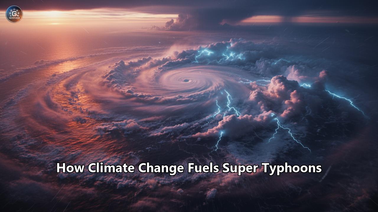
An era of super storms is upon us. The very terminology — super typhoon — evokes a sense of awe and trepidation, a weather phenomenon of such immense power that it seems to belong more to the realm of fiction than to our lived reality. Yet, these monstrous storms are not only real, but there is a growing body of scientific evidence to suggest that human-induced climate change is making them more frequent, more intense, and more destructive. This article will delve into the intricate and alarming relationship between our warming planet and the rise of these super typhoons, exploring the scientific mechanisms at play, the devastating real-world consequences, and the ominous projections for our future.
The Anatomy of a Typhoon: A Force of Nature
Before we can comprehend how climate change is altering typhoons, we must first understand what they are and how they form. A typhoon is a mature tropical cyclone that develops in the Western Pacific Ocean. These storms are known as hurricanes in the Atlantic and Northeast Pacific, and cyclones in the South Pacific and Indian Ocean. They are, in essence, the same weather phenomenon, distinguished only by their location of origin.
Tropical cyclones are powerful, rotating storm systems with a low-pressure center, strong winds, and a spiral arrangement of thunderstorms that produce heavy rain. Their formation is a complex process that requires a specific set of ingredients:
- Warm Ocean Waters: This is the primary fuel for a typhoon. Sea surface temperatures must be at least 26.5 degrees Celsius (79.7 degrees Fahrenheit) to a depth of at least 50 meters (160 feet). This warm water provides the heat and moisture necessary to power the storm.
- Atmospheric Instability: The air must be unstable, meaning that a parcel of air, if given an upward push, will continue to rise. This allows for the formation of the towering clouds that are characteristic of a typhoon.
- High Humidity: A significant amount of moisture in the lower to middle levels of the troposphere is crucial. This moisture is the "fuel" that is converted into the immense energy of the storm through condensation.
- Coriolis Force: The rotation of the Earth provides the spin necessary for the storm to develop its characteristic cyclonic rotation. This is why typhoons do not form within about 5 degrees of the equator, where the Coriolis effect is too weak.
- A Pre-existing Weather Disturbance: Typhoons do not just appear out of nowhere. They typically form from a pre-existing weather disturbance, such as a cluster of thunderstorms over tropical waters.
- Low Vertical Wind Shear: This refers to a small change in wind speed and direction with height. Strong vertical wind shear can tear a developing storm apart, preventing it from intensifying.
When these conditions align, a tropical disturbance can begin to organize. Warm, moist air over the ocean rises, creating an area of lower pressure near the surface. Air from surrounding areas with higher pressure pushes into the low-pressure area. This new air becomes warm and moist and rises, too. As the warm, moist air rises, it cools, and the water vapor condenses into clouds, releasing latent heat. This process warms the surrounding air, causing it to rise further and creating a self-sustaining cycle that can lead to the formation of a powerful typhoon.
The "Super" in Super Typhoon: A New Level of Destructive Power
The term "super typhoon" is not just a dramatic descriptor; it is a specific meteorological classification for the most intense typhoons. While different meteorological agencies have slightly different criteria, a super typhoon is generally defined by its sustained wind speeds.
The U.S. Joint Typhoon Warning Center (JTWC) unofficially classifies typhoons with one-minute sustained wind speeds of at least 150 miles per hour (241 kilometers per hour) as super typhoons. This is the equivalent of a strong Category 4 or Category 5 hurricane on the Saffir-Simpson Hurricane Wind Scale.
Other agencies, such as the Philippine Atmospheric, Geophysical and Astronomical Services Administration (PAGASA), have their own classifications. In the Philippines, a super typhoon is a tropical cyclone with maximum sustained winds exceeding 185 kilometers per hour. This classification was adopted after the devastating experience of Typhoon Haiyan in 2013, which was initially classified only as a typhoon despite its immense power.
The Hong Kong Observatory also has a "super typhoon" category for storms with sustained wind speeds of at least 185 km/h. These classifications underscore the need to differentiate these exceptionally powerful storms from less intense typhoons, as their potential for destruction is significantly higher.
Climate Change: The Steroid Shot for Typhoons
The link between climate change and the increasing intensity of typhoons is a subject of intense scientific research. While it is challenging to attribute any single weather event solely to climate change, the overwhelming scientific consensus is that a warming planet is creating conditions that are more conducive to the formation of stronger and more destructive storms.
The Intergovernmental Panel on Climate Change (IPCC), the world's leading authority on climate science, has stated with high confidence that anthropogenic climate change has increased extreme tropical cyclone rainfall. The IPCC also projects that the global proportion of tropical cyclones that reach very intense (Category 4 and 5) levels is projected to increase with anthropogenic warming over the 21st century.
Here are the key physical mechanisms through which climate change is fueling super typhoons:
Warmer Ocean Temperatures: More Fuel for the Fire
The most direct and well-understood link between climate change and typhoon intensity is through the warming of the oceans. The world's oceans have absorbed about 90% of the extra heat from greenhouse gas emissions. This has led to a significant increase in sea surface temperatures, providing more of the "fuel" that typhoons need to develop and intensify.
A warmer sea surface provides more energy for storm development and thus favors higher intensification rates and more intense typhoons. For every 1°C increase in sea surface temperature, the potential intensity of a tropical cyclone can increase by about 5-8%. This translates to stronger winds and lower central pressures, the hallmarks of a more powerful storm.
A 2015 study published in Science Advances found that the intensity of typhoons in the northwest Pacific could increase by as much as 14% by the end of the century due to rising ocean temperatures. The study also found that the upper ocean layers, particularly those just below the surface, play a crucial role in typhoon intensification.
Increased Atmospheric Moisture: Supercharging the Rain Machine
A warmer atmosphere can hold more moisture. For every 1°C of warming, the atmosphere can hold about 7% more water vapor. This increased atmospheric moisture leads to more intense rainfall, especially during extreme weather events like typhoons.
A typhoon acts like a giant engine, drawing in moist air and converting it into wind and rain. With more moisture available in the atmosphere, typhoons can produce heavier and more prolonged rainfall, leading to a greater risk of devastating floods and landslides.
A study by ClimaMeter on Super Typhoon Ragasa, a powerful storm in 2025, found that similar cyclones in the present-day climate are up to 10% wetter than in the past. This highlights the direct impact of increased atmospheric moisture on the destructive potential of these storms.
Rising Sea Levels: A Head Start for Storm Surges
One of the most destructive aspects of a typhoon is the storm surge, an abnormal rise in sea level caused by the storm's strong winds pushing water toward the coast. Climate change is exacerbating the threat of storm surges in two ways: by making the storms themselves more intense, and by raising the baseline sea level.
Global sea levels are rising due to the thermal expansion of seawater as it warms and the melting of glaciers and ice sheets. This means that when a typhoon makes landfall, the storm surge is riding on a higher sea level, allowing it to penetrate further inland and cause more extensive flooding.
Even if the intensity of typhoons did not increase, rising sea levels alone would make storm surges more dangerous. However, with typhoons becoming stronger and producing more powerful winds, the combination of a higher baseline sea level and more intense storm surges creates a recipe for catastrophic coastal flooding.
The Rogues' Gallery: Super Typhoons in a Warming World
The scientific theory and climate models are borne out by the increasing number of devastating super typhoons that have been witnessed in recent years. These storms serve as stark reminders of the growing threat we face in a warming world.
Super Typhoon Haiyan (Yolanda), 2013: A Wake-Up Call for the World
Super Typhoon Haiyan, known locally as Yolanda, was one of the most powerful tropical cyclones ever recorded at landfall. It struck the Philippines on November 8, 2013, with sustained winds of 195 mph (315 km/h) and gusts of up to 235 mph (380 km/h). The storm caused catastrophic destruction, particularly in the city of Tacloban, where a massive storm surge, likened to a tsunami, flattened entire communities.
The official death toll from Haiyan is over 6,300, with millions more affected. The storm's immense power and the scale of the devastation it wrought brought the issue of climate change and its impact on extreme weather to the forefront of global attention. While scientists were cautious about attributing the storm's intensity solely to climate change at the time, many agreed that it was a clear example of the type of extreme storm that is likely to become more common in a warming world.
The sea surface temperatures in the area where Haiyan formed were exceptionally warm, providing the storm with an abundance of energy. The event was a catalyst for the establishment of the Warsaw International Mechanism for Loss and Damage, a UN framework to address the impacts of climate change that go beyond what countries can adapt to.
Super Typhoon Meranti, 2016: A Monster in the Pacific
Super Typhoon Meranti was one of the most intense tropical cyclones on record, with one-minute sustained winds reaching an incredible 195 mph (315 km/h). The storm made landfall in the Philippines and Taiwan before striking mainland China in September 2016.
Meranti's rapid intensification was a key feature, a phenomenon that is becoming more common with warming oceans. The storm caused widespread damage, including significant destruction to vegetation and infrastructure in the Chinese city of Xiamen. Studies of Meranti have highlighted the role of pre-existing ocean conditions, such as warm eddies, in fueling the intensification of super typhoons.
Super Typhoon Rai (Odette), 2021: A Christmas Catastrophe
Super Typhoon Rai, known in the Philippines as Odette, struck the country in December 2021, just days before Christmas. It was a Category 5 super typhoon that caused widespread devastation, particularly in the Visayas and Mindanao regions. The storm brought a deadly combination of violent winds, torrential rain, and storm surges, leaving a trail of destruction in its wake.
Over 400 people were killed, and millions were affected, with many losing their homes and livelihoods. The economic damage was estimated to be in the billions of dollars. A study on Typhoon Rai found that anthropogenic climate change made the extreme rainfall and high winds observed during the storm significantly more likely and intense. The study concluded that climate change has likely more than doubled the likelihood of a compound event like Typhoon Rai.
The recovery from Rai has been slow and challenging, with many communities still struggling to rebuild their lives and livelihoods long after the storm has passed.
The Domino Effect: Cascading Consequences of Super Typhoons
The destructive power of a super typhoon extends far beyond its initial impact. The primary hazards of extreme winds, torrential rain, and storm surge can trigger a cascade of secondary disasters, amplifying the overall devastation.
- Flooding and Landslides: The intense rainfall from a super typhoon can overwhelm rivers and drainage systems, leading to widespread flooding. In mountainous regions, this can trigger deadly landslides and debris flows. Climate change is exacerbating this risk by increasing the amount of rainfall that typhoons can produce.
- Infrastructure Damage: The powerful winds of a super typhoon can destroy buildings, bridges, and power lines, leading to widespread power outages and communication disruptions. This can cripple a region's ability to respond to the disaster and can have long-lasting economic consequences. The damage to infrastructure from Super Typhoon Rai, for example, was extensive, with many areas remaining without power and communication for weeks.
- Impact on Agriculture and Food Security: Typhoons can devastate agricultural land, destroying crops and killing livestock. This can lead to food shortages and have a severe impact on the livelihoods of farmers. Super Typhoon Rai affected 462,000 hectares of agricultural land, impacting food security for months and even years to come.
- Public Health Crises: The aftermath of a super typhoon can create a breeding ground for disease. Contaminated water supplies can lead to outbreaks of waterborne diseases like cholera and typhoid. The displacement of large populations into crowded evacuation centers can also increase the risk of disease transmission. The response to Super Typhoon Rai was further complicated by the ongoing COVID-19 pandemic.
- Long-Term Socio-Economic Impacts: The economic and social consequences of a super typhoon can be felt for years after the storm has passed. The cost of rebuilding can be enormous, and the disruption to livelihoods can push already vulnerable populations deeper into poverty. A study on the economic impact of typhoons in the Philippines found that while the initial impact is short-lived, rarer, more intense typhoons can cause a reduction in local economic activity of up to nearly 3%. Another study found that intense tropical cyclones have the power to slow down the economic development of a country for more than a decade.
A Glimpse into the Future: Projections for a Warmer World
The scientific consensus is clear: as our planet continues to warm, the threat from super typhoons will only grow. Climate models project that while the overall number of tropical cyclones may decrease or stay the same, the proportion of the most intense storms is likely to increase.
Here are some of the key projections for the future of typhoons in a warming world:
- Increased Intensity: Tropical cyclone intensities are projected to increase on average by 1 to 10% for a 2-degree Celsius global warming scenario. This may seem like a small number, but it translates to a much larger increase in the destructive potential of a storm.
- More Intense Rainfall: Tropical cyclone rainfall rates are projected to increase in the future due to the increased moisture content in a warmer atmosphere. Modeling studies on average project an increase of about 14% in rainfall rates for a 2-degree Celsius global warming scenario.
- More Category 4 and 5 Storms: The global proportion of tropical cyclones that reach the most intense categories (4 and 5) is projected to increase as the climate warms. This means we can expect to see more storms with the destructive power of Haiyan and Rai.
- Slower Storms: There is evidence to suggest that tropical cyclones are slowing down, which means they can linger over an area for longer, dumping more rain and causing more damage.
- Poleward Shift: The latitude at which typhoons reach their peak intensity is migrating towards the poles. This means that regions that were previously less vulnerable to the strongest storms may be at increased risk in the future.
The socio-economic consequences of these projections are dire. The cost of damage from tropical cyclones is already in the billions of dollars annually, and this is expected to rise as storms become more intense. Vulnerable coastal communities, particularly in developing countries, will bear the brunt of these impacts.
The Imperative of Action: Mitigation and Adaptation
The science is unequivocal: climate change is a super typhoon steroid. The storms that have always been a part of life in many parts of the world are being transformed into something far more monstrous and destructive. The window of opportunity to avert the most catastrophic impacts of climate change is closing fast.
We must act now on two fronts:
- Mitigation: This means drastically reducing our greenhouse gas emissions to slow the rate of global warming. This will require a global transition away from fossil fuels and towards renewable energy sources. The sooner we can achieve this, the less severe the impacts of climate change will be.
- Adaptation: We must also prepare for the impacts of climate change that are already locked in. This means building more resilient infrastructure, developing better early warning systems, and protecting and restoring natural coastal defenses like mangroves and coral reefs.
The challenge is immense, but so is our capacity for innovation and collective action. The stories of communities rebuilding after devastating storms like Haiyan and Rai are a testament to human resilience. However, resilience alone is not enough. We must address the root cause of the problem: climate change.
The era of super typhoons is a stark warning that we can no longer afford to ignore. It is a call to action for a more sustainable and just future, a future where we can live in harmony with our planet, rather than in fear of its increasingly destructive power.
Reference:
- https://pia.gov.ph/news/metro-manila-reports-zero-casualties-infra-damage-following-super-typhoon-uwan/
- https://www.researchgate.net/publication/388395142_Socio-Economic_Implications_of_Severe_Storms_in_the_Changing_Climatic_Scenarios_A_Case_of_South_Asia
- https://www.jstage.jst.go.jp/article/ger/13/2/13_13-2_02/_article/-char/en
- https://www.ilo.org/resource/super-typhoon-rai-odette-ilo-response-decent-work-and-human-centred
- https://www.climate.gov/news-features/understanding-climate/climate-change-probably-increasing-intensity-tropical-cyclones
- https://www.preventionweb.net/news/fifth-higher-tropical-cyclones-substantially-raise-social-cost-carbon
- https://www.tandfonline.com/doi/full/10.1080/21664250.2021.2002060
- https://www.gfdl.noaa.gov/global-warming-and-hurricanes/
- https://www.adb.org/publications/impact-typhoons-philippines
- https://www.preventionweb.net/news/impacts-super-typhoons-and-climate-change
- https://crisisresponse.iom.int/sites/g/files/tmzbdl1481/files/appeal/documents/PHL-TyphoonRai-HumanitarianNeedsPriorities_Revision%2002February.pdf
- https://www.allianz.com/en/economic_research/insights/publications/specials_fmo/241009-economy-cyclones.html
- https://disasterphilanthropy.org/disasters/super-typhoon-odette-rai/
- https://www.carbonbrief.org/warming-oceans-could-mean-typhoons-are-14-stronger-by-2100-study-says/
- https://www.researchgate.net/figure/A-framework-for-addressing-the-nature-of-the-cascading-effects-of-typhoon-disasters_fig2_281135508
- https://www.preventionweb.net/news/philippines-ready-rebuild-aftermath-typhoon-rai
- https://tyndall.ac.uk/wp-content/uploads/2023/10/ScienceBrief_Review_CYCLONES_Mar2021.pdf
- https://en.vietnamplus.vn/typhoon-fung-wong-causes-severe-economic-damage-in-philippines-post332227.vnp
- https://www.youtube.com/watch?v=XUi4DHDldBQ
- https://earth.org/climate-change-intensified-super-typhoon-ragasa-study-finds/
- https://newsinfo.inquirer.net/2137625/deped-312-schools-damaged-bicol-and-calabarzon-hardest-hit-by-uwan
- https://www.theguardian.com/world/2025/nov/10/super-typhoon-fung-wong-philippines
- https://www.yecap-ap.org/post/the-legacy-of-super-typhoon-haiyan-on-climate-action
- https://www.infoans.org/en/sections/news/item/14627-philippines-solidarity-and-resilience-to-recover-from-rai-odette-devastation
- https://www.unep.org/news-and-stories/story/cascading-disasters-are-causing-extreme-weather-pack-even-bigger-punch
- https://www.ilo.org/resource/news/rebuilding-livelihoods-after-super-typhoon-haiyan
- https://www.greenpeace.org/eastasia/blog/6988/how-the-climate-crisis-is-making-typhoons-worse/
- https://www.undrr.org/news/ten-years-after-haiyan-building-back-better-philippines