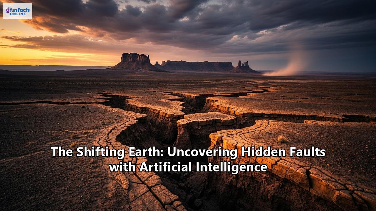
Beneath our feet, the Earth's crust is a fractured mosaic of tectonic plates, constantly in motion. These movements, often imperceptible, build up immense stress along fractures known as faults. When this stress is released, the ground shakes, sometimes with devastating consequences. Earthquakes are one of nature's most formidable forces, capable of leveling cities and reshaping landscapes in mere moments. Yet, for all our scientific progress, a veil of mystery still shrouds many of the faults that lie hidden deep within the Earth, silently accumulating strain. Identifying these unseen threats is one of the most critical challenges in geology and seismology, a painstaking process that has traditionally relied on meticulous fieldwork and indirect measurements.
However, we are now in the midst of a technological earthquake of our own, one that is shaking the very foundations of geoscience. Artificial intelligence (AI) is providing us with a new set of eyes, capable of peering into the subsurface with unprecedented clarity and speed. This powerful tool is not just improving upon old methods; it is creating a paradigm shift, enabling the discovery of thousands of previously unknown faults and providing a much deeper understanding of the complex processes that govern our planet's restless nature. This article will journey into the heart of this revolution, exploring the traditional methods of fault finding, the sophisticated AI models that are replacing them, the vast datasets that fuel these new technologies, and the groundbreaking discoveries they have already unlocked. We will also confront the challenges and ethical considerations that come with such a powerful technology and look ahead to a future where the synergy of human expertise and artificial intelligence may help us build a safer and more resilient world on our ever-shifting planet.
Part 1: The Old Ways - A History of Fault Finding
For centuries, our understanding of the Earth's faults has been built piece by piece, through a combination of astute observation, brute force, and clever scientific techniques. The traditional methods of fault detection, while foundational to modern geology, have always been a battle against the Earth's inherent opacity.
Mapping the Cracks: Surface Geology and GeomorphologyThe earliest fault finders were geologists armed with little more than a rock hammer, a compass, and a keen eye. They walked the land, meticulously mapping rock formations and looking for tell-tale signs of displacement. A sudden break in a continuous layer of rock, a scarp or cliff that cuts across the landscape, or a line of springs forced to the surface by a subterranean barrier—all could point to the presence of a fault. This practice, known as surface geologic mapping, is the bedrock of structural geology. Geomorphology, the study of landforms, also provides clues. Faults can create distinctive features like linear valleys, offset stream channels, and uplifted terraces. However, this method is limited to what is visible at the surface. In many parts of the world, faults are buried beneath thick layers of sediment, dense vegetation, or urban development, rendering them invisible to the surface mapper.
Digging for History: Paleoseismology and TrenchingTo understand the history of a fault and its potential for future earthquakes, geologists literally dig into the past. This field, known as paleoseismology, often involves excavating trenches across a suspected fault zone. The walls of these trenches reveal a cross-section of the shallow subsurface, showing layers of sediment that have been broken and displaced by past earthquakes. By dating the organic material within these layers, scientists can build a timeline of seismic events, estimating the frequency and magnitude of past earthquakes. This information is crucial for long-term seismic hazard assessment. However, trenching is a localized, labor-intensive, and expensive process. It provides a detailed history at a single point but cannot easily map the full extent and geometry of a fault system.
The Earth's Ultrasound: Seismic Reflection SurveysOne of the most powerful tools for peering into the Earth's crust is the seismic reflection survey. The principle is similar to a medical ultrasound or a ship's sonar. Geoscientists generate sound waves at the surface—using sources ranging from specialized "thumper" trucks on land to compressed air guns at sea—and listen for the echoes that bounce back from different rock layers below. These echoes are recorded by arrays of sensors called geophones or hydrophones.
The data collected is a complex jumble of wave forms, which must undergo extensive computer processing to create a 2D or 3D image of the subsurface. In these seismic images, faults often appear as sharp discontinuities or breaks in otherwise continuous rock layers. For decades, the interpretation of these seismic volumes has been the primary method for fault detection in industries like oil and gas exploration and for academic research.
The Inherent Limitations of Traditional MethodsWhile these traditional methods have been invaluable, they all share significant limitations. The interpretation of seismic data, in particular, is a highly subjective and time-consuming task. An experienced geoscientist might spend weeks or even months manually picking out faults slice by slice through a 3D seismic volume. This manual process is not only slow but also prone to interpreter bias; two different experts might produce two different fault maps from the same dataset.
Furthermore, traditional interpretation and the attributes used to enhance fault visibility can struggle in areas of complex geology or poor data quality. Subtle faults, or those that are part of a dense, interconnected network, can be easily missed. The sheer volume of data being collected today also presents a major challenge. Modern seismic surveys can cover thousands of square kilometers and generate petabytes of data, far more than can be efficiently analyzed by human interpreters alone. It is at this intersection of massive data volumes and the need for greater accuracy and efficiency that artificial intelligence has emerged as a transformative force.
Part 2: The AI Revolution in Seismology
The world of geology is being fundamentally reshaped by the same artificial intelligence technologies that power facial recognition on our phones, recommend movies, and enable self-driving cars. At its core, AI, and specifically its subfields of machine learning and deep learning, is about teaching computers to recognize patterns in data. Given that geology and seismology are all about deciphering patterns in complex datasets, the synergy was inevitable.
The application of AI to seismic interpretation is not just an incremental improvement; it's a leap forward in capability. Where a human interpreter might painstakingly scan a few lines of a seismic survey, an AI model can analyze the entire 3D volume at once, identifying subtle relationships and features that are invisible to the naked eye. This has led to the development of a new generation of tools that can automate much of the laborious work of fault detection, freeing up geoscientists to focus on higher-level interpretation and understanding.
The Brains of the Operation: AI Models ExplainedSeveral types of AI models have proven to be particularly adept at finding faults. The most prominent among them are deep learning models, which use multi-layered artificial neural networks inspired by the structure of the human brain.
Convolutional Neural Networks (CNNs): Masters of the ImageConvolutional Neural Networks are a class of deep learning models that have revolutionized computer vision. They are designed to automatically and adaptively learn spatial hierarchies of features from images. A CNN learns to recognize simple features like edges and corners in its initial layers, and then combines these in subsequent layers to detect more complex shapes and objects.
This is perfectly suited for seismic interpretation, where 3D seismic data can be treated as a large image volume. Faults, within these images, have distinct visual characteristics—they are discontinuities that disrupt the otherwise continuous layering of sedimentary rocks. A CNN can be trained on thousands of examples of seismic images with and without faults to learn what a fault "looks like." Once trained, it can rapidly scan new seismic volumes and generate a "fault probability volume," where each point in the volume is assigned a value indicating the likelihood of it being part of a fault. This provides interpreters with a clear and detailed map of the fault network, often with much greater clarity than traditional seismic attributes.
U-Net and Its Progeny: Precision SegmentationWhile a CNN is excellent at classifying whether an image patch contains a fault, a more advanced architecture called the U-Net excels at precisely delineating the boundaries of those faults. The U-Net architecture, originally developed for biomedical image segmentation (like identifying tumors in medical scans), is characterized by its distinctive "U" shape.
It consists of two main paths:
- The Encoder (Contracting Path): This path is a series of convolutional and pooling layers that act like a traditional CNN. It progressively down-samples the input image, capturing the contextual information and identifying what features are present.
- The Decoder (Expanding Path): This path takes the compressed feature representation from the encoder and progressively up-samples it. Crucially, it combines this up-sampled information with high-resolution features from the corresponding layer in the encoder path via "skip connections."
This architecture allows the U-Net to combine the "what" (context from the encoder) with the "where" (localization from the decoder) to produce a highly precise segmentation map of the input image. In the context of fault detection, this means the U-Net can output a clean, pixel-perfect map of the fault planes.
The success of the basic U-Net has led to the development of several more advanced variants tailored for seismic data, such as:
- Nested Residual U-Net: This architecture incorporates residual connections within the U-Net, which helps in training deeper networks and can improve the detection of fine fault details.
- Transformer-assisted U-Nets: These models integrate "transformer" blocks, a technology that has been hugely successful in natural language processing. Transformers use an "attention mechanism" that allows the model to weigh the importance of different parts of the input data, helping it to focus on the most relevant features for fault detection and to better understand long-range dependencies within the data.
These sophisticated architectures are at the cutting edge of AI-driven fault interpretation, delivering results that are more accurate, continuous, and geologically consistent than ever before.
Part 3: The Fuel for the Machine - Data, Data, and More Data
An AI model, no matter how sophisticated its architecture, is nothing without data. The process of "learning" in machine learning is, in essence, the process of finding patterns in vast amounts of training data. In the quest to uncover hidden faults, geoscientists are harnessing an ever-expanding array of datasets, creating a more holistic and dynamic view of the Earth's crust than was ever possible before.
The Main Course: Seismic DataThe primary fuel for AI-powered fault detection remains seismic reflection data. Modern 3D seismic surveys generate massive, data-rich "cubes" that represent a volume of the Earth's subsurface. These volumes are the raw material that AI models are trained on and applied to. The models learn to identify the subtle changes in texture, amplitude, and continuity within these data volumes that signify the presence of a fault. The sheer size of these datasets, which was once a bottleneck for manual interpretation, is a major advantage for AI, which thrives on large quantities of information.
The Power of Integration: Multi-Modal DatasetsWhile seismic data provides a static, structural image of the subsurface, faults are dynamic systems that deform and move over time. To capture this dynamic behavior, scientists are increasingly integrating data from other sources, a practice known as multi-modal data fusion. AI is particularly powerful in this domain, as it can learn the complex, non-linear relationships between different types of data.
- InSAR (Interferometric Synthetic Aperture Radar): This remarkable satellite-based technique allows us to monitor tiny changes in the ground surface over vast areas with millimeter-level precision. By comparing radar images of the same area taken at different times, InSAR can detect subtle uplift or subsidence of the ground. This deformation can be caused by the slow, continuous movement along a fault, known as aseismic creep, or by the buildup of strain before a major earthquake. AI can analyze these large-scale deformation patterns to identify active faults that might not have any clear surface expression.
- LiDAR (Light Detection and Ranging): LiDAR works by firing rapid pulses of laser light from an aircraft or drone towards the ground and measuring the time it takes for the light to return. This process generates an incredibly detailed 3D map of the Earth's surface, known as a point cloud. By filtering out vegetation, LiDAR can create a "bare-earth" model, revealing subtle geological features that would otherwise be hidden. This has been revolutionary for identifying fault scarps—the surface expression of a fault's movement—in forested or vegetated areas.
- GPS (Global Positioning System): A network of high-precision, continuously operating GPS stations can track the movement of tectonic plates and the deformation of the Earth's crust in real-time. This data provides direct measurements of how strain is accumulating on and around fault systems. AI models can integrate this GPS data with seismic and InSAR data to build a comprehensive picture of a fault's behavior and its potential for future rupture.
By fusing these disparate datasets, AI can move beyond simple fault mapping to a more holistic form of fault system analysis, linking the deep structure seen in seismic data with the surface deformation and strain accumulation that are the hallmarks of an active, and potentially hazardous, fault.
The Synthetic Data Solution: Overcoming a Scarcity of RealityOne of the biggest challenges in training supervised machine learning models is the need for large quantities of high-quality, labeled data. In geology, this means having countless examples of seismic images where faults have been accurately and painstakingly labeled by human experts. Creating such a dataset is a significant bottleneck.
To overcome this, researchers are turning to a clever solution: synthetic data. Using their deep understanding of geological processes and wave physics, scientists can programmatically generate a virtually limitless number of synthetic 3D seismic volumes. These artificial datasets can be designed to include a huge variety of fault types, orientations, and complexities, along with perfectly accurate fault labels.
This synthetic data can be used in several ways:
- Training from Scratch: AI models can be trained entirely on synthetic data, allowing them to learn the fundamental characteristics of faults in a controlled environment free from the noise and ambiguity of real data.
- Pre-training and Fine-tuning: A model can be "pre-trained" on a massive synthetic dataset to learn general fault features, and then "fine-tuned" on a smaller set of real, labeled data from a specific geological region. This approach, known as transfer learning, significantly improves the model's performance in the target area.
- Data Augmentation: Synthetic data can be used to augment existing real datasets, helping to create a more balanced and diverse training set, which in turn leads to more robust and generalizable AI models.
The use of synthetic data is a game-changer, breaking the dependency on limited, manually labeled datasets and opening the door to the creation of powerful, generalized "foundation models" for geology that can be adapted to a wide range of specific tasks.
Part 4: From Code to Crust - Real-World Discoveries
The theoretical promise of AI in geology is being realized in a series of stunning real-world applications. Across the globe, from the fiery bellies of supervolcanoes to the resource-rich basins deep underground, AI is uncovering a hidden world of geological structures, leading to profound new insights and tangible benefits for society.
Case Study: The Underbelly of a Supervolcano - Campi Flegrei, ItalyThe Campi Flegrei caldera, located just west of Naples, is one of the world's most dangerous supervolcanoes, with over half a million people living within its restless confines. The region is characterized by "bradyseism," a phenomenon of gradual ground uplift and subsidence, accompanied by swarms of small earthquakes. Understanding the fault systems that accommodate this unrest is critical for assessing the risk of both earthquakes and a potential eruption.
Traditional seismic monitoring struggled to make sense of the dense, overlapping earthquake signals. Recently, however, researchers applied a Stanford-developed AI model to the seismic data. The results were nothing short of revolutionary. The AI sifted through the noise and identified over 54,000 earthquakes in a two-year period, a four-fold increase over the 12,000 events detected by conventional methods. This vastly expanded earthquake catalog allowed geophysicists to map the subsurface fault structures with unprecedented precision. The AI-enhanced analysis revealed a well-defined ring fault system around the caldera's rim and, more critically, two previously unappreciated fault systems converging directly beneath the densely populated town of Pozzuoli. This newfound clarity is a crucial advancement for refining seismic hazard models and improving disaster preparedness for the half a million people living in the shadow of the volcano.
Case Study: Yellowstone's Hidden TremorsYellowstone National Park in the United States is another iconic volcanic caldera that is closely monitored by scientists. In a recent study, researchers used a machine learning algorithm to re-examine 15 years of historical seismic data. The AI-powered analysis unearthed approximately 86,000 previously undetected earthquakes, increasing the known seismic catalog for the period by a factor of ten.
This massive new dataset revealed that more than half of the earthquakes in Yellowstone are part of seismic swarms—dense clusters of small, interconnected events. The AI analysis showed that these swarms are occurring along relatively immature and rough fault structures, likely caused by the movement of hot, pressurized fluids through the volcanic plumbing system. This provides a much more detailed picture of the processes occurring deep beneath the caldera and will help scientists to better understand the volcanic and seismic hazards of the region. The sheer scale of the discovery highlights a task that would have been impossible through manual analysis, demonstrating the power of AI to unlock insights hidden within vast archives of data.
Global Applications: A World of DiscoveryThe impact of AI extends far beyond these headline-grabbing case studies. The technology is being deployed across a wide range of applications, driving efficiency and discovery in numerous fields.
- Earthquake-Prone Nations: In countries like Japan and New Zealand, which are situated on active plate boundaries, AI is becoming an indispensable tool. In Japan, researchers are using machine learning models to create highly detailed 3D maps of soil stability, helping city planners to identify areas vulnerable to liquefaction—a phenomenon where the ground behaves like a liquid during an earthquake—and thus guide safer urban development. In New Zealand, AI is being used in various sectors, including the analysis of geospatial data, which has direct applications for understanding geological hazards. These applications are moving geoscience from a reactive to a proactive stance on disaster risk reduction.
- The Hunt for Energy Resources:
Oil and Gas: The oil and gas industry, a long-time user of seismic data, has been an early adopter of AI. AI models can analyze vast 3D seismic surveys in a fraction of the time it would take a human, rapidly identifying the fault-bounded traps where hydrocarbons can accumulate. This not only accelerates the exploration process but also reduces uncertainty and financial risk.
Geothermal Energy: The transition to a sustainable energy future depends on sources like geothermal power. AI is proving to be a powerful ally in the search for geothermal reservoirs, which are often controlled by complex fault and fracture networks that allow hot water to circulate. AI can integrate seismic data with other information, like surface temperature and mineral markers, to pinpoint the most promising locations for drilling, reducing the high costs and risks associated with geothermal exploration.
- Securing Critical Minerals: The clean energy transition also requires a massive supply of critical minerals like lithium, cobalt, and rare earth elements. AI is revolutionizing mineral exploration by sifting through enormous amounts of geological, geophysical, and geochemical data to identify patterns that indicate the presence of valuable mineral deposits. This targeted approach minimizes the need for extensive and environmentally disruptive exploratory drilling, making the search for these vital resources more efficient and sustainable.
- Rapid Response After Disaster: The utility of AI doesn't end when an earthquake strikes. In the chaotic aftermath of a major seismic event, rapid and accurate damage assessment is crucial for guiding emergency response. AI algorithms are now being deployed to automatically analyze high-resolution satellite and drone imagery taken after an earthquake. By comparing pre- and post-disaster images, these models can quickly identify and classify building damage on a city-wide scale, providing first responders with an invaluable map of the hardest-hit areas so they can prioritize search and rescue efforts and allocate resources more effectively.
From fundamental science to industrial application and disaster relief, AI is proving to be a versatile and powerful tool, giving us a clearer and more actionable understanding of our dynamic planet.
Part 5: Peering Inside the Black Box - Challenges and the Quest for Trust
For all its power and promise, the rise of artificial intelligence in geology is not without its challenges. The very complexity that makes deep learning models so effective can also make them opaque. This "black box" problem, where the reasoning behind an AI's decision is not immediately apparent, poses a significant hurdle in a high-stakes field like seismic hazard assessment. To truly integrate AI into critical workflows, geoscientists need not only accurate predictions but also trustworthy and understandable ones.
The Need for Explainable AI (XAI)This has given rise to a burgeoning field of research known as Explainable AI (XAI). The goal of XAI is to develop techniques that can shed light on the decision-making process of complex machine learning models. In geology, this is not just an academic exercise; it's a prerequisite for trust and adoption. An interpreter is unlikely to sign off on drilling a billion-dollar well or redrawing a seismic hazard map based on an AI's recommendation without understanding why the model made that choice.
Several XAI techniques are being adapted for geoscience applications:
- SHAP (SHapley Additive exPlanations): This is a powerful method based on game theory that can explain the output of any machine learning model. For a given prediction (e.g., identifying a point as a fault), SHAP assigns each input feature (e.g., a specific seismic attribute, the texture of the image) an "importance" value. This allows an interpreter to see which features the model was "paying attention" to. For instance, a SHAP analysis might reveal that the model correctly identified a fault based on a combination of a sharp break in the seismic reflectors and a specific textural change, mimicking the logic a human expert would use.
- Saliency Maps: In the context of image analysis, saliency maps are used to create a heatmap that highlights the pixels in the input image that were most influential in the model's decision. This provides a direct visual cue as to what the AI is "looking at," allowing a geoscientist to quickly assess whether the model is focusing on geologically meaningful features or being misled by noise or artifacts.
By using XAI tools, geoscientists can effectively "audit" the AI's reasoning, building confidence in its predictions, identifying potential weaknesses in the model, and ultimately fostering a more collaborative relationship between human and machine.
The Human in the Loop: Augmenting, Not ReplacingA common misconception about AI is that it is destined to replace human experts. In geology, however, the consensus is that AI is a tool for augmentation, not automation. The goal is to build a partnership where AI handles the data-heavy, pattern-recognition tasks it excels at, while human geoscientists provide the crucial context, geological knowledge, and critical thinking that machines currently lack.
This "human-in-the-loop" approach is essential for several reasons:
- Geological Plausibility: An AI model might identify a pattern that is statistically significant but geologically nonsensical. An experienced geoscientist is needed to validate the AI's output against fundamental geological principles and regional knowledge.
- Uncertainty Management: Geological interpretation is rarely a matter of absolute certainty. Human experts can assess the uncertainties in both the data and the AI's predictions, leading to more robust and reliable conclusions.
- Iterative Improvement: The most effective AI workflows are interactive. A geoscientist can review the AI's initial fault interpretation, make corrections based on their expertise, and then use these corrections to retrain and improve the model. This creates a virtuous cycle where both the human and the machine learn and improve.
Beyond the black box problem, several other challenges must be addressed for the widespread and responsible adoption of AI in geology:
- Data Quality and Bias: The adage "garbage in, garbage out" is especially true for AI. If a model is trained on poor-quality, noisy, or biased data, its predictions will be unreliable. For example, if a model is only trained on faults from one particular geological setting, it may perform poorly when applied to a different one. Ensuring access to diverse, high-quality, and well-curated datasets is a critical, ongoing effort.
- Computational Cost: Training large-scale deep learning models requires immense computational power, which can be a significant barrier for academic institutions or smaller companies. The development of more efficient algorithms and the increasing accessibility of cloud computing are helping to mitigate this challenge.
- Ethical Considerations: As AI becomes more powerful, it raises important ethical questions. How should AI-driven assessments of earthquake risk be communicated to the public to inform without causing panic? How can we ensure that these life-saving technologies are deployed equitably and do not exacerbate existing inequalities? These are questions that the geoscience community is actively beginning to address.
Part 6: The Future is Shifting - What's Next for AI in Geology?
The AI revolution in geology is still in its early stages, and the road ahead is filled with exciting possibilities. Researchers are continuously developing more sophisticated models and innovative techniques that promise to further deepen our understanding of the Earth and enhance our ability to live safely and sustainably on it. The future of AI in this field is not just about doing the same things faster, but about enabling entirely new ways of doing science.
Physics-Informed Neural Networks (PINNs): Marrying Data and TheoryOne of the most promising frontiers in scientific machine learning is the development of Physics-Informed Neural Networks (PINNs). Unlike traditional deep learning models that learn solely from data, PINNs are designed to also incorporate the fundamental laws of physics into their learning process.
In the context of seismology, a PINN could be trained not only on seismic data but also constrained by the physical equations that govern how seismic waves propagate through different materials. The model's predictions must, therefore, be consistent with both the observed data and the laws of physics. This has several key advantages:
- Improved Accuracy with Less Data: By embedding physical principles, PINNs can often achieve high accuracy even with smaller training datasets, helping to overcome the data scarcity problem.
- Enhanced Generalization: Because they are grounded in universal physical laws, PINNs are likely to be more robust and generalize better to new, unseen geological environments.
- More Plausible Results: The physics constraints ensure that the model's output is geologically realistic, reducing the likelihood of the model producing nonsensical predictions.
PINNs represent a powerful fusion of data-driven and physics-based approaches, and they hold the potential to revolutionize not just fault detection, but also a wide range of geophysical modeling and inversion problems.
Towards Real-Time Monitoring and ForecastingThe ultimate goal for many seismologists is to move from mapping existing faults to monitoring their behavior in near real-time. The speed and efficiency of AI are making this vision increasingly attainable. Systems are being developed that can continuously ingest and analyze real-time data streams from vast networks of seismic sensors and high-precision GPS stations.
- AI-Powered Early Warning Systems: AI is already enhancing earthquake early warning (EEW) systems. By rapidly analyzing the very first seismic waves (the P-waves) that arrive at a sensor, AI algorithms can predict the intensity of the more damaging S-waves that will follow, potentially providing a few crucial seconds of warning before the strongest shaking begins.
- Real-Time Hazard Assessment: In the future, AI systems may be able to continuously monitor the subtle signals of strain accumulation and release along fault zones, providing a dynamic, evolving assessment of seismic hazard. While true earthquake prediction (specifying the exact time, place, and magnitude of a future earthquake) remains a distant and perhaps unattainable goal, AI is providing the tools to move towards a more probabilistic and time-dependent form of forecasting.
As AI models become more robust and reliable, we can expect to see the development of increasingly automated interpretation workflows. It is conceivable that in the not-too-distant future, an AI system could take a raw 3D seismic volume and, with minimal human input, produce a preliminary 3D geological model, complete with faults, horizons, and different rock layers.
This will not make geoscientists obsolete. Instead, it will free them from the tedious, time-consuming tasks of manual data processing and interpretation, allowing them to focus on what humans do best: critical thinking, creative problem-solving, and integrating diverse lines of evidence to build a comprehensive geological story. The geoscientist of the future may be less of a "data clicker" and more of an "AI orchestrator," guiding and validating these powerful new tools to answer the most complex and important questions about our planet.
Ethical and Societal ResponsibilitiesAs we harness the power of AI to reveal the Earth's hidden dangers, we also take on new ethical responsibilities. The geoscience community is actively engaged in developing ethical frameworks for the use of AI. This includes ensuring the transparency and explainability of models used for public safety, working to mitigate biases in data and algorithms, and establishing clear guidelines for the responsible communication of risk. The goal is to ensure that these powerful technologies are used not just to advance science, but to serve the public good, uphold human rights, and build a more just and resilient global society.
Conclusion
The ground beneath us is in constant, silent motion, a dynamic and powerful system that we are only just beginning to fully comprehend. For generations, our view into the Earth's depths has been hazy, pieced together from surface clues and the faint echoes of sound waves. We have been like detectives trying to solve a case with only a few smudged fingerprints. Now, artificial intelligence has provided us with a revolutionary new set of forensic tools, allowing us to analyze the data-rich tapestry of the Earth's crust with astonishing speed and clarity.
We have seen how sophisticated AI models, inspired by the human brain, can learn to see the subtle signatures of faults in seismic data, uncovering tens of thousands of hidden earthquakes and revealing the true complexity of our planet's tectonic plumbing. From the volcanic caldera of Campi Flegrei to the resource-rich basins of the world's oceans, AI is not only redrawing our geological maps but also making the search for energy and mineral resources more efficient and sustainable. This technological leap is enabling us to build a more dynamic and detailed understanding of seismic hazards, which in turn informs safer urban planning, more resilient infrastructure, and more effective disaster response.
Yet, this new power comes with profound responsibilities. The journey ahead requires a commitment to transparency and a deep understanding of the "black box" of AI, ensuring that these powerful algorithms are not just predictive, but also explainable and trustworthy. It demands a continued partnership between human and machine, a synergy where the computational power of AI augments the irreplaceable wisdom and critical judgment of the expert geoscientist.
The shifting earth will always present us with challenges. But as we continue to refine these remarkable AI tools, we are better equipped than ever before to understand the forces at play. We are moving from a static to a dynamic view of our planet, from reaction to proaction. By embracing the power of artificial intelligence, we are not just uncovering hidden faults; we are illuminating a path toward a future where we can live more safely and intelligently on our restless, beautiful, and ever-shifting world.
Reference:
- https://www.geoinsights.com/future-of-seismic-interpretation-with-machine-learning-and-deep-learning/
- https://geoexpro.com/artificial-intelligence-and-seismic-interpretation/
- https://www.earthanalytics.ai/earthnet-ai-seismic-interpretation
- https://www.halliburton.com/en/resources/optimizing-seismic-fault-interpretation-with-ai-and-cloud-technologies
- https://geoexpro.com/how-machine-learning-is-helping-seismic-structural-interpreters-in-the-age-of-big-data/
- https://www.earthdoc.org/content/papers/10.3997/2214-4609.2022616010
- https://www.preventionweb.net/news/building-safer-cities-ai-machine-learning-model-enhances-urban-resilience-against-liquefaction
- https://www.sciencedaily.com/releases/2024/10/241028131746.htm
- https://www.ibm.com/us-en
- https://www.sandtech.com/insight/ai-in-urban-planning-using-tech-to-redefine-city-design/
- https://arxiv.org/pdf/2309.00652
- https://arxiv.org/html/2506.11164v1
- https://tcblog.protiviti.com/2024/01/03/the-pros-and-cons-of-using-synthetic-data-for-training-ai/
- https://www.ecinnovations.com/blog/synthetic-data-generation-what-is-its-role-in-ai-training/
- https://newzealand.ai/case-studies
- https://newzealand.ai/artificial-intelligence-case-studies
- https://www.researchgate.net/publication/370239930_Explainable_Artificial_Intelligence_XAI_Model_for_Earthquake_Spatial_Probability_Assessment_in_Arabian_Peninsula
- https://energy.sustainability-directory.com/question/what-role-does-ai-play-in-geothermal-exploration/
- https://www.ogspace.com/ais-impact-on-geothermal-resource-mapping/
- https://www.researchgate.net/publication/383748467_Applications_of_artificial_intelligence_in_geothermal_resource_exploration_A_review
- https://www.baseloadcap.com/why-ai-is-turning-to-geothermal-and-vice-versa/
- https://journal.hep.com.cn/duse/EN/10.1002/dug2.12122
- https://pmc.ncbi.nlm.nih.gov/articles/PMC8271973/
- https://masai-project.eu/masai-pioneering-damage-assessment-through-ai-and-satellite-technology/
- https://polen.itu.edu.tr/items/568a5888-eeaf-4639-883b-e1c1bafbba2a
- https://flypix.ai/blog/building-damage-assessment/
- https://www.mdpi.com/2075-5309/14/10/3255
- https://www.mdpi.com/2072-4292/15/9/2248
- https://www.researchgate.net/figure/Explainable-AI-XAI-framework-using-data-driven-model-for-seismic-design-and-assessment_fig1_384101436
- https://research.aalto.fi/files/171094975/1-s2.0-S0141029625000112-main.pdf
- https://seg.org/podcasts/episode-234-how-ai-is-being-applied-to-seismic-interpretation/
- https://www.geoinsights.com/ai-trends-in-geoscience-technology/
- https://www.google.com/search?q=time+in+Central+Otago+District,+NZ
- https://www.geoinsights.com/trends-in-geoscience-technology/
- https://www.the-innovation.org/article/id/676cfaf7ca8e190bae900af2