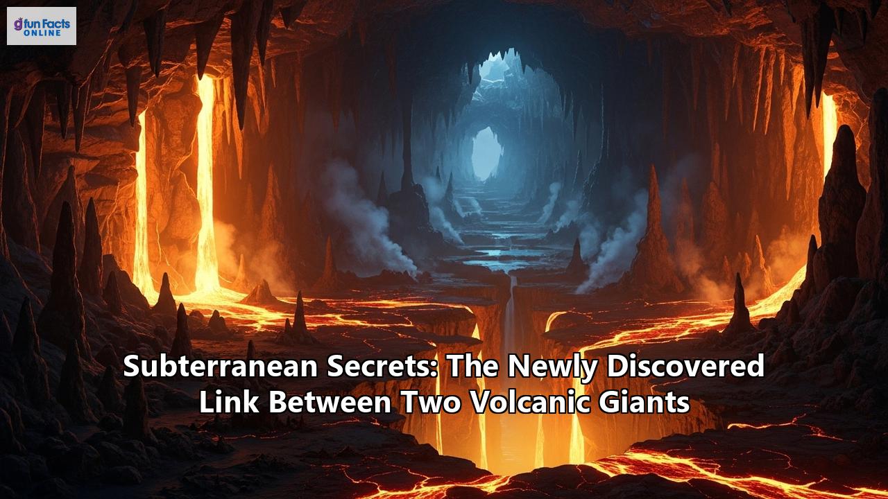
An Earth-shattering revelation has sent tremors through the world of volcanology. In a groundbreaking discovery, scientists have unearthed a hidden, fiery artery connecting two of Greece's most formidable volcanic giants: Santorini and Kolumbo. This subterranean link, long suspected but never proven, was unveiled through a dramatic series of events that has permanently altered our understanding of how volcanoes work. The finding suggests that these seemingly separate entities are, in fact, part of a single, colossal, and dynamically interconnected magmatic system.
This is not just a story about two volcanoes. It is a narrative that delves deep into the Earth's crust, rewriting textbooks and forcing a critical re-evaluation of volcanic hazards in some of the most densely populated and visited places on the planet. The discovery in the Aegean Sea is a critical piece of a much larger, global puzzle that scientists are just beginning to assemble. From the volcanic archipelago of Japan to the majestic, ice-clad peaks of North America's Cascade Range, evidence is mounting that volcanoes rarely act alone. They are part of vast, interconnected plumbing networks, or "magma highways," where molten rock can travel, share, and compete for supply, creating a complex and unpredictable dance of pressure and release.
This comprehensive article will journey into the heart of these volcanic behemoths, exploring the subterranean secrets that bind them. We will begin with the dramatic story of Santorini and Kolumbo, detailing the intense seismic crisis that led to this paradigm-shifting discovery. We will then travel across the globe to examine other known and suspected volcanic connections, from Japan's Aira and Kirishima to the sprawling magmatic web beneath the Pacific Northwest. Along the way, we will unravel the cutting-edge science and technology that allows geologists to peer deep beneath the Earth's surface, transforming our view of the planet from a collection of isolated geological features into a single, intricate, and living system. Finally, we will confront the profound implications of these discoveries, exploring what they mean for the millions of people living in the shadow of these sleeping, but interconnected, giants.
The Aegean Underworld: A Tale of Two Volcanoes
The Aegean Sea, a cradle of ancient civilizations, is also a crucible of immense geological power. It is home to the Hellenic Volcanic Arc, a 500-kilometer-long chain of volcanoes stretching from mainland Greece to Turkey. This arc is the product of a timeless battle between tectonic plates, where the African Plate dives beneath the Aegean microplate, a process known as subduction. This geological turmoil melts rock deep within the Earth, giving birth to the magma that fuels the region's fiery temperament. For millennia, the most famous and feared member of this arc has been Santorini.
Santorini: A Legacy of Fire and Water
Santorini, known officially as Thera, is the stuff of legends. Its iconic, crescent-shaped caldera, with whitewashed villages clinging to vertiginous cliffs, is the breathtaking remnant of one of the largest volcanic eruptions in recorded human history. Around 1600 BCE, a cataclysmic event, now known as the Minoan eruption, occurred here. The volcano, which was then a single, round island called Stronghylì, exploded with unimaginable force, ejecting an enormous volume of ash and pumice. The center of the island collapsed into the sea, creating the vast caldera we see today and triggering colossal tsunamis that radiated across the Mediterranean, devastating coastal communities and contributing to the decline of the great Minoan civilization on the nearby island of Crete.
Santorini's eruptive history did not end there. Over the subsequent centuries, renewed volcanic activity began to build new land within the flooded caldera. A series of eruptions, starting as early as 197 BCE and continuing intermittently into the 20th century, created the Kameni islands, Palia (Old) Kameni and Nea (New) Kameni, which now sit in the center of the bay. The most recent eruption occurred in 1950, a relatively minor event that produced a small lava dome and flow. Despite its periods of quiescence, Santorini has always been considered an active and closely monitored volcano, a beautiful but potent threat slumbering beneath the waves.
Kolumbo: The Hidden Neighbor
Just seven kilometers northeast of Santorini, hidden beneath the surface of the Aegean, lies another, more mysterious volcanic giant: Kolumbo. Kolumbo is a large, active submarine volcano, one of about twenty submarine cones that extend in a line from Santorini. For centuries, its presence was known only through the violent disruption it once caused. In the summer of 1650, fishermen and sailors reported strange phenomena: the water began to bubble and change color, and the sea itself grew hot. These were the harbingers of a catastrophic eruption.
On September 29, 1650, Kolumbo breached the surface and exploded with tremendous force. The eruption, which was heard over 100 kilometers away, sent a column of ash and pumice into the sky and unleashed pyroclastic flows—superheated currents of gas and volcanic debris—that raced across the sea to the shores of Santorini. Historical accounts tragically record that around seventy people and many animals were killed, not by lava, but by the asphyxiating toxic gases, likely hydrogen sulfide, released during the eruption. The blast also triggered a powerful tsunami, with waves reportedly reaching up to 20 meters high, causing widespread damage on Santorini and other islands up to 150 kilometers away. The volcano's cone collapsed back into the sea, leaving behind a massive crater more than 1.5 kilometers wide and 500 meters deep.
Modern scientific expeditions have since revealed that Kolumbo is far from dormant. Its crater floor is a hotbed of geothermal activity, featuring a vibrant field of hydrothermal vents that spew superheated, metal-rich water, building chimney-like structures on the seafloor. A 2023 study using advanced seismic imaging uncovered a previously undetected magma chamber growing beneath Kolumbo, confirming it as a significant and active threat. Scientists estimated that since its 1650 eruption, the chamber had been accumulating new melt, raising concerns about its potential for a future highly explosive, tsunami-generating event.
The Crisis of 2024-2025: A Region on Edge
For decades, scientists had debated whether Santorini and Kolumbo were part of the same magmatic system or were fed by separate plumbing. While their proximity was suggestive, there was no definitive proof of a connection. That all changed during a period of intense geological unrest that began in mid-2024 and culminated in a dramatic crisis in early 2025.
The first sign of trouble was subtle. Starting in July 2024, highly sensitive GPS instruments on Santorini detected that the island's surface was beginning to swell, rising by a few centimeters. This "inflation" is a classic sign of magma accumulating in a shallow reservoir beneath a volcano. This swelling was accompanied by an increase in low-level seismic activity centered around the Santorini caldera.
Then, on January 27, 2025, the situation escalated dramatically. The earthquake rate surged, with an intense swarm of over 1,200 tremors rattling the region over several weeks. Tens of thousands of earthquakes were recorded in total, with the strongest reaching magnitudes over 5.0. The seismic crisis was so intense that Greek authorities declared a state of emergency, fearing an imminent eruption.
Crucially, scientists observed that the epicenter of this seismic swarm was not stationary. It began under Santorini and then migrated over several weeks, moving northeastward away from the island and directly towards the submarine volcano Kolumbo. This migration path was a critical clue, suggesting that magma was not just accumulating but was on the move, forcing its way through the crust.
The Revelation: A Shared Magma Source
The wealth of data collected during this crisis—from land-based seismic stations, ocean-bottom sensors placed near Kolumbo, GPS measurements, and satellite radar (InSAR) that can detect ground deformation with millimeter precision—allowed a team of international researchers to reconstruct the subterranean events with unprecedented detail. Led by scientists from the GFZ German Research Centre for Geosciences and the GEOMAR Helmholtz Centre for Ocean Research, the study, published in the prestigious journal Nature in September 2025, provided the first-ever direct evidence of a magmatic connection between Santorini and Kolumbo.
The story told by the data was astonishing. The sequence of events revealed a complex, coupled system:
- Inflation at Santorini: The initial swelling of Santorini from mid-2024 was caused by the influx of magma into its shallow reservoir from a deeper source.
- Magma Migration: The intense earthquake swarm that began in late January 2025 was the sound of this magma on the move. The migrating seismicity tracked the path of a dike—a sheet-like intrusion of magma—as it propagated laterally from a mid-crustal reservoir located beneath Kolumbo, pushing its way northeastward. The researchers calculated that a staggering 0.31 cubic kilometers of magma intruded into this dike.
- A Simultaneous Sigh: The most compelling piece of evidence came from the geodetic data. As the earthquake swarm migrated away from Santorini and towards Kolumbo, GPS stations showed that both volcanoes began to deflate simultaneously. It was as if both volcanic edifices let out a collective "sigh."
This simultaneous deflation could only be explained one way: both Santorini and Kolumbo are fed by the same, much deeper, mid-crustal magma reservoir. The movement of magma out of this shared source and into the propagating dike caused a pressure drop that was felt across the entire system, leading to the subsidence of both volcanoes. The crisis was not a story of one volcano waking up, but of a single, interconnected system stirring in its sleep. The two volcanic giants, it turns out, compete for the same supply of molten rock from deep within the Earth's crust.
This discovery has profound implications. The existence of a complex, shared plumbing system complicates the task of eruption forecasting. Unrest at one volcano could be a prelude to an eruption at the other, or it could signal a subterranean shift that relieves pressure and makes an eruption less likely. It highlights the urgent need for real-time, high-resolution monitoring of both volcanic centers to better understand their dynamic interplay and to provide more accurate warnings to the hundreds of thousands of residents and tourists who flock to the iconic island, unaware of the fiery secrets hidden just below.
A Global Phenomenon: The Web of Volcanic Connections
The groundbreaking discovery at Santorini and Kolumbo is not an isolated case. It is a powerful confirmation of a phenomenon that volcanologists are now identifying across the globe. From the densely populated shores of Japan to the rugged, volcanic spine of North America, evidence is mounting that many of the world's most dangerous volcanoes are linked by subterranean plumbing systems, forming complex networks of fire and rock.
Japan's Dueling Giants: Aira and Kirishima
In southern Japan, on the island of Kyushu, lie two of the country's most active and hazardous volcanic centers: the Aira caldera and the Kirishima volcanic group. The Aira caldera, a massive depression similar to Santorini's, is home to the relentlessly active Sakurajima volcano, which frequently dusts the nearby city of Kagoshima with ash. Just 22 kilometers to the north lies Kirishima, a group of several volcanic cones, including Shinmoedake, which produced a significant eruption in 2011.
For years, scientists at the Sakurajima Volcano Research Center had observed a steady, continuous inflation of the Aira caldera, indicating a constant supply of magma into its reservoir. But during the 2011 eruption of Kirishima, they noticed something peculiar. As Kirishima erupted, the steady inflation of Aira suddenly stopped and reversed; the caldera began to deflate. Once the eruption at Kirishima ceased, the deflation at Aira stopped, and the caldera resumed its steady inflation.
A 2018 study published in Scientific Reports analyzed this sequence of events using data from a dense network of GPS stations. The researchers, led by a team from the University of Miami, concluded that the temporary deflation of Aira could not be explained simply by the change in stress in the crust caused by the Kirishima eruption. Instead, the only plausible explanation was that magma was being withdrawn from the Aira system to feed the eruption at its neighbor. This provided the first clear geodetic evidence of a deep, subterranean connection between the two volcanic systems.
The Aira-Kirishima case demonstrates that the interaction between linked volcanoes can be a delicate balancing act. The eruption of one can effectively "steal" magma from the other, temporarily reducing the pressure and, potentially, the eruption risk at its neighbor. However, it also proves the existence of a much larger, shared magmatic system at depth, a crucial piece of information for assessing the long-term volcanic hazard in the densely populated Kagoshima region. The study highlighted that these magma pathways might open and close periodically, making their interactions complex and variable over time.
The Cascade Connection: A Magma Highway Under the Pacific Northwest
Stretching over 1,100 kilometers from northern California to southern British Columbia, the Cascade Volcanic Arc is the fiery spine of the Pacific Northwest. It is the result of the Juan de Fuca oceanic plate subducting beneath the North American continental plate, a process that has given rise to iconic and dangerous volcanoes such as Mount Rainier, Mount St. Helens, Mount Hood, and Mount Shasta. For a long time, these volcanoes were largely studied and monitored as individual threats. Mount Rainier, with its colossal cloak of ice, poses a major lahar (volcanic mudflow) risk to the Seattle-Tacoma metropolitan area. Mount St. Helens is infamous for its explosive 1980 eruption, a stark reminder of the arc's violent potential.
However, a wave of recent research, much of it emerging in 2023 and 2025, has begun to shatter the illusion that these are isolated systems. Instead, scientists are uncovering evidence of vast, interconnected magma reservoirs and corridors deep beneath the range, suggesting a complex, shared plumbing system on a regional scale.
The first major clues came from geophysical techniques that can map the Earth's subsurface. Magnetotelluric surveys, which measure variations in the Earth's electrical conductivity, revealed a large, highly conductive zone in the mid-crust beneath southern Washington, located between Mount St. Helens, Mount Adams, and Mount Rainier. This anomaly, dubbed the Southern Washington Cascades Conductor (SWCC), was interpreted as a large zone of partial melt—a crustal magma reservoir.
More recent and advanced seismic imaging studies have added stunning detail to this picture. A January 2025 study in Nature Geoscience used upgraded seismic networks to show that large magma reservoirs are widespread and persistent features beneath most Cascade volcanoes, including those that have been dormant for thousands of years, like Crater Lake. This finding challenged the long-held belief that magma chambers are ephemeral features that dissipate after an eruption, suggesting instead that they are a "baseline situation" for these volcanoes.
Building on this, a 2023 study published in the journal Geochemistry, Geophysics, Geosystems by a team including researchers Chengxin Jiang, Brandon Schmandt, and Geoffrey Abers, used a technique called radial seismic anisotropy to analyze ambient seismic noise. Their results were startling. They imaged two distinct, sub-parallel low-velocity zones—interpreted as deep crustal magma reservoirs—at a depth of 15 to 30 kilometers. One of these zones appears to connect Mount Rainier to Mount Adams, while the other connects Mount St. Helens to Mount Hood.
This research provides the scientific foundation for the recent, and often sensationalized, claims of a "magma highway" or "magma corridor" beneath the Cascades. While not a literal tunnel, this network of deep crustal mush zones and reservoirs allows for the potential transfer of magma and stress across significant distances, linking the fates of multiple volcanoes. The study suggests that a single, large reservoir may fuel several stratovolcanoes at the surface.
The implications are profound. An injection of magma or a change in pressure in one part of the system could theoretically influence the behavior of a neighboring volcano miles away. This forces a complete re-evaluation of volcanic risk in the Pacific Northwest, a region with a rapidly growing population of over 10 million people. Emergency planners, who once focused on the threat from a single, nearby volcano, must now consider the possibility of a more complex, regional crisis, where unrest at one volcano could be a symptom of a much larger disturbance, or even a precursor to activity at another. While there is no evidence to suggest an imminent chain-reaction eruption, the discovery of this interconnected system underscores the dynamic and poorly understood nature of the ground beneath one of North America's most beautiful and hazardous regions.
The Science of Seeing the Unseen: How Subterranean Links Are Found
Uncovering the secret lives of volcanoes and their hidden connections requires a sophisticated arsenal of scientific tools and techniques. Geologists can no longer rely solely on what they see at the surface. They must become forensic detectives, piecing together clues from deep within the Earth's crust to build a picture of the magmatic plumbing systems below. The discoveries in Greece, Japan, and the Cascades were made possible by the integration of multiple geophysical and geodetic methods, each providing a unique window into the planet's inner workings.
Seismic Tomography: A CT Scan for the Earth
One of the most powerful tools for imaging the subsurface is seismic tomography. In much the same way a medical CT scan uses X-rays to create a 3D image of the human body, seismic tomography uses seismic waves—the vibrations from earthquakes or artificial explosions—to create a 3D map of the Earth's interior.
These waves travel at different speeds depending on the material they pass through. They slow down when moving through hotter, less dense material, such as molten or partially molten rock (magma), and speed up when passing through colder, denser rock. By deploying a network of seismometers around a volcanic area, scientists can record the arrival times of seismic waves from distant earthquakes as they pass through the crust and mantle below. By analyzing the delays in these arrival times, they can identify "slow zones" that correspond to potential magma reservoirs.
Recent advancements have made this technique even more powerful. Full-waveform inversion (FWI), for example, doesn't just use the arrival time but analyzes the entire seismic waveform, allowing for much higher-resolution images of magma bodies. Another technique, ambient noise tomography, uses the constant, low-level seismic vibrations of the Earth (the "hum" of the planet) as a source, which is particularly useful in areas with few earthquakes. It was through these kinds of advanced seismic imaging techniques that researchers were able to identify the persistent magma reservoirs under the Cascade volcanoes and the large conductive body of the Southern Washington Cascades Conductor.
Geodesy: Measuring the Earth's Breath
While seismic methods reveal the structure of the plumbing system, geodesy measures its activity. Volcano geodesy is the science of measuring changes in the shape, gravity field, and orientation of the Earth. Active volcanic systems are dynamic; as magma moves into or out of a reservoir, the ground above it deforms, swelling (inflating) or subsiding (deflating). These movements, though often minuscule, can be precisely measured.
The primary tools of modern volcano geodesy include:
- Global Navigation Satellite Systems (GNSS), most commonly the Global Positioning System (GPS), can measure the position of a point on the Earth's surface with millimeter-level accuracy. By establishing a network of permanent GNSS stations on a volcano, scientists can track ground deformation in three dimensions over time, revealing inflation and deflation that signals magma movement. The critical evidence for the Aira-Kirishima link came from analyzing the deflation of Aira's GPS stations during Kirishima's eruption.
- Interferometric Synthetic Aperture Radar (InSAR) is a satellite-based radar technique that can create detailed maps of ground deformation over large areas. By comparing two radar images of the same area taken at different times, scientists can detect surface changes with centimeter to sub-centimeter precision. This was a key technology used in the Santorini-Kolumbo study, helping to model the deflation of both volcanic centers and the intrusion of the magma-filled dike.
- Tiltmeters and Strainmeters are highly sensitive instruments installed on the flanks of a volcano that measure tiny changes in the slope of the ground (tilt) or the stretching and squeezing of the rock (strain), providing real-time data on deformation caused by subsurface pressure changes.
By combining these geodetic techniques, scientists can model the location, depth, and volume change of a magma source with remarkable accuracy, as was demonstrated in both the Santorini and Aira caldera studies.
A Symphony of Signals: The Integrated Approach
The true power of modern volcanology comes from integrating these different datasets. The Santorini-Kolumbo discovery is a perfect example. Scientists combined data from land-based seismometers, ocean-bottom seismometers, GNSS stations on the island, and InSAR satellite imagery. The seismic data tracked the path of the moving magma (the earthquake swarm), while the geodetic data measured the resulting "breathing" of the volcanoes (the inflation and deflation). Together, they told a cohesive story of a shared plumbing system being activated.
Furthermore, new technologies like Artificial Intelligence (AI) and machine learning are revolutionizing data analysis. In the Santorini study, researchers used a newly developed AI model to help locate the thousands of small earthquakes with greater speed and precision than would have been possible manually, allowing for a near real-time reconstruction of the crisis.
This multi-faceted, technology-driven approach is what allows scientists to move beyond observing individual volcanoes and start to understand them as complex, interacting systems. It is this integrated science that is uncovering the subterranean secrets that are fundamentally changing our view of the volcanic world.
Living on a Web of Fire: The New Reality of Volcanic Risk
The discovery that volcanic giants can be secretly linked by vast subterranean plumbing systems is more than just a scientific curiosity; it is a profound revelation that fundamentally changes our assessment of volcanic hazards and the nature of risk for millions of people worldwide. This new understanding forces us to look beyond the immediate threat of a single, smoking cone and consider the interconnected dynamics of an entire region.
Complicating the Forecast
For decades, the standard model of volcano monitoring focused on tracking signs of unrest at an individual volcano—an increase in earthquakes, ground swelling, or gas emissions—to forecast a potential eruption. The discovery of interconnected systems throws a wrench into this linear approach.
Unrest at one volcano may no longer be a simple indicator of its own impending eruption. As seen with Aira and Kirishima, the inflation of one volcano could be curtailed as its neighbor begins to erupt, siphoning magma from a shared reservoir. Conversely, an injection of magma into a deep, shared system could increase pressure on multiple volcanoes simultaneously, potentially leading to a chain reaction or "domino effect," a scenario of great concern in the Cascade Range. The seismic crisis at Santorini in 2025 could have been a precursor to an eruption at either Santorini or Kolumbo, or neither—it was the signature of magma moving between them, an event that ultimately arrested below the seafloor.
This complexity makes eruption forecasting significantly more challenging. Scientists must now ask a new set of questions: Where is the magma coming from? Where is it going? Is unrest at Volcano A increasing or decreasing the likelihood of an eruption at Volcano B? Answering these questions requires a more holistic and regional approach to monitoring, treating clusters of volcanoes not as individuals, but as members of a single, potentially interactive family.
Redrawing the Hazard Maps
Volcanic hazard maps are crucial tools for land-use planning and emergency management. They delineate the areas likely to be affected by various volcanic phenomena, such as lava flows, pyroclastic flows, lahars, and ashfall. These maps are typically based on a volcano's past eruptive history.
The existence of magma highways, however, suggests that future eruptions may not follow the old scripts. A magmatic dike could propagate laterally for many kilometers, as seen between Santorini and Kolumbo, and potentially erupt at a new, unexpected location far from the main volcanic cone. In the Cascades, the discovery of vast magma reservoirs that don't always sit directly beneath the main peaks suggests that future volcanic vents could open in areas previously considered to be at low risk.
This means that hazard zones may need to be expanded, and planners must account for a wider range of possible eruption scenarios. Communities that believed they were safe because they were situated at a distance from a known volcano might, in fact, be living directly above a branch of a hidden magmatic highway. This new reality demands a comprehensive reassessment of volcanic hazards, particularly in densely populated regions like the Pacific Northwest, southern Japan, and the Aegean.
The Imperative for Advanced, Integrated Monitoring
The only way to navigate this new and more complex volcanic landscape is through enhanced, real-time, and integrated monitoring. The discoveries of these linked systems were not made by chance; they were the result of dense networks of modern scientific instruments collecting high-resolution data.
- Regional Networks: Monitoring can no longer be confined to a single volcanic edifice. Seismic and geodetic networks must be expanded to cover entire volcanic regions to capture the subtle interactions between neighboring systems.
- Offshore Observatories: Submarine volcanoes like Kolumbo and Axial Seamount pose a unique challenge because they are hidden beneath the waves. The 1650 Kolumbo eruption is a stark reminder of the devastating tsunami potential of underwater explosions. The establishment of cabled seafloor observatories, which provide continuous, real-time data on seismicity, deformation, and vent chemistry, is critical for monitoring these hidden threats.
- Integrated Data and AI: As demonstrated by the Santorini crisis, the future of volcano monitoring lies in the ability to rapidly integrate vast amounts of data from different sources (seismic, geodetic, gas, satellite) and use advanced computational tools like AI to interpret the signals in near real-time.
This paradigm shift requires significant international cooperation and investment in scientific infrastructure. Initiatives like the National Volcano Early Warning System in the United States and proposals for permanent seafloor observatories like SANTORY near Santorini are crucial steps in the right direction.
A New Chapter in Volcanology
The discovery of subterranean links between volcanic giants marks the beginning of a new and exciting chapter in our understanding of the Earth. It reveals a planet that is far more interconnected and dynamic than we previously imagined. The ground beneath our feet is not a static mosaic of isolated geological features, but a complex web of hidden pathways and simmering reservoirs, a world of subterranean secrets that we are only just beginning to unveil.
The journeys into the fiery underworlds of Santorini, Japan, and the Cascades have shown that volcanoes have secret lives and hidden conversations. They can compete, they can share, and they can influence one another over vast distances through a language of pressure and stress transmitted through molten rock.
This deeper understanding brings with it a heavy responsibility. As our scientific vision sharpens, so too does our awareness of the hazards. Living in the shadow of these interconnected giants requires a new level of vigilance, a commitment to scientific research, and a willingness to adapt our planning to this new, more complex reality. The story of the Earth is one of constant change, and the unearthing of these subterranean secrets is a powerful reminder that we must continue to listen, to monitor, and to learn from the pulse of our living planet. The survival of those who live on its restless crust may depend on it.
Reference:
- http://media.mcclatchydc.com/static/pdf/Les-magma.pdf
- https://www.researchgate.net/publication/389490079_Novel_Empirical_Models_Comparative_Probabilistic_Analysis_of_Interconnectedness_of_Volcano_Eruption_Nearby_Earthquakes
- https://www.mdpi.com/2076-3417/11/22/10759
- https://www.frontiersin.org/journals/earth-science/articles/10.3389/feart.2017.00102/full
- https://drjameshickey.co.uk/publications/
- https://www.researchgate.net/publication/366402477_The_Nature_of_Active_Magma_Reservoirs_and_Storage_Underneath_Cascade_Volcanoes?_tp=eyJjb250ZXh0Ijp7InBhZ2UiOiJzY2llbnRpZmljQ29udHJpYnV0aW9ucyIsInByZXZpb3VzUGFnZSI6bnVsbCwic3ViUGFnZSI6bnVsbH19
- https://www.nrc.gov/docs/ML0728/ML072830586.pdf
- https://research-information.bris.ac.uk/en/publications/thermomechanical-controls-on-magma-supply-and-volcanic-deformatio
- https://www.usgs.gov/publications/tectonics-and-conductivity-structures-southern-washington-cascades
- https://www.researchgate.net/publication/375769433_Geophysical_and_Geochemical_Constraints_on_Magma_Storage_Depths_Along_the_Cascade_Arc_Knowns_and_Unknowns
- https://pubmed.ncbi.nlm.nih.gov/27619897/
- https://www.usgs.gov/publications/southern-washington-cascades-conductor-a-previously-unrecognized-thick-sedimentary
- https://610kona.com/new-study-shows-washington-volcanoes-intertwined/
- https://www.sci.news/othersciences/geoscience/cascade-volcano-magma-reservoirs-13618.html
- https://www.heritagedaily.com/2020/08/study-rewrites-the-recent-history-of-productive-cascade-arc-volcanoes/134724
- https://pmc.ncbi.nlm.nih.gov/articles/PMC12002533/
- https://research-information.bris.ac.uk/en/publications/thermomechanical-controls-on-magma-supply-and-volcanic-deformatio/projects/
- https://www.researchgate.net/publication/361675866_Volcanic_and_Seismic_Source_Modeling_An_Open_Tool_for_Geodetic_Data_Modeling
- https://www.researchgate.net/publication/315593588_Vertically_extensive_and_unstable_magmatic_systems_A_unified_view_of_igneous_processes
- https://www.frontiersin.org/journals/earth-science/articles/10.3389/feart.2022.917222/full
- https://pubs.usgs.gov/publication/70196222
- https://www.youtube.com/watch?v=czHrvznBbwI
- https://www.usgs.gov/publications/long-lived-partial-melt-beneath-cascade-volcanoes
- https://medium.com/@ferreradaniel/cascade-volcanoes-pulsing-after-megaquake-what-scientists-found-at-mount-rainier-05286f89a586
- https://journals.plos.org/plosone/article/figures?id=10.1371/journal.pone.0320210
- https://agu.confex.com/agu/agu24/meetingapp.cgi/Paper/1564280
- https://pubs.geoscienceworld.org/aapgbull/article-lookup/76/10/1569
- https://www.livescience.com/planet-earth/volcanos/scientists-find-giant-magma-reservoirs-hidden-beneath-dormant-volcanoes-in-the-cascades
- https://earthsky.org/earth/cascade-volcanoes-large-pools-of-magma/
- https://openresearch-repository.anu.edu.au/server/api/core/bitstreams/a6a6dc92-0f57-4279-9d06-c04fc247e83d/content
- https://www.youtube.com/watch?v=Lk9Z3SeRzyY
- https://www.usgs.gov/programs/VHP/volcano-hazards-assessments-support-decision-making
- https://www.researchgate.net/publication/364417606_Segmentation_and_radial_anisotropy_of_the_deep_crustal_magmatic_system_beneath_the_Cascades_arc
- https://www.eskp.de/en/natural-hazards/assessing-volcanic-hazards-935307/
- https://cerg-c.github.io/CERG-C/2024.1/Teaching/CERG/HazardMaps/
- https://www.researchgate.net/publication/337846882_A_comparison_of_inner_Solar_System_volcanism
- https://ouci.dntb.gov.ua/en/works/7WE80zZl/