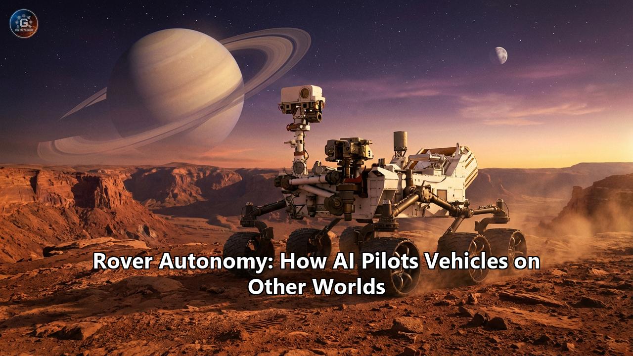
The red dust of Jezero Crater settles on the titanium rims of the Perseverance rover. It is February 2026. A hundred and forty million miles away, a team of engineers at NASA’s Jet Propulsion Laboratory (JPL) sips coffee, waiting. There is no joystick, no real-time video feed, and no "brake" pedal. The signal they just received confirms that for the last two days, their six-wheeled explorer has been driving itself—not just following a blind line, but thinking its way through a labyrinth of Martian boulders.
For decades, planetary exploration was a game of "stop-and-go," a painstaking waltz where human operators moved a rover a few meters, took a picture, waited 20 minutes for the signal to reach Earth, planned the next move, and sent it back. Today, that paradigm is dead. We have entered the era of the autonomous agent.
As humanity pushes toward a permanent presence on the Moon and sets its sights on the icy moons of the outer solar system, the vehicles we send ahead are no longer just remote-controlled cars. They are geologists, cartographers, and decision-makers. They are powered by onboard neural networks, cooperative swarm algorithms, and, increasingly, the same generative AI architectures that power chatbots on Earth.
This is the story of how artificial intelligence pilots vehicles on other worlds—from the lonely tracks of Perseverance to the swarm intelligence of the upcoming CADRE mission and the flying "eyes" of Dragonfly on Titan.
Part I: The Evolution of the Alien Driver
To understand the sophisticated autonomy of 2026, we must look back at the "stone age" of planetary roving. When Sojourner landed on Mars in 1997, it was essentially a reactive insect. It had a simple hazard avoidance system: strictly laser-based striping. If a laser beam didn't hit the ground where expected, the rover stopped. It was safe, but agonizingly slow.
The Spirit and Opportunity rovers (2004) introduced Visual Odometry (VO). This was the first step toward true "self-awareness" of motion. By comparing successive images of the terrain, the rovers could calculate exactly how much they had slipped in the loose sand—a critical capability when a command to "drive forward 1 meter" might result in only 50 centimeters of actual progress due to wheel slip.
Curiosity (2012) upped the ante with AutoNav (Autonomous Navigation). For the first time, a rover could build a local map of "keep-out zones." Human drivers would define a safe corridor, and Curiosity would pick the specific path. But it was computationally expensive. Curiosity had to stop frequently to take images, process them with its limited onboard CPU, think, and then drive again. It was a "stop-think-drive" rhythm that limited autonomous travel to a few dozen meters an hour.Perseverance and the "Thinking While Driving" Breakthrough
When Perseverance landed in 2021, it brought a dedicated computing element for vision processing. This allowed for Enhanced AutoNav (ENav). Perseverance doesn't stop to think; it thinks while it moves. Its cameras snap wide-angle photos, an onboard FPGA (Field-Programmable Gate Array) processes the stereo disparity maps instantly, and the path-planning algorithm updates the trajectory in real-time.
By 2026, this system has evolved even further. The most significant recent leap has been the integration of Generative AI into the planning loop.
The Claude Experiment: A Generative Pilot
In late 2025, JPL conducted a historic experiment involving Claude, a large language and vision model developed by Anthropic. Traditionally, "path planning" was a geometric problem: Is this rock too high? Is this slope too steep? But geometric planners lack "semantic" understanding. They see a geometry that looks like a rock, but they don't understand context—for instance, that a specific texture of sand ripple is dangerous, while a flat bedrock slab is safe, even if the geometry looks similar.
In the 2025 tests, engineers fed the AI high-resolution orbital imagery from the Mars Reconnaissance Orbiter (HiRISE) and surface-level NavCam data. The AI wasn't just asked to find a path; it was asked to "reason" about the terrain.
- Input: "Plot a path to the crater rim that avoids high-slip sand zones."
- Process: The model analyzed the visual textures, identified "sand traps" that geometric filters might miss, and generated a series of waypoints encoded in RML (Rover Markup Language).
The result? The AI-generated path was 95% identical to what a senior human rover driver would have plotted, but it was generated in seconds rather than hours. This "semantic navigation" capability allows Perseverance to handle complex terrains that would previously have triggered a "fault and stop" condition in classic AutoNav.
Part II: The European Approach—Rosalind Franklin
While NASA focused on the "speed" of autonomy, the European Space Agency (ESA) has been refining the "precision" of autonomy for its Rosalind Franklin rover, scheduled for a 2028 launch.
The challenge for Rosalind Franklin is different. It carries a heavy, 2-meter-long drill. Navigating isn't just about not crashing; it's about positioning the vehicle with millimeter-level accuracy over a drill target without sliding.
Visual GNC (Guidance, Navigation, and Control)
Rosalind Franklin's navigation architecture draws from the RAPID and FASTNAV development projects. Unlike the early NASA rovers that relied heavily on wheel odometry (counting wheel turns), the European rover places primary trust in its eyes.
The system uses a "multi-resolution" mapping approach.
- Global Path Planning: Uses orbital data to map out a coarse route of several kilometers.
- Local Path Planning: The rover’s NavCam and LocCam (Localization Cameras) build a dense 3D disparate map of the immediate 20 meters.
- Visual SLAM (Simultaneous Localization and Mapping): As it moves, it tracks "feature points"—distinctive sharp edges of rocks or crater rims. By triangulating these points frame-by-frame, the rover knows its position relative to the start point without needing a GPS (which doesn't exist on Mars).
The crucial innovation here is the Drill Positioning System. Once the rover arrives at a "Science Region of Interest," autonomy shifts from "driving" to "manipulation." The rover must use visual servoing to align its drill box with the surface, compensating for the suspension's settling on soft soil. This is a level of autonomous physical interaction that goes beyond mere driving.
Part III: The Moon—A Commercial & Cooperative Frontier
The Moon is witnessing an explosion of robotic activity in 2026, driven by the Artemis program and the CLPS (Commercial Lunar Payload Services) initiative. The autonomy challenges here are unique: lighting conditions at the Lunar South Pole are brutal, with long, pitch-black shadows that confuse standard cameras.
The LTV (Lunar Terrain Vehicle) Wars
NASA has selected three providers to develop the next-generation "moon buggies"—unpressurized rovers that astronauts can drive, but which must also operate autonomously when the crew is gone.
- Intuitive Machines & The "Moon RACER":
The Brain: Intuitive Machines partnered with CSIRO (Australia’s national science agency) and AVL.
The Tech: They use a LiDAR-first approach. While cameras struggle in the high-contrast lighting of the lunar pole, LiDAR (Light Detection and Ranging) brings its own light. The Moon RACER scans the terrain with laser pulses, building a high-fidelity "point cloud." CSIRO’s "Wildcat" SLAM technology, originally developed for autonomous mining in GPS-denied caves on Earth, allows the rover to localize itself by matching current laser scans against previous ones.
- Venturi Astrolab & The "FLEX":
The Concept: FLEX (Flexible Logistics and Exploration) is a "flatbed truck" for the Moon. Its autonomy is focused on logistics.
Intermodal Autonomy: The rover is designed to autonomously crouch, drive under a cargo module (like a shipping container), lift it, and transport it. This requires "docking autonomy"—the ability to align mechanical interfaces with sub-centimeter precision using visual fiducials (QR-code-like markers).
- Lunar Outpost & The "Eagle":
The Partner: General Motors (GM).
The Edge: This team leverages GM’s massive investment in self-driving cars on Earth (Cruise technology). The "Eagle" rover uses a condensed version of terrestrial autonomous driving stacks, adapted for regolith. Their MAPP (Mobile Autonomous Prospecting Platform) rover has already demonstrated "swarm" capabilities, where multiple small rovers move in a search pattern to map magnetic anomalies.
CADRE: The Rise of the Swarm
Perhaps the most futuristic mission of 2026 is NASA’s CADRE (Cooperative Autonomous Distributed Robotic Exploration). This mission landed three shoebox-sized rovers on the Moon (via an Intuitive Machines lander) to test Multi-Agent Autonomy.
In traditional missions, a human operator is the "central brain." In CADRE, the brain is distributed.
- MoonDB: This is the heart of the system—a distributed database that lives across all three rovers. When Rover A sees an obstacle, it updates its local MoonDB. This update is propagated to Rover B and Rover C via a mesh radio network.
- Leader Election: The swarm uses a consensus algorithm (similar to Raft or Paxos used in cloud computing) to elect a "leader." If the leader rover falls into a crater or its radio dies, the remaining two detect the silence, hold an electronic "vote," and elect a new leader to coordinate the mapping task.
- Cooperative Stereo: One rover cannot see depth accurately at long range. But if Rover A and Rover B stand 10 meters apart and look at the same distant mountain, they can function as a giant, synthetic pair of eyes, calculating distance with massive baseline capability. This is distributed sensing, and it requires the rovers to autonomously coordinate their positions relative to each other.
Part IV: Beyond the Inner Solar System—Dragonfly and the Icy Moons
If driving on Mars is hard, flying on Titan is a nightmare of autonomy. Dragonfly, NASA’s rotorcraft lander scheduled to arrive at Saturn’s moon Titan in 2034, is being finalized now.
Titan has a thick atmosphere (good for flying) but is dim and featureless in many areas.
- VIO (Visual Inertial Odometry): Dragonfly lacks the luxury of "stopping" to think. If its software hangs, it falls out of the sky. It uses a tight coupling of IMUs (Inertial Measurement Units) and cameras. The IMU gives a fast, high-frequency guess of position ("I felt an acceleration forward"), and the camera corrects that drift 30 times a second by tracking the flow of pixels ("I see the ground moving backward").
- The "Leapfrog" Strategy: This is a unique autonomous behavior. Dragonfly will never fly "blind" into the unknown.
1. It sits at Site A.
2. It takes off and flies to Site B (which it has already seen).
3. While hovering over Site B, it uses its sensors to scan a future Site C.
4. It lands at Site B.
This way, the autonomous navigation system always has a pre-validated map for its landing zone, significantly reducing risk.
Part V: The "Science" of Autonomy
Autonomy isn't just about moving; it's about doing science. Bandwidth from Mars is limited. A rover might collect 100 gigabytes of data but can only send back 500 megabytes a day. Who decides what to send?
AEGIS (Autonomous Exploration for Gathering Increased Science) has been the pioneer here. Running on Perseverance and Curiosity, AEGIS analyzes images after a drive.- Detection: It uses computer vision to find rocks in the scene.
- Filtering: It filters them based on scientist-defined criteria (e.g., "Find me bright, white veins" or "Find me large, dark basalts").
- Action: It automatically aims the SuperCam laser, zaps the rock to get a spectral reading, and prioritizes that data for downlink.
In 2026, this is evolving into Onboard Science Captioning. Instead of just sending back raw numbers, onboard AI models (like the quantized LLMs tested on the ground) analyze the spectra and image, generating a text summary: "Target A: Basaltic composition with high silica content, possible hydration signature. Priority: High." This allows scientists to read a "text message" from the rover before deciding which heavy image files to download.
Conclusion: The Age of the Robotic Explorer
We are witnessing a fundamental shift in the nature of exploration. The rovers of the past were tools—extensions of human will, tethered by the long, invisible string of radio commands. The rovers of 2026 are partners.
When Perseverance uses a vision-language model to navigate a boulder field, or when the CADRE swarm votes on a new leader after a failure, they are displaying a primitive form of agency. They are not just surviving the alien environment; they are understanding it.
As we look toward the 2030s, to the human-robot teams of the Artemis moon base and the solitary flight of Dragonfly through the orange mists of Titan, one thing is clear: The first intelligent life we find on other worlds will be the life we built and sent there.
Reference:
- https://plus.nasa.gov/video/the-science-of-dragonfly/
- https://www.youtube.com/watch?v=5WCpIwGnXrw
- https://www.esa.int/Science_Exploration/Human_and_Robotic_Exploration/Exploration/ExoMars/FAQ_The_rebirth_of_ESA_s_ExoMars_Rosalind_Franklin_mission
- https://www.esa.int/Science_Exploration/Human_and_Robotic_Exploration/ExoMars_Rosalind_Franklin_rover_will_have_a_European_landing_platform
- https://en.wikipedia.org/wiki/Rosalind_Franklin_(rover))
- https://www.researchgate.net/publication/326698356_ExoMars_Rover_Vehicle_Detailed_Description_of_the_GNC_System
- https://www.borntoengineer.com/nasa-selects-lunar-terrain-vehicle-providers-for-artemis-moon-missions-intuitive-machines-lunar-outpost-and-venturi-astrolab-to-develop-autonomous-rovers