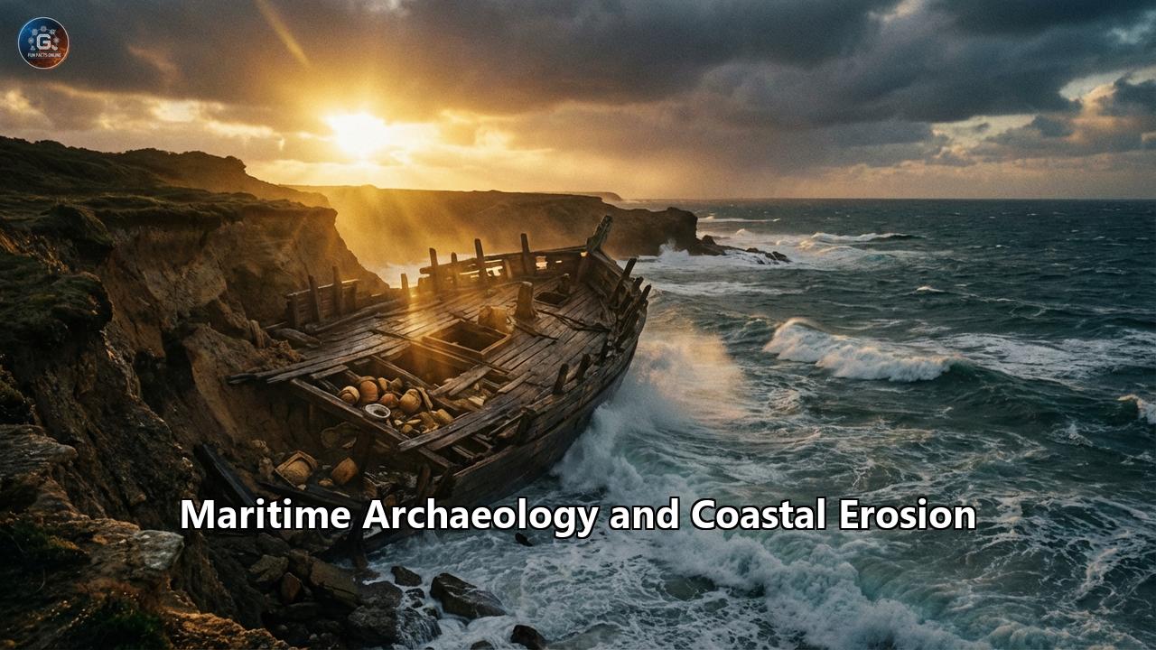
Introduction: The Silent Emergency
In the early hours of an October morning in 2025, the remnants of Typhoon Halong slammed into the western coast of Alaska. It was a storm that had lost its tropical name but none of its fury. By the time the winds died down, over 60 feet of shoreline near the village of Quinhagak had vanished into the Bering Sea. With the mud went history. Thousands of wooden masks, ivory carvings, and tools belonging to the pre-contact Yup’ik people—artifacts that had been preserved in the permafrost for centuries—were scattered across the tidal flats, resembling, as one archaeologist put it, "a museum exploded from the inside out."
This event was not an anomaly; it was a notification. Across the globe, from the wind-battered Orkney Islands to the sun-bleached statues of Easter Island, the boundary between land and sea is being violently redrawn. For maritime archaeology, this is not merely a geological shift; it is an existential crisis. The vast majority of human history has played out along coastlines. We are a species of edges. We migrated along kelp highways, built our first cities in deltas, and buried our dead overlooking the ocean. Now, as the oceans rise and storms intensify, the physical record of our past is being erased faster than we can record it.
This article explores the catastrophic intersection of maritime archaeology and coastal erosion. We will journey to the front lines of this battle—to the freezing tundra of Alaska, the sinking islands of the Sundarbans, and the crumbling cliffs of England—to understand what is at stake. We will examine the cutting-edge technologies being deployed to create digital arks for our heritage, the agonizing ethical decisions regarding "managed retreat," and the legal limbos that arise when a nation’s history literally washes away.
Part I: The North Atlantic – A Race Against the Waves
The Ghost Village of Skara Brae
On the Bay of Skaill in the Orkney Islands, a cluster of stone houses huddles against the Atlantic wind. This is Skara Brae, Northern Europe’s best-preserved Neolithic village. For 5,000 years, it was hidden under sand dunes, a time capsule of Stone Age life complete with stone dressers, beds, and hearths. Ironically, it was a storm in 1850 that stripped away the grass and revealed the village to the modern world. Now, a century and a half later, storms threaten to take it back.
Skara Brae is protected by a sea wall built in the 1920s, a concrete shield against the battering ram of the North Sea. But the climate of 2026 is not the climate of the 1920s. Rising sea levels and increased wave energy are scouring the sand from beneath the wall's foundations and eroding the soft dunes at its flanks. The site is effectively being outflanked by the ocean.
Historic Environment Scotland (HES) has classified Skara Brae as one of the sites most vulnerable to climate change. The strategy here has shifted from "preserve forever" to "manage the loss." Laser scanning monitors the site down to the millimeter, detecting the slightest shift in the masonry. It is a high-tech vigil. The fear is not just the gradual gnawing of erosion, but a catastrophic failure during a "1-in-100-year" storm—events that now seem to happen every decade. The loss of Skara Brae would not just be the loss of a tourist attraction; it would be the loss of a unique chapter of human domesticity, a place that proves our Neolithic ancestors were not just surviving, but living with complexity and comfort.
Happisburgh: The Footprints in the Mud
While Skara Brae fights a defensive war, the village of Happisburgh in Norfolk, England, offers a lesson in the fleeting nature of discovery. In May 2013, a severe storm stripped away the beach sand, exposing a layer of laminated silt that had been laid down in an ancient estuary 850,000 to 950,000 years ago.
Embedded in this dark mud were hollows—footprints. They were the tracks of a small family group of Homo antecessor (Pioneer Man), the earliest humans known in Northern Europe. There were prints of adults and children, meandering as if they were foraging for shellfish or simply pausing to look at the river.
The discovery was monumental, rewriting the timeline of human occupation in Britain. But the medium was mud, and the tide was coming in. Archaeologists had no time for a slow, methodical excavation. They had two weeks. Racing against the twice-daily tides and the deteriorating weather, they used photogrammetry to create 3D models of the prints. Within a fortnight, the currents had washed the silt away. The footprints were gone forever, existing now only as digital data.
Happisburgh represents the new paradigm of "Rapid Response Archaeology." As coastlines retreat—Happisburgh’s cliffs are eroding at an alarming rate, taking modern houses with them—deep time is momentarily revealed before being destroyed. It requires a new kind of archaeologist: one who is part scientist, part first responder.
Part II: The Pacific & The Arctic – Indigenous Heritage on the Brink
Alaska: The Melting Museum
The disaster at Nunalleq in October 2025 was a wake-up call for the Arctic, but the alarm had been ringing for years. The Nunalleq site ("The Old Village") in the Yukon-Kuskokwim Delta is one of the most significant archaeological finds in Alaska. Dating back to the "Bow and Arrow Wars" of the 14th-17th centuries, the site was preserved perfectly in permafrost. The frozen earth held organic materials that usually rot away: grass baskets, wooden dolls, hair, and even the remains of a tragic massacre.
However, the Arctic is warming four times faster than the rest of the planet. The permafrost is thawing, turning the soil into an unstable slurry. When storms like Typhoon Halong hit, the land doesn't just erode; it liquefies.
Dr. Rick Knecht and the local Yup’ik community have been engaged in a desperate rescue excavation. This is "community archaeology" in its purest form. The artifacts being saved are not abstract data points; they are the possessions of the direct ancestors of the people digging them up. The erosion is so severe that the team has had to prioritize what to save. Do you save the house floor that tells you how they lived, or the midden (trash heap) that tells you what they ate?
The emotional toll of this erosion is profound. For the Yup’ik, the ocean is not just taking "sites"; it is taking their heritage. As the coastline recedes, it exposes ancient burials. The community is faced with the trauma of seeing their ancestors' bones washed out to sea, a disruption of spiritual rest that no seawall can fix.
Easter Island: The Toppling Giants
Thousands of miles south, in the middle of the Pacific, the isolation of Rapa Nui (Easter Island) offers no protection against the rising ocean. The island is famous for its Moai—the monolithic statues that stand watch over the landscape. Most of these statues are situated on ahu (platforms) located directly on the coast, as the Rapa Nui people believed the statues channeled mana (power) from the ancestors to the living community inland.
Today, this placement puts them in the crosshairs of climate change. A study by the United Nations has flagged Rapa Nui as critically endangered. Rising sea levels are not the only threat; it is the energy of the waves. As the ocean swells, waves are breaking with greater force against the vertical basalt walls of the ahu.
At Ahu Tongariki, the largest ceremonial platform with 15 standing Moai, the threat is visible. The seawalls are being undercut. If the platform collapses, the Moai will fall. The Rapa Nui community, led by the Ma’u Henua organization, is experimenting with sea walls and breakwaters, but the cost is astronomical for a remote island. There is a profound sense of powerlessness, eloquently expressed by community leaders who speak of the pain of being unable to protect the "bones of their ancestors."
The erosion here also threatens the petroglyphs (rock carvings) at sites like Orongo. Carved into soft volcanic tuff on the edge of cliffs, these intricate designs depicting the "Birdman" cult are flaking away as the cliffs destabilize. It is a slow-motion erasure of a culture’s artistic legacy.
Part III: The Indian Ocean – Sinking Islands and Living Deltas
Majuli: The Shrinking Island of God
In the Brahmaputra River in Assam, India, lies Majuli, the world’s largest river island. It is the spiritual capital of Neo-Vaishnavism, a monotheistic tradition of Hinduism. The island is dotted with Sattras (monasteries) that house centuries-old manuscripts, masks, and traditions of dance and drama.
But Majuli is dying. Since the middle of the 20th century, the island has shrunk from approximately 1,250 square kilometers to less than 400 square kilometers. The Brahmaputra, swollen by melting Himalayan glaciers and erratic monsoon rains, eats away at the island’s sandy banks like a hungry beast.
Here, heritage is not just stone and bone; it is a living culture rooted in a specific geography. When a Sattra is threatened by erosion, it can be moved—rebuilt further inland—but the sacred geography is lost. The trauma of displacement tears at the social fabric. The "erosion refugees" of Majuli lose their land, their livelihoods, and their physical connection to the spiritual centers that define their identity.
Ghoramara: The Island of No Return
Further south, in the Sundarbans delta straddling India and Bangladesh, the situation is even more dire. Ghoramara Island is a symbol of the Anthropocene. Once a thriving settlement with a post office, a fort, and vast paddy fields, it has lost 50% of its landmass since the 1960s.
The "heritage" here is the memory of a landscape that no longer exists. The colonial-era post office, which once doubled as a watchtower for British ships, is now underwater. The families still living on the shrinking sliver of land are "climate refugees in waiting."
Archaeologists working in the Sundarbans face a unique challenge: the landscape is so dynamic that "sites" are transient. Artifacts from shipwrecks or old settlements wash up on mudflats one day and are buried under feet of silt the next. Documenting this history is like trying to read a book while the pages are burning. The loss of Ghoramara is a preview of the fate awaiting the entire delta, home to millions of people and a rich history of riverine trade and culture.
Part IV: The Toolbox of the Future – Innovation in the Face of Loss
Faced with the impossibility of saving everything, maritime archaeologists are turning to technology to save the data, if not the matter.
1. Digital Twins and 3D Preservation
The gold standard for modern documentation is the "Digital Twin." Using a combination of LiDAR (Light Detection and Ranging) and photogrammetry (stitching together thousands of overlapping photos), archaeologists can create sub-millimeter accurate 3D models of sites.
At Easter Island, researchers have created a digital twin of the eastern coastline. This allows them to run computer simulations of future sea-level rise scenarios to predict exactly which ahu will be hit by waves in 2050 or 2080. This predictive modeling is crucial for triage—deciding which sites to reinforce and which to document and abandon.
In Scotland, the SCAPE (Scottish Coastal Archaeology and the Problem of Erosion) Trust uses these tools to create permanent records of sites like the Wemyss Caves, home to Pictish carvings. If the caves collapse tomorrow, the carvings exist in a virtual reality environment that future generations can explore.
2. Citizen Science: The Army of Eyes
There are too many miles of coastline and too few archaeologists. The solution is the public.
- SCAPE’s Shorewatch: In Scotland, local volunteers are trained to monitor archaeological sites in their area. They use a simple app to upload photos and condition reports. If a storm exposes a new stone wall or a skeleton, the "Shorewatchers" alert the professionals.
- CITiZAN (Coastal and Intertidal Zone Archaeological Network): In England, this project mobilized an army of volunteers to document the history of the intertidal zone—the mudflats and beaches exposed at low tide. They recorded shipwrecks, Roman salt works, and prehistoric forests before they were lost.
- The Calusa Island Project: In Florida, volunteers have been trained to monitor the erosion of ancient shell middens left by the Calusa kingdom. Using simple stakes and measurements, they provide the data needed to understand how fast the site is disappearing.
3. Rapid Recording & "Rescue Digs"
When a site is deemed "doomed," the strategy shifts to "preservation by record." This is a rescue dig. It is fast, often brutal archaeology. The goal is to extract as much information as possible before the site is destroyed. The Nunalleq excavation in Alaska is a prime example—working in freezing mud to save thousands of fragile artifacts before the next typhoon.
Part V: The Ethical & Legal Quagmire
The erosion of coastal heritage raises profound questions that go beyond science.
1. The Ethics of "Managed Retreat"
"Managed retreat" is a term borrowed from coastal engineering—the decision to stop fighting the sea and move back. But how do you apply this to heritage? Who decides that a 5,000-year-old temple is "too expensive" to save?
This creates a painful hierarchy of heritage. Iconic sites like Skara Brae or the Moai might get sea walls and millions of dollars in funding. But what about the humble shell midden of a pre-contact tribe in Florida? Or the 19th-century fishing cottage in Yorkshire? The current funding models favor the spectacular, leaving "everyday" history to be washed away. This bias threatens to skew the archaeological record, preserving the monuments of the elite while losing the history of the common people.
2. Legal Limbo: When Land Becomes Sea
Legal jurisdiction is tied to geography. But what happens when the geography moves?
- The "Khoai" Dilemma: In West Bengal, the term "Khoai" refers to eroding laterite canyons. A recent Supreme Court case highlighted that this landform has no legal status. If a heritage site sits on land that legally ceases to exist (because it is now underwater), does the state’s obligation to protect it end?
- The Shipwreck Boundary: Generally, shipwrecks are subject to maritime law, while ruins are subject to land heritage laws. As coastlines recede, terrestrial ruins are becoming submerged. Do they legally become "shipwrecks" or "underwater cultural heritage"? This distinction matters for permitting, protection against treasure hunters, and international treaties like the 2001 UNESCO Convention on the Protection of the Underwater Cultural Heritage.
3. Indigenous Rights and "Letting Go"
For many Indigenous cultures, the "preservation" ethic of Western archaeology—arresting decay, keeping things forever—is foreign. In some traditions, things are meant to decay and return to the earth. However, the rate of loss due to climate change is unnatural.
The conflict arises when "saving" a site means disturbing it. In Alaska, the Yup’ik community had to decide whether to allow archaeologists to excavate their ancestors' village or let the ocean take it. They chose excavation, but it was a heavy choice. In other places, communities might choose to let the site go, viewing the ocean’s reclamation as a natural, albeit accelerated, cycle.
Conclusion: Memory in a Drowning World
We are entering an era of loss. No amount of sea walls, gabions, or mangrove planting can save every mile of coastline. The task of the 21st-century maritime archaeologist is not just discovery, but stewardship of this loss.
The footprints at Happisburgh are gone. The land of Ghoramara is fading. The artifacts of Nunalleq are safe in a museum, but the house they came from is driftwood.
Yet, in this crisis, there is a glimmer of a new relationship with our past. The threat of erosion has galvanized communities. It has brought together Yup’ik elders and Swiss scientists, Scottish dog-walkers and digital modelers. It has forced us to value our heritage not because it is permanent, but precisely because it is fragile.
As the tides rise, they remind us that our grip on the earth has always been tenuous. The archaeology of the future will not be measured by what we can keep in a box, but by what we can remember, record, and understand before the water closes over it. We are building an ark, not of wood, but of data and memory, hoping it will be enough to carry the story of who we were into the uncertain waters of who we will become.
Reference:
- https://icsf.net/newss/west-bengal-coastal-erosion-threatens-indian-sundarbans/
- https://www.climatechangenews.com/2015/11/13/meet-the-indian-islanders-losing-ground-to-the-sea/
- https://www.telegraphindia.com/opinion/ports-ships-a-doomed-isle-ghoramaras-residents-are-being-ignored/cid/2082263
- https://www.researchgate.net/publication/282848440_Erosion_activity_on_Majuli_-_the_largest_river_island_of_the_world
- https://phmuseum.com/news/the-indian-islanders-losing-their-home-and-heritage
- https://fennia.journal.fi/article/download/140862/93852/347574
- https://livingdeltas.org/blog/existential-crisis-tales-of-ghoramara-island-dwellersin-the-indian-sundarbans
- https://www.nationalgeographic.com/magazine/article/sundarbans-mangrove-forest-in-bangladesh-india-threatened-by-rising-waters-illegal-logging
- https://lawchakra.in/supreme-court/housing-calcutta-hc-demolition-order/
- https://en.wikipedia.org/wiki/Ghoramara_Island