The journey of representing our three-dimensional Earth on a two-dimensional surface is a story of mathematical ingenuity and evolving human understanding of the world. This process, known as cartographic projection, is fundamental to map-making and involves transforming geographic coordinates (latitude and longitude) from a globe's surface to a flat plane.
Early Conceptions and the Dawn of Mathematical Cartography:For centuries, humans created maps, with the earliest examples dating back to prehistoric times, such as cave paintings and etchings. These initial maps were often pictorial and focused on small, local areas, largely ignoring the Earth's curvature. Ancient civilizations in Babylon, Egypt, Greece, Rome, China, and India all contributed to early map-making.
A significant shift occurred with the ancient Greeks, who began applying mathematical principles to represent the celestial sphere and, eventually, the Earth. Figures like Eratosthenes, around 276-194 BCE, not only calculated the Earth's circumference but also devised a system of latitude and longitude, laying the groundwork for more accurate mapmaking. Claudius Ptolemy, a Greek scholar living in Egypt around 150 CE, revolutionized cartography with his book "Geographia." He advocated for using perspective projection and a coordinate system to accurately place geographical features, significantly influencing mapmaking for centuries. Though his original maps haven't survived, his principles, including early forms of conic projections, guided cartographers.
Even before Ptolemy, around 600 BCE, Thales of Miletus is credited with creating the first map in a projection – a gnomonic projection of the celestial sphere. Hipparchus, around 150 BCE, utilized stereographic and orthographic projections for celestial maps.
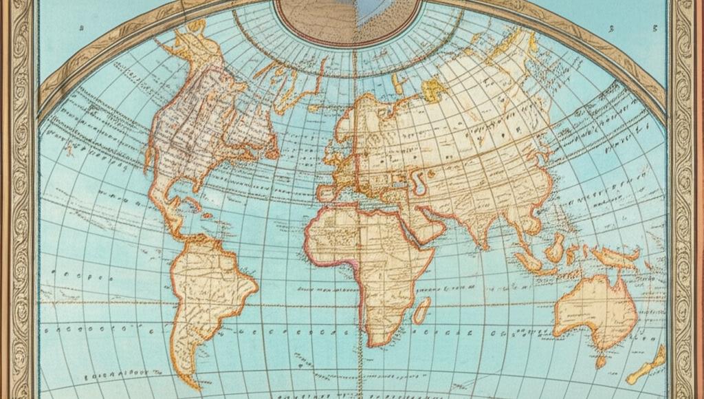
The Renaissance and Mercator's Revolution:The Renaissance (roughly 1470-1669) marked a period of substantial development in map projections, with a renewed interest in mathematical sophistication. Mapmakers began to build upon previous work and innovate. A pivotal moment arrived in 1569 when Gerardus Mercator, a Flemish geographer and cartographer, introduced his world map. The Mercator projection, a cylindrical projection, was ideal for maritime navigation because straight lines on the map corresponded to lines of constant compass bearing (loxodromes). However, this came at the cost of significantly distorting the size of landmasses, especially near the poles. Despite this, the Mercator projection became a standard and is still widely known. Mercator also coined the term "atlas" for a collection of maps. In 1599, Edward Wright published mathematical tables that provided the basis for Mercator's projection.
Understanding Distortion: The Inevitable Compromise:A core challenge in cartography is that it's mathematically impossible to perfectly represent a spherical surface on a flat plane without some form of distortion. Every map projection distorts at least one of these properties: shape, area, distance, or direction. The type and degree of distortion depend on the projection method and increase as you move away from standard lines or points on the projection.
Projections are often categorized by the properties they preserve:
- Conformal (or orthomorphic) projections: Preserve local shapes and angles. The Mercator projection is an example.
- Equal-area (or equivalent) projections: Preserve the relative sizes of areas. The Gall-Peters projection is a well-known example, though it significantly distorts shapes.
- Equidistant projections: Preserve true distances from one or two points to all other points on the map, or along certain lines.
- Azimuthal projections: Preserve true directions from a central point.
Map projections can also be classified by the geometric shape onto which the globe's surface is projected before being "unrolled" into a plane:
- Cylindrical projections: Imagine wrapping a cylinder around the globe. Meridians are typically straight and equally spaced, while parallels are also straight but their spacing can vary. (e.g., Mercator, Plate Carrée).
- Conic projections: Imagine placing a cone over the globe. Parallels are typically depicted as arcs of circles, and meridians as straight lines radiating from the cone's apex. (e.g., Albers Equal Area Conic, Lambert Conformal Conic).
- Azimuthal (or planar) projections: Imagine a flat plane tangent to the globe at a single point. (e.g., Gnomonic, Stereographic, Orthographic).
- Pseudocylindrical projections: These are a hybrid, often featuring straight parallels and curved meridians (except for the central meridian, which is straight). They are often used for world maps. (e.g., Sinusoidal, Robinson).
The aspect of the projection describes how the developable surface is oriented relative to the globe: normal (axis aligns with Earth's axis), transverse (axis at a right angle to Earth's axis), or oblique (any other angle).
Mathematical Underpinnings:The creation of a map projection involves two key steps:
- Model Selection: Choosing a mathematical model for the Earth's shape, typically a sphere for small-scale maps or an oblate spheroid (an ellipsoid of revolution) for more accurate large-scale mapping.
- Transformation: Applying mathematical functions to convert geographic coordinates (latitude φ, longitude λ) to Cartesian (x,y) or polar (r, θ) plane coordinates.
These transformations involve complex mathematical formulas, often utilizing trigonometry and calculus. For instance, scale factors (h and k) along meridians and parallels can be calculated using partial derivatives of the projection equations to quantify distortion at specific points on the map. The Tissot's indicatrix is a graphical way to visualize the distortion at a point on a map by showing how an infinitesimally small circle on the globe is projected as an ellipse on the map.
Evolution into the Modern and Digital Era:The 18th century and beyond saw the rise of national surveys and more precise mapping, driven by military and administrative needs. The development of more accurate reference spheroids, like those by Alexander Ross Clarke, improved the foundation for projections.
The late 19th and 20th centuries brought further refinements and new projections. The Winkel Tripel projection, for example, was developed to minimize distortion across area, direction, and distance, and has been adopted by organizations like the National Geographic Society for world maps.
The advent of computers and Geographic Information Systems (GIS) in the latter half of the 20th century revolutionized cartography. The process of map creation shifted from manual drawing to digital methods. GIS allows for:
- Easy switching between different projections.
- Integration of multiple data layers.
- Dynamic map adjustments based on zoom level and function.
- Sophisticated analysis of projection distortions.
Modern technology continues to push the boundaries of cartographic projections:
- AI-Driven Cartography: Artificial intelligence and machine learning algorithms can analyze geographic data to suggest optimal projections for specific visualization needs or even create dynamic projections that adapt to minimize distortion.
- Interactive Mapping: Web-based and mobile mapping applications (like Google Maps) use various projections and allow real-time interaction, such as panning, zooming, and on-the-fly projection adjustments.
- Projection Mapping (Spatial Augmented Reality): This technology uses projectors to superimpose computer-generated graphics onto real-world surfaces (buildings, objects, etc.), effectively merging physical and virtual worlds. Recent advancements focus on robust auto-calibration, geometric correction for dynamic surfaces, and radiometric compensation for textured surfaces.
- Creative Projections: Cartographers and artists experiment with unconventional projections like the Dymaxion map (Buckminster Fuller's projection onto an icosahedron) or the Butterfly map, which offer new perspectives on global relationships by minimizing certain types of distortion or preserving continental connections in novel ways.
- Virtual Reality (VR) Applications: VR is transforming how we experience map projections by enabling immersive transitions between 2D maps and 3D globes, allowing users to intuitively understand spatial relationships and distortion patterns.
The study of map projections remains a vibrant field. While the fundamental challenge of distortion persists, the mathematical tools and technological capabilities available to cartographers today allow for more sophisticated, customized, and interactive representations of our world than ever before. The ongoing evolution ensures that maps will continue to be essential tools for navigation, planning, education, and understanding our planet.