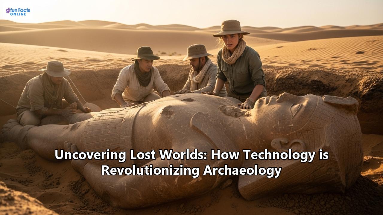
Uncovering Lost Worlds: How Technology is Revolutionizing Archaeology
A new golden age of archaeological discovery is upon us, not defined by the crack of a whip or the glint of a dusty treasure, but by the hum of drones, the flicker of laser beams, and the silent processing of vast datasets. The romantic image of the archaeologist, toiling for decades to unearth a single site, is being dramatically reshaped. Today, entire ancient cities are being discovered from the air, hidden structures are revealed without turning a single spade of earth, and the very stories of our ancestors are being pieced together with unprecedented detail and accuracy. This revolution is powered by a suite of groundbreaking technologies that are peeling back the layers of time, revealing lost worlds, and transforming our understanding of human history.
Peering Through the Veil: Remote Sensing Technologies
For centuries, the dense canopies of jungles, the shifting sands of deserts, and the unassuming fields of the countryside have jealously guarded the secrets of our past. But now, a range of remote sensing technologies is allowing archaeologists to see through these natural and man-made obstructions, creating a paradigm shift in how sites are discovered and surveyed.
LiDAR: The All-Seeing Eye in the Sky
Light Detection and Ranging, or LiDAR, has emerged as one of the most transformative tools in modern archaeology. By firing millions of laser pulses from an aircraft or drone, LiDAR can create hyper-detailed 3D maps of the ground's surface. The key to its power lies in its ability to penetrate vegetation. While some laser pulses reflect off the top of the tree canopy, others find their way to the forest floor and bounce back to the sensor. By analyzing the time it takes for these pulses to return, researchers can digitally "remove" the vegetation and create a bare-earth model of the landscape, revealing subtle topographic features that are invisible to the naked eye.
The Lost City of the Monkey God and the Mayan Megalopolis:The power of LiDAR was dramatically demonstrated in the jungles of Honduras with the discovery of a lost city, dubbed the "City of the Monkey God" or "Ciudad Blanca." For decades, a legend of a white city in the Mosquitia rainforest had tantalized explorers. In the early 2010s, a team of archaeologists used LiDAR to survey a remote, unexplored valley. The results were astounding. The LiDAR data revealed the unmistakable outlines of plazas, earthworks, mounds, and even a pyramid, all concealed beneath a triple-canopy jungle so dense it was virtually impenetrable on foot. This discovery, once the stuff of legend, was brought to light not by machetes, but by lasers.
Even more recently, LiDAR has completely rewritten our understanding of the ancient Maya civilization in Central America. In northern Guatemala, researchers using airborne laser scanning have uncovered a vast network of interconnected ancient cities, towns, and farms, revealing a level of societal complexity and population density far greater than previously imagined. These surveys have identified tens of thousands of previously unknown structures, including defensive walls, causeways, and sophisticated irrigation systems, suggesting that the Mayan population may have been in the millions. One massive Maya site, stretching approximately 650 square miles, was found to date back to the Middle and Late Preclassic period (roughly 1000 B.C. to 250 B.C.), showcasing the early development of this complex society. These discoveries, made possible by LiDAR's ability to pierce through the dense jungle canopy, have overturned long-held theories about the scale and nature of Maya civilization.
Angkor Wat's Hidden Urban Sprawl:The application of LiDAR has also shed new light on well-known sites. At Angkor Wat in Cambodia, for instance, LiDAR surveys have revealed a sprawling medieval urban network complete with canals, roads, and neighborhoods, suggesting a population of up to 900,000 people at its peak. The lasers also uncovered massive water management systems that may have failed due to climate shifts, potentially contributing to the city's decline. This previously undocumented urban landscape demonstrates that the famous temples were not isolated ceremonial centers but were integrated into a vast and complex city.
Satellite Archaeology: Our Eye in the Cosmos
The use of satellite imagery in archaeology, often referred to as "space archaeology," has opened up a new frontier of discovery. Satellites equipped with high-resolution cameras and various sensors, including infrared and multispectral, can detect subtle variations on the Earth's surface that may indicate the presence of buried archaeological features. For instance, the way moisture is retained in the soil or slight changes in vegetation growth can be indicative of underlying structures.
Sarah Parcak and the Secrets of Egypt:Dr. Sarah Parcak, a pioneer in the field of space archaeology, has used satellite imagery to make extraordinary discoveries in Egypt. By analyzing infrared images, which can highlight denser materials like mud-brick walls buried beneath the sand, her team has identified thousands of previously unknown tombs and settlements, and even potential pyramids. One of her most notable achievements was the detailed mapping of the ancient city of Tanis, revealing a network of streets and houses invisible from the ground. Her work has not only uncovered lost sites but has also been instrumental in monitoring and combating the looting of archaeological sites, a growing problem in many parts of the world.
The declassification of historical satellite imagery has also provided a unique window into the past. Photographs from the CORONA spy satellite program of the 1960s, for example, have allowed archaeologists to study landscapes in the Near East before recent large-scale agricultural and urban development, preserving a record of sites that have since been damaged or destroyed.
Drones: The Agile Archaeologist's Assistant
Unmanned Aerial Vehicles (UAVs), or drones, have become an indispensable and increasingly affordable tool for archaeologists. They offer a flexible and cost-effective way to conduct aerial surveys, map sites, and monitor their condition. Equipped with high-resolution cameras, drones can be used for photogrammetry, a technique where multiple overlapping photographs are stitched together to create detailed 3D models and orthomosaic maps of a site.
Drones can be deployed quickly and can fly at lower altitudes than traditional aircraft, allowing for the capture of incredibly detailed data. They are particularly useful for documenting ongoing excavations, providing a daily record of progress, and for monitoring the condition of fragile sites without the need for physical access, which can cause damage. In a case study in an historically rich region of England, a single drone survey increased the number of known archaeological sites by 50%, demonstrating the immense potential of this technology. Furthermore, drones can be equipped with various sensors, including LiDAR and thermal imaging cameras, making them a versatile platform for a range of non-invasive survey techniques.
Probing the Earth: Geophysical Surveys
While remote sensing technologies provide a view from above, a suite of geophysical survey methods allows archaeologists to peer beneath the ground without excavation. These non-invasive techniques are akin to giving the Earth a medical check-up, revealing hidden anomalies that can indicate the presence of buried walls, ditches, buildings, and other features.
Ground-Penetrating Radar (GPR): X-raying the Past
Ground-Penetrating Radar (GPR) works by sending pulses of electromagnetic energy into the ground and recording the reflections. Different materials reflect the radar waves in different ways, allowing archaeologists to create a 3D map of what lies beneath the surface. GPR can be used on a variety of surfaces, including in urban areas where other methods may be less effective.
Mapping an Entire Roman City: Falerii NoviA groundbreaking project at the site of Falerii Novi, an ancient Roman city north of Rome, has showcased the revolutionary potential of GPR. A team of archaeologists towed GPR instruments behind a quad bike, surveying the entire 30.5-hectare area within the city walls. The resulting data, consisting of billions of data points, revealed an astonishingly detailed map of the city, including a bath complex, a market, a temple, a public monument, and the city's intricate network of water pipes. This survey allowed the researchers to study the city's layout in unprecedented detail, challenging some assumptions about Roman urban design, all without any digging. The success at Falerii Novi demonstrates how GPR can be used to investigate entire urban sites as single entities, providing a holistic understanding of ancient city life.
Magnetometry and Electrical Resistivity
Other geophysical techniques, such as magnetometry and electrical resistivity, also play a crucial role in non-invasive archaeology. Magnetometry measures variations in the Earth's magnetic field, which can be affected by features like hearths, kilns, and ditches filled with organic material. Electrical resistivity, on the other hand, involves passing an electrical current through the ground and measuring the resistance, which can indicate the presence of buried walls or other solid features.
From Data to Discovery: The Digital Revolution in Analysis
The vast amounts of data generated by these new technologies require a revolution in how archaeological information is processed, analyzed, and visualized. The digital realm is not just a tool for discovery but is becoming the very medium through which the past is reconstructed and understood.
3D Modeling and Virtual Reality: Rebuilding Lost Worlds
3D modeling has become a cornerstone of modern archaeology, allowing researchers to create detailed digital replicas of artifacts, structures, and even entire landscapes. This is often achieved through photogrammetry, where hundreds or even thousands of photographs taken from different angles are processed by software to create a 3D model. Laser scanners can also be used to capture the precise geometry of an object or site.
These digital models have numerous applications. They allow for the non-invasive analysis of fragile artifacts, which can be studied from any angle and measured with incredible accuracy. They can also be used to digitally reconstruct fragmented objects, helping archaeologists to understand their original form and function. Furthermore, 3D models are an invaluable tool for preservation, creating a permanent digital record of sites and artifacts that are at risk from environmental degradation or human conflict.
Virtual Reality (VR) and Augmented Reality (AR) are taking this a step further, creating immersive experiences that allow both researchers and the public to step back in time. Imagine walking through a digitally reconstructed Roman villa, seeing the frescoes on the walls and the furniture in its original place, or holding a virtual replica of an ancient pot and examining its every detail. These technologies are not only powerful research tools but are also revolutionizing how archaeological discoveries are shared with the public, making the past more accessible and engaging than ever before.
The Rise of the Digital Twin in Cultural Heritage
The concept of a "digital twin," a dynamic digital replica of a physical object or system, is now being applied to cultural heritage. A digital twin of an archaeological site would not just be a static 3D model but a constantly updated virtual counterpart, fed with real-time data from sensors monitoring environmental conditions like temperature, humidity, and structural stress. This would allow for predictive maintenance and proactive conservation, helping to preserve our most precious heritage sites for future generations. While still in its early stages, the development of digital twins for cultural heritage promises to be a game-changer in the field of preservation.
Artificial Intelligence and Machine Learning: The Archaeologist's Smart Assistant
Artificial Intelligence (AI) and machine learning are rapidly becoming powerful allies for archaeologists. These technologies excel at identifying patterns in vast datasets, a task that would be incredibly time-consuming and difficult for a human researcher. AI algorithms are being trained to analyze satellite imagery and LiDAR data to predict the locations of potential archaeological sites with remarkable accuracy. In Mesopotamia, for example, an AI system identified new areas of interest with 80% accuracy.
AI is also being used to analyze artifacts. Image recognition algorithms can classify pottery shards, identify tool types, and even help to reconstruct fragmented inscriptions. In a testament to the power of collaborative innovation, AI-driven robots are even being used to piece together fragile frescoes from thousands of fragments discovered in Pompeii. As AI technology continues to develop, it promises to automate many of the more laborious aspects of archaeological research, freeing up archaeologists to focus on interpretation and analysis.
A New Era of Dating: Refining Our Timelines
The ability to accurately date archaeological finds is fundamental to understanding the past. While radiocarbon dating has been a cornerstone of archaeology for decades, new technological advancements are refining this process, providing more precise and reliable timelines.
Advanced Radiocarbon Dating
Traditional radiocarbon dating measures the decay of the carbon-14 isotope in organic materials. However, this method can be limited by the size and preservation of the sample. Advanced techniques, such as Accelerator Mass Spectrometry (AMS), now allow for the dating of much smaller samples, as little as a few milligrams, with greater precision and in a shorter amount of time.
Furthermore, new methods are being developed to remove contaminants from samples more effectively, leading to more accurate dates. The use of Bayesian statistical modeling is also helping to refine radiocarbon chronologies by integrating multiple dates with other archaeological information, such as stratigraphy. These advancements are allowing archaeologists to build more robust and detailed timelines of past events, from the spread of early humans to the rise and fall of civilizations.
The Challenges and Ethical Considerations of a Digital Past
The technological revolution in archaeology is not without its challenges and ethical dilemmas. The very tools that are opening up new frontiers of discovery also raise important questions about access, ownership, and the responsible stewardship of our shared cultural heritage.
The Digital Divide
The high cost of many of these new technologies, such as LiDAR and advanced satellite imagery, creates a "digital divide" in archaeology. Well-funded research institutions and projects may have access to the latest tools, while those with fewer resources are left to rely on more traditional, and often more time-consuming, methods. This can exacerbate existing inequalities in the field and raises the question of how to ensure that the benefits of these new technologies are shared more equitably.
Data Management and the Need for New Skills
The sheer volume of data being generated by these new technologies presents a significant challenge for data management and storage. A single GPR survey of a site like Falerii Novi can generate terabytes of data. Ensuring that this data is properly archived, curated, and made accessible for future research is a major undertaking that requires new infrastructure and new skills.
The modern archaeologist increasingly needs to be a data scientist, proficient in GIS, 3D modeling software, and even coding languages like Python and R. University curricula are beginning to adapt to this new reality, with the emergence of specialized programs in digital archaeology.
The Ethics of a Virtual Past: Ownership and Repatriation
The creation of high-fidelity digital replicas of artifacts raises complex questions about ownership and intellectual property. Who owns the digital model of an artifact – the museum that houses the physical object, the researchers who created the scan, or the community from which the artifact originated?
This leads to the emerging and contentious issue of "virtual repatriation." Some have proposed that creating and sharing digital replicas of artifacts could be a way to return cultural heritage to its communities of origin, especially in cases where the physical return of an object is contested or logistically difficult. However, many argue that a digital surrogate is no substitute for the physical object, and that virtual repatriation could be used as a way for institutions to avoid the more difficult conversations about the physical return of looted or unethically acquired artifacts. This debate highlights the need for a more nuanced and collaborative approach to the stewardship of cultural heritage in the digital age, one that prioritizes the rights and voices of the communities of origin.
The Future of Archaeology: A Glimpse into Tomorrow's Discoveries
The pace of technological change shows no signs of slowing down, and the future of archaeology promises to be even more extraordinary. Emerging technologies will continue to push the boundaries of what is possible, allowing us to explore the past in ways we can only just begin to imagine.
We can expect to see the increasing use of robotics in archaeology, from fleets of small, autonomous drones mapping vast and inaccessible landscapes to tiny bots that can carefully excavate delicate sites, documenting every step of the process. New sensor technologies, such as quantum gravity sensors, may one day allow us to see deep beneath the surface with even greater clarity.
The integration of all these technologies will likely culminate in the creation of comprehensive digital twins of entire archaeological landscapes, allowing for a holistic and dynamic understanding of how these places evolved over time. These virtual worlds will not only be invaluable research tools but will also offer immersive and educational experiences for the public, bringing the past to life for a global audience.
While the tools of archaeology are changing, the fundamental human curiosity that drives the discipline remains the same. The desire to understand who we are and where we come from is a timeless pursuit. The technological revolution in archaeology is not replacing the archaeologist, but rather empowering them with a new set of powerful tools. The future of archaeology will be a collaborative one, where human expertise and technological innovation work hand in hand to uncover the lost worlds that still lie hidden, waiting to be discovered.
Reference:
- https://advexure.com/blogs/news/archaeological-surveying-drones-uncovering-the-past
- https://www.jouav.com/blog/lidar-archaeology.html
- https://www.lidartechpros.com/lidar-drones-in-archaeology/
- https://www.sci.news/archaeology/falerii-novi-ground-penetrating-radar-survey-08513.html
- https://www.geoscan.ca/blog/gpr-is-revolutionizing-archaeology/
- https://www.pnas.org/doi/abs/10.1073/pnas.1306539110
- https://www.pnas.org/doi/10.1073/pnas.1306539110
- https://www.researchgate.net/publication/248706129_Uncovering_archaeological_landscapes_at_Angkor_using_lidar
- https://leica-geosystems.com/about-us/news-room/customer-magazine/reporter-78/pulling-artifacts-from-the-jungle-using-full-waveform-lidar
- https://www.3dflow.net/case-studies/
- https://mds.marshall.edu/colaconf/2022/day2/27/
- https://www.dsamun.gr/archives/26th-conference-2023/study-guides/448-social-humanitarian-and-cultural-committee-the-question-of-ownership-and-possession-of-foreign-cultural-art/file
- https://heritagemanagement.org/beyond-access-rethinking-ownership-justice-and-decolonization-in-digital-repatriation-initiatives/
- https://www.researchgate.net/publication/378440261_Modern_technologies_and_artificial_intelligence_in_archaeology_and_bioarchaeology
- https://intarch.ac.uk/journal/issue44/1/5.html
- https://github.com/zackbatist/open-archaeo
- https://ozobot.com/ways-archaeologists-use-technology/
- https://www.brandeis.edu/library/design-innovation/dig-scholarship-hub/dig-scholarship-hub-contents/disc-guides/archaeology.html
- https://www.rdworldonline.com/how-3d-technology-creates-digital-twins-to-protect-historical-and-cultural-heritage/
- https://coptrz.com/wp-content/uploads/2023/12/Coptrz-x-Archaeological-Research-Services.pdf
- https://intarch.ac.uk/journal/issue67/3/
- https://ceur-ws.org/Vol-3266/paper8.pdf
- https://www.researchgate.net/publication/320527378_UAV_photogrammetry_for_archaeological_site_survey_3D_models_at_the_Hierapolis_in_Phrygia_Turkey
- https://www.researchgate.net/publication/374421482_Toward_a_Digital_Twin_for_Cultural_Heritage
- https://easychair.org/publications/preprint/CmnD/open
- https://www.mdpi.com/2076-3417/15/5/2495
- https://popular-archaeology.com/article/entire-roman-city-revealed-without-any-digging/
- https://www.sciencefocus.com/news/roman-city-revealed-in-astonishing-level-of-detail-by-radar-technology
- https://www.cambridge.org/core/journals/antiquity/article/groundpenetrating-radar-survey-at-falerii-novi-a-new-approach-to-the-study-of-roman-cities/BE7B8E3AE55DB6E03225B01C54CDD09B
- https://open-archaeo.info/categories/standalone-software/
- https://www.numberanalytics.com/blog/ethics-modern-museology-challenges-opportunities
- https://www.researchgate.net/publication/389341493_Digital_Twin_Technology_Transforming_Cultural_Heritage_Preservation
- https://openscience.icac.cat/archaeological-data-lifecycle/
- https://chnt.at/wp-content/uploads/2024/08/Rohland_375.pdf
- https://www.google.com/search?q=time+in+Provincia+di+Viterbo,+IT
- https://www.york.ac.uk/study/postgraduate-taught/courses/msc-digital-archaeology/
- https://annahodgkinson.co.uk/osgis
- https://journals.plos.org/plosone/article?id=10.1371/journal.pone.0268401
- https://www.scispot.com/blog/how-can-archaeology-labs-overcome-data-and-workflow-challenges-with-modern-software-solutions
- https://www.mdpi.com/2504-446X/6/2/31
- https://www.myartbroker.com/opinion/articles/who-does-art-belong-to-ownership-legacy-repatriation
- https://newro.co/blog/data-management-for-archaeology
- https://www.utwente.nl/en/bms/vandijk/publications/digital_divide_impact_access.pdf
- https://www.researchgate.net/figure/Workflow-of-archaeological-data-management_fig1_254461963
- https://chi.anthropology.msu.edu/2011/10/defining-digital-archaeology/
- https://www.nssn.org.au/news/2019/7/9/archaeologists-use-advanced-sensing-technologies-to-map-excavations