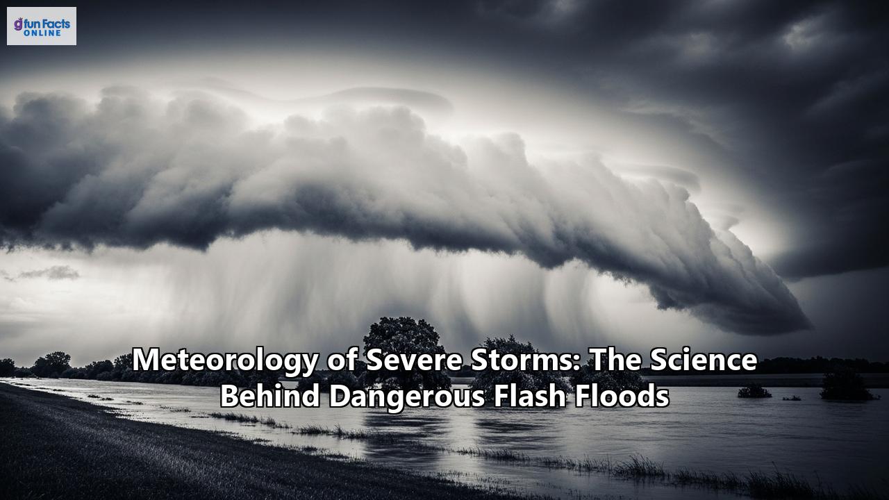
The Unseen Forces: Decoding the Meteorology of Severe Storms and the Fury of Flash Floods
Flash floods are some of the most dangerous and destructive natural disasters, capable of transforming a dry creek bed into a raging torrent in mere minutes. They are the leading cause of weather-related deaths in the United States, surpassing tornadoes, hurricanes, and lightning. This destructive power stems from a complex interplay of atmospheric conditions that birth severe thunderstorms, the primary instigators of these sudden and violent floods. Understanding the science behind these events is not just an academic exercise; it's a critical component of saving lives and mitigating their devastating impact.
The Anatomy of a Storm: Ingredients for Disaster
For a severe thunderstorm to unleash the kind of torrential rainfall that triggers a flash flood, a specific and potent combination of atmospheric ingredients must come together. These are moisture, instability, and a lifting mechanism.
Moisture: Abundant moisture is the fuel for any significant rainfall event. Deep layers of moist air, often transported from large bodies of water like the Gulf of Mexico, provide the necessary water vapor. A key indicator meteorologists look for is high dew point temperatures and significant precipitable water values, which represent the total amount of water vapor in a column of air. The warmer the air, the more moisture it can hold, a principle described by the Clausius-Clapeyron relationship, which states that for every 1°C (1.8°F) increase in temperature, the atmosphere can hold about 7% more water vapor. Instability: An unstable atmosphere is one where the air is warmer and more buoyant than its surroundings. This allows rising air parcels to accelerate upwards, a crucial process for forming deep, moisture-laden clouds. This instability is often measured by indices like CAPE (Convective Available Potential Energy). When warm, moist air at the surface is situated beneath a layer of much colder air aloft, the stage is set for explosive thunderstorm development. Lifting Mechanism: A lifting mechanism is the trigger that forces the moist, unstable air to rise. This can be a cold front, a warm front, or a stationary front, where air masses with different densities collide. Other triggers include outflow boundaries from previous thunderstorms, sea breezes, or even the subtle lift provided by a low-level jet stream—a fast-moving ribbon of air in the lower atmosphere.The Architects of Deluge: Storms that Breed Flash Floods
Not all thunderstorms are created equal when it comes to producing flash floods. Certain types of storms and weather patterns are particularly efficient at generating extreme rainfall rates.
- Mesoscale Convective Systems (MCSs): These are large, organized complexes of thunderstorms that can persist for several hours and cover vast areas. They are notorious for producing widespread heavy rainfall and are a common cause of flash flooding across the central and eastern United States.
- Supercell Thunderstorms: While often associated with tornadoes and large hail, supercells can also be prolific rain producers. Their rotating updrafts are incredibly efficient at processing moisture and can lead to very high rainfall rates in a localized area.
- "Training" Thunderstorms: This phenomenon occurs when a series of thunderstorms repeatedly move over the same area, much like the cars of a freight train passing over the same section of track. This can lead to staggering rainfall totals in a short period, overwhelming the ground's ability to absorb the water.
- Tropical Systems: Hurricanes and tropical storms are massive moisture collectors, capable of dumping immense amounts of rain as they make landfall and move inland. In fact, inland flooding has been responsible for more than half of the deaths associated with tropical cyclones in the United States since the 1970s.
- Atmospheric Rivers: These are long, narrow plumes of concentrated moisture in the atmosphere that can transport vast quantities of water vapor from the tropics to higher latitudes. When these "rivers in the sky" make landfall, especially over mountainous terrain, they can produce extreme rainfall and catastrophic flooding.
From Downpour to Devastation: The Hydrology of a Flash Flood
While intense rainfall is the primary driver, the transition from a severe storm to a life-threatening flash flood is heavily influenced by the landscape and ground conditions. Flash floods are distinguished from regular floods by their rapid onset, typically occurring within six hours of the causative rainfall.
Several factors can exacerbate the potential for flash flooding:
- Topography: Steep, hilly, or mountainous terrain significantly accelerates runoff, channeling water into streams and valleys at high speeds. Narrow canyons can be particularly dangerous, as a storm miles away on a mesa can send a wall of water rushing through them.
- Soil Conditions: The ground's ability to absorb water plays a critical role. If the soil is already saturated from previous rains, or if it is rocky or composed of clay, very little water can infiltrate, leading to rapid runoff.
- Urbanization: Impervious surfaces like buildings, roads, and parking lots prevent rainwater from soaking into the ground, dramatically increasing the volume and speed of runoff in urban areas. Storm drains can become overwhelmed or clogged with debris, causing water to back up and flood streets and buildings.
- Burn Scars: Areas recently ravaged by wildfires are highly susceptible to flash floods and debris flows. The fire destroys vegetation that would normally help absorb rainfall, and it can create a water-repellent layer on the soil, further increasing runoff.
- Dam or Levee Failure: A breach in a dam or levee can release a sudden, catastrophic surge of water downstream, causing a devastating flash flood with little to no warning.
The Science of Seeing it Coming: Forecasting and Warning Systems
Predicting the precise location and timing of flash floods remains one of the most significant challenges in meteorology. While forecasters can often identify conditions favorable for heavy rain days in advance, the small-scale nature of the thunderstorms that trigger flash floods makes pinpointing the exact threat area difficult until the storms are already developing.
Despite the challenges, significant advancements in technology and forecasting techniques have improved our ability to anticipate and warn for these dangerous events.
- Doppler Radar: The WSR-88D Doppler radar network is a cornerstone of severe weather forecasting, allowing meteorologists to estimate rainfall intensity and track storm movement. Dual-polarization technology provides even more detailed information about the size and shape of precipitation particles, leading to more accurate rainfall estimates.
- Satellite Imagery: Satellites are crucial for identifying developing thunderstorms, especially over areas with limited radar coverage. They provide a broad view of weather patterns and can help forecasters spot the signatures of storms likely to produce heavy rain.
- Numerical Weather Prediction (NWP) Models: Sophisticated computer models simulate the atmosphere and help predict where severe weather is likely to occur. High-resolution models are increasingly able to capture the small-scale features that lead to flash flooding.
- Flash Flood Guidance: This system, developed by hydrologists, estimates how much rainfall is needed over a specific time to initiate flooding in a particular basin. It takes into account factors like soil moisture and streamflow.
- Advanced Systems: Projects like the Multi-Radar Multi-Sensor (MRMS) and the Flooded Locations and Simulated Hydrographs (FLASH) systems are at the forefront of flash flood forecasting. MRMS integrates data from multiple sources to provide a high-resolution picture of precipitation, while FLASH uses this data to run hydrologic models and produce flash flood forecasts with lead times as short as a few minutes.
These tools lead to the issuance of public alerts:
- Flash Flood Watch: Issued when conditions are favorable for flash flooding. This is the time to prepare and stay informed.
- Flash Flood Warning: Issued when a flash flood is imminent or already occurring. Immediate action is required to protect life and property.
- Flash Flood Emergency: Issued in exceedingly rare situations when a severe threat to human life and catastrophic damage from a flash flood is happening or will happen soon.
The Human Toll: The Far-Reaching Impacts of Flash Floods
The consequences of flash floods extend far beyond the immediate damage of rising waters. They inflict a heavy toll on individuals, communities, and economies.
Immediate Dangers: The most direct impacts are loss of life and injuries. The force of fast-moving water can be deceptive; just six inches of swift water can knock a person off their feet, and two feet can float most vehicles. Drowning is a primary cause of death, often occurring when people attempt to drive through flooded roadways. Property and Infrastructure Damage: Floodwaters can destroy homes, businesses, and personal belongings, leading to significant financial and emotional distress. Critical infrastructure such as roads, bridges, power lines, and communication systems can be damaged or destroyed, paralyzing communities and hindering emergency response. Economic Disruption: The costs of flash floods are immense. Beyond the price of rebuilding and repairs, there are indirect economic impacts like business interruptions, loss of livelihoods, and disruptions to supply chains. The agricultural sector can be devastated by the loss of crops and livestock. Social and Psychological Trauma: The experience of a flash flood is deeply traumatic. Displacement from homes, the loss of property, and the disruption of daily life can lead to long-term stress, anxiety, and other psychological impacts. Community services like schools and health clinics can be temporarily lost, further impacting the well-being of residents.Weathering the Storm: Safety and Preparedness
Given the sudden and unpredictable nature of flash floods, preparedness is paramount.
Before the Flood:- Know Your Risk: Determine if you live in a flood-prone area by checking resources like FEMA's Flood Map Service Center.
- Make a Plan: Develop a family evacuation plan that includes a designated meeting place on higher ground.
- Build a Kit: Assemble an emergency kit with essentials like water, non-perishable food, a flashlight, batteries, a first-aid kit, and important documents.
- Stay Informed: Monitor weather forecasts and sign up for local emergency alerts. A NOAA Weather Radio can be a crucial source of information.
- Move to Higher Ground: If a flash flood warning is issued for your area, or if you see signs of rising water, move to higher ground immediately.
- Heed Evacuation Orders: If authorities advise you to evacuate, do so immediately.
- Turn Around, Don't Drown®: This is the most crucial rule of flash flood safety. Never attempt to walk, swim, or drive through floodwaters. The depth and current are often deceptive. It is the leading cause of flood-related deaths.
- Avoid Floodwaters: Stay out of flooded areas. The water may be contaminated with sewage, chemicals, and sharp debris, and can hide dangers like downed power lines.
- Wait for the All-Clear: Do not return home until authorities have declared it safe.
- Inspect for Damage: Check for structural damage before entering your home. Be cautious of electrical systems and gas lines.
- Health and Hygiene: Boil drinking water until it is declared safe. Throw away any food that has come into contact with floodwaters. Take precautions against mold, which can grow quickly in damp conditions.
From the atmospheric dance of moisture and instability to the devastating rush of water through a community, the science of severe storms and flash floods is a stark reminder of nature's power. By understanding the forces at play, improving our ability to forecast these events, and embracing a culture of preparedness, we can work to reduce the tragic human and economic toll of these all-too-common disasters.
Reference:
- https://www.nssl.noaa.gov/education/svrwx101/floods/
- https://www.nsc.org/community-safety/safety-topics/emergency-preparedness/flood-preparedness
- https://www.cisa.gov/topics/critical-infrastructure-security-and-resilience/extreme-weather/severe-storms
- https://www.weather.gov/lmk/flash-flood101
- https://www.correntics.com/understanding-extreme-precipitation-risks-impacts-and-climate-resilience/
- https://www.climatecouncil.org.au/resources/climate-change-floods/
- https://learn.weatherstem.com/modules/learn/lessons/181/17.html
- https://www.accuweather.com/en/weather-forecasts/severe-storms-torrential-downpours-to-erupt-in-eastern-central-us-ahead-of-july-4th-holiday/1788990
- https://www.e-education.psu.edu/meteo3/l9_p2.html
- https://www.ametsoc.org/AMs/about-ams/ams-statements/archive-statements-of-the-ams/flash-floods-the-role-of-science-forecasting-and-communications-in-reducing-loss-of-life-and-economic-disruptions/
- https://www.ses.nsw.gov.au/plan-and-prepare/storm/storm-types
- https://www.lonestarsaferooms.com/12-types-of-severe-storms/
- https://www.nssl.noaa.gov/education/svrwx101/floods/forecasting/
- https://www.nssl.noaa.gov/education/svrwx101/floods/types/
- https://scijinks.gov/flood/
- https://www.weather.gov/safety/flood-hazards
- https://en.wikipedia.org/wiki/Flash_flood
- https://medium.com/@info_52191/flash-floods-causes-prevention-and-safety-tips-f4a790377852
- https://www.nssl.noaa.gov/education/svrwx101/thunderstorms/forecasting/
- https://wmo.int/projects/ffgs
- https://www.fjc.gov/content/376958/water-and-law-sidebar-cutting-edge-science-advances-flood-forecasting
- https://www.weather.gov/mob/severe_flood
- https://www.weather.gov/bmx/outreach_flw
- https://www.floodmanagement.info/what-are-the-negative-social-impacts-of-flooding/
- https://www.redcross.org/get-help/how-to-prepare-for-emergencies/types-of-emergencies/flood.html
- https://www.waterconnect.sa.gov.au/Flood-Awareness/SitePages/What%20are%20the%20impacts%20of%20floods.aspx
- https://www.floodinfo.ie/about_frm/impacts_of_flooding/
- https://oxfordre.com/naturalhazardscience/display/10.1093/acrefore/9780199389407.001.0001/acrefore-9780199389407-e-281?d=%2F10.1093%2Facrefore%2F9780199389407.001.0001%2Facrefore-9780199389407-e-281&p=emailAopFLZXERoko6
- https://news.tempest.earth/flash-flood-preparedness
- https://www.weather.gov/afc/FloodSafety