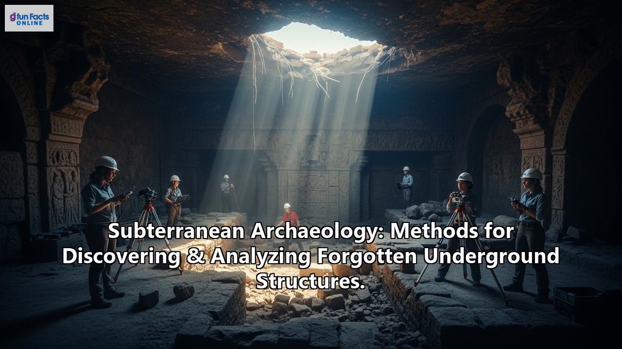
Beneath our feet lies a largely unseen dimension of human history, a world of forgotten structures and lost passages. Subterranean archaeology endeavors to unveil these hidden realms, offering profound insights into the ingenuity, beliefs, and daily lives of those who came before us. This journey into the depths requires a sophisticated toolkit of methods, blending age-old investigative principles with cutting-edge technologies to discover and analyze these enigmatic underground legacies.
The Allure of the Underworld: Why We Dig DeeperForgotten underground structures are not mere holes in the ground; they are time capsules. From the intricate catacombs of ancient Rome and the sprawling subterranean cities of Cappadocia like Derinkuyu, to hidden military bunkers, ancient qanat water systems, and the forgotten basements and crypts beneath bustling modern cities, these spaces hold unique archaeological and historical significance. They can reveal how past societies adapted to their environments, protected themselves, conducted rituals, or managed resources. The unique preservation conditions often found underground can protect organic materials and delicate artifacts that would have long vanished on the surface, offering an exceptionally clear window into the past.
Peeling Back the Layers: Methods for DiscoveryUncovering forgotten underground structures often begins long before the first shovel breaks ground. Archaeologists employ a range of non-invasive and minimally invasive techniques to locate potential sites.
- Historical Detective Work: The search frequently starts in archives, pouring over ancient texts, old maps, and local folklore. These sources can offer tantalizing clues about locations that have faded from collective memory.
- Remote Sensing – Eyes in the Sky (and On the Ground):
Satellite Imagery and Aerial Photography: These tools can reveal subtle surface anomalies, such as variations in vegetation growth or soil marks, which might indicate buried structures. Changes in landscape or vegetation patterns can be valuable indicators of past human activity.
LiDAR (Light Detection and Ranging): This technology, often deployed from aircraft or drones, uses laser pulses to create highly detailed 3D topographical maps of the surface. LiDAR can effectively "see" through dense vegetation, revealing ground features that are invisible to the naked eye and hinting at what lies beneath. Its ability to map complex topographies has revolutionized the discovery of sites obscured by forests or debris.
- Geophysical Surveys – X-Raying the Earth: These techniques are the workhorses of subterranean discovery, allowing archaeologists to "see" beneath the soil without excavation.
Ground Penetrating Radar (GPR): GPR transmits radio waves into the ground and records the reflected signals. Different materials and voids reflect these waves differently, allowing archaeologists to create 2D or 3D maps of subsurface features, such as walls, foundations, cavities, or even graves. Multichannel GPR systems can cover large areas quickly and provide real-time 3D visualizations.
Magnetometry: This method measures minute variations in the Earth's magnetic field. Features like hearths, kilns, ditches, and even buried iron objects create detectable magnetic anomalies.
Electrical Resistivity Tomography (ERT): ERT involves passing an electrical current through the ground and measuring resistance. Different soil types and buried features (like stone walls versus moist pit fills) conduct electricity differently, creating a subsurface map of these variations.
Electromagnetic Conductivity (EM): Similar to resistivity, EM surveys measure the ability of the ground to conduct electricity, often faster but with less depth penetration than ERT.
- Accidental Discoveries: Sometimes, the past quite literally erupts into the present. Construction projects, farming, or even natural erosion can unexpectedly reveal forgotten underground structures, as was the case with the astonishing Derinkuyu underground city in Turkey, discovered when a man knocked down a basement wall.
Once a potential subterranean structure is identified, a new phase of investigation begins, often involving carefully planned incursions.
- Minimally Invasive Probes:
Boreholes and Coring: Drilling small-diameter holes can retrieve soil and material samples from deeper underground, helping to confirm the nature of geophysical anomalies and understand stratigraphy.
Test Pits: Small, strategically placed excavations can provide a first look at the actual structure, its depth, and the state of preservation before committing to larger-scale digs.
- Excavation with Precision and Care:
Targeted Excavation: Modern archaeology aims to be as minimally destructive as possible. Excavations are often targeted, focusing on specific areas of interest identified through remote sensing.
Safety First: Underground excavations present unique dangers, including structural collapse, poor air quality (low oxygen, toxic gases), and flooding. Robust safety protocols, including ventilation, shoring, atmospheric monitoring, and emergency preparedness, are paramount.
- Documentation in the Digital Age: Meticulous recording is the cornerstone of archaeology.
3D Laser Scanning (Terrestrial LiDAR) and Photogrammetry: These technologies are revolutionizing how subterranean spaces are documented. They capture millions of data points to create highly accurate and detailed 3D models of complex underground environments, even in dark and cramped conditions. These digital replicas can be analyzed off-site, shared globally, and used for virtual reconstructions and monitoring. Handheld 3D laser scanners are particularly useful for navigating narrow passages.
Borescope and Robotic Exploration: For spaces too small or dangerous for human entry, borescopes (small cameras on flexible tubes) and specialized robots equipped with sensors and cameras can provide invaluable imagery and data. A 360° borescope prototype has been developed for documenting human remains in narrow burial vaults.
Traditional Methods: Alongside high-tech tools, traditional methods like detailed note-taking, sketching, and photography remain crucial for capturing nuances and context.
- Analyzing the Fabric of the Past:
Stratigraphic Analysis: Understanding the layers (strata) of soil and deposits within and around the structure is key to establishing a chronological sequence of its construction, use, and abandonment.
Material Analysis: Scientific analysis of construction materials (like mortar, bricks, or stone) can reveal their origin, age, and the technologies used in their creation. Artifacts found within the structures—pottery, tools, organic remains—are carefully cataloged and studied to understand the activities that took place.
Dating Techniques: Radiocarbon dating (for organic materials) and Optically Stimulated Luminescence (OSL - for sediments) help to establish the age of the structures and associated deposits.
- Reconstructing Ancient Environments:
Paleoenvironmental Studies: Analysis of pollen, faunal remains, and sediments found within underground structures can help reconstruct the local environment at the time the structure was in use.
Geoarchaeology: Studying the soils and sediments in and around the site helps understand site formation processes and the local landscape.
The Unique Challenges of Going UndergroundSubterranean archaeology is not without its significant hurdles:
- Accessibility and Safety: Many sites are difficult and dangerous to access, requiring specialized equipment and safety measures. Confined spaces, darkness, unstable structures, and potential for hazardous gases are constant concerns.
- Preservation Variables: While some underground environments offer exceptional preservation, others can be detrimental due to factors like humidity, waterlogging, or soil chemistry.
- Water Inundation: Many ancient underground structures are now partially or fully flooded, complicating exploration and excavation.
- Cost and Specialization: The specialized techniques and equipment required for subterranean work can be expensive, and a highly skilled interdisciplinary team is often necessary.
- Ethical Considerations: Subterranean sites often include human remains, such as in catacombs or tombs, requiring sensitive handling, respect, and adherence to ethical guidelines and legal regulations.
The application of these methods has led to breathtaking discoveries:
- Derinkuyu, Turkey: This vast multi-level underground city, capable of housing up to 20,000 people, was accidentally rediscovered in 1963. Its exploration continues to reveal the complexity of ancient subterranean life.
- Roman Catacombs: Geophysical surveys and 3D laser scanning have enhanced our understanding of these extensive underground burial networks, revealing their layout and construction without disturbing sensitive remains.
- Mayan Discoveries via LiDAR: LiDAR technology has been instrumental in uncovering thousands of previously unknown Mayan structures, including houses, palaces, and defensive walls, hidden beneath dense jungle canopies in Central America, transforming our understanding of the scale and complexity of Mayan civilization.
- Giza Pyramid Complex Anomaly: Recent GPR and ERT surveys in the Western Cemetery near the Giza pyramids have identified a significant subsurface anomaly, suggesting previously unknown archaeological remains that warrant further investigation.
- Sforza Castle, Milan: Leonardo da Vinci's sketches, combined with GPR and 3D scanning, verified the existence of hidden passageways beneath the castle, offering new insights into Renaissance military architecture.
The field of subterranean archaeology is constantly evolving, driven by technological innovation and interdisciplinary collaboration:
- Advanced Robotics and AI: Autonomous robots capable of navigating and mapping confined underground spaces will become increasingly important. Artificial intelligence and machine learning are being developed to process vast datasets from geophysical surveys and LiDAR, identifying patterns and anomalies that might escape human detection. The AutoMIRA system, a fully autonomous GPR robot, promises to revolutionize survey efficiency and accuracy.
- Enhanced Imaging and Sensing: Continued improvements in GPR, LiDAR, and other remote sensing technologies will offer higher resolution, greater depth penetration, and the ability to distinguish more subtle features. Multispectral and hyperspectral LiDAR may provide additional layers of data about material properties.
- Virtual and Augmented Reality (VR/AR): These technologies are already being used to create immersive virtual reconstructions of underground sites for research, education, and public outreach. VR can also aid in engineering geological mapping and stability analysis of ancient underground structures.
- Non-Destructive Analysis: An increasing emphasis will be placed on analyzing sites and artifacts with minimal physical impact, preserving these fragile records for the future.
Subterranean archaeology is a captivating field that peels back the surface of the earth to reveal forgotten chapters of human history. Through a sophisticated and ever-evolving array of methods, from meticulous historical research to advanced remote sensing and 3D modeling, archaeologists are charting these hidden landscapes. The challenges are significant, but the rewards—a deeper understanding of our ancestors' ingenuity, resilience, and the complex worlds they inhabited beneath our very feet—are immeasurable. As technology continues to advance, the quest to discover and analyze these forgotten underground structures promises to unveil even more astonishing secrets from the depths.
Reference:
- https://bigthink.com/strange-maps/derinkuyu-underground-city/
- https://go2tutors.com/20-hidden-tunnels-and-underground-cities-discovered-by-accident/
- https://www.taylorfrancis.com/books/edit/10.1201/NOE0415374521/underground-space-use-analysis-past-lessons-future-two-volume-set-t%C3%BClin-solak-s%C3%B6ren-erdem
- https://zombura.com/1885/exploring-ancient-underground-systems-function-and-thrive/
- https://upcolorado.com/university-press-of-colorado/item/6703-exploring-the-mesoamerican-subterranean-realm
- https://www.heritagedaily.com/2021/10/why-archaeology-will-be-the-next-harbour-for-technology/141637
- https://www.emilyexpedition.com/post/indiana-drones-the-future-of-archaeology
- https://www.studysmarter.co.uk/explanations/archaeology/archaeology-documentation/data-collection-methods/
- https://easychair.org/publications/preprint/RHdJ/open
- https://www.youtube.com/watch?v=CLVaxg7Xn4o
- https://easychair.org/publications/preprint/RHdJ
- https://archaeology.ncdcr.gov/blog/2021-04-16/remote-sensing
- https://hertsgeosurvey.wordpress.com/geophysical-survey-in-archaeology/
- https://archaeologicalresearchservices.com/our-services/specialist-services/geophysical-survey/
- https://www.ohiohistory.org/wp-content/uploads/2022/12/Archaeology_Guidelines_Supplement_Geophysical_Survey.pdf
- https://www.screeningeagle.com/en/solutions/geospatial-survey/archaeological-exploration
- https://www.discovermagazine.com/planet-earth/how-archaeologists-are-using-radar-to-visualize-subterranean-structures
- https://www.quora.com/What-are-the-tools-used-to-scan-for-historical-underground-structures-beneath-the-soil
- https://www.newsweek.com/archaeologists-discover-mysterious-underground-anomaly-near-giza-pyramids-1900087
- https://www.mdpi.com/2571-9408/6/3/154
- https://octa-trails.org/arch-topic-category/geophysical-methods-in-archaeology/
- https://www.princeton.edu/news/2024/04/09/princeton-archaeologists-are-using-cutting-edge-digital-technologies-help-reveal
- https://www.nationalgrid.com/stories/grid-at-work-stories/going-underground-archaeological-finds-somerset
- https://fastercapital.com/topics/challenges-and-techniques-of-tunnel-archaeology.html
- https://www.quora.com/What-are-some-challenges-of-an-archaeological-dig
- https://www.quora.com/What-are-some-of-the-challenges-faced-by-archaeologists-when-excavating-historical-sites-in-urban-areas
- https://www.studysmarter.co.uk/explanations/archaeology/conservation-and-preservation/archaeological-documentation-methods/
- https://mycoordinates.org/innovation-in-archaeological-documentation-methods/
- https://www.pointscan.co.uk/structures-3d-laser-scanning/
- https://isprs-archives.copernicus.org/articles/XLII-2-W9/311/2019/isprs-archives-XLII-2-W9-311-2019.pdf
- https://www.indissoluble.com/project/focus-3d-laser-scanner-the-cloaca-massima-indissoluble-rome-italy/
- https://www.gim-international.com/content/article/handheld-3d-laser-scanning-in-underground-heritage-documentation
- https://idai.world/what/documentation
- https://cris.fbk.eu/retrieve/acae1665-1c90-4220-8246-f584d53aebb4/3DMAPPINGOFUNDERGROUNDENVIRONMENTSWITHAHAND-HELDLASERSCANNER.pdf
- https://www.mdpi.com/2571-9408/6/5/210
- https://www.mdpi.com/2072-4292/17/3/544
- https://dailygalaxy.com/2025/01/leonardo-da-vinci-tunnels-italian-castle/
- https://www.niku.no/en/2024/05/technology-meets-archaeology/
- https://www.youtube.com/watch?v=U0ZZX3Ppkag