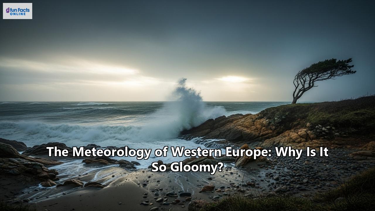
The Enduring Enigma of the European Sky: A Deep Dive into the Meteorology of Western Europe's Gloom
A pervasive stereotype often precedes any discussion of Western Europe's climate: the notion of perpetual grey skies, a constant drizzle, and a landscape shrouded in a melancholic gloom. While the sun-drenched shores of the Mediterranean and the crisp, snowy winters of the Alps are also part of the continent's diverse climatic tapestry, the reputation for overcast weather, particularly in its western reaches, is not entirely unfounded. This persistent gloom is not a matter of chance but the result of a complex and fascinating interplay of powerful meteorological forces that define the region's weather.
At the heart of Western Europe's climate is its classification as a maritime or oceanic climate. This is characterized by cool to warm summers and mild winters, a relatively narrow annual temperature range, and, crucially, frequent overcast skies and precipitation throughout the year. But what are the specific ingredients in this atmospheric recipe that so often produce a cloudy sky? The answer lies in a dynamic dance between a massive ocean current, a fluctuating atmospheric pressure system, the relentless march of storm systems, and the very shape of the land itself.
The Gulf Stream: Europe's Double-Edged Central Heating
One of the most significant players in shaping Western Europe's climate is the Gulf Stream, a powerful and warm Atlantic ocean current. Originating in the Gulf of Mexico, it travels north along the eastern coast of the United States before veering northeast across the Atlantic, where it becomes the North Atlantic Drift. This current acts as a colossal conveyor belt of heat, bringing warmth to latitudes that would otherwise be significantly colder. Cities like London and Berlin, for instance, enjoy much milder winters than their latitudinal counterparts in Canada and Russia. This warming effect is so profound that the Gulf Stream is often nicknamed "Europe's central heating."
However, this thermal blessing comes with a "gloomy" caveat. As the warm waters of the North Atlantic Drift travel north, a significant amount of moisture evaporates into the air above it. The prevailing winds in the mid-latitudes, known as the westerlies, then carry this moisture-laden air directly over Western Europe. This constant supply of atmospheric humidity is a key ingredient for cloud formation and precipitation. As the moist air arrives over the cooler landmass, it cools, and the water vapor condenses into the thick layers of cloud that are so characteristic of the region.
So, while the Gulf Stream and North Atlantic Drift are to thank for keeping Western Europe's winters from being brutally cold, they are also a primary source of the very moisture that fuels its famously grey and damp weather.
The North Atlantic Oscillation: The Conductor of the Atmospheric Orchestra
While the Gulf Stream provides the moisture, the North Atlantic Oscillation (NAO) acts as the conductor, directing where that moisture goes and how intensely it is delivered. The NAO is a climatic phenomenon characterized by the fluctuation of atmospheric pressure at sea level between the Icelandic Low (a semi-permanent low-pressure center over Iceland) and the Azores High (a semi-permanent high-pressure center over the Azores). The NAO alternates between two main phases, positive and negative, and its state has a dramatic impact on winter weather in Western Europe.
The Positive Phase of the NAO: A Recipe for Mild and Stormy WeatherWhen the NAO is in a positive phase, there is a greater than usual pressure difference between the Icelandic Low and the Azores High. This intensified pressure gradient results in a stronger jet stream and a more northerly storm track. The powerful westerly winds push mild, moist Atlantic air directly into Northern and Western Europe, leading to winters that are warmer and wetter than average. This phase is associated with an increase in storminess, bringing frequent and sometimes intense wind and rain to countries like the United Kingdom, Ireland, and Scandinavia. While this means milder temperatures, it also translates to more days of unsettled, cloudy, and rainy weather.
The Negative Phase of the NAO: A Shift in the Weather PatternConversely, a negative NAO phase is characterized by a weaker pressure difference between the Icelandic Low and the Azores High. This results in a weaker jet stream that follows a more east-to-west path, often meandering southwards. This southern shift in the storm track tends to block the flow of mild Atlantic air into Northern Europe. Consequently, this region experiences colder and drier conditions, with a decrease in storminess. Instead, the moisture and storms are directed towards the Mediterranean region, bringing wetter weather to Southern Europe. While a negative NAO might mean less rain for some in the north, it often comes with colder temperatures and the potential for snow.
The NAO can remain in a particular phase for weeks or even months, especially during winter, significantly influencing the overall character of the season. Its unpredictable nature adds another layer of complexity to Western Europe's already changeable weather.
The North Atlantic Storm Track: A Highway for Low-Pressure Systems
The constant procession of low-pressure systems, or extratropical cyclones, across the North Atlantic is a fundamental reason for Western Europe's gloomy reputation. These weather systems are the primary drivers of precipitation in the mid-latitudes. The North Atlantic storm track is one of the most active in the world, representing the preferred path of these cyclones as they travel from west to east.
These cyclones are born over the warmer waters of the western Atlantic, often off the coast of North America. As they move northeastward, they draw in the abundant moisture and energy from the ocean, intensifying as they travel. Their journey often takes them towards Western Europe, with the UK, Ireland, and the Nordic countries being particularly exposed.
The arrival of these cyclones brings with it the classic signs of unsettled weather: falling barometric pressure, increasing cloud cover, and the onset of precipitation. This precipitation is often "cyclonic" in nature, meaning it is widespread and can be long-lasting, manifesting as hours of drizzle or steady rain. While thunderstorms can and do occur, the general lack of strong daytime heating in this maritime climate makes them less frequent than in continental regions.
The frequency and intensity of these storms are also influenced by the NAO. During a positive NAO phase, the storm track is more robust and directed towards Northern Europe, leading to more frequent and powerful storms. Even the remnants of tropical cyclones, such as hurricanes, can travel across the Atlantic and impact Western Europe as powerful post-tropical storms, bringing strong winds and heavy rainfall.
Orographic Lift: When Mountains Make Their Own Weather
The final key element in the meteorological puzzle of Western Europe is its varied topography. The presence of mountain ranges plays a crucial role in enhancing precipitation through a process known as orographic lift. When the moisture-laden westerly winds encounter a mountain barrier, the air is forced to rise. As it ascends, it cools adiabatically, causing the water vapor to condense into clouds and, eventually, precipitate.
This effect is particularly pronounced on the windward (western) slopes of mountain ranges, leading to significantly higher rainfall in these areas. The western coasts of Scotland, Norway, and the western slopes of the Alps are prime examples of this phenomenon. The air that descends on the leeward (eastern) side of the mountains is much drier, creating a "rain shadow" with significantly less precipitation.
This orographic effect means that even within a relatively small geographical area, there can be dramatic differences in rainfall and cloud cover. It contributes to the lush, green landscapes of Western Europe's coastal and mountainous regions, but it does so by wringing out the atmospheric moisture in the form of frequent rain and low-lying clouds, often enveloping the peaks in fog.
A Symphony of Gloom
The perception of Western Europe as a gloomy region is, therefore, not just a cultural trope but a meteorological reality rooted in a powerful convergence of factors. The warm waters of the Gulf Stream provide the fuel in the form of abundant moisture. The North Atlantic Oscillation then directs the flow of this moisture, with its positive phase in particular steering a barrage of wet and windy weather towards the north. The North Atlantic storm track provides the vehicle for this weather in the form of a relentless procession of low-pressure systems. And finally, the region's own topography, through orographic lift, gives the atmosphere a final squeeze, ensuring that any remaining moisture is released as rain or snow.
While the sun does, of course, shine in Western Europe, the ever-present influence of the Atlantic Ocean and the complex atmospheric dynamics it engenders mean that grey skies and a scattering of rain are never too far away. It is this very "gloom," however, that has sculpted the region's verdant landscapes, filled its rivers, and shaped the resilient character of its inhabitants, proving that even in the greyest of skies, there is a silver lining. Interestingly, despite the reputation, recent data has shown a trend towards less cloud cover and more sunshine duration in Europe over the last four decades, a potential sign of a shifting climate.
Reference:
- https://www.worldclimateservice.com/2021/08/26/north-atlantic-oscillation/
- https://en.wikipedia.org/wiki/European_windstorm
- https://www.climate.gov/news-features/understanding-climate/climate-variability-north-atlantic-oscillation
- https://weather.metoffice.gov.uk/learn-about/weather/atmosphere/north-atlantic-oscillation
- https://brainly.com/question/54742904
- https://ocp.ldeo.columbia.edu/res/div/ocp/gs/pubs/Seager_etal_QJ_2002.pdf
- https://journals.ametsoc.org/view/journals/clim/10/7/1520-0442_1997_010_1635_nastva_2.0.co_2.xml
- https://en.wikipedia.org/wiki/Climate_of_Europe
- https://www.quora.com/Why-does-the-gulf-stream-make-the-temperatures-of-western-northern-Europe-so-moderate-yet-doesnt-seem-to-have-a-similar-affect-on-much-of-the-east-coast-of-the-US
- https://www.preventionweb.net/news/european-floods-and-relationship-north-atlantic-oscillation
- https://www.britannica.com/science/North-Atlantic-Oscillation
- https://pmc.ncbi.nlm.nih.gov/articles/PMC5993218/
- https://www.researchgate.net/publication/328677544_Significantly_increased_extreme_precipitation_expected_in_Europe_and_North_America_from_extratropical_cyclones
- https://alexbakey.wordpress.com/2019/01/08/north-atlantic-post-tropical-cyclones/
- https://www.researchgate.net/publication/221912107_The_Impact_of_Hurricanes_on_the_Weather_of_Western_Europe
- https://en.wikipedia.org/wiki/Orographic_lift
- https://www.britannica.com/science/orographic-precipitation
- https://repetitio.ai/subjects/geography/weather-systems/orographic-lifting-and-rain-shadows/
- https://journals.ametsoc.org/downloadpdf/view/journals/mwre/152/7/MWR-D-23-0156.1.pdf
- https://www.meteoswiss.admin.ch/weather/weather-and-climate-from-a-to-z/northern-orographic-effect.html
- https://climate.copernicus.eu/esotc/2022/clouds-and-sunshine-duration
- https://climate.copernicus.eu/esotc/2021/clouds-and-sunshine-duration