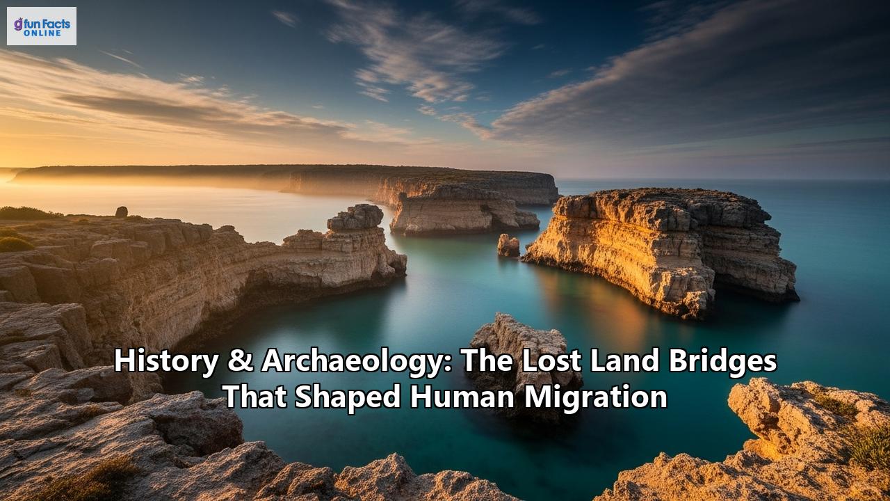
Vanished Highways of Humanity: The Lost Land Bridges That Shaped Our World
Beneath the restless waves of our planet's oceans lies a hidden world, a sprawling map of sunken landscapes that once served as the great highways of prehistoric humanity. These are the lost land bridges, vast territories that emerged from the sea during the frigid embrace of the Ice Ages, only to be reclaimed by the rising tides as the world warmed. Far from being mere corridors for crossing, these were vibrant, living worlds in their own right—sprawling tundras, lush forests, and fertile plains that supported unique ecosystems and cradled human populations for millennia. The story of these vanished lands is not just a geological footnote; it is a fundamental chapter in the epic of human migration, a tale of adaptation, survival, and loss written into the very fabric of our DNA and whispered in the oldest surviving memories of our species.
The engine that created and destroyed these ephemeral continents was the planet's own climate cycle. During glacial periods, or Ice Ages, immense quantities of Earth's water became locked away in continent-spanning ice sheets. This sequestration of water led to a dramatic drop in global sea levels, in some cases by more than 120 meters (400 feet), exposing the shallow continental shelves that fringe our landmasses. These newly revealed territories were not barren undersea deserts but complex landscapes shaped by the same forces as the land we know today, complete with rivers, lakes, hills, and coastlines. For tens of thousands of years, they offered new frontiers for plants, animals, and the nomadic human groups who hunted them. Then, as the climate warmed and the ice sheets melted, this process reversed. The relentless rise of the sea gradually, and sometimes catastrophically, inundated these low-lying lands, swallowing homes, hunting grounds, and sacred sites, and forever altering the course of human history.
Today, the quest to understand these drowned worlds is a grand scientific detective story, uniting disciplines from archaeology and genetics to marine geology and paleoecology. Using advanced technologies like high-resolution sonar to map the seabed, remotely operated vehicles (ROVs) to explore its features, and sediment coring to read the layers of its past, researchers are painstakingly piecing together the story of these lost lands. This archaeological evidence, combined with the powerful insights of genetic analysis and the enduring echoes found in the oral traditions of Indigenous peoples, is bringing these vanished highways of humanity back to life, revealing their profound impact on who we are and where we come from.
Beringia: The Great Arctic Steppe and the Peopling of the Americas
Perhaps the most famous of all lost land bridges is Beringia, the immense subcontinent that periodically connected northeastern Asia with northwestern North America. At its greatest extent, around 21,000 years ago during the Last Glacial Maximum, Beringia was a vast expanse of territory stretching over 1,600,000 square kilometers (620,000 square miles), an area as large as British Columbia and Alberta combined. This was no narrow isthmus but a huge, habitable landscape that remained largely free of ice, serving as a crucial ecological refuge and a vital corridor for life.
A World of Shrub Tundra and MegafaunaThe environment of Beringia was a subject of much debate, once envisioned as a uniform "mammoth steppe." However, modern research, including analysis of fossil pollen and ancient animal remains, paints a more complex picture. Beringia was a mosaic of environments, dominated by a cold, dry, but productive steppe-tundra. It was a world of grasses, herbs, and low-lying shrubs like birch and willow, with pockets of larch and spruce trees in more sheltered areas. This environment was distinct from the drier steppes on either side, receiving more moisture from the Pacific Ocean, which supported a richer diversity of plant life. This vegetation was capable of sustaining a remarkable array of large Ice Age mammals, often referred to as megafauna.
The fossil record attests to a veritable Serengeti of the north. Herds of woolly mammoths, steppe bison, and wild horses—the "characteristic triad" of dominant animals—roamed the plains, preyed upon by formidable predators like the scimitar cat and giant short-faced bears. The landscape also supported caribou, musk-oxen, and even species like the Arctic camel. The very anatomy of these animals, such as the small, firm hooves of horses and bison, points to a dry, solid ground, unlike the boggy tundra that characterizes much of the Arctic today. This rich animal life was the critical resource that drew human hunters out onto this immense, now-vanished plain.
The Human Journey: Footprints, Tools, and Genetic TrailsFor decades, the prevailing theory, known as the "Clovis-First" model, held that the first humans crossed Beringia around 13,500 years ago and spread rapidly south through an "ice-free corridor" that opened between the massive Laurentide and Cordilleran ice sheets covering Canada. However, a cascade of discoveries has pushed this timeline back and complicated the narrative.
One of the most significant Beringian archaeological sites is the Upward Sun River site (Xaasaa Na') in the Tanana River Valley of Alaska. Here, archaeologists uncovered the 11,500-year-old remains of two infants and a young child. The infant burials are particularly poignant and revealing. They were interred in a pit with grave goods, including finely crafted bifacial stone points and four decorated antler rods, likely components of a sophisticated weapon system. The remains were covered in red ochre, a pigment used in burials across the ancient world, signifying a complex ritual and spiritual life. Analysis of the camp revealed a diet that included salmon, ground squirrels, and ptarmigan, demonstrating a broad and adaptable subsistence strategy. Perhaps most strikingly, an obsidian flake found with the burials was traced to a source 600 km (370 miles) away, a testament to the extensive mobility or long-distance trade networks of these early peoples.
Other sites like the Bluefish Caves in Yukon, Canada, provide even more ancient, though debated, evidence. Cut-marked animal bones from the caves have been dated to as old as 24,000 years ago, suggesting a human presence in Eastern Beringia during the height of the last Ice Age. While some scientists argue these marks could be from carnivores, the findings lend support to the "Beringian Standstill Hypothesis," which posits that a population of humans lived in the isolation of the Beringian refuge for thousands of years before moving south.
Genetics has revolutionized this story. Analysis of both ancient and modern DNA has confirmed that Indigenous peoples of the Americas are descended from these Siberian migrants. Groundbreaking research on the Upward Sun River infants revealed they belonged to a previously unknown population, now named "Ancient Beringians." This group was related to, but distinct from, the ancestors of all other Native Americans, suggesting they split from the main migrating population early on. The evidence points to a single founding migration event into the Americas, likely occurring before 20,000 years ago.
The story is not a simple one-way street. Genetic studies also show evidence of a "back-migration," where some groups returned from North America to Siberia, adding to the complex tapestry of population movements across the strait. The debate over the route south also continues, with growing support for a coastal migration by boat, which could have allowed people to bypass the ice sheets even before the inland corridor was fully viable. What is certain is that the now-submerged land of Beringia was the gateway, a homeland and a highway that funneled the ancestors of tens of millions of people into the New World.
Doggerland: The Drowned Heart of Mesolithic Europe
In the gray and often turbulent waters of the North Sea, between Great Britain and continental Europe, lies another lost world: Doggerland. Named after the Dogger Bank, a large sandbank that was once one of its highest points, this submerged landscape was the heartland of Mesolithic northwestern Europe for thousands of years. For much of the 20th century, it was dismissed as a simple "land-bridge," a feature of convenience for human transit. Today, we know it was a vast and vibrant country in its own right, a rich landscape whose final, catastrophic destruction has been called Britain's own Atlantis.
A Verdant Landscape of Rivers, Marshes, and ForestsAfter the last glaciers began their retreat around 18,000 years ago, the tundra of the exposed North Sea floor gradually transformed into an increasingly temperate and attractive environment. Pollen analysis from sediment cores reveals a changing world: first came pine and birch forests, later replaced by oak, hazel, and elm as the climate continued to warm. Seismic data, originally collected for oil and gas exploration, has allowed archaeologists to map this vanished world in astonishing detail, revealing a complex landscape of gentle hills, wooded valleys, large freshwater lakes, and meandering river systems.
This was a paradise for hunter-gatherers. The extensive wetlands, marshes, estuaries, and coastlines would have been teeming with life. It was a prime location for fishing, fowling, and gathering plant resources. The forests and plains supported abundant game, including red deer, aurochs (wild cattle), and wild boar. The sheer productivity of this environment meant that Doggerland was likely one of the most densely populated regions of Mesolithic Europe, a place where typically nomadic groups may have established more permanent settlements.
Life and Death on the Drowning PlainEvidence of the people who called Doggerland home has been literally dredged up from the seafloor for over a century. In 1931, the crew of the fishing trawler Colinda, working near the Leman and Ower Banks, hauled up a lump of peat containing a stunning artifact: a barbed point masterfully carved from antler. Dated to the Mesolithic period, this harpoon tip, designed for hunting large fish or seals, was the first concrete proof that humans had inhabited this now-underwater realm. The peat it was found in was later confirmed to have formed in a freshwater environment, proving it was lost on dry land.
Since then, numerous other artifacts have been recovered by fishing vessels and dedicated archaeological surveys, including flint tools, human remains, and the bones of both extinct Ice Age beasts like mammoths and the Mesolithic animals that succeeded them. Each find is a pinprick of light into a lost way of life. By studying nearby coastal sites from the same period, like Star Carr in Britain, we can infer that the people of Doggerland lived sophisticated lives, crafting a wide array of tools from stone, bone, and antler, and possessing a deep knowledge of their environment.
The end of Doggerland was a two-act tragedy. The first act was a slow, relentless rise in sea levels as the world's ice sheets melted. Over centuries, the inhabitants would have witnessed their world shrinking. Coastlines retreated, rivers widened into estuaries, and highlands became islands. This process, while gradual, would have forced populations to move, creating pressure and potentially sparking conflict as groups were pushed into smaller territories. It was a climate crisis played out over generations.
The final act was sudden and catastrophic. Around 8,200 years ago, a massive underwater landslide occurred off the coast of Norway, an event known as the Storegga Slide. This colossal displacement of sediment triggered a mega-tsunami that ripped across the North Sea. The waves, estimated to have been 3 to 6 meters (10 to 20 feet) high by the time they reached the British coast, would have been devastating for the low-lying plains and islands that were all that remained of Doggerland. Entire communities living along the coast would have been annihilated with little to no warning. This event didn't cause the final submergence of Doggerland, which was an ongoing process, but it would have been a cataclysm of unimaginable proportions for its inhabitants, an apocalypse that likely wiped out a significant portion of the remaining population and accelerated the abandonment of the last vestiges of this Mesolithic heartland. Within a few centuries, the last islands of Doggerland slipped beneath the waves, and a human world vanished from sight, but not from memory.
The Drowned Worlds of the South: Sundaland and Sahul
While Beringia and Doggerland were defined by ice and tundra, the Pleistocene epoch created equally significant, though vastly different, lost worlds in the tropics. During periods of low sea level, the geography of Southeast Asia and Australia was radically transformed. The great islands of Sumatra, Java, and Borneo were not islands at all, but were connected to the Asian mainland, forming a vast, exposed shelf called Sundaland. To the southeast, Australia, New Guinea, and Tasmania were joined into a single giant continent known as Sahul. These landmasses were central to the story of modern human dispersal into Asia, Australia, and Oceania.
Sundaland: A Tropical Cradle of Biodiversity and MigrationSundaland was an evolutionary hotspot, a region of immense biodiversity. When exposed, it was a dynamic landscape. While long thought to be covered in dense tropical rainforest, recent studies suggest a more varied environment, possibly including a "savanna corridor" of more open grassland that ran through the center of the landmass. This corridor would have been a crucial highway for savanna-dwelling fauna and the early humans who hunted them. The flooding of Sundaland at the end of the last glacial period was dramatic; sea-level rise of 130 meters submerged half of the landmass, breaking it apart into the familiar archipelagos of today.
The impact on human populations was profound. Genetic and paleogeographic studies have shown that this submergence was a major driver of human migration. As the land was inundated, particularly during two rapid "meltwater pulses" around 14,500 and 11,500 years ago, human groups became fragmented and isolated on newly formed islands. This isolation fostered genetic divergence. However, the warmer, wetter climate also led to population growth in the remaining areas, causing population density to surge. This pressure, in turn, drove migrations, forcing people to move in search of new lands. Evidence suggests that this process spurred a northward migration out of Sundaland back towards mainland Southeast Asia and even into South Asia.
This has led to a fascinating, though minority, scientific debate. The mainstream "Out of Taiwan" theory posits that the Austronesian-speaking peoples who colonized the Pacific migrated south from mainland Asia via Taiwan. However, the "Out of Sundaland" theory suggests this vast, now-drowned subcontinent could have been the original cradle of these populations, who were then dispersed by the rising seas. Regardless of which theory holds, it is clear that the drowning of Sundaland was a formative event that shaped the genetic and cultural landscape of Southeast Asia for millennia.
Sahul: The First Australian FrontierThe settlement of Sahul represents one of humanity's greatest achievements: the first major maritime colonization event. To reach Sahul from Sunda, people had to make a series of open-water crossings through the islands of Wallacea, a feat accomplished by at least 50,000 to 65,000 years ago. Once there, they found a continent teeming with unique megafauna, including giant marsupials like the rhino-sized Diprotodon and the formidable marsupial lion, Thylacoleo.
Archaeological sites like Madjedbebe in Arnhem Land have yielded stone tools and evidence of ochre use dating back 65,000 years, pushing back the timeline of human arrival. Other ancient sites across the continent, such as Carpenter's Gap and Riwi Cave in the Kimberley region, have revealed artifacts like shell beads and some of the world's earliest ground-edge axes, dating back over 40,000 years. These finds demonstrate that the first Australians were not "primitive" but were technologically and symbolically sophisticated from the moment they arrived.
Much of their earliest history, however, likely lies underwater. Recent research on the now-submerged Northwest Shelf of Sahul, which connected the Kimberley and Arnhem Land, has revealed a landscape that could have supported a population of up to half a million people. This region was not a barren plain but a complex environment, at times an extensive archipelago and at others a vast shelf with an inland sea and freshwater lakes. The inundation of this shelf by rising seas between 14,500 and 9,000 years ago would have displaced huge numbers of people, likely triggering major cultural shifts and population movements inland, events that may be recorded in peaks of activity at inland archaeological sites and the sudden appearance of new rock art styles.
Another crucial part of Sahul was the Bassian Plain, the land bridge that connected mainland Australia to Tasmania. This was not a narrow causeway but a vast plain, a country in its own right, where people lived for thousands of years. It was a cold, dry, open grassland environment where people hunted game on the plains. Its eventual flooding, which fully separated Tasmania around 14,000 years ago, created one of the longest periods of human isolation known, as the Palawa people of Tasmania lived without outside contact for millennia until European arrival.
Echoes of a Drowned World: Cultural Memory and Oral Tradition
Perhaps the most compelling and humanizing evidence for these lost lands comes not from sonar scans or sediment cores, but from the memories of humanity itself. In many parts of the world, Indigenous oral traditions, once dismissed by Western science as mere myths, are now being recognized as remarkably accurate records of deep historical and geological events.
Nowhere is this clearer than in Australia. Researchers have documented at least 21 distinct and consistent groups of stories from Aboriginal communities all around the continent's coastline that describe the drowning of their former lands. The Yidindji people of the Cairns area tell of a time when Fitzroy Island was part of the mainland. The Narrangga people of Spencer Gulf speak of when the gulf was a marshy plain with freshwater lagoons, before the sea catastrophically broke through and flooded it. In the Gulf of Carpentaria, stories tell of home islands that were once part of a peninsula, before a mythical figure, the seagull woman Garnguur, dragged her raft across the land, letting the sea pour in.
What is astonishing is the age of these memories. By correlating the details in the stories with scientifically established timelines of sea-level rise, researchers have concluded that these oral traditions have been faithfully passed down for at least 7,000 years, and in some cases, possibly as long as 13,000 years. They are accounts of eyewitnesses to a world-altering climate transition, preserved through countless generations.
Similar echoes are found in North America. Along the Pacific Northwest coast, the oral traditions of peoples like the Klallam and Quinault contain numerous references to great floods and shaking earth. Stories of a battle between the powerful Thunderbird and a great Whale are now interpreted by some as metaphorical accounts of the tectonic struggle of a subduction zone earthquake and the ensuing tsunami that floods the land. While more difficult to date than the sea-level rise stories of Australia, these traditions speak to a deep-time memory of catastrophic landscape change.
Even the story of the Persian Gulf Oasis, a fertile landmass that was inundated around 8,000 years ago, may have a mythological parallel. Archaeologist Jeffrey Rose notes that the sudden appearance of highly developed Neolithic villages along the shores of the Gulf corresponds with the final flooding of the basin, suggesting a displaced population moving to higher ground. He also points out that many Mesopotamian civilizations, including the Sumerians, told flood myths and stories of ancestral origins from a now-drowned paradise, a potential cultural echo of the lost Gulf Oasis.
These stories transform our understanding of the past. They are not simply curiosities; they are invaluable data sets, human records of geological change that provide a powerful complement to scientific evidence. They remind us that these were not abstract events; they were lived experiences that profoundly scarred and shaped the cultures that survived them.
New Frontiers and Other Lost Worlds
The search for humanity's drowned highways extends beyond these major examples. The Japanese islands were periodically connected to the Asian mainland via land bridges across the Korea Strait and to Sakhalin, allowing for the migration of megafauna like the Steppe mammoth and Naumann's elephant, and very likely the humans who followed them.
In the Mediterranean, new discoveries are challenging long-held assumptions about migration into Europe. Recently, the discovery of Paleolithic stone tools along the Aegean coast of Turkey suggests the existence of a now-submerged land bridge that connected Anatolia to the Greek coast, offering an alternative southern route for early humans entering Europe.
These lost worlds are the missing pieces of the great puzzle of human history. They were the stages upon which some of the most critical dramas of our species' journey played out: the first steps into new continents, the adaptation to radically changing climates, and the development of the resilience and ingenuity that define us. They remind us that the map of our world is not static; it is a fluid, dynamic entity shaped by planetary forces far beyond our control. As we today face our own crisis of rising seas and a changing climate, the story of these lost land bridges serves as a powerful and humbling reminder from our deep past. The waters have risen before, worlds have been lost, and humanity has been forced to adapt, move, and remember. The drowned landscapes beneath the waves hold not just the secrets of our ancient origins, but perhaps also lessons for our future.
Reference:
- https://www.splashtravels.com/world-history/lost-civilization-under-water
- https://indigenous.sl.nsw.gov.au/recent-updates/ancient-aboriginal-stories-preserve-history-rise-sea-level
- https://beringia.com/exhibits/first-people
- https://www.i-repository.net/contents/osakacu/kiyo/DBe0500001.pdf
- https://explorersweb.com/prehistoric-australian-archaeology-modeling/
- https://www.uaf.edu/news/archives/news-archives-2010-2021/ancient-beringians.php
- https://www.researchgate.net/publication/273812288_The_stages_of_land_bridge_formation_between_the_Japanese_Islands_and_the_continent_on_the_basis_of_faunal_succession
- https://www.youtube.com/watch?v=pFYr0wFSVTQ
- https://ink.library.smu.edu.sg/context/soss_research/article/4558/viewcontent/Flood_mortality_SE_hyp_2020_av.pdf
- https://www.nsnews.com/local-news/researchers-study-ancient-water-levels-3062735
- https://www.arcus.org/witness-the-arctic/2012/2/article/19167
- https://www.tananachiefs.org/upward-sun-river-site-faq/
- https://aahs1916.org/2011/03/joshua-d-reuther-the-upward-sun-river-site-and-the-late-pleistocene-and-early-holocene-archaeology-of-the-middle-tanana-valley-interior-alaska/
- https://en.wikipedia.org/wiki/Upward_Sun_River_site
- https://archaeology.org/issues/may-june-2017/digs-discoveries/trenches-canada-bluefish-caves/
- https://ceetep.oregonstate.edu/sites/ceetep.oregonstate.edu/files/resources/24-tsunamis-and-floods-in-native-american-oral-tradition-and-mythology.pdf
- https://www.sci.news/othersciences/linguistics/science-aboriginal-stories-australia-03272.html
- https://earthlymission.com/doggerland-rediscovery-mesolithic-landscape-seismic-mapping-science/
- https://www.sciencedaily.com/releases/2010/12/101208151609.htm
- https://europe.factsanddetails.com/article/entry-857.html
- https://archaeology.org/issues/march-april-2022/letters-from/doggerland-mesolithic-submerged-landscape/
- https://biotech.law.lsu.edu/blog/doggerlandmidresolution.pdf
- https://www.sidestone.com/books/doggerland-lost-world-under-the-north-sea
- https://www.reddit.com/r/AskAnthropology/comments/jctnlz/a_question_about_life_on_doggerland/
- https://www.britannica.com/art/mythologies-of-the-Indigenous-peoples-of-the-Americas/Oral-literatures
- https://research.usc.edu.au/esploro/outputs/journalArticle/Aboriginal-Memories-of-Inundation-of-the/99449181802621
- https://medium.com/global-science-news/revisiting-the-doggerland-hypothesis-assessing-its-validity-in-light-of-recent-archaeological-and-2fc0d11bb406
- https://medium.com/@piotrmak/archaeologists-uncover-true-garden-of-eden-beneath-persian-gulf-as-religious-leaders-keep-biblical-92edaf56c9e2
- https://www.nwnewsnetwork.org/disasters-and-accidents/2019-05-07/the-oral-history-wasnt-a-myth-tsunamis-hit-this-tribal-village-five-times-new-study-shows
- https://www.youtube.com/watch?v=LQkWh9WOnFY
- https://www.researchgate.net/figure/The-barbed-point-from-Leman-and-Ower-Banks-from-Lowe-Kooijmans-1970-71-Scale-12_fig9_265420489
- https://en.wikipedia.org/wiki/Land_bridges_of_Japan
- https://www.ancient-origins.net/news-general/submerged-land-australia-0020231
- https://pages.upd.edu.ph/sites/default/files/pawlik/files/habgood_2008_revolution_that_didnt_arrive_sahul_jhe_55.pdf
- https://www.researchgate.net/figure/Sunda-and-Sahul-illustrating-Pleistocene-sites-mentioned-in-text-and-possible-migration_fig1_325274176
- https://www.eurekalert.org/news-releases/1029599
- https://www.livescience.com/10340-lost-civilization-existed-beneath-persian-gulf.html
- https://www.researchgate.net/publication/286315397_Land_bridge_formation_and_proboscidean_immigration_into_the_Japanese_Islands_during_the_Quaternary
- https://cityperspectives.smu.edu.sg/article/learning-past-enhancing-flood-resilience-southeast-asia
- https://www.tehrantimes.com/news/482202/Archaeologists-to-commence-underwater-survey-in-Persian-Gulf