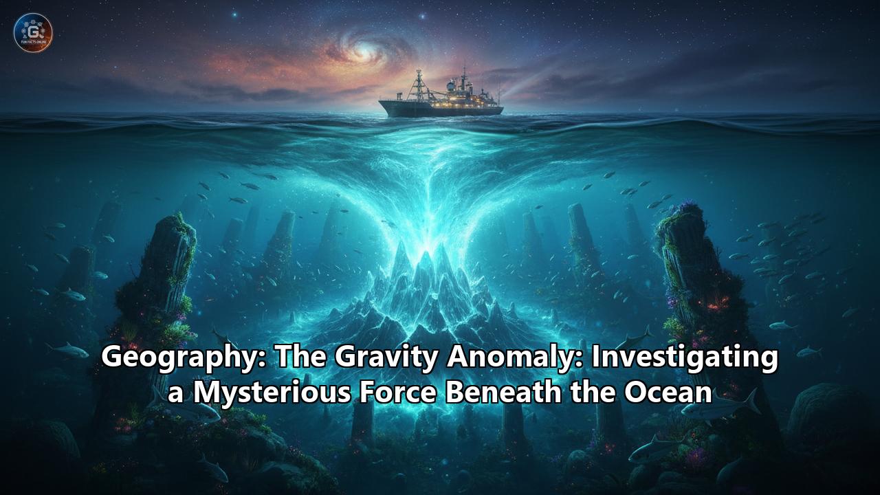
An unseen force, a subtle and silent variation in one of the universe's most fundamental constants, is continuously shaping the face of our planet's oceans. Far from the uniform, placid blue marble it appears to be from space, Earth's gravitational field is a complex, lumpy, and dynamic tapestry. Nowhere are these variations more intriguing than beneath the waves, where mysterious forces create vast "holes" and "hills" in the ocean itself. These are the planet's marine gravity anomalies: deviations from the expected pull of gravity that betray the hidden architecture of the world below.
These anomalies are not mere curiosities; they are cryptic messages from the deep Earth. They tell tales of sunken continents, burgeoning mountain ranges, and the slow, majestic churn of molten rock deep within the mantle. By studying these faint gravitational whispers, scientists can map uncharted volcanic seamounts, unravel the awesome power of plate tectonics, and even gain insights into the circulation of ocean currents that drive our planet's climate. This is a journey into the world of oceanic geography where the primary tool is not a sonar pulse, but the measurement of a force that holds the cosmos together. We will dive into the history of its discovery, the ingenious methods used to detect it, and the profound implications it holds for understanding the very workings of our planet.
The Foundation: Deconstructing Gravity's Uniform Pull
At its most basic, gravity is the force of attraction between two objects. As formulated by Sir Isaac Newton, the strength of this force depends on the masses of the objects and the distance between them. In a perfect world—a flawless, non-rotating sphere of uniform density—the acceleration due to gravity would be identical at every single point on its surface. Every object would be pulled toward the center with the exact same force.
However, our Earth is far from this idealized model. It is a dynamic, multifaceted, and heterogeneous body. Several factors conspire to disrupt the uniformity of its gravitational field:
- Shape: Earth is not a perfect sphere. Its rotation causes it to bulge at the equator and flatten at the poles, making it an "oblate spheroid." Because the equatorial radius is about 21 kilometers (13 miles) longer than the polar radius, a point on the equator is farther from the planet's center of mass than a point at the pole. This increased distance results in slightly weaker gravity at the equator compared to the poles.
- Rotation: The planet's spin generates a centrifugal force that acts in opposition to gravity. This force is strongest at the equator, where the rotational velocity is highest, and diminishes to zero at the poles. This effect further reduces the effective gravitational pull at the equator.
- Topography: The presence of massive mountain ranges or deep ocean trenches obviously alters the local mass distribution. A mountain represents a surplus of mass, while a trench represents a deficit, both of which affect the local gravitational pull.
- Subsurface Density: This is the most crucial factor for geophysicists. The Earth's crust, mantle, and core are not uniform. The crust varies in thickness and composition; for example, the continental crust is thicker but less dense on average than the thinner, denser oceanic crust. Deeper within the mantle, variations in temperature and composition create regions of hotter, less dense rock and cooler, denser rock.
A gravity anomaly is the difference between the actual, measured value of gravity at a specific location and the theoretical value predicted by a simplified model that accounts for latitude and elevation on a uniform Earth. These anomalies are typically very small, measured in units called milliGals (mGal). One Gal (named after Galileo) is an acceleration of 1 centimeter per second squared, and the Earth's average gravity is about 980 Gals. Anomalies are just tiny fractions of this—often just a few dozen to a few hundred milliGals—but they are immensely significant. A positive anomaly indicates that the gravitational pull is stronger than predicted, suggesting a local excess of mass (e.g., denser rock) beneath the surface. Conversely, a negative anomaly signifies a weaker pull, implying a mass deficit (e.g., less dense rock or a void). By mapping these subtle deviations, scientists can start to build a picture of the unseen geology hidden deep beneath the land and, most dramatically, the sea.
Measuring the Invisible: A Tale of Submarines and Satellites
Charting the ocean's gravity field presents a monumental challenge. How can one measure minuscule gravitational fluctuations while on a moving, heaving ship, thousands of meters above the feature of interest? The history and technology of marine gravity measurement are a testament to scientific ingenuity.
The Pioneering Spirit: Felix Andries Vening Meinesz
The story of marine gravity measurement begins with Dutch geophysicist and geodesist Felix Andries Vening Meinesz. In the early 20th century, gravity measurements on land were becoming common, but the sea remained a blank slate. The rolling and pitching of a surface ship, with its constant vertical and horizontal accelerations, would completely overwhelm the delicate instruments, known as gravimeters, used to measure gravity.
Vening Meinesz devised a brilliant solution. His academic work had focused on a pendulum-based apparatus designed to work on the unstable, swampy soils of the Netherlands. He created an instrument with two pendulums swinging in the same plane but with opposite phases. By optically measuring the difference in their motion, the horizontal accelerations of their shared support were canceled out, allowing the underlying gravitational force to be isolated.
The next challenge was finding a stable enough platform at sea. The answer came from an unexpected quarter: the Royal Netherlands Navy. Vening Meinesz realized that a submerged submarine, running on quiet electric motors, would be shielded from the wind and waves that plague surface vessels, providing a remarkably stable environment. Beginning in 1923, he embarked on a series of extraordinary expeditions aboard Dutch submarines, including the KII and the KXVIII. In these cramped and uncomfortable conditions, he and his crew sailed the world's oceans, making hundreds of painstaking measurements.
His voyages were legendary. He discovered long, linear belts of strong negative gravity anomalies running parallel to deep-sea trenches, particularly the Indonesian Trench. These features, which became known as the "Meinesz belts," were the first compelling evidence that the Earth's crust was being actively forced downwards in these regions, a foundational concept for what would later become the theory of plate tectonics. He was also the first to identify the enormous area of low gravity in the Indian Ocean, now famously known as the Indian Ocean Geoid Low. Vening Meinesz's work single-handedly opened the oceans to geophysical exploration and laid the groundwork for our entire modern understanding of marine geodynamics.
Modern Techniques: From Ship Tracks to Space Beams
While Vening Meinesz's methods were revolutionary, they were slow and arduous. Today, scientists employ two primary methods for measuring marine gravity, each with its own strengths.
1. Ship-based Gravimetry:The modern marine gravimeter is a direct descendant of Vening Meinesz's principles, but with 21st-century technology. These are incredibly sensitive instruments, often based on a spring-balance system, where a mass is suspended by a delicate spring. Variations in gravity cause minute changes in the length of the spring, which are measured electronically.
The primary challenge remains the motion of the ship. Even on a calm day, a research vessel experiences vertical accelerations from swells that can be a hundred thousand times stronger than the gravity anomaly being measured. To counteract this, the gravimeter sensor is mounted on a gyro-stabilized platform that keeps it perfectly level, isolating it from the roll and pitch of the ship.
However, another significant correction must be made: the Eötvös effect. This correction accounts for the centrifugal force generated by the ship's own east-west motion. A ship traveling eastward is moving in the same direction as the Earth's rotation, increasing its angular velocity and thus experiencing a stronger centrifugal force, which slightly reduces the measured gravity. Conversely, a ship traveling westward moves against the Earth's rotation, decreasing the centrifugal force and increasing the measured gravity. Accurately calculating this correction requires extremely precise knowledge of the ship's speed and heading, which is provided by the Global Navigation Satellite System (GNSS). Despite these challenges, ship-based measurements provide high-resolution data along the vessel's track and are essential for calibrating satellite data and for detailed local surveys.
2. Satellite Altimetry:The most revolutionary tool for mapping global marine gravity is the satellite altimeter. This technology doesn't measure gravity directly but instead uses a clever proxy: the height of the sea surface.
Here's how it works: A satellite (like the TOPEX/Poseidon, Jason-1, CryoSat-2, or missions from the European Space Agency) orbits the Earth, continuously bouncing radar pulses off the ocean surface and measuring the time it takes for the signal to return. With a precise knowledge of the satellite's orbit, this allows for the measurement of the sea surface height with astonishing accuracy—down to a few centimeters.
If the ocean were at rest, with no winds, tides, or currents, its surface would conform to an equipotential surface of the gravity field called the geoid. The geoid is essentially the level to which water would settle under the influence of gravity alone. This surface is not smooth; it has hills and valleys that directly mimic the gravity field beneath it.
An underwater mountain (a seamount) is a large concentration of mass. Its gravitational pull attracts the surrounding water, causing the sea surface above it to bulge outwards in a "hill" that can be tens of centimeters to a few meters high. Conversely, a region with a mass deficit, like a deep trench or an area of low-density crust, will have a weaker gravitational pull, causing the sea surface to be depressed, forming a "valley" or dip.
By measuring these subtle bumps and dips in the sea surface across the globe, satellites can create an incredibly detailed map of the marine gravity field. This method has been transformative, allowing scientists to "see" the tectonic fabric of the entire ocean floor, including abyssal hills, fracture zones, and thousands of previously uncharted seamounts, all from space. The accuracy of these satellite-derived gravity models is now in the range of 2-4 mGal, providing a global view that would be impossible to achieve with ships alone.
Decoding the Signals: A Field Guide to Anomaly Types
When geophysicists analyze gravity data, they don't just use the raw measurements. They apply a series of corrections to peel back different layers of the Earth's structure, resulting in different types of anomaly maps, each telling a different story. The three most important are the Free-Air, Bouguer, and Isostatic anomalies.
- Free-Air Anomaly: This is the simplest correction. It accounts for the fact that gravity weakens with elevation. A measurement taken at a higher altitude is farther from the Earth's center, so gravity will be weaker. The free-air correction adjusts the measured gravity to what it would be at a reference level, typically mean sea level (the geoid), without considering the mass of the rock between the measurement point and the reference level. Free-air anomalies are excellent at highlighting topographical features. Over the ocean, a massive seamount will produce a strong positive free-air anomaly, while a deep trench will produce a strong negative one. This is because they directly reflect the immediate excess or deficit of mass.
- Bouguer Anomaly: The Bouguer (pronounced "boo-gay") anomaly takes the correction a step further. After applying the free-air correction, it also mathematically removes the gravitational effect of the visible topography itself—the rock above sea level or the water filling an ocean basin. The goal is to see what's going on beneath the surface features. This is where things get interesting in the ocean. Because water is much less dense than rock, the Bouguer correction for an ocean basin involves "replacing" the water with rock of average crustal density.
This leads to a seemingly paradoxical result: ocean basins consistently show very large positive Bouguer anomalies. This doesn't mean there is extra mass on the seafloor. It tells us that the rock beneath the seafloor is much denser than the rock beneath continents. This was one of the first key pieces of evidence showing the fundamental difference between thin, dense oceanic crust and thick, less-dense continental crust. It reveals the principle of isostasy in action.
- Isostatic Anomaly: Isostasy is the geological principle that the Earth's rigid outer layer, the lithosphere, "floats" on the more fluid, ductile asthenosphere beneath it, much like an iceberg floats in water. Thicker, less-dense continental crust floats higher (forming land and mountains), while thinner, denser oceanic crust sits lower (forming ocean basins). The Isostatic anomaly map is created by calculating the gravitational effect of the theoretical "root" that should be supporting the surface topography (like the deep, low-density root of a mountain range) and subtracting it from the Bouguer anomaly.
An isostatic anomaly of near zero suggests that the region is in gravitational equilibrium, or "isostatically compensated." A significant positive or negative isostatic anomaly suggests that some other dynamic process is at work, holding the crust up or pushing it down. For example, a region being actively pushed up by a current of hot, rising mantle material might show a positive isostatic anomaly, while an area being pulled down by a cold, sinking tectonic plate might show a negative one. This map, therefore, provides the clearest window into the dynamic forces of plate tectonics.
A Tour of Undersea Anomalies: Mountains and Trenches
Armed with these tools, we can now embark on a tour of the ocean floor, interpreting the gravitational landscape to understand the geological forces at play.
The Positive Side: Mid-Ocean Ridges and Seamounts
Vast regions of the ocean floor are characterized by positive gravity anomalies, indicating an excess of mass. These are places of creation and volcanic activity.
- Mid-Ocean Ridges: The Mid-Atlantic Ridge is a prime example of the planet's colossal mountain range that runs down the center of the Atlantic Ocean. This is a divergent plate boundary, where tectonic plates are pulling apart and new oceanic crust is being born from upwelling magma. The gravity signature here is complex and revealing. The free-air anomaly is generally small and follows the topography, indicating that the ridge is largely in isostatic balance. However, the Bouguer anomaly, while strongly positive across the entire ocean basin, shows a distinct relative low right along the ridge axis, dropping from over 350 mGal on the flanks to around 200 mGal at the crest. This relative low, in an area of otherwise very high gravity, is crucial. It points to the presence of a low-density body beneath the ridge—a chamber of hot, partially molten magma that is feeding the volcanic creation of new crust.
- Seamounts and Volcanic Islands: Scattered across the ocean basins are tens of thousands of seamounts—underwater volcanoes that can be thousands of meters tall. Being composed of dense volcanic rock, they represent a significant local concentration of mass. As such, they produce a distinct, localized positive gravity anomaly. This effect is so reliable that satellite altimetry has become a primary tool for their discovery. The gravitational pull of a large seamount causes a visible bulge on the sea surface, which satellites can detect. In recent years, analysis of high-resolution satellite data has led to the discovery of nearly 20,000 previously uncatalogued seamounts. This is not just a map-making exercise; seamounts are biological hotspots, creating unique habitats that support vibrant and diverse deep-sea ecosystems. Finding them is the first step toward understanding and protecting them.
The Negative Side: Trenches and Geoid Lows
Equally dramatic are the negative anomalies, regions where gravity is mysteriously weaker than expected. These are often places of destruction and deep mantle mystery.
- Deep-Sea Trenches: These are the deepest parts of the ocean, formed at subduction zones where one tectonic plate bends and slides beneath another. The Mariana Trench, the deepest point on Earth, provides a classic example of the gravity signature of a subduction zone. It's a triptych of anomalies:
1. A Powerful Negative Anomaly: Directly over the trench, there is an intense negative free-air anomaly, reaching values more negative than -250 mGal. This is caused by the massive deficit of mass: the trench is filled with low-density water and sediments instead of rock.
2. The "Outer Rise" or "Outer Gravity High": Just seaward of the trench, there is a consistent belt of positive anomalies. This is caused by the elastic bending of the oceanic plate as it approaches the subduction zone. Like a flexible ruler being pushed over an edge, the plate flexes upwards before it plunges down, creating a topographic bulge that generates a positive gravity signal.
3. The Volcanic Arc Positive Anomaly: Landward of the trench, a broad and strong positive anomaly is found over the associated chain of volcanoes (like the Mariana Islands). This is caused by the subducting slab itself—a huge slab of cold, dense oceanic crust diving deep into the mantle—and the processes of magma generation that build the dense volcanic arc.
This distinctive pattern of negative-positive-positive anomalies acts as a clear fingerprint for an active subduction zone, a place where the Earth's crust is being recycled back into the mantle.
- The Great "Gravity Hole": The Indian Ocean Geoid Low (IOGL)
Perhaps the most enigmatic gravity anomaly on the planet is the Indian Ocean Geoid Low (IOGL). Discovered by Vening Meinesz in 1948, this is the largest and most profound gravity "hole" on Earth. It is a vast region of more than 3 million square kilometers, centered south of the Indian peninsula, where the geoid—the hypothetical sea level—dips by as much as 106 meters (about 348 feet). For decades, its origin was a complete mystery.
Early theories suggested a depression in the core-mantle boundary or strange density variations in the upper mantle, but none were fully convincing. However, recent research combining sophisticated computer modeling of mantle convection with seismic data has produced a compelling explanation.
The story begins over 100 million years ago, when the ancient supercontinent of Gondwana was breaking apart. The landmass that would become India broke away and began its rapid northward journey. Between India and Asia lay an ancient ocean called the Tethys Ocean. As India migrated north, the dense oceanic crust of the Tethys Ocean was forced to subduct, or sink, into the Earth's mantle.
According to a 2023 study published in Geophysical Research Letters, these cold, dense slabs of the sunken Tethys sea floor did not just passively sink. As they plunged into the deep mantle beneath present-day Africa, they displaced vast quantities of hotter, less-dense rock from a massive, deep-mantle structure known as the "African large low-shear-velocity province" (LLSVP), or "African superplume." This displacement generated plumes of hot, buoyant material that rose upwards, spreading out in the upper mantle beneath the Indian Ocean.
It is this large volume of hot, less-dense mantle material, stretching from a depth of about 900 km up to 300 km, that creates the mass deficit responsible for the IOGL. The "gravity hole" is therefore a surface expression of this colossal deep-mantle structure, a ghostly echo of a long-vanished ocean. This discovery is a stunning confirmation of how surface gravity measurements can provide a window into the most profound processes occurring hundreds of kilometers deep within our planet.
The Bigger Picture: Why These Subtle Forces Matter
The study of marine gravity anomalies is far more than an academic exercise in mapping density. It has profound implications for some of the most critical areas of Earth science.
- Defining the True "Sea Level" (The Geoid): An accurate model of the geoid is the fundamental reference surface for all oceanography. Ocean currents are, in essence, water flowing "downhill" from bumps on the ocean surface to its dips. But this "hill" is not the geoid itself; it is the Mean Dynamic Topography (MDT), which is the difference between the actual mean sea surface (MSS) height measured by altimeters and the geoid height. By precisely mapping the geoid through gravity models, scientists can isolate the MDT and, from its slopes, calculate the direction and speed of major surface currents like the Gulf Stream.
- Oceanography and Climate Change: Understanding ocean circulation is paramount to understanding climate. Ocean currents transport enormous amounts of heat around the globe, profoundly influencing regional and global weather patterns. As global temperatures change, so do ocean currents and sea levels. Satellite missions like GRACE (Gravity Recovery and Climate Experiment) can detect minute, time-variable changes in gravity, which can be used to track the melting of ice sheets in Greenland and Antarctica as their mass is transferred to the ocean. By monitoring changes in the geoid and sea surface height, scientists can better model global sea-level rise and understand how heat is being distributed in the ocean system.
- A Window into the Deep Earth: Plate tectonics is driven by the slow convection of the Earth's mantle. Hot, buoyant material rises, while cool, dense material sinks. These massive movements of rock create large-scale density variations deep within the planet. The longest-wavelength gravity anomalies—those spanning thousands of kilometers, like the IOGL or the broad highs over the central Pacific—are the surface expression of this deep mantle flow. By correlating gravity anomaly maps with seismic tomography images (which use earthquake waves to map mantle temperature), geophysicists can build and test models of mantle convection, peering into the very engine that drives the continents, creates oceans, and builds mountains.
- Resource Exploration and Hazard Assessment: On a more local scale, gravity data is a valuable tool in the search for natural resources. Sedimentary basins, which can be traps for oil and natural gas, are often filled with low-density sediments and thus may appear as negative gravity anomalies. Conversely, dense ore bodies may be associated with positive anomalies. Furthermore, detailed gravity maps of subduction zones can help identify features on the subducting plate, like large seamounts, which can affect the behavior of the plate interface and potentially influence the location and magnitude of large earthquakes.
Conclusion: Reading the Ocean's Hidden Language
The surface of the ocean, which appears so uniform, is in fact a dynamic and uneven surface that speaks a hidden language. It is a language written in the subtle grammar of gravity, where dips and bulges in the water reveal the epic sagas of geology occurring in the darkness below. From the fiery birth of crust at mid-ocean ridges to its dramatic demise in deep-sea trenches, and from the lonely peaks of uncharted volcanoes to the vast, enigmatic gravity hole in the Indian Ocean, these anomalies are the clues.
The quest to measure this force, initiated by the daring submarine voyages of Vening Meinesz, has now reached the precision of space-based lasers and radar. This journey has not only filled in the blank spaces on our maps but has fundamentally reshaped our understanding of Earth. We have learned that the planet is not a static rock but a living, breathing system, where the slow dance of mantle convection is reflected in the delicate topography of the sea's surface. By continuing to listen to these gravitational whispers, we can decipher the complex processes that govern our world, from the circulation of heat in the oceans that dictates our climate to the deep-seated forces that shape the very ground beneath our feet. The mysterious force beneath the ocean is, in the end, the pulse of the planet itself.
Reference:
- https://www.egu.eu/egs/meinesz.htm
- https://fig.net/resources/proceedings/fig_proceedings/fig2020/papers/ts08j/TS08J_root_10809_abs.pdf
- https://www.science.gov/topicpages/g/global+geoid+models
- https://en.wikipedia.org/wiki/Gravity_anomaly
- https://pmc.ncbi.nlm.nih.gov/articles/PMC3037522/
- https://www.mdpi.com/1424-8220/23/2/881
- https://www.recyclingrohstoffe-dialog.de/EN/Themen/GG_Geophysik/Marine_Geophysik/Marine_Gravimetrie/gravimetrie_node_en.html
- https://en.wikipedia.org/wiki/Felix_Andries_Vening_Meinesz
- https://www.universiteitleiden.nl/en/research/research-output/science/the-diving-dutchman-het-marien-gravimetrisch-onderzoek-van-f.a.-vening-meinesz-1887-1966
- https://www.vice.com/en/article/massive-gravity-anomaly-caused-by-ancient-sea-remnants-deep-inside-earth-study-says/
- https://www.mdpi.com/2077-1312/12/8/1314
- https://www.mdpi.com/2072-4292/16/3/461
- https://www.semanticscholar.org/paper/Marine-gravity-anomaly-from-Geosat-and-ERS-1-Sandwell/5ce1d07735a17a1446f3355bcc5f8f1b6e27ee7f
- https://topex.ucsd.edu/pub/sandwell/posters/grav_poster.pdf
- https://topex.ucsd.edu/grav_outreach/
- https://www.researchgate.net/publication/381396139_Application_of_Geoid_and_Mean_Dynamic_Topography_Models_as_an_Alternative_to_the_Mean_Sea_Level_Approach_in_Determining_Vertical_Datum_Case_Study_Java_Island_and_Surrounding
- https://www.earthbyte.org/new-global-marine-gravity-model-sandwell-et-al-2014/
- https://orbit.dtu.dk/files/190978673/AAA_Dissertation_print_FINAL_.pdf
- https://www.ebsco.com/research-starters/science/gravity-anomalies
- https://www.researchgate.net/figure/Marine-gravimeters-a-CHZ-II-b-ZL11-c-SAG-2M-d-SGA-WZ-e-GT-2M-f-LCR_fig1_342641084
- https://www.mdpi.com/1424-8220/18/11/3902
- https://www.ngs.noaa.gov/research/geopotential-datums/modeling-calculations.shtml
- https://www.frontiersin.org/journals/earth-science/articles/10.3389/feart.2021.730777/full
- https://e-docs.geo-leo.de/server/api/core/bitstreams/9776837f-c6fc-46e6-bf3d-ad8c38934d18/content
- https://www.researchgate.net/publication/229479763_Surface_deformation_gravity_anomalies_and_convection
- https://ntrs.nasa.gov/citations/20040040130
- https://fiveable.me/geophysics/unit-3/gravity-anomalies-interpretation/study-guide/rLsOIrwperwlrKKV