Courage in the Eye of the Storm: The Technological Armada That Hunts and Predicts Hurricanes
In the vast, turbulent theater of the Atlantic and Pacific, a high-stakes drama unfolds each year. It is a contest of prediction and preparation against one of nature's most formidable forces: the hurricane. These swirling titans of wind and rain are born over warm tropical waters, and their paths of destruction can lay waste to coastlines and communities. Yet, in the face of this immense power, humanity does not stand idle or unaware. A dedicated and technologically sophisticated effort, a practice known as "hurricane hunting," is continuously waged to understand, track, and forecast these colossal storms. This is the story of the intricate web of technology—from daring aircraft that fly into the heart of the tempest to silent satellites that watch from above and powerful supercomputers that peer into the future—that forms our shield against the fury of the hurricane.
The quest to comprehend these storms is not merely an academic pursuit; it is a critical mission that saves lives and safeguards property. Every piece of data collected, every model run, and every forecast issued is a testament to a relentless drive to unravel the complexities of these atmospheric giants. The arsenal of tools deployed in this endeavor is as varied as it is advanced, a multi-layered system of observation and analysis that provides a remarkably detailed picture of a storm's behavior. This allows for warnings to be issued days in advance, giving communities precious time to prepare for the onslaught. It is a story of human ingenuity, bravery, and the unyielding pursuit of knowledge in the face of nature's awesome power.
A Legacy of Daring: The History of Hurricane Hunting
Before the age of sophisticated technology, coastal inhabitants relied on rudimentary signs to anticipate the arrival of a hurricane. The first formal attempts at a warning service began in the 1870s, pioneered by Father Benito Viñes in Cuba, who established a network of observation sites to develop the first predictive methods for tropical cyclone movement. For decades, however, forecasting was largely dependent on sporadic reports from ships at sea and land-based observations, which often provided little to no warning for those in a storm's path. The Great Galveston Hurricane of 1900, which struck the Texas city with no warning and claimed an estimated 8,000 lives, stands as a grim reminder of the limitations of this era.
The dawn of aviation brought with it a new and daring possibility: to meet the storm on its own terms. The first documented flight with the specific purpose of locating a hurricane occurred in 1935, when aviator Leonard J. Povey volunteered to fly over the Florida Straits to determine the true path of the Great Labor Day Hurricane. However, the legendary practice of "hurricane hunting" was truly born from a moment of audacious bravery during World War II.
On July 27, 1943, with a Category 2 hurricane churning towards Texas, U.S. Army Air Forces Lt. Col. Joseph B. Duckworth, a seasoned pilot and instrument flying instructor, made a decision that would change meteorology forever. On a dare from British pilots training at Bryan Army Air Field, Duckworth took a single-engine AT-6 "Texan" trainer aircraft and deliberately flew it into the heart of the storm. Accompanied by his navigator, Lt. Ralph O'Hair, he successfully penetrated the tempest and returned, proving that it was possible to fly into a hurricane and survive. Not content with one foray, Duckworth flew into the storm a second time that day, this time with the base's meteorologist, Lt. William Jones-Burdick, in the back seat taking notes. These unauthorized flights, born of a challenge, demonstrated the immense potential of aerial reconnaissance for gathering invaluable storm data.
This pioneering act paved the way for organized military weather reconnaissance. In 1944, the 3rd Weather Reconnaissance Squadron was activated, tasked initially with tracking weather along aircraft ferry routes in the North Atlantic. By 1945, the squadron, soon to be redesignated the 53rd Weather Reconnaissance Squadron, was intentionally flying B-17 Flying Fortresses into hurricanes. The moniker "Hurricane Hunters" was first applied to their missions in 1946, a name that has stuck with the U.S. Air Force Reserve unit to this day.
The early days were perilous. Crews flew in converted bombers like the B-25 Mitchell and the B-29 Superfortress, relying on visual observations of the sea surface to estimate wind speeds. They navigated through extreme turbulence and blinding rain with rudimentary instruments, and several aircraft and their crews were tragically lost in these early decades. The U.S. Navy also played a crucial role, with its own "Hurricane Hunters" squadron, VW-4, operating aircraft like the WC-121N "Willy Victor" from the mid-1950s until the mid-1970s.
The advent of weather satellites in the 1960s revolutionized storm detection, providing a "big picture" view from space that could identify storms long before they neared land. While this led to a reduction in routine reconnaissance flights, it soon became clear that satellites alone were not enough. They could see the storm, but they couldn't directly measure the crucial interior data—central pressure and precise wind speeds—that aircraft could. This realization solidified the vital, ongoing role of crewed reconnaissance flights.
In the 1970s, the National Oceanic and Atmospheric Administration (NOAA) began its own storied history of hurricane research flights, operating highly specialized aircraft to complement the work of the Air Force. Today, the U.S. Air Force Reserve's 53rd Weather Reconnaissance Squadron and the NOAA Hurricane Hunters form the backbone of airborne hurricane reconnaissance, a testament to a legacy of courage that began with a single, audacious flight.
The Flying Laboratories: Reconnaissance Aircraft and Their Tools
The cornerstone of hurricane hunting remains the fleet of specialized aircraft that fly directly into the storm's maelstrom. These are not ordinary planes; they are flying laboratories, reinforced and packed with sophisticated instruments designed to dissect a hurricane from the inside out. The two primary organizations conducting these missions are the U.S. Air Force Reserve's 53rd Weather Reconnaissance Squadron and NOAA's Aircraft Operations Center.
The Workhorses of the Air Force: The WC-130J Super Hercules
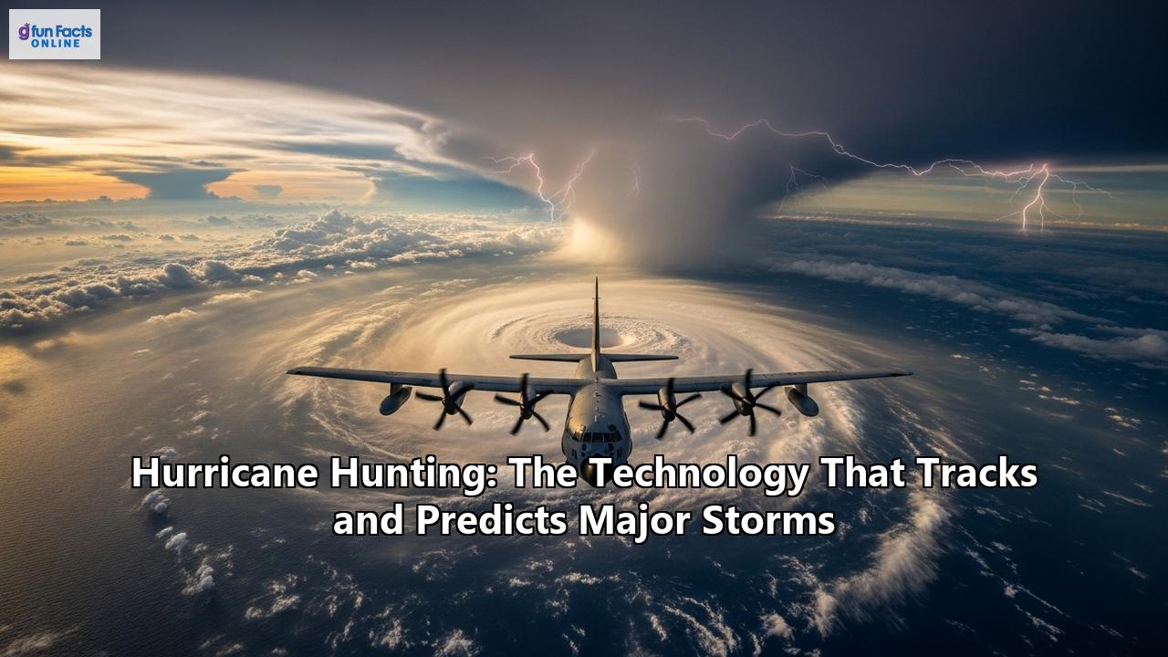
The 53rd Weather Reconnaissance Squadron, the "Hurricane Hunters," operates a fleet of ten Lockheed WC-130J Super Hercules aircraft from Keesler Air Force Base in Mississippi. This weather-modified version of the C-130J transport is a true workhorse, capable of flying missions lasting up to 18 hours. Their primary mission is to fly directly into the hurricane, typically at altitudes between 500 and 10,000 feet, and penetrate the storm's eye multiple times. This allows them to locate the center of the storm and measure the key parameters that define its intensity.
The crew of a WC-130J consists of a pilot, co-pilot, navigator, aerial reconnaissance weather officer (ARWO), and a weather reconnaissance loadmaster. The ARWO acts as the flight director within the storm, operating the computerized weather reconnaissance equipment and analyzing atmospheric conditions. The data they collect is transmitted in real-time via satellite to the National Hurricane Center (NHC) in Miami, feeding directly into the forecast models. The collection of this data has been shown to increase the accuracy of hurricane predictions by as much as 30 percent.
Key instruments aboard the WC-130J include:
- GPS Dropsonde Windfinding System: This is one of the most critical instruments. The loadmaster releases cylindrical probes called dropsondes from a tube in the aircraft. As these instruments parachute down to the sea, they continuously transmit data on pressure, temperature, humidity, and GPS-derived wind speed and direction. This provides a detailed vertical profile of the atmosphere within the storm, from flight level down to the ocean surface.
- Stepped-Frequency Microwave Radiometer (SFMR): Mounted on the wing, the SFMR, or "smurf," is a downward-looking instrument that measures microwave radiation emitted from the sea surface. By analyzing this radiation, scientists can accurately determine the wind speed at the ocean's surface and the rain rate within the storm—critical data for forecasting the life-threatening storm surge.
NOAA's High-Tech Fleet: The WP-3D Orion and Gulfstream IV-SP
NOAA's hurricane hunting fleet brings its own unique and powerful capabilities to the mission, operating out of the Aircraft Operations Center in Lakeland, Florida. Their fleet includes two Lockheed WP-3D Orion aircraft and a Gulfstream IV-SP jet.
The two WP-3D Orions, affectionately nicknamed "Kermit" and "Miss Piggy," are four-engine turboprops that serve as the agency's primary "into the storm" platforms. Like their Air Force counterparts, these planes fly through the eyewall of hurricanes, typically on missions lasting 8-10 hours, deploying dropsondes and other instruments. What makes the NOAA P-3s unique is their comprehensive suite of radar systems. They are equipped with a C-band radar in the nose, another on the lower fuselage, and a sophisticated Tail Doppler Radar (TDR). The lower fuselage and tail radars scan horizontally and vertically, respectively, providing a three-dimensional, MRI-like view of the storm's structure and wind fields, which is invaluable for researchers and forecasters. The P-3s also deploy bathythermographs, probes that measure the temperature of the sea, helping scientists understand the ocean's role in fueling the storm. After decades of service, NOAA has announced plans to replace these aging Orions with two new, specially configured Lockheed Martin C-130J aircraft, expected to enter service around 2030.
While the P-3s tackle the storm's core, the Gulfstream IV-SP jet, nicknamed "Gonzo," plays a different but equally crucial role. This high-altitude, high-speed jet flies around and over the hurricane at altitudes up to 45,000 feet. Its mission is to create a detailed picture of the large-scale weather patterns in the upper atmosphere that steer the storm. The G-IV's primary tool is the GPS dropwindsonde, which it releases to measure the winds, pressure, and moisture in the surrounding environment. This high-altitude data is a key ingredient for the computer models that predict a hurricane's future track. The G-IV also has a Tail Doppler Radar to analyze the storm's structure from a distance.
Over the decades, a variety of other aircraft have been pressed into service for hurricane reconnaissance, particularly in the early years. These include WWII-era bombers like the B-17, B-24, and B-25, as well as the WB-29 and the massive WB-50 Superfortress. The U.S. Navy's WC-121N Super Constellation, known as the "Willy Victor," was a notable platform from the mid-1950s to the early 1970s. Each of these aircraft played a part in building the foundation of knowledge upon which modern hurricane hunting is based.
The Watchful Eyes from Above: Satellites
Long before the first Hurricane Hunter aircraft takes off, the storm has already been under intense scrutiny from a fleet of sentinels in space. Weather satellites are the first line of defense in hurricane tracking, providing a continuous and global watch that is essential for detecting, monitoring, and forecasting these powerful storms. The era of satellite meteorology began with the launch of TIROS-1 in 1960, and the technology has since become indispensable.
The primary satellite systems used by the U.S. are managed by NOAA and include the Geostationary Operational Environmental Satellites (GOES) and the Joint Polar Satellite System (JPSS). These two types of satellites, geostationary and polar-orbiting, provide complementary views of the Earth and its weather.
The Constant Stare: Geostationary Satellites (GOES)
Geostationary satellites orbit the Earth above the equator at an altitude of about 22,236 miles (35,786 km). At this specific altitude, their orbital speed matches the rotation of the Earth, allowing them to remain "parked" over the same spot. This provides a constant, fixed-point view of an entire hemisphere, making them ideal for monitoring the full lifecycle of storms. NOAA operates two primary geostationary satellites, GOES-East and GOES-West, which together keep watch over the Atlantic and Eastern Pacific hurricane basins.
The latest generation, the GOES-R Series, represents a quantum leap in capability. These satellites can scan the Western Hemisphere every 15 minutes and can focus on areas of severe weather, capturing images as frequently as every 30 to 60 seconds. This provides forecasters with a near-real-time movie of a developing hurricane.
The main instruments on GOES satellites used for hurricane tracking are:
- Advanced Baseline Imager (ABI): This is the primary instrument, capturing images of the Earth in 16 different spectral bands (three times more than previous GOES). It provides high-resolution imagery in visible and infrared wavelengths, allowing forecasters to see cloud patterns, estimate storm motion, and analyze the storm's structure.
- Geostationary Lightning Mapper (GLM): This is the first instrument of its kind in geostationary orbit. It continuously maps lightning flashes, both in-cloud and cloud-to-ground. A significant increase in lightning activity within a storm can be a precursor to rapid intensification, giving forecasters a valuable early warning sign.
The Detailed Fly-by: Polar-Orbiting Satellites (JPSS)
In contrast to their geostationary cousins, polar-orbiting satellites circle the globe from the North Pole to the South Pole at a much lower altitude of about 512 miles (824 km). This lower orbit allows their instruments to capture data in much higher resolution, providing a more detailed look at the storm's structure. The JPSS satellites, including NOAA-20 and Suomi-NPP, orbit the Earth about 14 times a day, providing full global coverage twice daily.
While GOES satellites provide the constant stare, JPSS satellites provide the crucial, detailed "fly-by." Their data, particularly measurements of atmospheric temperature and moisture, are the backbone of numerical weather prediction models, providing about 85% of the input data used to generate 3-to-7 day forecasts.
Key instruments on JPSS satellites for hurricane analysis include:
- Visible Infrared Imaging Radiometer Suite (VIIRS): This instrument provides high-resolution imagery and can measure sea surface temperatures, which is critical for understanding the "fuel" available to a hurricane. It also has a "Day/Night Band" that can capture images of storms at night using moonlight, which is invaluable for continuous monitoring.
- Advanced Technology Microwave Sounder (ATMS) and Cross-track Infrared Sounder (CrIS): These two instruments work together as a pair. Microwave sounders have the unique ability to "see" through clouds, providing detailed profiles of atmospheric temperature and moisture at different levels within the storm. This is essential for understanding the storm's internal structure and the conditions that will influence its future intensity.
Making Sense of the Images: The Dvorak Technique
One of the most ingenious applications of satellite imagery is the Dvorak Technique, developed in the 1970s by Vernon Dvorak. It is a systematic method for estimating the intensity of a tropical cyclone based on the patterns of clouds seen in visible and infrared satellite images. By analyzing features like the curvature of the storm's bands, the size and shape of the central dense overcast (CDO), and the characteristics of the eye, forecasters can assign a "T-number" (Tropical Number) which corresponds to a specific wind speed and pressure. For storms with a clear eye, the technique uses the temperature difference between the warm eye and the cold surrounding cloud tops—the greater the difference, the stronger the storm. The Dvorak technique remains a cornerstone of hurricane intensity estimation, especially for storms that are far from the reach of reconnaissance aircraft.
The New Breed of Hunters: Drones and Unmanned Systems
In recent years, a new and revolutionary class of technology has joined the hurricane hunting arsenal: unmanned systems. These drones—operating in the air and on the sea surface—can venture into the most dangerous parts of a storm, places where sending a crewed aircraft would be too risky. They offer greater flexibility, lower costs, and the ability to gather data for extended periods, providing an unprecedented look at the storm's most violent regions.
Drones in the Air: Surveying the Boundary Layer
A critical area for understanding hurricane intensity is the boundary layer—the turbulent region in the lowest few thousand feet of the atmosphere where the storm interacts directly with the ocean. This is where the storm draws its heat energy, and it's a notoriously dangerous place to fly. Air-launched drones, deployed from NOAA's P-3 Hurricane Hunter aircraft, are now being used to sample this critical zone.
- Altius-600: This small Uncrewed Aircraft System (UAS) is launched from a tube in the belly of the P-3. After its wings deploy, it can be remotely piloted to fly for hours within the storm at very low altitudes. In 2022, an Altius-600 was flown into Hurricane Ian, where it descended to less than 2,300 feet and recorded wind speeds over 216 mph. This provides invaluable data on wind speed, temperature, pressure, and humidity in the region too hazardous for the P-3 itself.
- Black Swift S0: This lightweight, air-deployable drone is another key tool for probing the hurricane boundary layer. Weighing just 2.6 pounds, it is the lightest UAS to have ever sampled a tropical cyclone. It is rugged enough to operate in extreme turbulence and can fly for over 100 minutes, capturing 3D wind measurements, pressure, temperature, and humidity. Its low cost and robustness make it an ideal platform for gathering high-resolution data in the most dangerous parts of the storm.
These aerial drones provide not just a snapshot, but a "movie" of the conditions in the storm's most critical region, data that is fed directly into forecast models to improve intensity predictions.
Drones on the Water: Riding the Waves
While aerial drones probe the lower atmosphere, a fleet of uncrewed surface vehicles (USVs) is battling the storm at the ocean's surface. NOAA, in partnership with the company Saildrone, deploys a fleet of these wind and solar-powered USVs into the paths of hurricanes.
- Saildrone: These remarkable vehicles are equipped with a special "hurricane wing" designed to withstand winds over 78 knots and waves over 50 feet. They are strategically positioned in areas where hurricanes are likely to form and can be remotely piloted directly into the storm. They measure a host of variables at the air-sea interface, including wind speed, wave height, air and sea temperature, pressure, and salinity. This data is crucial for understanding how the ocean's heat fuels a storm's intensification. In a groundbreaking mission in 2021, a Saildrone not only survived but also transmitted the first-ever live video from inside the eyewall of a major hurricane.
NOAA has also begun to coordinate these missions, deploying aerial drones like the Altius-600 in the same location as a Saildrone and underwater gliders, creating a comprehensive, multi-layered data set from the top of the storm to deep within the ocean.
After the Storm: Damage Assessment
The role of drones doesn't end when the storm passes. In the aftermath of a hurricane, UAVs are proving to be invaluable tools for disaster response. They can be quickly deployed to survey vast, inaccessible areas, providing real-time imagery of the damage. Equipped with high-resolution and thermal imaging cameras, they can identify damaged infrastructure like bridges and power lines, locate stranded individuals, and help emergency managers prioritize aid efforts. This rapid and safe assessment capability significantly speeds up recovery and helps get resources to where they are needed most.
The Digital Brain: Supercomputers and Predictive Models
All the vast streams of data pouring in from aircraft, satellites, drones, and buoys would be of little use without the immense power of supercomputers. These digital brains are the heart of modern hurricane forecasting, running complex mathematical models that simulate the physics of the atmosphere and ocean to predict a storm's future.
Numerical Weather Prediction (NWP)
The process is called Numerical Weather Prediction (NWP). It begins by feeding the supercomputers a massive amount of observational data to create the most accurate possible picture of the atmosphere's current state—the "initial conditions." The computers then use a set of complex equations based on the laws of physics (fluid dynamics, thermodynamics, etc.) to calculate how these conditions will evolve over time, stepping forward in increments to produce a forecast.
NOAA's weather and climate supercomputers are among the most powerful in the world. Recent upgrades have brought their operational computing speed to over 29 petaflops, meaning they can perform 29 quadrillion calculations per second. This immense power allows for the use of increasingly sophisticated and high-resolution models.
The Next Generation of Hurricane Models: HAFS
For years, the primary hurricane model in the U.S. was the Hurricane Weather Research and Forecasting (HWRF) system. However, NOAA has recently rolled out its next-generation model, the Hurricane Analysis and Forecast System (HAFS). HAFS is a significant leap forward, designed to provide more accurate and reliable guidance on hurricane track and intensity, including the notoriously difficult-to-predict rapid intensification events.
A key feature of HAFS is its use of a high-resolution "moving nest." This allows the model to zoom in on the storm's inner core, resolving fine-scale features like the eyewall and rainbands with much greater detail—a critical element for improving intensity forecasts. HAFS is also an ocean-atmosphere coupled model, meaning it simulates the crucial interactions between the storm and the ocean below, which is vital for predicting how a storm will strengthen or weaken. HAFS is part of the larger Unified Forecast System (UFS), a community-based modeling effort aimed at streamlining and accelerating advances in weather prediction.
Dealing with Uncertainty: Ensemble Forecasting
Because the atmosphere is a chaotic system, even tiny errors in the initial data can lead to large differences in a forecast. To account for this uncertainty, forecasters don't rely on a single model run. Instead, they use a technique called "ensemble forecasting."
An ensemble is a collection of many different forecasts for the same storm. This can be done by running the same model multiple times with slightly different initial conditions, or by using the output from many different models (a multi-model ensemble). The resulting "spaghetti plots," which show the tracks from all the different ensemble members, give forecasters a clear picture of the range of possible outcomes and the uncertainty in the forecast. On average, the consensus or average of the ensemble forecasts is more accurate than any single model prediction.
The Ocean's Pulse: Buoys and Undersea Sentinels
Hurricanes are fueled by the heat of the ocean, making the collection of oceanic data a critical component of the prediction puzzle. A vast network of buoys and other ocean sensors provides a continuous stream of information on the conditions at and below the sea surface, serving as the "ground truth" that validates satellite data and informs forecast models.
Moored and Drifting Buoys
NOAA's National Data Buoy Center (NDBC) operates a large network of moored and drifting buoys in coastal and offshore waters.
- Moored Buoys: These are anchored to the seafloor and provide continuous, hourly observations from a fixed location. They measure a wide range of parameters, including wind speed and direction, barometric pressure, air and sea surface temperature, and wave height and period. Specially designed "hurricane buoys" are more robust, with backup systems to ensure they can survive and transmit data from within the storm.
- Drifting Buoys: These smaller, more numerous buoys drift freely with the ocean currents. They are a cost-effective way to gather data over vast areas of the open ocean. Drifters measure sea surface temperature and barometric pressure, and their movement provides valuable information about ocean currents. During hurricane season, drifting buoys are sometimes deliberately deployed in the path of a developing storm from Hurricane Hunter aircraft to gather crucial in-situ data.
This data is vital. The warmth of the ocean is a hurricane's fuel, so knowing the sea surface temperature is key to predicting intensity. A drop in barometric pressure recorded by a buoy can be one of the first signs of a storm's development. This real-time data is fed into forecasting models, helping to refine and strengthen predictions of a storm's path and power.
Diving Deeper: Gliders and Floats
To get a picture of what's happening beneath the waves, scientists deploy a fleet of autonomous underwater vehicles.
- Underwater Gliders: These AUVs are deployed in areas where hurricanes are known to track. They use small changes in buoyancy to "swim" and dive, collecting temperature and salinity profiles down to depths of 1,000 meters. This information is critical for determining the total "ocean heat content," which is a better measure of the energy available to a storm than just the surface temperature.
- Argo Floats: This global network of deep-diving floats provides temperature and salinity data down to 2,000 meters, revealing how a hurricane's passage can churn up colder water from the depths, a process that can cause a storm to weaken.
New Frontiers in Buoy Technology
Innovation in buoy technology continues. Companies like Sofar Ocean are developing air-deployable "Spotter" buoys that can be tossed from aircraft directly into a storm's path. They are also pioneering submersible buoys that sink to the ocean floor to ride out the storm, measuring the change in water pressure to provide unprecedented data on storm surge, before surfacing to transmit their data after the storm has passed.
The Final Watch: Ground-Based Radar
As a hurricane approaches land, the final line of technological defense comes into play: ground-based Doppler radar. The primary network used in the United States is NEXRAD (Next-Generation Radar), a system of 160 high-resolution S-band Doppler radars jointly operated by the National Weather Service, the FAA, and the U.S. Air Force.
When a storm is within about 200 miles of the coast, NEXRAD provides incredibly detailed information on its structure, movement, wind fields, and rainfall intensity. This allows local forecast offices to issue specific, short-term warnings for the most immediate threats, such as flash floods and tornadoes.
How Doppler Radar Works
Doppler radar works by sending out pulses of energy and listening for the return signal scattered back by precipitation. The intensity of the returned signal, known as reflectivity, indicates the intensity of the rain or hail. This is what produces the familiar green, yellow, and red images seen on weather reports.
The "Doppler" aspect of the radar allows it to detect the velocity of the precipitation particles either toward or away from the radar. By convention, greens and blues represent motion toward the radar, while reds and yellows show motion away from it. This radial velocity data is crucial for seeing the wind patterns inside a storm. It allows meteorologists to identify the storm's rotation and spot the tell-tale signatures of embedded tornadoes, such as a "hook echo" or a "tornado vortex signature."
The Power of Dual-Polarization
A major upgrade to the NEXRAD system was the implementation of dual-polarization technology. Instead of just sending out a horizontal pulse of energy, dual-pol radars send out both horizontal and vertical pulses. By comparing the returned signals from both pulses, meteorologists can determine the size and shape of the precipitation particles.
This has several key advantages for hurricane forecasting. It allows for much more accurate estimates of rainfall rates, which is critical for flood warnings. It can also clearly distinguish between heavy rain, hail, and non-weather targets. One of the most significant benefits is its ability to detect the "debris ball" lofted into the air by a tornado, providing definitive confirmation that a tornado is on the ground and causing damage, even at night or when obscured by rain.
A Future of Integrated Defense
The story of hurricane hunting technology is one of constant evolution. From a single daredevil flight to an integrated global network of sensors, our ability to see and understand these storms has grown exponentially. The future promises even greater integration, with crewed aircraft, satellites, autonomous drones, ocean sensors, and ground-based radar all working in concert. AI-powered models are beginning to revolutionize forecasting, processing vast datasets at incredible speeds to provide more accurate predictions. New constellations of small satellites promise to provide even more frequent and detailed observations.
Each layer of this complex technological shield provides a different piece of the puzzle. The satellites give us the broad view, the Hurricane Hunters provide the ground truth from within the storm's core, the drones explore the most dangerous regions, the buoys feel the ocean's pulse, the supercomputers predict the future, and the ground-based radars stand the final watch. Together, they form a powerful system of observation and prediction, a testament to the human drive to confront the forces of nature not with fear, but with knowledge, courage, and ingenuity. It is this relentless pursuit that allows us to stand ready, to warn, and to protect, when the winds begin to howl and the storm begins to rage.
Reference:
- https://www.quora.com/Can-the-radar-technology-used-to-detect-tornados-be-used-for-other-purposes-such-as-predicting-hurricanes-floods-and-other-storms
- https://www.researchgate.net/publication/323312830_Ground-Based_Radar_Technologies_for_Tornado_Observations
- https://journals.ametsoc.org/view/journals/wefo/36/2/WAF-D-20-0163.1.xml
- https://ntrs.nasa.gov/citations/20210014371
- https://en.wikipedia.org/wiki/NEXRAD
- https://www.nssl.noaa.gov/publications/dopplerguide/chapter3.php
- https://www.ncei.noaa.gov/access/metadata/landing-page/bin/iso?id=gov.noaa.ncdc:C00708
- https://www.ncei.noaa.gov/products/radar/next-generation-weather-radar
- https://www.researchgate.net/publication/258390793_Dual-polarization_radar_rainfall_estimation
- https://catalog.data.gov/dataset/?tags=nexrad
- https://www.youtube.com/watch?v=nir2GePOqlg
- https://journals.ametsoc.org/view/journals/atot/36/12/jtech-d-19-0081.1.xml
- https://www.accuweather.com/en/weather-news/what-is-nexrad-doppler-radar/229152
- https://www.noaa.gov/jetstream/dual-polarization
- https://www.numberanalytics.com/blog/weather-radar-in-severe-weather-events
- https://www.mdpi.com/2072-4292/13/16/3155
- https://www.hurricanescience.org/science/observation/landbased/radar/index.html
- https://www.weather.gov/marine/nexrad
- https://pdfs.semanticscholar.org/fe6c/a3176c75ecb7dc8c8eaee7fa071b94e5478b.pdf
- https://www.noaa.gov/jetstream/velocity
- https://ams.confex.com/ams/88Annual/techprogram/paper_135226.htm
- https://impact.earthdata.nasa.gov/casei/instrument/NEXRAD/
- https://www.youtube.com/watch?v=R8JLMa6SKy0
- https://www.weather.gov/cle/area_radars
- https://www.weather.gov/mkx/using-radar