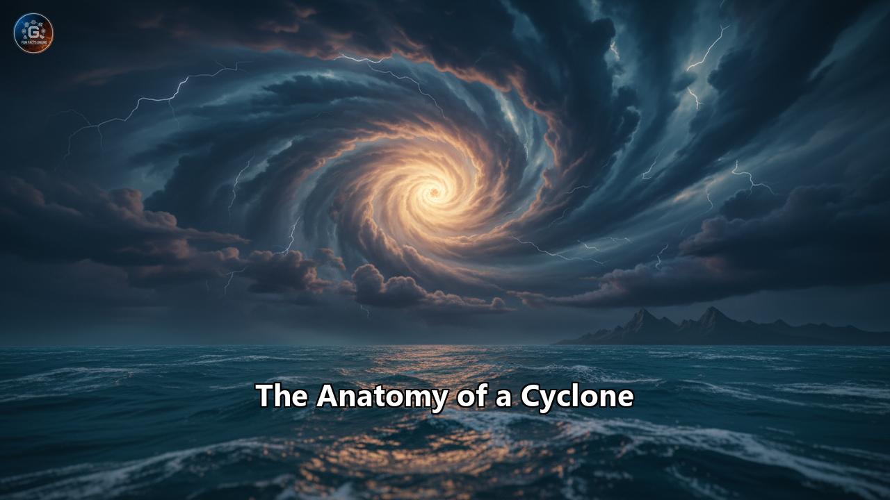
The Unseen Engine of Chaos: Deconstructing the Anatomy of a Cyclone
From the serene expanse of a tropical ocean, a monster can be born. It is a spiraling behemoth of wind and water, a testament to the immense power of our planet's atmosphere. Known by many names—hurricane, typhoon, or simply cyclone—this phenomenon is one of nature's most formidable and destructive forces. To understand its wrath, we must first dissect its intricate structure, from the deceptively calm eye to the furious, swirling bands of rain and wind that can stretch for hundreds of kilometers. This is the anatomy of a cyclone, a journey into the heart of a storm that reveals a complex interplay of physics, thermodynamics, and raw natural energy.
A Whirlwind of Names: Defining the Cyclone
In the lexicon of meteorology, a cyclone is fundamentally a large mass of air that rotates around a strong center of low atmospheric pressure. This rotation is a direct consequence of the Earth's spin, a phenomenon known as the Coriolis effect. As air rushes from areas of higher pressure towards the central low-pressure zone, the planet's rotation deflects it, setting up a characteristic spin. In the Northern Hemisphere, this rotation is counter-clockwise, while in the Southern Hemisphere, it is clockwise.
While the term "cyclone" is the generic scientific name, the storm's designation often changes based on its location. In the Atlantic and Northeast Pacific oceans, it is called a hurricane, a name derived from Huracan, the ancient Central American deity of wind. In the Northwest Pacific, it is known as a typhoon, and in the South Pacific and Indian Oceans, it is referred to as a tropical cyclone. These are not different types of storms, but rather regional names for the same powerful weather system. Beyond these well-known tropical cyclones, other, less common types exist, including extratropical cyclones that form in the middle latitudes, smaller mesocyclones that can spawn tornadoes, and even polar lows.
The Genesis of a Giant: Conditions for Creation
A cyclone is not a spontaneous creation; it requires a specific and delicate recipe of atmospheric and oceanic conditions. The primary ingredient is a vast expanse of warm ocean water. For a tropical cyclone to form, the sea surface temperature must be at least 26.5° to 27° Celsius (around 80° Fahrenheit) and this warmth must extend to a depth of at least 50 meters (about 150-165 feet). This warm water acts as the fuel for the cyclonic engine, providing the immense energy needed for its development.
The process begins with the evaporation of this warm ocean water. The resulting warm, moist air rises, and as it ascends into the cooler upper atmosphere, the water vapor condenses into clouds and rain. This condensation releases a tremendous amount of latent heat, which warms the surrounding air, causing it to become lighter and rise even faster. This continuous upward movement of air creates an area of lower pressure near the ocean's surface. Air from surrounding high-pressure areas then rushes in to fill this void, and the cycle intensifies.
However, warm water alone is not enough. Several other atmospheric factors must align for a cyclone to be born:
- Atmospheric Instability: The atmosphere must cool sufficiently with increasing altitude to allow for moist convection, the process of warm, moist air rising to form thunderstorms.
- Mid-Tropospheric Moisture: A relatively high level of humidity in the middle layers of the troposphere (around 16,000 feet or 4,900 meters) is necessary to support the development of deep convection.
- The Coriolis Force: A sufficient rotational force from the Earth's spin is crucial to initiate the cyclonic circulation. This is why cyclones rarely form within 5 degrees of the equator, where the Coriolis effect is negligible. A minimum distance of about 300 miles (480 km) from the equator is generally required.
- A Pre-existing Disturbance: Cyclones don't form from a perfectly calm atmosphere. They typically develop from a pre-existing weather disturbance, such as a tropical wave (an inverted trough of low pressure) moving westward in the tropics. The majority of tropical cyclones originate from these easterly waves.
- Low Vertical Wind Shear: This is perhaps one of the most critical factors. Vertical wind shear is the change in wind speed and/or direction with height in the atmosphere. High wind shear will disrupt the vertical structure of a developing storm, tilting it and preventing the heat engine from organizing. Low wind shear allows the storm to grow vertically, enabling the heat and moisture to remain concentrated and fuel its intensification.
When all these ingredients come together, a tropical disturbance can begin its transformation into a formidable cyclone.
The Anatomy of the Beast: A Tour of Cyclone Structure
As a tropical cyclone matures, it develops a highly organized and distinct structure, a marvel of atmospheric engineering. At its heart lies the eye, surrounded by the violent eyewall, and spiraling outwards are the extensive rainbands. The entire system is a giant, rotating engine, with air spiraling inwards at the surface, rising dramatically in the eyewall, and then flowing outwards at the top. A typical hurricane-strength cyclone can be about 300 miles (483 km) wide, though their size can vary considerably and is not always an indicator of their intensity.
The Deceptive Calm of the Eye
At the very center of a mature and powerful cyclone lies the eye, a region of surprisingly calm and often clear weather. This tranquil core, typically 20 to 40 miles (30-65 km) in diameter, is characterized by light winds, minimal precipitation, and sometimes even a glimpse of blue skies or stars. The lowest atmospheric pressure of the entire storm is found within the eye, which can be as much as 15% lower than the pressure outside the storm.
The formation of the eye is a complex process that is still not fully understood, but it is believed to be a result of the interplay between the conservation of angular momentum and centrifugal force. As air spirals inward toward the center of the storm, its rotational speed increases, much like a figure skater spinning faster as they pull their arms in. This rapid rotation creates a strong outward-directed force (centrifugal force).
When the wind speeds reach a certain threshold, typically around 74 mph (119 km/h), the inward-pulling pressure gradient force is balanced by this outward-flinging centrifugal force. This balance prevents the wind from reaching the absolute center, forcing the air to ascend in a ring around it, forming the eyewall. This strong rotation also creates a partial vacuum at the center, causing some of the air that has risen in the eyewall and flowed out at the top to sink back down in the middle. This sinking air, known as subsidence, warms and dries as it descends, suppressing cloud formation and creating the calm, clear conditions of the eye. The clarity and definition of the eye are often used as a visual indicator of a storm's strength; a well-defined, circular eye typically signifies a more powerful hurricane.
The Fury of the Eyewall
Encircling the tranquil eye is the eyewall, the most dangerous and destructive part of the cyclone. The eyewall is a towering ring of dense cumulonimbus thunderstorms where the storm's most intense convection occurs. It is within this ferocious ring that the highest wind speeds and heaviest rainfall are found. The eyewall is the engine room of the storm, where the release of latent heat is at its maximum, powering the entire system.
The inner edge of the eyewall marks the boundary of the eye, and the diameter of the eyewall can sometimes increase with height, creating a "stadium effect" that resembles an open-air sports arena when viewed from above. The winds in the eyewall are a product of the powerful updrafts that carry warm, moist air to the top of the troposphere, sometimes reaching altitudes of around 50,000 feet. As a hurricane makes landfall, a location in its path will experience the fury of the eyewall twice: once as the front of the storm passes over, and again after the brief lull of the eye, as the back half of the eyewall arrives.
The structure of the eyewall is not static and can undergo changes that directly impact the storm's intensity. One of the most significant of these is the eyewall replacement cycle. In intense tropical cyclones, some of the outer rainbands may organize into a new, outer eyewall. This new eyewall gradually moves inward, "choking" the original inner eyewall by cutting off its supply of moisture and momentum. During this phase, the storm typically weakens temporarily. Eventually, the outer eyewall completely replaces the inner one, and the storm may then re-intensify, sometimes becoming even stronger than before, with a larger eye.
The Spiraling Arms: Rainbands
Spiraling outwards from the central core of the cyclone are the rainbands, which are curved bands of clouds and thunderstorms that can extend for hundreds of kilometers. These bands are capable of producing heavy bursts of rain and strong, gusty winds. Between these rainbands, there can be gaps with little to no precipitation. Traveling from the outer edge of a hurricane toward its center, one would experience alternating periods of increasingly intense weather as each rainband passes.
These rainbands are not just passive features; they are an integral part of the cyclone's circulation. They draw in moisture and warmth from the ocean surface, feeding it towards the storm's core and contributing to its self-sustaining nature. The rainbands are also where tornadoes associated with hurricanes most often form.
A Cyclone's Journey: From Cradle to Grave
The life of a tropical cyclone is a dynamic process, a journey through distinct stages of development, maturation, and eventual decay. This life cycle can be as short as a day or last for as long as a month, as was the case with Hurricane/Typhoon John, which traversed the Pacific for 31 days. The journey typically begins with a humble disturbance and can culminate in a monstrous, mature hurricane before it finally meets its end.
The Formative Stages: Disturbance, Depression, and Storm
The very first stage of a cyclone's life is the tropical disturbance. This is often an unorganized cluster of thunderstorms with very little, if any, defined wind circulation. In the Atlantic, these disturbances frequently originate from African easterly waves, which are patterns of stormy weather that move off the west coast of Africa every few days. If conditions are favorable, with warm water and low wind shear, this disturbance can begin to organize.
As the system develops a more organized circulation with winds converging towards a low-pressure center, it is upgraded to a tropical depression. At this stage, the system begins to draw its energy from the warm ocean waters rather than from atmospheric temperature gradients. Tropical depressions are numbered to keep track of them, but they are not yet given a formal name.
If the tropical depression continues to intensify and its maximum sustained winds reach 39 mph (63 km/h), it is classified as a tropical storm and is given a name from a predetermined list. This naming convention helps in communicating warnings and tracking the storm's progress. Globally, about 100 tropical cyclones form each year, but only about half of them reach the strength of a mature hurricane.
The Peak of Power: The Mature Hurricane
A tropical storm officially becomes a hurricane (or typhoon or severe tropical cyclone, depending on the region) when its maximum sustained winds exceed 74 mph (119 km/h). At this stage, the storm is a mature, self-sustaining system with a well-developed eye and eyewall.
The intensification of a cyclone is a positive feedback loop. The release of latent heat from condensation warms the core, causing surface pressures to drop further. This lower pressure strengthens the inward flow of warm, moist air at the surface, which in turn fuels more convection and rainfall, leading to an even greater drop in pressure. Under ideal conditions, a cyclone can undergo rapid intensification, a dramatic increase in wind speed in a short amount of time. The most widely used definition for rapid intensification is an increase in maximum sustained winds of at least 30 knots (35 mph) in a 24-hour period. This process is often associated with extremely warm sea surface temperatures and is a major challenge for forecasters.
The Inevitable Decline: Dissipation
Every cyclone, no matter how powerful, eventually weakens and dissipates. There are several factors that can lead to a cyclone's demise:
- Moving over cooler water: When a cyclone moves over ocean waters cooler than 26.5°C (79.7°F), it is cut off from its primary fuel source. This deprives the storm of the heat and moisture it needs to maintain its warm core and thunderstorm activity, causing it to weaken into a remnant low-pressure area.
- Moving over land: Landfall is a major cause of cyclone dissipation. The storm is not only cut off from the warm ocean water that fuels it, but the increased friction from the land surface disrupts the low-level circulation and weakens the updrafts.
- Encountering high vertical wind shear: As a cyclone moves into an area with high vertical wind shear, the top of the storm can be blown off-center from the low-level circulation, disrupting its structure and heat engine, which leads to weakening.
- Interaction with dry air: The entrainment of dry air into the storm's core can diminish convection and weaken the cyclone.
- Extratropical Transition: As a tropical cyclone moves into higher latitudes (typically between 30° and 40°), it can undergo a process called extratropical transition. During this transition, the storm's energy source shifts from the release of latent heat (a warm-core process) to the temperature differences between air masses (a baroclinic, or cold-core, process), characteristic of mid-latitude storms. The storm's structure changes, becoming less symmetric and often increasing in size. While the core weakens, the storm can still retain hurricane-force winds and produce significant rainfall.
Measuring the Fury: Cyclone Classification Scales
To communicate the potential danger of an approaching cyclone, meteorological agencies around the world use various classification scales based primarily on a storm's maximum sustained wind speed. It is important to note that these scales do not account for other deadly hazards like storm surge, rainfall-induced flooding, or tornadoes.
The Saffir-Simpson Hurricane Wind Scale
The most well-known of these is the Saffir-Simpson Hurricane Wind Scale, used for hurricanes in the Atlantic and Northeast Pacific. This scale is a 1 to 5 rating based on a hurricane's maximum sustained wind speed, measured as a one-minute average.
- Category 1: Winds of 74-95 mph (119-153 km/h). Very dangerous winds will produce some damage.
- Category 2: Winds of 96-110 mph (154-177 km/h). Extremely dangerous winds will cause extensive damage.
- Category 3: Winds of 111-129 mph (178-208 km/h). Devastating damage will occur. Hurricanes of Category 3 and higher are considered "major hurricanes."
- Category 4: Winds of 130-156 mph (209-251 km/h). Catastrophic damage will occur.
- Category 5: Winds of 157 mph (252 km/h) or higher. Catastrophic damage will occur, with a high percentage of framed homes destroyed.
International Scales
Other regions use different scales, often based on 10-minute or 3-minute average wind speeds, which makes direct comparison with the Saffir-Simpson scale difficult.
- Australian Tropical Cyclone Intensity Scale: Used in the Australian and South Pacific regions, this is also a five-category system. A Category 1 has winds of 63-88 km/h, while a Category 5 has winds of 200 km/h or more.
- India Meteorological Department (IMD) Scale: Used for cyclones in the North Indian Ocean, this scale has seven categories, based on 3-minute sustained winds. The classifications range from a "Depression" with winds of 31-49 km/h to a "Super Cyclonic Storm" with winds of 222 km/h or more.
- Western Pacific Scales: In the Northwest Pacific, agencies like the Japan Meteorological Agency (JMA) and others use their own classifications, with terms like "Typhoon," "Severe Typhoon," and "Violent Typhoon" or "Super Typhoon."
The Arsenal of Destruction: Cyclone Hazards
While strong winds are the defining characteristic of a cyclone, they are just one of the many dangers these storms unleash. The combination of wind, water, and the sheer scale of these systems can lead to widespread devastation.
The Onslaught of Water: Storm Surge and Flooding
Often the deadliest hazard associated with a landfalling cyclone is the storm surge, an abnormal rise in sea level that can be as high as 6 meters (20 feet) or more. The primary cause of storm surge is the friction between the powerful winds in the eyewall and the ocean surface, which piles up water in the direction the wind is blowing. This effect is most pronounced in the right-front quadrant of a Northern Hemisphere storm, where the winds are strongest. The low atmospheric pressure in the eye contributes a smaller amount to the surge, causing the sea surface to bulge upwards. As the cyclone approaches the coast, this dome of water is pushed ashore, causing massive flooding. The severity of a storm surge is influenced by the storm's intensity, size, speed, and the geography of the coastline.
In addition to the coastal flooding from storm surge, the torrential rainfall from a cyclone can lead to widespread inland flooding. A tropical cyclone can draw in and release enormous amounts of moisture, with rainfall rates of several centimeters per hour. This can overwhelm drainage systems and cause rivers and streams to overflow their banks, leading to devastating floods and landslides, often far from the coast.
The Power of Wind and a Storm's Fury
The sustained high winds of a cyclone can cause immense structural damage, turning loose debris into deadly projectiles. The force of the wind increases exponentially with speed; a doubling of wind speed increases the pressure it exerts by a factor of nearly five. This is why higher-category storms cause disproportionately more damage.
Within the chaotic environment of a hurricane, other localized wind hazards can occur. As a storm makes landfall, friction with the surface can increase turbulence, allowing stronger winds from aloft to be transported down to the surface in the form of powerful gusts and downbursts.
Cyclonic Tornadoes
Perhaps one of the more surprising hazards is the formation of tornadoes within a landfalling cyclone. These tornadoes typically form in the spiral rainbands, particularly in the right-front quadrant of the storm in the Northern Hemisphere, where the vertical wind shear is greatest. While usually weaker and shorter-lived than their counterparts on the Great Plains, these tornadoes still pose a significant threat. The interaction of the cyclone's circulation with land increases friction and can create the localized conditions necessary for tornado formation.
A Force to Be Respected
From its genesis in the warm tropical seas to its eventual decay over land or cooler waters, the cyclone is a testament to the intricate and powerful forces that govern our planet's climate. Its anatomy reveals a highly organized, self-sustaining engine of incredible scale and power. By understanding the conditions that give it birth, the structure that defines its might, and the arsenal of hazards it wields, we can better appreciate the majesty and the menace of these awe-inspiring storms. They are a reminder of nature's raw power and the critical importance of heeding the warnings they provide.
Reference:
- https://www.weather.gov/mfl/saffirsimpson
- https://en.wikipedia.org/wiki/Tropical_cyclone
- https://en.wikipedia.org/wiki/Cyclone
- https://www.nhc.noaa.gov/aboutsshws.php
- https://en.wikipedia.org/wiki/Tropical_cyclone_intensity_scales
- https://www.britannica.com/science/tropical-cyclone/The-storm-surge
- http://www.bom.gov.au/cyclone/tropical-cyclone-knowledge-centre/understanding/categories/
- https://weather.metoffice.gov.uk/learn-about/weather/types-of-weather/hurricanes/measuring
- https://typhoonmanila.weebly.com/wind-damage.html
- https://www.hurricanescience.org/society/impacts/tornadoes/index.html
- https://www.internetgeography.net/topics/tropical-cyclone-hazards-and-vulnerability/
- https://ntslf.org/storm-surges/about-storm-surges
- https://en.wikipedia.org/wiki/Saffir%E2%80%93Simpson_scale
- https://en.wikipedia.org/wiki/List_of_super_cyclonic_storms
- https://weather.metoffice.gov.uk/learn-about/weather/types-of-weather/hurricanes/hazards
- https://en.wikipedia.org/wiki/Storm_surge
- https://skybrary.aero/articles/saffir-simpson-hurricane-wind-scale-sshws
- https://besafenet.net/hazards/hurricanes-and-storm-surges/
- https://imdpune.gov.in/hazardatlas/cyclone.pdf
- https://en.wikipedia.org/wiki/Effects_of_tropical_cyclones
- https://www.weather.gov/cae/tropicaltornadoes.html
- https://scied.ucar.edu/learning-zone/storms/what-causes-storm-surge
- https://www.quora.com/How-do-tropical-cyclones-cause-floods
- https://www.britannica.com/science/tropical-cyclone/Ranking-and-naming-a-cyclone
- https://www.hurricanezone.org/
- https://www.scribd.com/document/541236405/Tropical-cyclone-scales
- https://byjus.com/ias-questions/what-are-the-categories-of-cyclones/
- https://agora.ex.nii.ac.jp/digital-typhoon/help/unit.html.en
- https://www.encyclopedie-environnement.org/en/air-en/tropical-cyclones-impacts-and-risks-2/
- https://www.typhooncommittee.org/docs/roving_seminar/2011/2011_C1a.pdf
- https://www.britannica.com/science/tropical-cyclone/Tropical-cyclone-damage
- https://www.reddit.com/r/weather/comments/164mjrt/how_does_a_tornado_form_in_a_hurricane_when_the/
- https://www.ecoflow.com/us/blog/hurricanes-vs-tornadoes