Plate Tectonics: The Engine Driving Earth's Geology and Geography
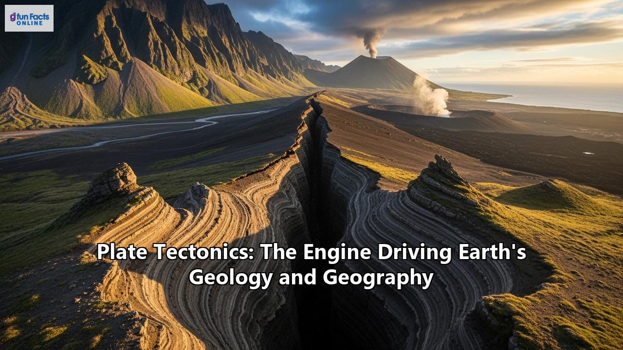
Our planet is a dynamic and ever-changing world. Seemingly solid ground shifts, majestic mountains rise, and fiery volcanoes erupt with tremendous force. For centuries, humanity has witnessed these geological phenomena, but a comprehensive understanding of the engine driving them remained elusive until the mid-20th century. The revolutionary theory of plate tectonics provided the framework, revealing that the Earth's outer shell is not a single, static piece but a mosaic of massive, moving slabs of rock. This constant, slow-motion dance of tectonic plates is the primary force shaping our planet's geology and geography, from the deepest ocean trenches to the highest peaks.
A Revolutionary Idea: The Genesis of Plate Tectonic Theory
The story of plate tectonics is a testament to scientific curiosity and perseverance. The concept's roots can be traced back to the early 20th century and the then-radical idea of "continental drift," championed by German meteorologist Alfred Wegener. In 1912, Wegener proposed that the Earth's continents were not fixed in their current positions but had moved over geological time. He was not the first to notice the uncanny, puzzle-like fit of the coastlines of South America and Africa, a feature observed by cartographers as early as 1596. However, Wegener was the first to build a detailed and comprehensive scientific case for this observation.
Wegener amassed a wealth of evidence to support his hypothesis. He pointed to the distribution of fossils of the same species found on continents now separated by vast oceans. For example, the fossil remains of the ancient reptile Mesosaurus were found in both southern Africa and South America, suggesting these landmasses were once connected. Furthermore, he presented geological evidence, showing that rock formations and mountain ranges on different continents aligned as if they were once part of a continuous belt. Wegener also cited paleoclimatic evidence, such as glacial deposits found in present-day tropical regions of Africa, South America, India, and Australia, indicating that these continents were once situated closer to the South Pole.
Despite the compelling evidence, Wegener's theory of continental drift was met with widespread skepticism and ridicule from the scientific community. The primary objection was the lack of a plausible mechanism to explain how massive continents could plow through the rigid oceanic crust. Wegener had proposed forces like the Earth's rotation and tidal forces as potential drivers, but these were quickly demonstrated to be far too weak. For decades, the idea of moving continents remained on the fringe of geological science.
The tide began to turn in the mid-20th century with technological advancements that allowed for detailed exploration of the ocean floor. In the 1950s, studies using sonar technology revealed the existence of a vast underwater mountain range running down the center of the Atlantic Ocean, known as the Mid-Atlantic Ridge. Further investigations showed that this ridge was a site of significant volcanic and seismic activity.
A crucial piece of the puzzle came from paleomagnetic studies. Scientists discovered that as new volcanic rock cools at mid-ocean ridges, magnetic minerals within the rock align with the Earth's magnetic field at that time. The Earth's magnetic field has reversed its polarity numerous times throughout history. By studying the magnetic patterns on the seafloor, researchers found a striped pattern of magnetic anomalies mirrored on either side of the mid-ocean ridges. This provided strong evidence for "seafloor spreading," a concept proposed by Harry Hess in the early 1960s. Hess theorized that new oceanic crust was being formed at the mid-ocean ridges and then pushed outwards, away from the ridge.
The final breakthrough came in the 1960s when the global distribution of earthquakes and volcanoes was mapped with greater accuracy. It became clear that these geological events were not random but were concentrated in narrow, linear bands that delineated the edges of large, rigid plates. This led to the formulation of the comprehensive theory of plate tectonics, which unified the concepts of continental drift and seafloor spreading. By the late 1960s, plate tectonics had become the unifying theory of geology, revolutionizing our understanding of the Earth.
The Earth's Layered Structure: The Foundation of Plate Tectonics
To understand how tectonic plates move, it's essential to first understand the layered structure of the Earth. The Earth can be divided into layers based on both chemical composition and mechanical properties.
Chemically, the Earth consists of the crust, the mantle, and the core. The crust is the thin, outermost layer, which can be further divided into two types: continental crust and oceanic crust. Continental crust is thicker, less dense, and primarily composed of granitic rocks rich in silicon and aluminum. Oceanic crust, on the other hand, is thinner, denser, and made of basaltic rocks rich in silicon and magnesium. Below the crust lies the mantle, a thick layer of silicate rock that extends down to the core-mantle boundary. The core is the Earth's innermost layer, composed mainly of iron and nickel, with a liquid outer core and a solid inner core.
From a mechanical perspective, the Earth's outer layers are divided into the lithosphere and the asthenosphere. The lithosphere is the rigid, outermost shell of the Earth, comprising the crust and the uppermost part of the mantle. It behaves as a brittle solid and is broken into the tectonic plates. The thickness of the lithosphere varies, being thinner under the oceans and thicker under the continents.
Beneath the lithosphere lies the asthenosphere, a mechanically weak and ductile layer within the upper mantle. The asthenosphere is not fully molten but is so hot and under such immense pressure that it behaves plastically, allowing it to flow like a very viscous fluid over geological timescales. This "lubricating" layer is what allows the rigid lithospheric plates to move. The boundary between the lithosphere and the asthenosphere is a zone of detachment, where the rigid plates can slide over the more fluid-like asthenosphere.
The Major and Minor Plates: A Global Jigsaw Puzzle
The Earth's lithosphere is fractured into numerous tectonic plates of varying sizes. Geologists generally agree on the existence of seven or eight major plates, depending on how they are defined, along with numerous minor and microplates. These plates are in constant motion, moving at rates of a few centimeters per year, roughly the same speed at which our fingernails grow.
The major plates include:
- Pacific Plate: The largest tectonic plate, consisting almost entirely of oceanic crust.
- North American Plate: A large plate that includes the North American continent and parts of the Atlantic and Arctic oceans.
- Eurasian Plate: Encompassing most of Europe and Asia.
- African Plate: Comprising the continent of Africa and the surrounding oceanic crust.
- Antarctic Plate: A major plate covering the continent of Antarctica and the surrounding ocean floor.
- Indo-Australian Plate: A large plate that includes the Indian subcontinent, Australia, and a significant portion of the Indian Ocean.
- South American Plate: A major plate that includes the continent of South America and a portion of the South Atlantic Ocean.
Some of the more prominent minor plates include the Nazca Plate, the Cocos Plate, the Scotia Plate, the Arabian Plate, and the Philippine Plate. These smaller plates are often wedged between the larger ones and can experience complex and intense geological activity. The constant interaction between these plates at their boundaries is the primary driver of most of the Earth's earthquakes, volcanic eruptions, and mountain building.
The Engine of Motion: Driving Forces of Plate Tectonics
The question of what drives the motion of tectonic plates has been a subject of intense scientific debate. While a single, definitive answer remains elusive, it is widely accepted that the movement is ultimately driven by the Earth's internal heat. The decay of radioactive elements within the Earth's mantle generates a tremendous amount of heat, which creates convection currents in the mantle. In this process, hotter, less dense material rises, while cooler, denser material sinks, creating a slow, creeping motion within the solid mantle.
However, the idea that these convection currents directly drag the plates along like a conveyor belt is now considered an oversimplification. Current models suggest that the forces driving plate motion are more complex and are primarily related to gravity. The two main forces thought to be the most significant are "slab pull" and "ridge push."
Slab Pull: This is widely considered to be the most dominant driving force. It occurs at subduction zones, where a dense oceanic plate sinks into the mantle. As the cold, dense edge of the plate, or "slab," descends into the hotter, less dense asthenosphere, its own weight pulls the rest of the plate along with it. This process is analogous to a heavy anchor pulling a chain down with it. Ridge Push: This force is generated at mid-ocean ridges, where new oceanic lithosphere is formed. The upwelling of hot mantle material at the ridge creates a topographically elevated area. As the newly formed lithosphere cools and becomes denser, gravity causes it to slide down the gentle slope of the ridge, pushing the plate away from the ridge axis. While the term "push" is used, it's more accurately described as a gravitational sliding force.Other potential driving forces include mantle drag, where the flow of the asthenosphere exerts a force on the base of the lithosphere, and trench suction, where the rollback of a subducting slab can create a suction force that pulls the overriding plate toward the trench. It is likely that a combination of all these forces, with slab pull being the most significant, is responsible for the movement of the tectonic plates.
Where Worlds Collide, Separate, and Slide: The Three Types of Plate Boundaries
The most dramatic geological action occurs at the boundaries where tectonic plates interact. These interactions can be categorized into three main types: divergent, convergent, and transform boundaries.
Divergent Boundaries: Creating New Crust
Divergent boundaries, also known as constructive or extensional boundaries, are where two tectonic plates move away from each other. As the plates pull apart, magma from the mantle rises to the surface, cools, and solidifies to create new crust.
- Mid-Ocean Ridges: Most divergent boundaries are found on the ocean floor, where they form the global mid-ocean ridge system, a vast underwater mountain range that encircles the planet. The Mid-Atlantic Ridge is a classic example, where the North American and Eurasian plates are separating, and the South American and African plates are moving apart. This process of seafloor spreading is responsible for the formation of new ocean basins. Volcanic activity is common along these ridges, often in the form of fissure eruptions that produce pillow lavas. Earthquakes at mid-ocean ridges are typically shallow and of relatively low magnitude.
- Continental Rifts: Divergent boundaries can also occur within continents, leading to the formation of rift valleys. The East African Rift Valley is a prime example of a continental rift in its early stages. Here, the African Plate is in the process of splitting into two smaller plates. As the crust is stretched and thinned, large blocks of land can drop down to form a valley, often accompanied by volcanic activity. If rifting continues, a new ocean basin may eventually form, as is the case with the Red Sea.
Convergent Boundaries: Destroying Old Crust
Convergent boundaries, or destructive boundaries, are where two plates collide. The nature of the resulting geological features depends on the types of crust involved in the collision.
- Oceanic-Continental Convergence: When a dense oceanic plate collides with a less dense continental plate, the oceanic plate is forced to bend and slide beneath the continental plate in a process called subduction. This creates a deep oceanic trench at the point of subduction, such as the Peru-Chile Trench off the coast of South America. As the subducting oceanic plate descends into the mantle, it heats up, and water trapped in the crustal rocks is released. This water lowers the melting point of the overlying mantle rock, causing it to melt and form magma. The buoyant magma rises to the surface, leading to the formation of a chain of volcanoes on the continental plate, known as a volcanic arc. The Andes Mountains in South America are a classic example of a volcanic arc formed by oceanic-continental convergence. These subduction zones are also responsible for some of the most powerful earthquakes on Earth, known as megathrust earthquakes.
- Oceanic-Oceanic Convergence: When two oceanic plates converge, the older, colder, and therefore denser plate will typically subduct beneath the younger, warmer, and less dense plate. Similar to oceanic-continental convergence, this process forms a deep oceanic trench and generates magma that rises to the surface. In this case, the resulting volcanoes form a chain of islands known as a volcanic island arc. The Mariana Islands and the Aleutian Islands are examples of volcanic island arcs. The Mariana Trench, the deepest part of the world's oceans, is formed by the subduction of the Pacific Plate beneath the Mariana Plate.
- Continental-Continental Convergence: When two continental plates collide, neither plate is dense enough to be subducted into the mantle. Instead, the immense compressional forces cause the crust to buckle, fold, and be pushed upwards, forming vast mountain ranges. The formation of the Himalayas, the world's highest mountain range, is a spectacular example of continental-continental convergence, resulting from the ongoing collision between the Indian Plate and the Eurasian Plate. This process is also responsible for the formation of the Alps in Europe.
Transform Boundaries: Sliding Past Each Other
Transform boundaries, or conservative boundaries, are where two plates slide horizontally past one another. At these boundaries, crust is neither created nor destroyed. The movement along these faults is not smooth; the plates can become locked, causing stress to build up over time. When the stress is released suddenly, it results in an earthquake.
The most famous example of a transform boundary is the San Andreas Fault in California, which marks the boundary between the Pacific Plate and the North American Plate. This fault is responsible for numerous earthquakes in the region. Transform faults can also be found on the ocean floor, where they offset segments of mid-ocean ridges.
The Geological Manifestations of Plate Tectonics
The relentless movement and interaction of tectonic plates have profound and dramatic consequences for the Earth's surface, creating a wide range of geological features and phenomena.
Earthquakes: The Shaking of the Earth
Earthquakes are one of the most direct and powerful manifestations of plate tectonics. They are caused by the sudden release of energy stored in the Earth's crust. This energy is released when rocks along a fault, a fracture in the crust where movement has occurred, slip past each other. The vast majority of earthquakes occur along plate boundaries, where the plates are constantly grinding against each other.
- Convergent Boundaries: These boundaries are responsible for the most powerful earthquakes, particularly at subduction zones. The immense friction between the subducting and overriding plates can cause them to become locked. Over time, strain builds up, and when it is finally released, it can result in a massive earthquake. These "megathrust" earthquakes can have magnitudes of 9.0 or greater and can generate devastating tsunamis. The 2004 Indian Ocean earthquake and the 2011 Tōhoku earthquake in Japan were both megathrust earthquakes.
- Divergent Boundaries: Earthquakes at divergent boundaries are generally less powerful and occur at shallower depths. They are caused by the tensional forces as the plates pull apart.
- Transform Boundaries: Earthquakes at transform boundaries can be very powerful and are often shallow, which can make them particularly damaging to urban areas. The slipping and grinding motion along these faults can cause significant ground shaking.
While most earthquakes occur at plate boundaries, they can also happen in the interior of plates, known as intraplate earthquakes. These are thought to be caused by the reactivation of ancient faults or by stress transmitted from the plate boundaries.
Volcanoes: Windows into the Earth's Fiery Interior
Volcanoes are another dramatic consequence of plate tectonics. They are vents in the Earth's crust through which molten rock (magma), ash, and gases can escape. Like earthquakes, the majority of volcanoes are located along plate boundaries.
- Convergent Boundaries: Subduction zones are home to some of the most explosive volcanoes on Earth. The magma generated by flux melting in these zones is often rich in silica and dissolved gases, which makes it very viscous and explosive. This leads to the formation of composite volcanoes, also known as stratovolcanoes, which are characterized by their steep, conical shape. The "Ring of Fire," a zone of intense volcanic and seismic activity encircling the Pacific Ocean, is a direct result of the subduction of the Pacific Plate and other smaller plates beneath the surrounding continental plates.
- Divergent Boundaries: Volcanism at divergent boundaries is generally less explosive. The magma that rises to the surface at mid-ocean ridges is typically basaltic, which is low in silica and flows more easily. This results in the formation of shield volcanoes and fissure eruptions. About 80 to 90 percent of all volcanic eruptions occur at these spreading centers.
- Hotspots: Not all volcanoes are associated with plate boundaries. Some, like the Hawaiian Islands, form over "hotspots," which are thought to be plumes of hot mantle material rising from deep within the Earth. As a tectonic plate moves over a stationary hotspot, a chain of volcanoes is created. The youngest and most active volcano is located directly over the hotspot, while older, extinct volcanoes are found further away, forming a linear island chain or seamount chain.
Mountain Building: Sculpting the Earth's Topography
The formation of mountain ranges, or orogeny, is a fundamental geological process driven by plate tectonics. Mountains can be formed in several ways, primarily through the collision of tectonic plates.
- Fold Mountains: When two continental plates collide, the immense compressional forces cause the crust to buckle and fold, creating massive fold mountains. The Himalayas, the Alps, and the Appalachians are all examples of fold mountains. The Appalachians are an older mountain range that formed hundreds of millions of years ago and has since been eroded to a lower elevation.
- Volcanic Mountains: As discussed earlier, chains of volcanoes formed at convergent boundaries and hotspots can create significant mountain ranges. The Andes and the Cascade Range are prominent examples of volcanic mountain ranges.
- Block Mountains: These mountains are formed by faulting rather than folding. When tensional forces stretch the crust, it can fracture into large blocks. Some blocks are uplifted to form horsts (ranges), while others are down-dropped to form grabens (basins). The Sierra Nevada in the western United States is an example of a block mountain range.
Plate Tectonics and the Supercontinent Cycle
The movement of tectonic plates over vast spans of geological time has led to the repeated assembly and breakup of supercontinents, a process known as the supercontinent cycle. The most famous of these supercontinents was Pangaea, which existed from about 335 to 175 million years ago. Pangaea was a single, massive landmass that included all of the Earth's present-day continents.
The breakup of Pangaea began during the Jurassic Period, as the continents started to drift apart, opening up new oceans like the Atlantic. This process of continental rifting and seafloor spreading continues to this day. The existence of Pangaea and other earlier supercontinents is supported by a wealth of geological and paleontological evidence, including the distribution of fossils and the matching of geological formations across continents.
The supercontinent cycle has had a profound impact on the Earth's climate and the evolution of life. The formation of a supercontinent can lead to a more extreme climate, with vast arid interiors and a reduction in the moderating influence of the oceans. The breakup of a supercontinent can create new coastlines and shallow seas, leading to a more moderate climate and providing new habitats for marine life.
The Broader Impacts of Plate Tectonics
The influence of plate tectonics extends far beyond the geological realm, playing a crucial role in shaping the Earth's climate and influencing the course of biological evolution.
Plate Tectonics and Climate
The positions of the continents have a significant impact on global climate patterns. The distribution of land and sea affects ocean currents and atmospheric circulation, which in turn regulate the transport of heat around the planet. For example, the opening and closing of ocean gateways can dramatically alter ocean circulation patterns. The formation of the Isthmus of Panama, which connected North and South America, is thought to have played a role in the onset of the ice ages by altering the circulation of the Atlantic and Pacific Oceans.
Volcanic activity, driven by plate tectonics, can also have a significant impact on climate. Large explosive eruptions can inject vast amounts of ash and sulfur dioxide into the stratosphere, which can block sunlight and cause short-term global cooling. Over geological timescales, the outgassing of carbon dioxide from volcanoes has played a crucial role in regulating the Earth's climate.
Plate Tectonics and the Evolution of Life
Plate tectonics has been a major driver of biological evolution. The breakup of continents can lead to the isolation of populations, which can then evolve into new species. The unique fauna of Australia, for example, is a result of its long isolation from other continents.
Conversely, the collision of continents can bring previously separated species into contact, leading to competition and extinction, as well as the dispersal of species into new environments. The formation of mountain ranges can also create new habitats and act as barriers to species migration.
Studying Plate Tectonics Today: Modern Techniques
Our understanding of plate tectonics continues to evolve, thanks to modern technologies that allow us to monitor plate movements with unprecedented accuracy.
- Global Positioning System (GPS): High-precision GPS measurements allow scientists to directly track the movement of tectonic plates. By placing GPS receivers at various locations on the Earth's surface, researchers can measure their positions with millimeter-level accuracy and determine the velocity and direction of plate motion.
- Seismic Tomography: This technique uses the seismic waves generated by earthquakes to create three-dimensional images of the Earth's interior. By analyzing how the speed of seismic waves changes as they travel through the mantle, scientists can identify areas of hotter, upwelling material and colder, downwelling material, providing insights into the convection currents that drive plate tectonics.
Conclusion: A Unifying Theory for a Dynamic Planet
The theory of plate tectonics stands as one of the most significant scientific revolutions of the 20th century. It provides a single, elegant framework for understanding a vast array of geological processes that were once considered unrelated. From the majestic rise of mountains to the terrifying power of earthquakes and volcanoes, plate tectonics is the engine that drives the constant transformation of our planet's surface.
The slow, inexorable dance of the tectonic plates has shaped the world we live in, dictating the distribution of continents and oceans, influencing global climate patterns, and guiding the course of life's evolution. As we continue to refine our understanding of this fundamental process, we gain not only a deeper appreciation for the intricate workings of our dynamic planet but also a greater ability to anticipate and mitigate the geological hazards that it presents. The story of plate tectonics is a reminder that the ground beneath our feet is not as solid and unchanging as it may seem, but is part of a grand and ongoing geological saga that has been unfolding for billions of years.
Reference:
- http://scecinfo.usc.edu/education/k12/learn/plate2.htm
- https://www.youtube.com/watch?v=IILDqD_l-ho
- https://www.iris.edu/hq/inclass/animation/plate_tectonic_theorya_brief_history
- https://www.britannica.com/biography/Alfred-Wegener
- https://science8sc.weebly.com/evidence-for-plate-tectonics.html
- https://rwu.pressbooks.pub/webboceanography/chapter/4-1-alfred-wegener-and-the-theory-of-plate-tectonics/
- https://www.reddit.com/r/askscience/comments/b8ki3p/what_evidence_do_we_have_of_plate_tectonics/
- https://courses.lumenlearning.com/geo/chapter/reading-wegener-and-the-continental-drift-hypothesis/
- https://open.maricopa.edu/fallglg102/chapter/development-of-plate-tectonic-theory/
- https://www.nps.gov/subjects/geology/plate-tectonics-the-unifying-theory-of-geology.htm
- https://en.wikipedia.org/wiki/Plate_tectonics
- https://www.geolsoc.org.uk/Plate-Tectonics/Chap2-What-is-a-Plate.html
- https://ser.im-ldi.com/GEO110/GEO110_S03/Dis2b.pdf
- https://pubs.usgs.gov/gip/dynamic/tectonic.html
- https://www.britannica.com/science/plate-tectonics
- https://en.wikipedia.org/wiki/Lithosphere%E2%80%93asthenosphere_boundary
- https://www.geologyin.com/2025/02/lithosphere-and-asthenosphere.html
- https://courses.lumenlearning.com/geo/chapter/reading-the-lithosphere-and-asthenosphere/
- https://en.wikipedia.org/wiki/List_of_tectonic_plates
- https://www.iris.edu/hq/inclass/animation/what_are_the_forces_that_drive_plate_tectonics
- http://www.columbia.edu/~vjd1/driving_forces_basic.htm
- https://geo.libretexts.org/Courses/University_of_California_Davis/GEL_056%3A_Introduction_to_Geophysics/Geophysics_is_everywhere_in_geology.../04%3A_Plate_Tectonics/4.01%3A_The_Forces_Driving_Plate_Motions
- https://oceanexplorer.noaa.gov/ocean-fact/plate-boundaries/
- https://www.geologyin.com/2014/03/types-of-continental-boundaries.html
- https://www.amnh.org/explore/ology/earth/power-of-plate-tectonics/volcanoes
- https://fiveable.me/earth-systems-science/unit-3/types-plate-boundaries-characteristics/study-guide/DPlbh9jUTvV35T7q
- https://www.bgs.ac.uk/discovering-geology/earth-hazards/earthquakes/what-causes-earthquakes/
- https://pressbooks.cuny.edu/gorokhovich/chapter/how-does-plate-tectonics-creates-mountains/
- https://www.slideshare.net/slideshow/volcanoes-and-plate-tectonics/238656305
- https://scitechdaily.com/earths-ancient-dance-new-evidence-suggests-plate-tectonics-occurred-over-4-2-billion-years-ago/
- https://www.amnh.org/explore/ology/earth/power-of-plate-tectonics/mountains
- https://www.britannica.com/science/How-Are-Mountains-Formed
- https://www.amnh.org/explore/ology/earth/power-of-plate-tectonics/earthquakes
- https://www.livescience.com/37706-what-is-plate-tectonics.html
- https://www.britannica.com/video/John-P-Rafferty-connection-tectonic-plates-earthquake/-160677
- https://www.nps.gov/subjects/volcanoes/plate-tectonics-and-volcanoes.htm
- https://minnstate.pressbooks.pub/environmentalgeology/chapter/plate-tectonics-and-volcanism/
- https://en.wikipedia.org/wiki/Mountain_formation
- https://courses.lumenlearning.com/suny-earthscience/chapter/mountain-formation/
- https://www.ebsco.com/research-starters/history/wegener-proposes-theory-continental-drift