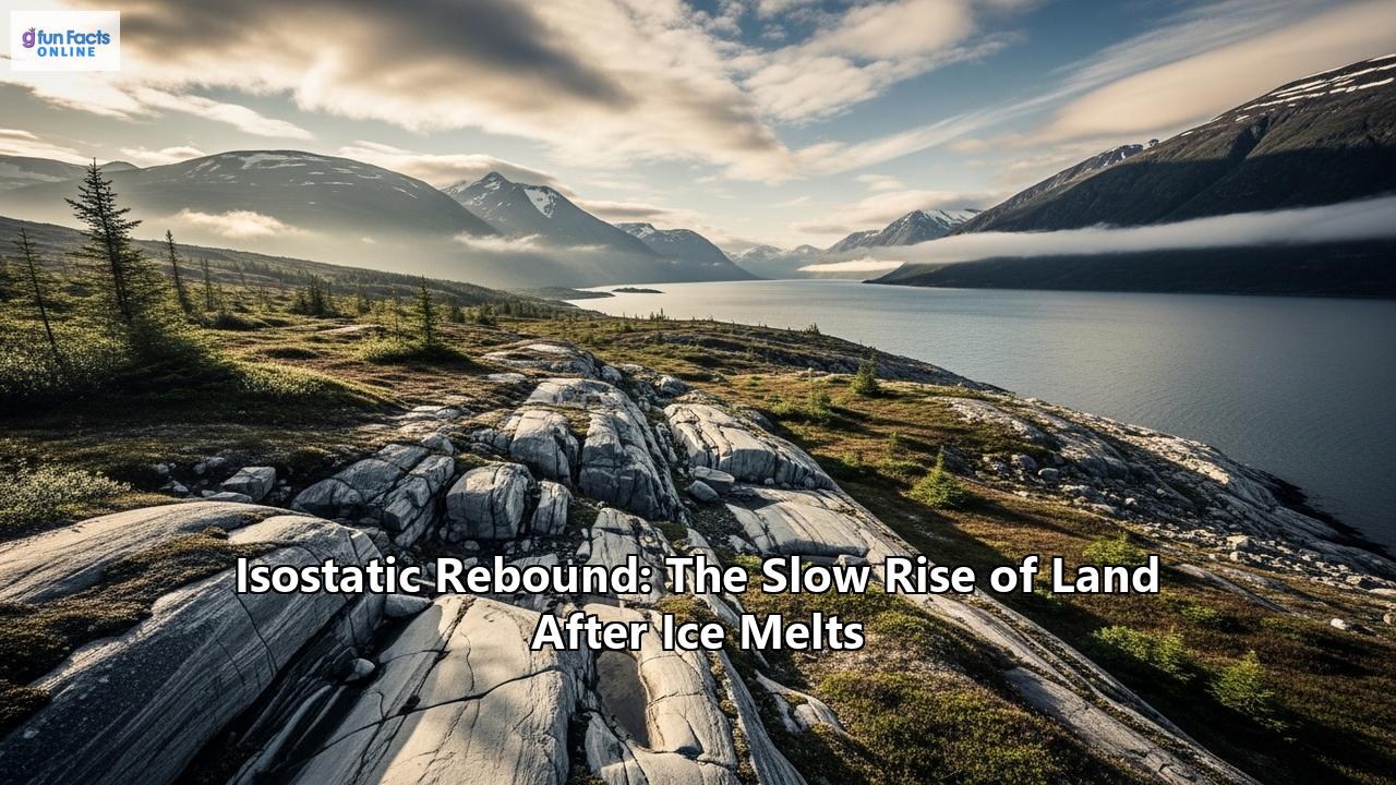
An invisible force is reshaping our world, a silent and remarkably slow process that is causing the very ground beneath our feet to rise. This phenomenon, known as isostatic rebound, is the Earth's protracted response to the melting of colossal ice sheets that once buried vast portions of our planet. Like a foam mattress slowly regaining its shape after a heavy weight is removed, the land is gradually ascending, a process that began thousands of years ago and continues to this day. This monumental adjustment has profound implications, influencing everything from global sea levels and the course of rivers to the stability of the ground we build upon. The story of isostatic rebound is a captivating journey back in time, a testament to the immense power of ice and the surprising fluidity of the solid Earth.
The Foundation: Understanding Isostasy
To comprehend the grand scale of isostatic rebound, one must first grasp the principle of isostasy. Coined in 1882 by American geologist Clarence Dutton, the term "isostasy" originates from the Greek words "ísos" (equal) and "stásis" (standstill), signifying a state of gravitational equilibrium. In essence, isostasy is the theory that the Earth's rigid outer layer, the lithosphere, "floats" on the denser, more fluid-like layer beneath it, the asthenosphere. This is analogous to an iceberg floating in the ocean, with a significant portion of its mass submerged to support the part that is visible above the water.
The lithosphere, which includes the crust and the uppermost part of the mantle, is not a uniform shell. It is broken into tectonic plates of varying thickness and density. Continental crust, being thicker and less dense than oceanic crust, "floats" higher on the asthenosphere, forming the landmasses we inhabit. Conversely, the denser oceanic crust sits lower, creating the ocean basins.
Isostasy explains how different topographic heights can exist on the Earth's surface. Any change in the mass of the lithosphere, such as the addition of large mountains through tectonic collision or the deposition of vast amounts of sediment, will cause it to sink deeper into the asthenosphere. Conversely, if mass is removed, through erosion for instance, the lithosphere will rise to a new equilibrium. This delicate balancing act is the fundamental mechanism driving isostatic rebound.
There are three primary models that describe isostasy:
- The Airy-Heiskanen model: This model assumes the crust has a constant density, and variations in topographic height are compensated by changes in crustal thickness. High mountains, therefore, have deep "roots" extending into the denser mantle.
- The Pratt-Hayford model: In contrast, this model proposes that topographic heights are a result of lateral variations in the density of the crust. Higher elevations are underlain by less dense crustal material.
- The Vening Meinesz, or flexural isostasy model: This model acknowledges the rigidity of the lithosphere, suggesting it acts as an elastic plate that bends under a load, distributing the weight over a broader region.
While these models provide different perspectives, they all underscore the fundamental principle that the Earth's surface is in a constant state of adjustment to maintain gravitational balance. It is within this framework of a dynamic and responsive Earth that the phenomenon of post-glacial isostatic rebound unfolds.
The Great Oppression: The Pleistocene Glaciations
The primary catalyst for the large-scale isostatic rebound we observe today was the Quaternary glaciation, a period of alternating glacial and interglacial periods that began about 2.58 million years ago and is technically still ongoing. During the colder glacial periods, vast ice sheets expanded across the Northern Hemisphere, covering significant portions of North America, Europe, and Asia.
The sheer scale of these ice sheets is difficult to fathom. During the Last Glacial Maximum, around 20,000 to 26,000 years ago, ice sheets such as the Laurentide Ice Sheet in North America and the Scandinavian Ice Sheet in Europe reached thicknesses of up to 3 to 4 kilometers (1.9 to 2.5 miles). It is estimated that at their maximum extent, glaciers covered about 30% of the Earth's land surface.
The immense weight of this ice exerted enormous pressure on the underlying lithosphere, causing it to depress and sink into the more malleable asthenosphere. For example, the area around what is now Hudson Bay, which was near the center of the Laurentide Ice Sheet, is thought to have been depressed by as much as 800 meters for a 3,000-meter-thick ice sheet. This downward warping of the crust was not localized; it extended for vast distances, creating a broad depression.
As the lithosphere was pushed down, the viscous material of the asthenosphere was slowly displaced outwards. This created a "forebulge" or a peripheral bulge of slightly uplifted land around the margins of the ice sheets. These bulges were a direct consequence of the displaced mantle material.
The formation and presence of these massive ice sheets had a profound impact on the planet. The vast quantities of water locked up in the ice led to a significant drop in global sea levels, by as much as 120 meters (390 feet) or more, exposing large areas of the continental shelves. The weight of the ice also influenced the Earth's crustal stress field and even its rotation.
As the climate began to warm and the ice sheets started to melt and retreat, a process that accelerated around 11,700 years ago, the immense weight on the continents was lifted. This unloading of the lithosphere set the stage for one of the most significant geological readjustments in recent Earth history: isostatic rebound.
The Slow Ascent: The Mechanism of Rebound
The melting of the glaciers did not result in an instantaneous "springing back" of the land. Instead, the process of isostatic rebound is a slow and protracted one, governed by the viscoelastic properties of the Earth's mantle. The mantle, while solid on short timescales, behaves like a very viscous fluid over long geological periods.
The rebound process can be understood in two main phases:
- An initial rapid elastic response: Immediately following the removal of the ice load, the lithosphere experiences a relatively quick, though still slow by human standards, elastic uplift. This initial phase is akin to the immediate partial recovery of a compressed spring.
- A slower, viscous flow: The more significant and longer-lasting component of the rebound is driven by the slow return flow of the displaced asthenosphere material back underneath the deglaciated area. This viscous flow is what dictates the overall timescale of the rebound, which can take many thousands of years to complete.
The rate of isostatic rebound is not uniform across all formerly glaciated regions. Several factors influence how quickly the land rises:
- Ice Thickness: The thicker the original ice sheet, the greater the initial depression and, consequently, the larger the total rebound. Regions that were under the center of the massive ice sheets, like the Hudson Bay area, experience the greatest and most rapid uplift.
- Mantle Viscosity: The viscosity, or resistance to flow, of the asthenosphere plays a crucial role. A lower viscosity mantle allows for a faster return flow of material and thus a more rapid rebound. The viscosity of the mantle can vary regionally, leading to different rebound rates in different parts of the world.
- Lithospheric Rigidity: The flexural rigidity of the lithosphere also influences the pattern of uplift. A more rigid lithosphere will distribute the uplift over a wider area.
The speed of rebound was greatest immediately following deglaciation and has been gradually slowing down over time. However, even today, thousands of years after the ice disappeared, the land in many regions is still rising at a measurable rate.
Measuring the Rise: The Tools of Detection
Scientists employ a variety of methods to measure and model the ongoing process of isostatic rebound, providing a detailed picture of this slow-motion geological phenomenon.
1. Global Positioning System (GPS): Modern GPS technology offers a highly precise way to measure the vertical movement of the Earth's crust. By establishing a network of fixed GPS receivers in formerly glaciated regions, scientists can track their changes in elevation over time with millimeter-level accuracy. The BIFROST GPS network in northern Europe, for example, has shown peak uplift rates of about 11 millimeters per year in the northern part of the Gulf of Bothnia. 2. Tide Gauges: Tide gauges, which have been used for centuries to measure sea level, also provide valuable data for understanding isostatic rebound. By analyzing long-term tide gauge records, scientists can determine the relative sea-level change in a particular location. In areas undergoing uplift, the land is rising relative to the sea, which can manifest as a local fall in sea level or a rate of sea-level rise that is lower than the global average. 3. Gravity Measurements: The redistribution of mass within the Earth as the mantle flows back under the rebounding crust causes subtle changes in the Earth's gravity field. Highly sensitive instruments called absolute gravimeters can detect these minute variations in gravity, providing another way to monitor the process of isostatic adjustment. 4. Geological Evidence: The most compelling evidence for isostatic rebound comes from the geological record itself. Features that were formed at or near sea level in the past are now found at significantly higher elevations.- Raised Beaches and Shorelines: Ancient beaches, complete with wave-cut platforms, sea caves, and fossilized shingle ridges, are now found far inland and hundreds of meters above the current sea level in many parts of the world. These "raised beaches" are a direct and striking testament to the land's uplift. The varying altitudes of these ancient shorelines also provide crucial information about the differential uplift across a region.
- Ancient Lake Shorelines: In a similar vein, the shorelines of ancient proglacial lakes (lakes that formed at the edge of melting glaciers) can now be found tilted, with the end that was closer to the center of the ice sheet now at a higher elevation. This tilting provides a clear record of the differential rebound.
- Marine Fossils: The discovery of marine fossils, such as seashells, far inland and at high elevations in areas like Scandinavia and the Ottawa River Valley was one of the earliest clues that led scientists to recognize the reality of isostatic rebound.
By combining data from these various sources, scientists can create detailed models of past and present isostatic rebound, helping them to understand the properties of the Earth's interior and to predict future changes.
Global Footprints: Case Studies of Isostatic Rebound
The effects of isostatic rebound are most pronounced in the regions that were once covered by the thickest ice sheets. These areas serve as natural laboratories for studying this fascinating process.
Scandinavia: The Scandinavian Peninsula, which was at the heart of the Eurasian Ice Sheet, is a classic example of isostatic rebound. The region is still rising today, with the fastest uplift occurring around the Gulf of Bothnia, where the land is ascending at a rate of up to 1 centimeter per year. The coastlines of Sweden and Finland are dotted with raised beaches, ancient shorelines, and harbors that have become too shallow for modern ships. The ongoing uplift is also causing the tilting of lakes and altering the courses of rivers. Scotland: Scotland, which was covered by its own ice sheet during the last glacial period, also displays dramatic evidence of isostatic rebound. Raised beaches and shore platforms are prominent features along its coastline, particularly in the west. In some areas, these ancient shorelines can be found more than 40 meters above the current sea level. The differential uplift, with greater rebound in the central Highlands where the ice was thickest, has led to a noticeable tilting of the land. This has had a significant impact on the evolution of Scotland's coastline and river systems since the end of the last ice age. North America (Hudson Bay): The region around Hudson Bay in Canada was the epicenter of the massive Laurentide Ice Sheet and is currently experiencing some of the most dramatic isostatic rebound on the planet. The land along the southern coast of Hudson Bay is rising at a rate of about 1 to 1.3 meters per century. This rapid uplift is causing the coastline to advance, creating vast new stretches of land. In some areas, ancient shorelines of the Tyrrell Sea, a prehistoric inland sea that flooded the region after the ice melted, can be found up to 250 kilometers inland from the present-day coast. It is estimated that the Hudson Bay area still has about another 100 meters to rise, a process that will take another 10,000 years to complete. Antarctica: The Antarctic continent is still largely covered by a massive ice sheet, but even here, isostatic rebound is occurring in response to past and present ice loss. The Antarctic Peninsula and parts of West Antarctica, where ice melt is most significant, are experiencing rapid uplift. In some areas of the Amundsen Sea embayment, the rebound has been measured at an astonishing rate of up to 4.1 centimeters per year. This rapid uplift is thought to have a complex and evolving impact on the stability of the remaining ice sheet. Some studies suggest that the rebound could have a modest stabilizing effect on marine ice sheets by raising the grounding line (the point where the ice sheet starts to float), but it is unlikely to be enough to halt the overall trend of ice loss.Ripples of Change: Environmental Consequences
The slow but inexorable rise of the land due to isostatic rebound has a wide range of environmental consequences, reshaping landscapes and influencing natural processes.
Relative Sea-Level Change: One of the most significant effects of isostatic rebound is on relative sea level. In areas of uplift, the land is rising faster than the global sea level, resulting in a local fall in sea level. This is why, in places like Hudson Bay and parts of Scandinavia, the coastline is advancing and new land is being created. Conversely, the peripheral bulges that formed around the ice sheets are now slowly subsiding. This subsidence, combined with global sea-level rise, is leading to an accelerated rate of relative sea-level rise in these areas, such as the east coast of the United States. River Drainage and Lake Tilting: Isostatic rebound can significantly alter the topography of a region, which in turn affects the flow of rivers and the shape of lakes. The differential uplift across a landscape can change the slope of riverbeds, causing some rivers to change their course or to incise deeper into the landscape. In Maine, for example, post-glacial rebound is thought to have caused regional tilting and the rerouting of major river systems. Similarly, large lakes in formerly glaciated areas are being tilted as the land rebounds more at one end than the other. This tilting is causing the lakes to slowly migrate and is affecting water levels along their shores. Coastal Evolution: The interplay between isostatic rebound and global sea-level change is a major driver of coastal evolution in many parts of the world. In areas of uplift, emergent coastlines are characterized by raised beaches and abandoned sea cliffs. In areas of subsidence, submergent coastlines are created, with drowned river valleys (rias) and glacial troughs (fjords) being prominent features. Induced Seismicity: The shifting stresses in the Earth's crust caused by isostatic rebound can, in some cases, trigger earthquakes. While these are typically not as large as earthquakes at plate boundaries, they can still be significant. This "induced seismicity" is most likely to occur near the margins of the former ice sheets where the stress changes are most pronounced.The Rebound and Modern Climate Change: A Complex Interplay
The ongoing process of isostatic rebound from the last ice age is now interacting with the effects of modern, human-induced climate change, creating a complex and sometimes counterintuitive picture of environmental change.
The primary interaction is with global (eustatic) sea-level rise. As global temperatures rise due to greenhouse gas emissions, glaciers and ice sheets are melting at an accelerated rate, and the oceans are expanding as they warm. This is causing a global rise in sea level.
In regions experiencing isostatic uplift, the rising land can partially or even completely offset the effects of global sea-level rise. This is why in some parts of Scotland and Scandinavia, the relative sea level is actually falling, despite the global trend. However, in areas of isostatic subsidence, such as the US East Coast, the sinking land exacerbates the problem of global sea-level rise, leading to a much higher rate of local sea-level rise and increased coastal flooding.
Furthermore, the rapid melting of the Greenland and Antarctic ice sheets due to modern warming is itself causing a contemporary isostatic rebound effect. As these ice sheets lose mass, the underlying land begins to rise. This modern rebound is happening on a much faster timescale than the rebound from the last ice age. In Antarctica, this rapid uplift may have a feedback effect on the ice sheet itself, potentially slowing the rate of ice loss in some areas, although the overall impact is still a subject of active research.
The Future of Rebound: A Legacy in Motion
The process of isostatic rebound is far from over. In many regions, the land will continue to rise for thousands of years to come. For example, it is estimated that the Hudson Bay region still has a significant amount of uplifting to do.
This ongoing and future rebound will continue to shape our planet in a number of ways:
- Continued Changes in Sea Level: The patterns of relative sea-level change we see today will continue, with ongoing uplift in some areas and subsidence in others. This has important implications for coastal communities, infrastructure, and ecosystems.
- Landscape Evolution: Rivers will continue to adjust their courses, lakes will continue to tilt, and coastlines will continue to evolve in response to the changing topography.
- Geohazards: The potential for induced seismicity will persist in some regions as crustal stresses continue to adjust.
Understanding isostatic rebound is therefore not just a matter of academic interest. It has real-world applications in fields such as:
- Coastal Management: Predicting future relative sea-level changes is essential for effective coastal planning and for developing strategies to mitigate the impacts of flooding and erosion.
- Water Resource Management: The tilting of lakes and the changing courses of rivers can affect water supplies and navigation, requiring careful management.
- Geotechnical Engineering: The stability of infrastructure, such as bridges, dams, and nuclear power plants, can be affected by the slow but steady movement of the ground.
The slow rise of the land after the melting of the great ice sheets is a powerful reminder of the Earth's dynamic nature. It is a process that operates on a timescale that dwarfs human experience, yet its effects are all around us, shaping the world we live in. As we continue to grapple with the challenges of a changing climate, understanding the long-term legacy of the last ice age, a legacy written in the rising land itself, has never been more important. Isostatic rebound is a profound and ongoing geological drama, a silent testament to the enduring power of ice and the slow, inexorable dance of the Earth's crust.
Reference:
- https://aboutdarwin.com/isostatic-rebound-post-glacial-rebound/
- https://en.wikipedia.org/wiki/Quaternary_glaciation
- https://www.21stcentech.com/climate-change-sea-level-calculations-looked-isostatic-rebound/
- https://en.wikipedia.org/wiki/Pleistocene
- https://en.wikipedia.org/wiki/Post-glacial_rebound
- https://www.studysmarter.co.uk/explanations/environmental-science/ecological-conservation/isostatic-adjustment/
- https://www.ontariobeneathourfeet.com/rising-land-isostatic-rebound
- https://earthscience.stackexchange.com/questions/4728/why-is-relative-sea-level-falling-in-hudson-bay
- https://www.livescience.com/planet-earth/climate-change/greenland-is-losing-so-much-ice-its-getting-taller
- https://www.researchgate.net/publication/249869057_Patterns_of_isostatic_land_uplift_during_the_Holocene_Evidence_from_mainland_Scotland
- https://climate.sustainability-directory.com/term/mantle-viscoelasticity/
- https://climate.sustainability-directory.com/term/viscoelastic-earth-response/
- https://rswystun.medium.com/ice-age-glaciers-may-be-long-gone-but-theyre-still-affecting-the-earth-will-be-for-millenia-to-1d70a7624f
- https://academic.oup.com/gji/article/148/3/443/821518
- http://neotectonics.seismo.unr.edu/CNS_pdfs/lahontan_JGR_&_figures.pdf
- https://climatechangenunavut.ca/content/what-do-scientists-mean-when-they-say-%E2%80%9C-land-rising-faster-sea-level-due-isostatic-rebound
- https://www.cambridge.org/core/journals/earth-and-environmental-science-transactions-of-royal-society-of-edinburgh/article/abs/stateoftheart-in-studies-of-glacial-isostatic-adjustment-for-the-british-isles-a-literature-review/F2FB019601906F480E0ED892FA4D61B0
- https://www.geolsoc.org.uk/science-and-policy/100-great-geosites/landscape/raised-beach-loch-tarbert/
- https://geographyas.info/coasts/sea-level-change/
- https://www.quora.com/How-is-a-modern-isostatic-rebound-from-contemporary-climate-change-affecting-global-sea-level
- https://earthwise.bgs.ac.uk/index.php/Sea_level_changes,_Palaeogene_volcanic_districts_of_Scotland
- https://scarf.scot/national/palaeolithic-mesolithic-panel-report/3-environment/3-4-relative-sea-level-changes-during-the-last-15000-years/
- https://earthwise.bgs.ac.uk/index.php/Sea-level_change,_Quaternary_to_the_present,_Southern_Uplands
- https://www.savemyexams.com/a-level/geography/edexcel/18/revision-notes/3-coastal-landscapes-and-change/3-3-coastal-erosion-and-sea-level-change/3-3-1-sea-level-change/
- https://www.journals.uchicago.edu/doi/pdfplus/10.1086/626809
- https://parks.canada.ca/lhn-nhs/mb/prince/culture/decouvrir-discover4
- https://www.ontariobeneathourfeet.com/sea-level-rise-james-hudson-bay
- https://www.quora.com/What-processes-could-cause-isostatic-adjustments
- https://www.bitsofscience.org/isostatic-rebound-amundsen-bay-negative-feedback-acceleration-antarctic-ice-melt/
- https://courses.ems.psu.edu/earth107/node/1501
- https://www.researchgate.net/publication/389673936_Glacial_isostatic_adjustment_shifted_early_Holocene_river_hydrology_in_Maine_USA
- https://pubs.geoscienceworld.org/gsa/geology/article/46/7/591/531399/Glacial-isostatic-adjustment-deflects-the-path-of
- https://tamarapico.github.io/images/Pico_2018_Geology.pdf
- https://m.x-mol.net/paper/article/5768210
- https://researchoutreach.org/articles/coastline-evolution-rise-fall-sea-level-time/
- https://www.netzerowatch.com/all-news/antarctic-sea-level-rise-40-lower-than-predicted