The Red Planet has long been a silent tantalizer. For centuries, we have mapped its rusted skin, tracing the scars of ancient rivers and the shadows of colossal volcanoes. We have sent rovers to scratch at its surface and orbiters to photograph its dust storms. Yet, despite decades of exploration, the true nature of Mars—its "hidden heart"—remains largely a mystery. Is the core liquid or solid? Do ancient aquifers truly slumber deep beneath the regolith? And are there massive, hollow lava tubes capable of housing future cities?
The answers do not lie in better cameras or faster rovers. They lie in a revolutionary new field of science that marries the subatomic weirdness of quantum mechanics with the planetary-scale grandeur of gravity mapping. It is called Quantum Geodesy, and it promises to strip Mars bare, not by looking at it, but by looking through it.
The Invisible Map: Why Gravity Matters
To understand why quantum geodesy is such a game-changer, we must first understand the limitations of our current vision. When we look at Mars, we see topography: mountains, valleys, and craters. But topography is just the skin. Gravity is the skeleton.
Planets are not uniform spheres of rock. They are lumpy, chaotic collections of dense iron cores, rocky mantles, water reservoirs, and hollow caverns. Each of these features exerts a slightly different gravitational pull. A mountain pulls harder than a valley; a dense deposit of iron ore pulls harder than a pocket of porous sandstone.
By measuring these minute fluctuations in gravity—a field known as gravimetry—scientists can create a density map of a planet’s interior. We have done this before with missions like NASA’s GRAIL (for the Moon) and GRACE (for Earth), which used pairs of satellites chasing each other to measure gravity changes. But Mars presents a unique challenge. Its atmosphere causes drag that messes with classical instruments, and the resolution required to find human-scale features—like a lava tube for a habitat or a water ice deposit for fuel—requires a level of sensitivity that classical mechanical sensors struggle to achieve.
Enter the atom.
The Quantum Revolution: Cold Atom Interferometry
The heart of this new technology is the Cold Atom Interferometer (CAI). It sounds like science fiction, but it is a rapidly maturing reality that is set to become the gold standard for space exploration.
In a classical accelerometer (like the one in your smartphone), a physical mass on a spring moves when the device accelerates. Friction, temperature changes, and material fatigue eventually cause these sensors to "drift," losing accuracy over time.
In a Cold Atom Interferometer, there is no spring. There is no solid mass. Instead, the "sensor" is a cloud of rubidium atoms cooled by lasers to near absolute zero. At these ultra-cold temperatures, atoms stop behaving like billiard balls and start behaving like waves.
Here is the magic:
- The Launch: A laser pulse launches this cloud of atomic waves into a vacuum chamber.
- The Split: Another laser pulse splits the matter-waves in two, sending them on different paths—a "quantum superposition" where the atoms are effectively in two places at once.
- The Interaction: As these two wave paths travel, they are affected by gravity. If there is a denser mass nearby (like a buried Martian glacier), the gravity from that mass will pull on one path slightly more than the other.
- The Recombination: A final laser pulse forces the paths to recombine. Because they experienced slightly different gravity, the waves don't line up perfectly. They interfere with each other, creating a pattern that tells scientists exactly how much gravity acted on them.
Because atoms are universal and identical, they don't "drift." An atom of rubidium today is the same as an atom of rubidium a million years from now. This offers absolute accuracy—a drift-free, hyper-sensitive eye capable of detecting a gravitational anomaly as small as a hidden cave or a buried lake from orbit.
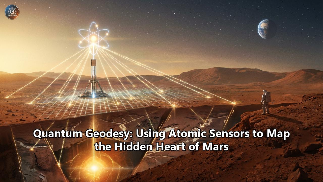
MaQuIs: The Mission to X-Ray Mars
The scientific community is already mobilizing to deploy this technology. The leading concept is the MaQuIs (Mars Quantum Gravity Mission), a proposed mission that aims to place two satellites in orbit around Mars.
Like the GRACE mission on Earth, these two satellites would trail each other, constantly measuring the distance between them with lasers. But unlike previous missions, they would be equipped with quantum accelerometers. As the leading satellite flies over a high-gravity region (like the Tharsis volcanic plateau), it gets pulled forward. The quantum sensors would measure this acceleration with unprecedented precision, filtering out the "noise" of the Martian atmosphere and solar radiation.
The result would be a high-definition 3D map of the Martian interior. Here is what this "quantum X-ray" could reveal:
1. The Search for Living Magma
For years, we believed Mars was geologically dead—a fossilized world where volcanic fire went out billions of years ago. But recent seismic data from NASA’s InSight lander suggests otherwise. We have detected "marsquakes" originating from the Cerberus Fossae region, hinting that magma might still be moving deep underground.
Quantum geodesy could settle the debate. By mapping the density of the mantle, MaQuIs could see the "plumes" of hot, less dense rock rising toward the surface. Finding active magma systems wouldn't just rewrite textbooks; it would identify geothermal hotspots that future colonists could tap for energy.
2. Mapping the Water
Water is the oil of the space age. It is drinking water, oxygen for breathing, and hydrogen for rocket fuel. We know there is ice at the poles, but the "gold" lies in mid-latitude subsurface glaciers or liquid aquifers buried deep beneath the dust, safe from sublimation.
Water is significantly less dense than rock. To a quantum gravity sensor, a massive buried glacier looks like a "gravity void." By scanning the mid-latitudes, quantum geodesy could produce a treasure map of water deposits, telling future mission planners exactly where to land to set up self-sustaining colonies.
3. The Lava Tube Shelters
Perhaps the most exciting application is the hunt for real estate. Mars has a thin atmosphere that offers little protection from cosmic radiation. Building radiation-shielded habitats on the surface is difficult and expensive. The solution? Move underground.
Mars is covered in "skylights"—holes in the ground that lead to volcanic caverns called lava tubes. Because Mars has lower gravity than Earth, these tubes can be massive—hundreds of meters wide, large enough to fit skyscrapers inside. A quantum gravity map could detect the "negative mass" anomaly of these hollow voids, effectively mapping the tunnel networks from orbit. We could identify structurally sound, radiation-proof caverns ready for human habitation before a single astronaut sets foot on the red dust.
The Hidden Heart
Beyond the practical resources, there is the fundamental question of planetary formation. Mars is a "failed" Earth. It formed in the same neighborhood, from the same stuff, but ended up dry and cold. Why?
The answer lies in the core. Did the core freeze solid, shutting down the planet's magnetic field and allowing the solar wind to strip away the atmosphere? Or is it still liquid, sluggishly churning?
Current models are fuzzy. We have some seismic data, but it's like trying to map the Earth's core with a single seismometer in one city. A global quantum gravity map would constrain the size and density of the core with extreme precision. It would tell us the story of how a planet dies—and perhaps, how to keep our own living Earth from suffering the same fate.
A New Era of Exploration
We are standing on the precipice of a new Golden Age of planetary science. For fifty years, we have been surface dwellers, scratching at the crust of other worlds. Quantum geodesy invites us to go deeper.
The technology is ready. Laboratory tests in drop towers and on the International Space Station have proven that cold atoms can handle the rigors of spaceflight. The MaQuIs concept and NASA's Quantum Gravity Gradiometer Pathfinder are paving the way.
When these sensors finally arrive at Mars, they will not send back photos of dusty horizons or red sunsets. They will send back something far more profound: a blueprint of the planet’s soul. They will show us the veins of water, the chambers of fire, and the hollow sanctuaries waiting to protect the first generation of Martians. The hidden heart of Mars is beating; we just needed the right stethoscope to hear it.
Reference:
- https://www.youtube.com/watch?v=6fxDHOZh3nQ
- https://www.universetoday.com/articles/a-gravity-map-of-mars-uncovers-subsurface-mysteries
- https://futurism.com/the-byte/hidden-structures-under-mars-surface
- https://svs.gsfc.nasa.gov/12181
- https://scitechdaily.com/nasas-quantum-sensor-could-revolutionize-gravity-mapping/
- https://www.youtube.com/watch?v=JfJWOgJF_KA
- https://www.nasa.gov/earth-and-climate/nasa-industry-team-creates-and-demonstrates-first-quantum-sensor-for-satellite-gravimetry/
- https://www.researchgate.net/publication/367237494_MaQuIs_-_Mars_Quantum_Gravity_Mission
- https://en.wikipedia.org/wiki/Martian_lava_tube