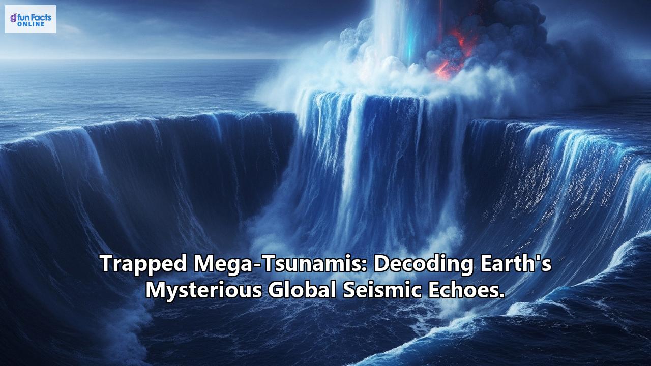
A bizarre global seismic signal that mystified scientists in September and October 2023 has now been decoded. The cause? Two colossal mega-tsunamis, born from landslides in a remote Greenland fjord, became trapped, generating standing waves that "shook the Earth" for days on end. This groundbreaking discovery, detailed in a study published in Nature Communications, not only solves a geophysical puzzle but also underscores the profound and sometimes startling impacts of our changing climate.
The Mystery of the 90-Second Tremors
In September 2023, seismometers across the globe detected a peculiar, rhythmic tremor. This seismic signal pulsed approximately every 90 seconds and persisted for an astonishing nine days. A month later, the phenomenon repeated itself. Scientists were initially baffled by these persistent, long-period seismic waves. While the Earth experiences a constant hum of microseisms generated by ocean waves, this signal was distinct and unusually tenacious.
Unraveling the Cause: Landslides and Trapped Waves
Almost a year after the event, two scientific studies proposed a startling hypothesis: the global tremors were the result of two mega-tsunamis. These weren't your typical tsunamis generated by undersea earthquakes. Instead, they were triggered by massive landslides in the remote Dickson Fjord in East Greenland. An estimated 25 million cubic meters of rock and ice, destabilized by the warming of an unnamed glacier, catastrophically collapsed into the fjord. This is roughly equivalent to the volume of 10,000 Olympic-sized swimming pools.
The sheer force of these landslides generated mega-tsunamis, with initial wave heights estimated to be as high as 650 feet (200 meters). Due to the unique geography of the Dickson Fjord, these powerful waves didn't dissipate as they normally would in the open ocean. Instead, they became "trapped" within the fjord system, creating what are known as seiches – standing waves that oscillate back and forth. It was the rhythmic sloshing of these trapped mega-tsunamis that generated the mysterious global seismic signals.
The Advent of New Technology: Seeing the Unseeable
Confirming this theory required direct observation of these seiches, a significant challenge given the remote location and the nature of the waves. Even a Danish military vessel that visited the fjord three days into the first seismic event did not visually observe the wave that was subtly shaking the entire planet.
The breakthrough came with the advent of a new generation of satellite altimetry. Researchers, led by a team from Oxford University, utilized data from the Surface Water and Ocean Topography (SWOT) satellite. Launched in December 2022, SWOT is equipped with the cutting-edge Ka-band Radar Interferometer (KaRIn) instrument. Unlike conventional altimeters that provide 1D profiles, KaRIn can map the height of water across a wide swath (30 miles or 50 kilometers) with unprecedented accuracy (up to 2.5 meters resolution).
Using KaRIn data, the scientists created elevation maps of the Greenland Fjord at various points following the tsunamis. These maps revealed clear, cross-channel slopes with height differences of up to two meters. Crucially, the slopes in these maps occurred in opposite directions over time, providing concrete evidence of the water sloshing back and forth – the tell-tale sign of a seiche.
To further validate their findings, the researchers meticulously linked these satellite observations to the minute movements of the Earth's crust recorded by seismometers thousands of kilometers away. This allowed them to reconstruct the characteristics of the wave even for periods when the satellite wasn't directly observing the fjord. They also painstakingly reconstructed weather and tidal conditions to rule out wind or tides as alternative causes for the observed water level changes. Machine learning played a significant role in identifying these trapped waves from the vast datasets.
Implications: Climate Change and a New Era of Observation
This extraordinary event highlights the far-reaching and sometimes unexpected consequences of climate change. The melting of glaciers, a direct result of global warming, is increasing the instability of surrounding landscapes, making such massive landslides and subsequent mega-tsunamis more likely in polar regions. As lead author Thomas Monahan from the University of Oxford stated, "Climate change is giving rise to new, unseen extremes. These extremes are changing the fastest in remote areas, such as the Arctic, where our ability to measure them using physical sensors is limited."
The successful use of SWOT satellite data in this study also heralds a new era in Earth observation. The ability to detect and analyze such complex and relatively subtle ocean phenomena from space opens up new avenues for understanding ocean extremes like tsunamis, storm surges, and even freak waves. It also demonstrates the power of combining different types of data – satellite altimetry and seismic records – to gain a more complete picture of Earth's dynamic processes.
While this particular trapped mega-tsunami occurred in a remote, uninhabited fjord (though it did destroy some unoccupied research infrastructure), the findings have broader implications for hazard assessment. Understanding how such events generate global seismic signals could help scientists identify similar past events in seismic records and better predict the conditions that might lead to future, potentially devastating, landslides in vulnerable coastal and fjord regions worldwide.
The Earth's mysterious global seismic echoes, in this instance, were not a sign of some deep, unknown internal process, but a remarkable manifestation of a climate-driven surface event, captured and decoded through ingenious scientific investigation and cutting-edge technology. The planet continues to reveal its secrets, and as our tools for listening and observing become more sophisticated, so too does our understanding of its intricate and interconnected systems.
Reference:
- https://www.marinetechnologynews.com/news/trapped-mystery-solved-649570
- https://www.sciencedaily.com/releases/2025/06/250603115015.htm
- https://www.miragenews.com/scientists-observe-world-shaking-trapped-waves-1471445/
- https://www.ndtv.com/science/greenlands-650-foot-mega-tsunami-shook-earth-for-9-days-satellite-data-confirms-8579132
- https://www.livescience.com/planet-earth/a-mysterious-seismic-event-shook-earth-for-9-days-straight-in-2023-now-scientists-have-found-its-origins
- https://www.earthscope.org/news/seismometers-listen-in-on-ocean-waves-in-a-warming-world/
- https://en.wikipedia.org/wiki/Megatsunami
- https://www.ox.ac.uk/news/2025-06-03-first-direct-observation-trapped-waves-shook-world
- https://www.techexplorist.com/earth-hidden-pulse-mystery-global-seismic-echo/99670/
- https://www.manchester.ac.uk/about/news/scientists-make-first-direct-observation-of-the-trapped-waves-that-shook-the-world/