In an era where our planet is undergoing rapid and profound changes, the need for a comprehensive and continuous understanding of the Earth's dynamic systems has never been more critical. Humanity is poised to receive an unprecedented tool in this endeavor: the NASA-ISRO Synthetic Aperture Radar (NISAR) mission. A landmark collaboration between the National Aeronautics and Space Administration (NASA) and the Indian Space Research Organisation (ISRO), NISAR is not just another satellite; it is a revolutionary leap in Earth observation, an "all-seeing eye" in the sky set to transform our ability to monitor our world.
Launched on July 30, 2025, from the Satish Dhawan Space Centre in Sriharikota, India, aboard an ISRO GSLV Mk-II rocket, this mission is one of the most ambitious and expensive Earth-observing satellites to date, with a cost of over $1.5 billion. It represents a monumental achievement in international space cooperation, combining American and Indian technological prowess to create a satellite with a unique and powerful capability: to see the unseen. NISAR will provide a detailed and dynamic picture of everything from the subtle heaving of the ground before an earthquake to the incremental melting of ancient ice sheets, offering invaluable insights for managing natural disasters, securing our food and water resources, and understanding the far-reaching impacts of climate change.
A Tale of Two Radars: The L- and S-Band Advantage
At the heart of the NISAR mission lies its groundbreaking science instrument: a dual-frequency Synthetic Aperture Radar (SAR) system. This is the first time a satellite will use two different radar frequencies—the L-band from NASA and the S-band from ISRO—to systematically map our planet. Unlike optical satellites that are hindered by clouds, darkness, and weather, radar can pierce through these obstacles, providing an uninterrupted, all-weather, day-and-night view of the Earth's surface.
The real genius of NISAR, however, is in the synergy of its two radar bands. Think of it as having two pairs of eyes with different, complementary superpowers. The L-band, with its longer wavelength of about 24 centimeters, can penetrate through dense vegetation like forests, allowing scientists to see the forest floor and tree trunks. This is crucial for accurately measuring forest biomass, a key component of the global carbon cycle, and for detecting changes on the ground that would otherwise be hidden. The S-band, with a shorter wavelength of about 12 centimeters, is more sensitive to lighter vegetation and the canopies of crops. This makes it ideal for monitoring agricultural fields, tracking crop growth, and assessing soil moisture.
By combining the data from both L- and S-bands, scientists will get a more holistic and detailed view of the Earth's surface than ever before. This dual-frequency approach will enable them to distinguish between different types of vegetation, understand the structure of forests, and measure subtle changes in the ground with astonishing precision—down to a fraction of an inch.
The Ingenious "SweepSAR" Technique
To cover the vast expanses of our planet with the required detail and frequency, NISAR employs a novel and advanced technique called SweepSAR. This innovative approach, used for the first time on a space-based mission, allows the satellite to survey a very wide swath of land—about 240 kilometers (150 miles)—without sacrificing the fine resolution of its images.
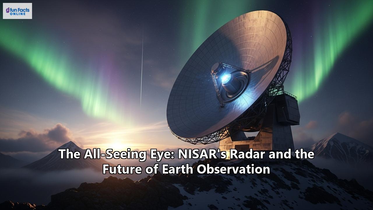
Here's how it works: When transmitting a radar pulse, NISAR uses its entire antenna feed to send out a broad beam that illuminates the full width of the swath on the ground. But when it listens for the returning echoes, the radar feed "sweeps" its beam across the massive 12-meter (39-foot) deployable mesh antenna, one of the largest of its kind ever sent to space. This sweeping motion allows the radar to capture the returning signals from different parts of the swath in rapid succession. The data is then processed on board to create a seamless, high-resolution image.
The SweepSAR technique is a technological marvel that enables NISAR to achieve its ambitious goal of mapping nearly the entire land and ice surfaces of the Earth every 12 days, with most areas being sampled even more frequently, on average every 6 days, due to overlapping orbits. This rapid revisit time is a game-changer for monitoring dynamic processes on our planet.
A World of Applications: From Predicting Disasters to Ensuring Food Security
The wealth of data that NISAR will generate—a staggering 80 terabytes per day—will have a profound impact on a wide range of scientific disciplines and practical applications, touching the lives of people around the world.
Forecasting and Responding to Natural Disasters
One of the most anticipated applications of NISAR is in the realm of natural hazard monitoring and response. The satellite's ability to detect tiny movements in the Earth's crust will revolutionize our understanding of earthquakes, volcanoes, and landslides.
For volcanoes, NISAR will be able to spot the subtle swelling of the ground that often precedes an eruption, as magma moves beneath the surface. This could provide crucial early warnings, giving communities more time to prepare and evacuate. The mission's consistent and frequent observations will be particularly valuable for monitoring the world's many uninstrumented or under-instrumented volcanoes.
In earthquake-prone regions, NISAR will track the slow build-up of strain along fault lines, helping scientists to better assess earthquake hazards. After a quake, the satellite's data will provide rapid and detailed maps of land deformation, which can be used to assess damage and guide emergency response efforts. Similarly, by monitoring the slow creep of hillsides, NISAR can help to identify areas at risk of landslides, potentially saving lives and property.
A Revolution in Agriculture and Water Management
NISAR is set to become an invaluable tool for farmers and water resource managers worldwide. The satellite's S-band radar will provide detailed information on crop growth, health, and acreage, helping to improve yield forecasts and enhance food security.
Crucially, NISAR will also be able to measure soil moisture with high resolution. This information is vital for farmers to optimize irrigation, especially in drought-prone regions, and can help governments to better manage water resources and issue early warnings for agricultural droughts. An algorithm developed by researchers at Michigan State University will use NISAR data to create detailed soil moisture maps, a technology that is expected to revolutionize farming.
Monitoring the Pulse of our Planet's Health
The health of our planet's ecosystems is under increasing threat from climate change and human activities. NISAR will provide a comprehensive and continuous assessment of these vital systems. By penetrating forest canopies, the L-band radar will allow scientists to create detailed maps of forest biomass and track deforestation with unprecedented accuracy. This is critical for understanding the role of forests in the global carbon cycle and for conservation efforts.
The mission will also monitor the world's wetlands, which are vital for biodiversity and water quality, and track the thawing of permafrost in the Arctic, a process that releases large amounts of greenhouse gases into the atmosphere.
Keeping a Watchful Eye on Our Changing Ice
The Earth's frozen regions, the cryosphere, are among the most sensitive indicators of climate change. NISAR will provide a detailed and dynamic picture of the world's ice sheets, glaciers, and sea ice. It will measure the flow rates of glaciers, track the melting of ice sheets in Greenland and Antarctica, and monitor changes in sea ice extent. This data is crucial for understanding the drivers of sea-level rise and for improving climate models.
Safeguarding Our Infrastructure
The subtle ground movements that NISAR can detect also have important implications for infrastructure monitoring. The satellite will be able to identify subsidence in urban areas, which can damage buildings and roads, and monitor the stability of critical infrastructure like dams, levees, and bridges. This information can help engineers and city planners to identify potential risks and take preventive action, enhancing public safety.
A New Era of Open Data and Global Collaboration
One of the most significant aspects of the NISAR mission is its commitment to an open data policy. All data from both the L-band and S-band radars will be made freely and openly available to the public within one to two days of being collected, and even faster in the case of emergencies. This will democratize access to this invaluable information, empowering scientists, governments, businesses, and the public around the world to use it for research, decision-making, and innovation.
NASA will distribute the data through its Alaska Satellite Facility Distributed Active Archive Center, while ISRO will provide access through its Bhoonidhi portal. This open data policy is expected to spur a new wave of scientific discovery and the development of a wide range of applications that we can only begin to imagine today.
The NISAR mission itself is a testament to the power of international collaboration in space. The partnership between NASA and ISRO has been a key enabler of this ambitious undertaking, with each agency bringing its unique expertise and capabilities to the table. NASA provided the L-band SAR, the high-rate communication subsystem for scientific data, GPS receivers, and a solid-state recorder, while ISRO was responsible for the satellite bus, the S-band SAR, and the launch vehicle. This successful collaboration sets a precedent for future joint missions to explore our planet and beyond.
The Future is Watching
As NISAR begins its three-year primary mission, it ushers in a new era of Earth observation. The continuous stream of high-resolution radar data it provides will create a "time-lapse" movie of our planet's surface, revealing the intricate and interconnected processes that shape our world. From the imperceptible creep of tectonic plates to the seasonal rhythms of plant growth, NISAR's all-seeing eye will give us a deeper and more dynamic understanding of our home.
The data from this remarkable satellite will not only advance our scientific knowledge but also provide actionable information to help us address some of the most pressing challenges of our time, from climate change and natural disasters to food and water security. In the years to come, the legacy of NISAR will be seen not just in the gigabytes of data it transmits, but in the new insights it provides, the innovations it inspires, and the more sustainable and resilient future it helps us to build. The future of Earth observation is here, and it is watching over us all.
Reference:
- https://www.seti.org/news/tracking-a-changing-planet-the-nasa-isro-nisar-mission/
- https://vajiramandravi.com/current-affairs/nisar-satellite-a-landmark-nasa-isro-collaboration/
- https://www.indiatoday.in/science/story/nisars-giant-reflector-fully-deployed-commissioning-underway-in-space-2771988-2025-08-16
- https://www.thehindu.com/sci-tech/science/anything-that-moves-nasa-isro-satellite-will-see-with-unprecedented-fidelity/article69881443.ece
- https://www.ainvest.com/news/earth-observation-revolution-nisar-satellite-data-reshaping-infrastructure-investment-2508/
- https://san.com/cc/nasa-and-indias-nisar-satellite-could-revolutionize-disaster-prediction/
- https://agu.confex.com/agu/agu25/meetingapp.cgi/Paper/1852869
- https://www.isro.gov.in/Mission_GSLVF16_NISAR_Home.html
- https://opentools.ai/news/nasa-isros-nisar-set-to-revolutionize-farming-from-space
- https://science.nasa.gov/mission/nisar/
- https://timesofindia.indiatimes.com/science/nasa-isro-successfully-deploy-worlds-largest-radar-antenna-in-orbit-a-milestone-in-earth-observation/articleshow/123344041.cms
- https://blueskyhq.io/blog/exploring-the-science-behind-nisar-how-radar-imaging-can-benefit-our-planet
- https://www.indiatoday.in/science/story/how-nisar-will-supercharge-indias-battle-against-climate-change-2761121-2025-07-25
- https://www.eoportal.org/satellite-missions/nisar
- https://www.korrai.com/blog/nisar-the-dual-band-revolution-in-ground-motion-monitoring
- https://www.nasa.gov/missions/nisar/nasa-isro-mission-will-map-farmland-from-planting-to-harvest/
- https://medium.com/predict/how-the-us-and-indias-joint-nisar-satellite-demonstrates-use-of-space-tech-to-solve-earth-s-8ef7ea1cec27
- https://science.nasa.gov/mission/nisar/sweepsar/
- https://cxquest.com/nisar-satellite-revolutionary-earth-monitoring-for-business-cx/
- https://www.slideshare.net/slideshow/nisar-nasaisro-synthetic-aperture-radar-nisar-volcanic-hazards/255784391
- https://www.youtube.com/watch?v=RclF5xRSuJA
- https://msutoday.msu.edu/news/2025/07/researchers-create-technology-nasa-mission
- https://www.youtube.com/watch?v=LJLraRzWVh8
- https://opentools.ai/news/nasa-and-isro-reach-for-the-stars-with-the-largest-space-antenna-on-nisar-satellite
- https://science.nasa.gov/mission/nisar/applications/