An astonishing technological revolution is peeling back the dense vegetation of the Americas, revealing a past far more complex and sophisticated than ever imagined. For centuries, the story of pre-Columbian Native Americans was often one of nomadic tribes living lightly on the land. Now, LiDAR (Light Detection and Ranging), a powerful remote-sensing technique, is uncovering the vast and intricate agricultural systems that supported bustling cities and large populations, forcing a dramatic rewrite of history. From the heart of the Amazon to the northern forests of Michigan, these discoveries paint a new picture of ancient America, one defined by ingenious engineering, intensive farming, and profound environmental transformation.
A Laser's Glimpse Through Time
The key to this archaeological revolution is LiDAR. This technology, often operated from a plane or drone, fires hundreds of thousands of laser pulses toward the ground every second. These light beams penetrate through the gaps in dense forest canopies, reflecting off the ground surface below. By measuring the time it takes for each pulse to return, the system creates a hyper-detailed, three-dimensional map of the terrain. For archaeologists, it’s like having X-ray vision, allowing them to digitally strip away the vegetation that has hidden ancient roads, buildings, and, crucially, vast agricultural landscapes for centuries. This non-invasive approach is a game-changer, preserving fragile sites while enabling researchers to understand the sheer scale of ancient civilizations in a way that was previously impossible.
Lost Garden Cities of the Amazon
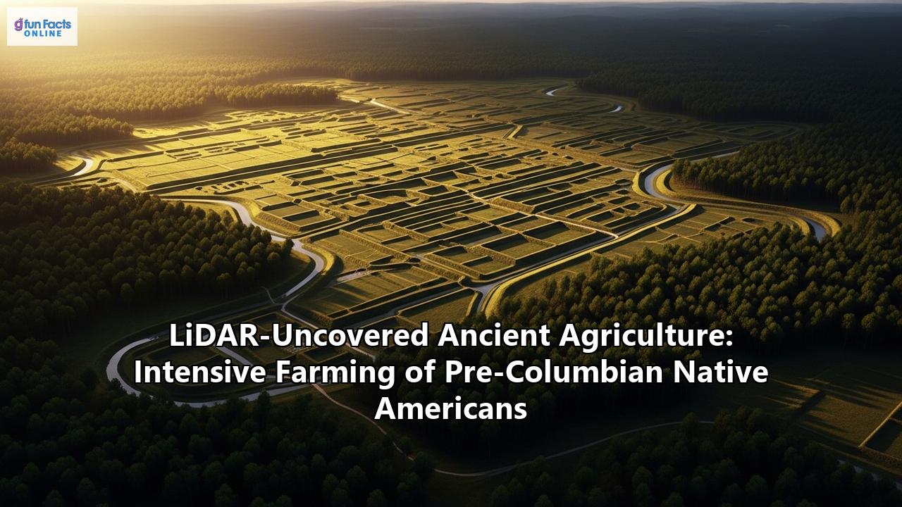
Perhaps the most startling revelations have emerged from the Amazon, long considered a "pristine wilderness" hostile to large-scale human settlement. LiDAR has shattered this myth. In the Upano Valley of eastern Ecuador, hidden for millennia, researchers have discovered a network of ancient cities connected by an astounding system of roads and canals. Dating back some 2,500 years, it stands as the oldest and largest agricultural civilization found in the Amazon.
The findings are breathtaking in their complexity. More than 6,000 rectangular earthen platforms, which served as foundations for homes and ceremonial buildings, have been mapped. These were not isolated villages but interconnected urban centers linked by a grid of wide, straight roads. To feed a population that scientists estimate was in the tens of thousands, if not more, this society engineered the landscape with remarkable skill. LiDAR scans have identified extensive hillside terraces and rectangular fields, complemented by canals and causeways for water management and transport, a level of landscape modification that rivals the famous civilizations of Mesoamerica.
This was not an isolated phenomenon. In the Llanos de Mojos, a savanna region in Bolivia, LiDAR has helped detail the ingenuity of the Casarabe Culture, which flourished between 500 and 1400 C.E. This society built a unique and sophisticated water-management infrastructure to master the region's seasonal floods and droughts. By digging an intricate network of drainage canals, they diverted excess water during the rainy season and stored it in ponds for the dry months. This advanced system allowed for the year-round cultivation of maize, their likely staple crop, ensuring food security for a large population without resorting to slash-and-burn techniques that would have destroyed the surrounding forests.
Revisiting the Agricultural Masters of Mesoamerica
LiDAR is also adding incredible new detail to our understanding of well-known civilizations like the Maya. The classic narrative often portrays the Maya collapse as a cautionary tale of a society that outgrew its agricultural capacity. However, LiDAR evidence suggests a far more sustainable and sophisticated relationship with their environment. Surveys have revealed vast systems of irrigation canals and agricultural terraces that were previously unknown, indicating that many Maya kingdoms were capable of producing food surpluses.
At the city of Caracol, Belize, LiDAR mapping has provided a complete picture of a massive, low-density urban landscape integrated with its agricultural systems. The technology revealed that the city was not just a concentrated center but a sprawling area of over 180 square kilometers, with more than 160 of those kilometers covered in continuous agricultural terracing. This demonstrates an astonishing degree of landscape engineering designed to support a huge population.
Similarly, the agricultural prowess of the Aztecs in the Basin of Mexico is being seen in a new light. Their most famous innovation was the chinampa, a highly productive system of artificial islands, or "floating gardens," built in shallow lakes to grow crops year-round. These specialized techniques, combined with terracing and irrigation, allowed the Aztecs to sustain one of the densest populations in Mesoamerican history.
Northern Ingenuity: Farming in Unexpected Climates
The reach of intensive pre-Columbian agriculture extends far beyond the tropics. In a groundbreaking discovery in Michigan's Upper Peninsula, a region known for its cold climate and short growing season, archaeologists have used LiDAR to uncover a massive agricultural system. At a site sacred to the Menominee Indian Tribe of Wisconsin, known as the Sixty Islands, researchers found an extensive network of raised garden beds dating back as early as the 10th century.
The ancestors of the Menominee people cultivated crops like corn, beans, and squash on these raised and ridged fields. The scale of the system is what stunned researchers; at approximately 330 acres, it is ten times larger than any previous estimates for the region. This finding forces a complete reconsideration of ancient agriculture in North America, proving that Native American communities possessed the knowledge to thrive and sustain themselves even in the most challenging environments.
A New History Written on the Land
LiDAR is doing more than just discovering lost cities; it is fundamentally changing our perception of the past. The evidence is now undeniable: across the Americas, pre-Columbian societies were comprised of skilled farmers and engineers who actively shaped their environments on a massive scale. They built sustainable agricultural systems that fed millions and supported complex societies with vibrant urban centers. This emerging picture replaces the outdated image of a sparsely populated, untouched wilderness with one of a landscape purposefully managed and modified by human hands for millennia. As this incredible technology continues to scan the continent, it promises to unveil even more secrets, deepening our appreciation for the rich and complex history of the hemisphere's first peoples.
Reference:
- https://www.imveurope.com/article/student-finds-lost-maya-city-accident-using-lidar
- https://eos.org/articles/lidar-uncovers-thousands-of-new-maya-structures
- https://www.ancientpages.com/2025/06/06/lidar-discovers-huge-sophisticated-ancient-native-american-farming-system-in-the-sacred-anaem-omot-area-in-michigan/
- https://www.jouav.com/blog/lidar-archaeology.html
- https://www.bbc.com/news/science-environment-67940671
- https://archaeologymag.com/2024/01/laser-scans-reveal-ancient-cities-hidden-deep-in-the-amazon-rainforest/
- https://www.smithsonianmag.com/science-nature/lost-cities-of-the-amazon-discovered-from-the-air-180980142/
- https://www.seedworld.com/latam/2025/02/04/pre-columbian-agricultural-innovation-uncovered-in-bolivia/
- https://impact-magazine.brown.edu/2023-issue/revisiting-mesoamerica
- https://caracol.org/wp-content/uploads/2016/05/CCW2013.pdf
- https://www.pnas.org/doi/10.1073/pnas.1205198109
- https://www.britannica.com/topic/pre-Columbian-civilizations/Agriculture
- https://library.fiveable.me/hs-native-american-studies/unit-2/pre-columbian-technologies-agriculture-trade-networks/study-guide/lpmMFlblxMJlza0G
- https://indiandefencereview.com/1000-year-native-american-fields-michigan/
- https://oxfordre.com/environmentalscience/display/10.1093/acrefore/9780199389414.001.0001/acrefore-9780199389414-e-175?d=%2F10.1093%2Facrefore%2F9780199389414.001.0001%2Facrefore-9780199389414-e-175&p=emailAY%2FgmjuymKQqE
- https://en.wikipedia.org/wiki/Pre-Columbian_agriculture_in_the_Amazon_Basin