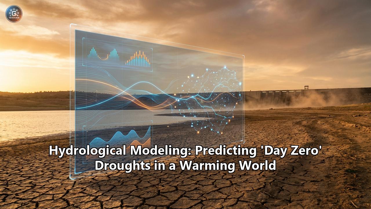
Part I: The countdown to Dry Taps
The New AbnormalIt was once the stuff of dystopian fiction: a major metropolis, a hub of commerce and culture, suddenly turning off the taps. But on a sweltering day in 2018, the residents of Cape Town, South Africa, stared that reality in the face. They called it "Day Zero"—the calculated date when the city’s reservoirs would drop below 13.5% capacity, forcing the municipal water supply to shut down. Residents would be left to queue for a daily ration of 25 liters (6.6 gallons) per person under the watchful eye of the military.
Cape Town narrowly averted that disaster through a combination of desperate conservation and lucky rains, but the term "Day Zero" entered the global lexicon. It became a shorthand for a terrifying new reality: water scarcity is no longer just a problem for arid outposts or rural villages. It is coming for the world’s megacities.
As we move deeper into the 21st century, the hydrological stability that underpinned the rise of modern civilization is fracturing. In 2019, Chennai, India—one of the world’s wettest major cities—saw its taps run dry, forcing millions to rely on water tankers. In 2024, Mexico City teetered on the brink, with reservoirs at historic lows and neighborhoods going weeks without reliable service. In 2025, warnings are flashing red across the Mediterranean, Southern Africa, and parts of North America.
This crisis is not merely a result of "bad weather." It is a collision of three titanic forces: anthropogenic climate change, which is supercharging the water cycle and making droughts longer and more intense; explosive urbanization, which concentrates thirst in concrete jungles; and antiquated water management, often flying blind into a future it cannot predict.
To survive this future, we need more than just concrete dams and desalination plants. We need a digital revolution in how we understand water. We need to see the invisible flows beneath our feet and the atmospheric rivers above our heads. We need Hydrological Modeling.
This is the story of how scientists, engineers, and data wizards are racing to build a "digital nervous system" for the planet’s water—a complex web of physics, satellites, and artificial intelligence designed to predict Day Zero before it happens, and more importantly, to stop it.
Part II: The Science of Scarcity
Defining the Day Zero Phenomenon"Day Zero" is not a scientific term, strictly speaking. It is a communication tool—a visceral deadline designed to panic a complacent public into action. Scientifically, it represents a system failure. It is the moment when the "buffer" in a hydrological system (reservoirs, aquifers, snowpack) is exhausted by the "load" (human consumption, evaporation, environmental flow requirements).
In a stable climate, calculating this buffer is standard engineering. You look at historical rainfall records, calculate the "safe yield" of a dam, and plan accordingly. But we no longer live in a stable climate. We live in a world of non-stationarity, a hydrological concept meaning "the past is no longer a reliable guide to the future."
The Physics of a Warming ThirstTo model drought today, you must first model heat. The 2024/2025 period has been the warmest on record, and heat is a thief. It steals water through evapotranspiration—the combined process of water evaporating from soil and transpiring from plants.
For every degree Celsius of warming, the atmosphere can hold about 7% more moisture. This turns the atmosphere into a giant sponge. Before rain can fall and fill a river, that atmospheric sponge must be saturated. In a warming world, the sponge gets bigger and thirstier. This leads to a phenomenon seen clearly in Australia’s "Millennium Drought" and the recent Colorado River crisis: declining runoff efficiency.
Historically, if you had 100mm of rain, you might expect 30mm to reach the river. Today, in parched catchments, that same 100mm might yield only 5mm of runoff. The thirsty soil and hungry air drink the first 95mm. Old hydrological models, calibrated on 20th-century data, often miss this. They predict reservoirs will fill, but the water never arrives. This "missing water" is the phantom that haunts modern water managers.
The Classification of DroughtTo predict Day Zero, modelers must track a drought as it shapeshifts through four distinct stages:
- Meteorological Drought: The deficit of rainfall. This is the early warning signal, tracked by satellites and weather stations.
- Agricultural Drought: The deficit of soil moisture. Plants become stressed, and irrigation demand spikes, putting pressure on the system.
- Hydrological Drought: The deficit in streamflow and reservoir levels. This is the slow-moving disaster. It takes months or years of meteorological drought to drain a massive reservoir.
- Socio-Economic Drought: The crisis point. This occurs when the physical shortage meets human demand. This is Day Zero.
Traditional hydrology focused heavily on stages 1, 2, and 3. The revolution in modern modeling is the integration of stage 4—the human element.
Part III: The Modeling Toolkit – From Equations to AI
Predicting the future of water requires a diverse arsenal of digital tools. No single model can do it all. Instead, scientists build "model chains" that link the sky to the city.
1. The Old Guard: Physically-Based Models (PBMs)
At the foundation of hydrological science are Physically-Based Models. These are complex software engines that solve the fundamental laws of physics—conservation of mass, conservation of momentum, and thermodynamics—across a landscape.
Famous examples include SWAT (Soil and Water Assessment Tool) and HEC-HMS. These models divide a watershed into thousands of tiny grid cells. For each cell, they calculate how rain hits the canopy, drips to the soil, infiltrates the pores, and flows downhill.
- Strengths: They are "transparent." If the model says there is no water, you can look at the equations and see exactly where it went (e.g., "evaporation in sub-basin 4"). They are excellent for testing "what if" scenarios, like "what if we cut down this forest?"
- Weaknesses: They are data-hungry monsters. They need precise maps of soil types, vegetation, and topography. If your map is wrong, your prediction is wrong. They are also computationally heavy, sometimes taking days to run a single simulation.
2. The Disruptor: Data-Driven & Machine Learning Models
In the last decade, a new player has entered the field: Artificial Intelligence. Unlike physical models, AI doesn't necessarily "know" that gravity pulls water downhill. It simply looks for patterns in massive datasets.
Algorithms like Long Short-Term Memory (LSTM) networks—a type of deep learning designed for time-series data—are proving uncannily accurate at predicting streamflow. You feed the AI thirty years of rainfall data and river level data, and it "learns" the relationship between the two.
- The "Physics-Informed" Revolution: The cutting edge today is Physics-Informed Machine Learning (PIML). Pure AI can be dangerous; it might predict physically impossible things, like a river creating water out of nothing. PIML fixes this by embedding physical laws (like "water cannot be created or destroyed") into the AI's loss function. The AI is punished during training if it violates these laws.
- Case Study: In the Gidra River case study and recent USGS experiments, PIML models like PIML-LSTM have outperformed traditional physical models, especially in "ungauged basins" where we lack detailed soil maps but have satellite data.
3. The Eye in the Sky: Remote Sensing Integration
You cannot model what you cannot measure. For decades, hydrology was limited by the number of rain gauges a country could afford to maintain. In the Global South, the decline of ground-based monitoring networks has been a major blind spot.
Satellites have filled this void.
- GRACE (Gravity Recovery and Climate Experiment): These twin satellites chase each other around the Earth, measuring subtle changes in the planet's gravity field caused by the movement of water mass. GRACE can "weigh" groundwater aquifers from space, revealing depletion in places like California’s Central Valley and Northern India that ground sensors might miss.
- SMAP (Soil Moisture Active Passive): NASA’s SMAP satellite measures the moisture in the top 5cm of soil globally every 2-3 days. This provides the critical "initial condition" for drought models. If the soil is already dry, the next rainstorm won't fill the river; the soil will drink it all.
4. Socio-Hydrology: Modeling the Human Feedback Loop
Perhaps the most important innovation is Socio-Hydrology. Traditional models treated humans as a static "boundary condition"—a fixed straw sucking water out of the river. But humans are dynamic.
When a drought forecast is issued, people change their behavior. They might panic-buy water (increasing demand), or they might adopt strict conservation (decreasing demand). Conversely, if a model predicts a wet year, farmers might plant thirstier crops, paradoxically increasing vulnerability if the model is wrong. This is known as the Reservoir Effect or the Jevons Paradox in water efficiency.
Agent-Based Models (ABMs) are now used to simulate this. These models populate a virtual city with thousands of "agents" (households, farmers, industries), each with their own behaviors and decision-making rules.- Example: An ABM for a city like Bogotá can simulate how different neighborhoods respond to rationing. Do wealthy neighborhoods just buy bigger tanks (hoarding)? do poorer neighborhoods suffer disproportionately? This helps policymakers design rationing schemes that don't trigger social unrest.
Part IV: The Digital Twin – A Flight Simulator for Cities
The culmination of all these technologies is the Digital Twin.
A Digital Twin is not just a model; it is a living, breathing virtual replica of a city’s entire water system, connected in real-time to the physical world via the Internet of Things (IoT).
Imagine a control room in Valencia, Spain, home to one of the world’s most advanced water Digital Twins (operated by Global Omnium).
- The Physical Layer: Thousands of sensors on pipes, pumps, and valves measure flow, pressure, and quality every second. Smart meters in homes measure consumption in real-time.
- The Digital Layer: A hydraulic model runs in the cloud, constantly calibrating itself against this live data.
- The Predictive Layer: The system runs thousands of simulations an hour. "What if a pipe bursts on Main Street?" "What if it doesn't rain for 100 days?"
In the context of Day Zero, a Digital Twin is a time machine. It allows utility managers to "fast forward" into a drought. They can test interventions virtually before deploying them.
- Scenario: "If we lower the pressure in the pipes by 10% at night, how much water do we save? Will the fire hydrants still work?" The Digital Twin gives the answer instantly.
- Leak Detection: In Mexico City, where 40% of water is lost to leaks, Digital Twins are the holy grail. AI analyzes pressure waves in the pipes to pinpoint leaks within meters, allowing repair crews to be surgical strikes against waste.
Part V: Global Hotspots – The Watchlist for 2025-2030
Hydrological modeling has allowed scientists to map the "risk landscape" of the next decade. The results are sobering. A 2025 study in Nature Communications identified that Day Zero hotspots could emerge in 35% of drought-prone regions within the next 15 years.
1. The Mediterranean Basin (Spain, Italy, North Africa)- The Situation: The region is warming 20% faster than the global average. In 2024/2025, Catalonia (Barcelona) faced its worst drought in centuries.
- The Model Warning: Models predict a "aridification" trend, not just a temporary drought. The sponge is drying out permanently. Early Warning Systems like the European Drought Observatory (EDO) are currently flashing "Warning" or "Alert" for vast swathes of Southern Europe.
- The Situation: Known as India’s Silicon Valley, Bangalore relies on the distant Cauvery River and depleting groundwater. In early 2024, the "tanker mafia" ruled the streets as borewells ran dry.
- The Failure: Hydrologists point to the disconnect between urban planning and hydrology. The city paved over its natural lakes (tanks) which acted as recharge zones. Models show that without 60-70% reduction in groundwater extraction, the aquifers will functionally collapse.
- The Situation: These cities rely on high-altitude "Páramo" ecosystems—natural water factories that capture moisture from clouds.
- The Shock: In 2024, Bogotá began rationing water. The culprit? El Niño, combined with the degradation of the Páramo.
- The Lesson: Even wet, high-altitude cities are not safe. Models failed to predict the speed at which the Chingaza reservoir emptied, highlighting the need for better soil-moisture monitoring in the high Andes.
- The Situation: A slow-motion train wreck. The reservoirs (Mead and Powell) serve 40 million people but have been over-allocated for a century.
- The Digital Pivot: This is the most modeled river on Earth. The Bureau of Reclamation uses a tool called CRMMS (Colorado River Mid-term Modeling System). It has shifted from "deterministic" forecasts (predicting one future) to "probabilistic" forecasts (predicting 100 possible futures). This shift allows for "Trigger Planning"—pre-agreed cuts that kick in automatically when the model hits a certain probability of failure, removing politics from the decision.
Part VI: The Human Element – Communicating the Unspeakable
The hardest part of hydrological modeling isn't the math; it's the politics.
The False Alarm DilemmaImagine you are the Mayor. The model says there is a 70% chance of Day Zero in six months if you don't implement drastic rationing today. Rationing will hurt the economy, anger voters, and kill tourism.
- Scenario A: You ration water. It rains next month. The reservoirs fill. You look like an idiot and an alarmist.
- Scenario B: You don't ration. It doesn't rain. The city runs dry. You are negligent and arguably criminal.
This is the "Cost-Loss" problem in decision science. Hydrologists are learning that they cannot just hand a politician a graph. They must communicate uncertainty effectively.
Success Story: Australia’s Water MarketsDuring the Millennium Drought, Australia didn't just rely on commands; they relied on markets. They separated land rights from water rights. They built sophisticated models that determined the "consumptive pool"—the total available water for the year. This pool was then traded.
If a farmer had a high-value crop (like almonds), they bought water. If they had a low-value crop (like pasture), they sold their water rights and lived off the cash. The water flowed to its highest economic value. This system, underpinned by rigorous transparent modeling of exactly how much water was in the system, saved Australia’s agriculture from total collapse.
Citizen Science: The CoCoRaHS EffectIn data-scarce regions, citizens are becoming the sensors. The CoCoRaHS (Community Collaborative Rain, Hail, and Snow) network in the US and similar initiatives globally allow regular people to upload rainfall data.
New research confirms that this "crowdsourced" data significantly improves drought detection. It catches the localized "flash droughts" that sparse official networks miss. In the future, every smartphone could be a hydrological node, submitting photos of dry riverbeds or reporting tap outages, feeding a global, real-time Day Zero dashboard.
Part VII: A Blue-Green Future
The era of "stationary" water management is dead. We can no longer look at a rainfall chart from 1950 and expect it to happen again. We are flying into a storm, and our old maps are useless.
But we have new instruments. We have satellites that weigh aquifers, AI that learns the rhythm of rivers, and Digital Twins that let us rehearse disasters before they happen.
The city of the future will be a "Sponge City"—designed to absorb every drop of rain, monitored by a digital nervous system, and inhabited by water-literate citizens.
- Singapore catches every drop that falls on its island, treating it and reusing it endlessly.
- Windhoek, Namibia, has been drinking recycled wastewater since 1968, a model of survival in the desert.
- Cape Town learned that consumption can be cut by 50% without destroying the economy, if the communication is clear and the threat is real.
Hydrological modeling gives us the foresight to see the cliff edge. Whether we hit the brakes or drive off it is no longer a technological question. It is a political and moral one.
The models are blinking red. Day Zero is a choice. And the time to choose is now.
Appendix: Key Terms & Technologies
- Non-Stationarity: The concept that natural systems fluctuate within an unchanging envelope of variability is dead; climate change has shifted the baseline.
- PIML (Physics-Informed Machine Learning): AI models constrained by physical laws (mass balance, energy conservation) to ensure realistic predictions.
- Digital Twin: A virtual replica of a physical water system used for real-time simulation and decision support.
- SPEI (Standardized Precipitation Evapotranspiration Index): A modern drought index that accounts for temperature/evaporation, not just rainfall.
- GRACE-FO: Gravity Recovery and Climate Experiment Follow-On satellites that measure changes in groundwater storage.
- Socio-Hydrology: The scientific study of the interplay and feedback loops between water systems and human society.
- Teleconnections: Links between distant climate phenomena (like El Niño or the Indian Ocean Dipole) and local rainfall patterns, crucial for long-range forecasting.
Reference:
- https://www.spacedaily.com/reports/Cities_face_risk_of_water_shortages_in_coming_decades_study_999.html
- https://timesofindia.indiatimes.com/home/environment/cities-face-risk-of-water-shortages-in-coming-decades-study/articleshow/124073825.cms
- https://news.tuoitre.vn/cities-face-risk-of-water-shortages-in-coming-decades-study-103250924165437417.htm
- https://bosaq.com/cities-facing-a-day-zero/
- https://tappwater.co/en-us/blogs/blog/day-zero-6-cities-running-out-of-water
- https://www.worisgo.com/Gallery/0aef87cf-32e9-4a7f-886d-c181c1c632f8_thumb.pdf
- https://timesofindia.indiatimes.com/city/bengaluru/bengaluru-water-crisis-explained/photostory/108229303.cms
- https://blogs.worldbank.org/en/latinamerica/mantenerse-unidos-tiempos-crisis-lecciones-gestion-sequias-bogota
- https://www.mdpi.com/2073-4441/14/3/387
- https://pmc.ncbi.nlm.nih.gov/articles/PMC3948235/
- https://arxiv.org/pdf/2402.13911
- https://www.clickorlando.com/news/world/2024/04/13/colombias-capital-starts-rationing-water-after-reservoirs-hit-historically-low-levels/
- https://www.drishtiias.com/daily-updates/daily-news-editorials/bengaluru-s-water-crisis-a-wake-up-call-for-india
- https://www.vifindia.org/article/2024/may/13/Bengaluru-Water-Crisis-A-Case-of-Inadequate-Water-Management
- https://www.waterdiplomat.org/story/2024/05/water-shortages-bogota-prompt-rationing
- https://www.ehn.org/bogota-faces-water-rationing
- https://co.usembassy.gov/message-for-u-s-citizens-u-s-embassy-bogota-water-rationing-in-bogota-april-10-2024/