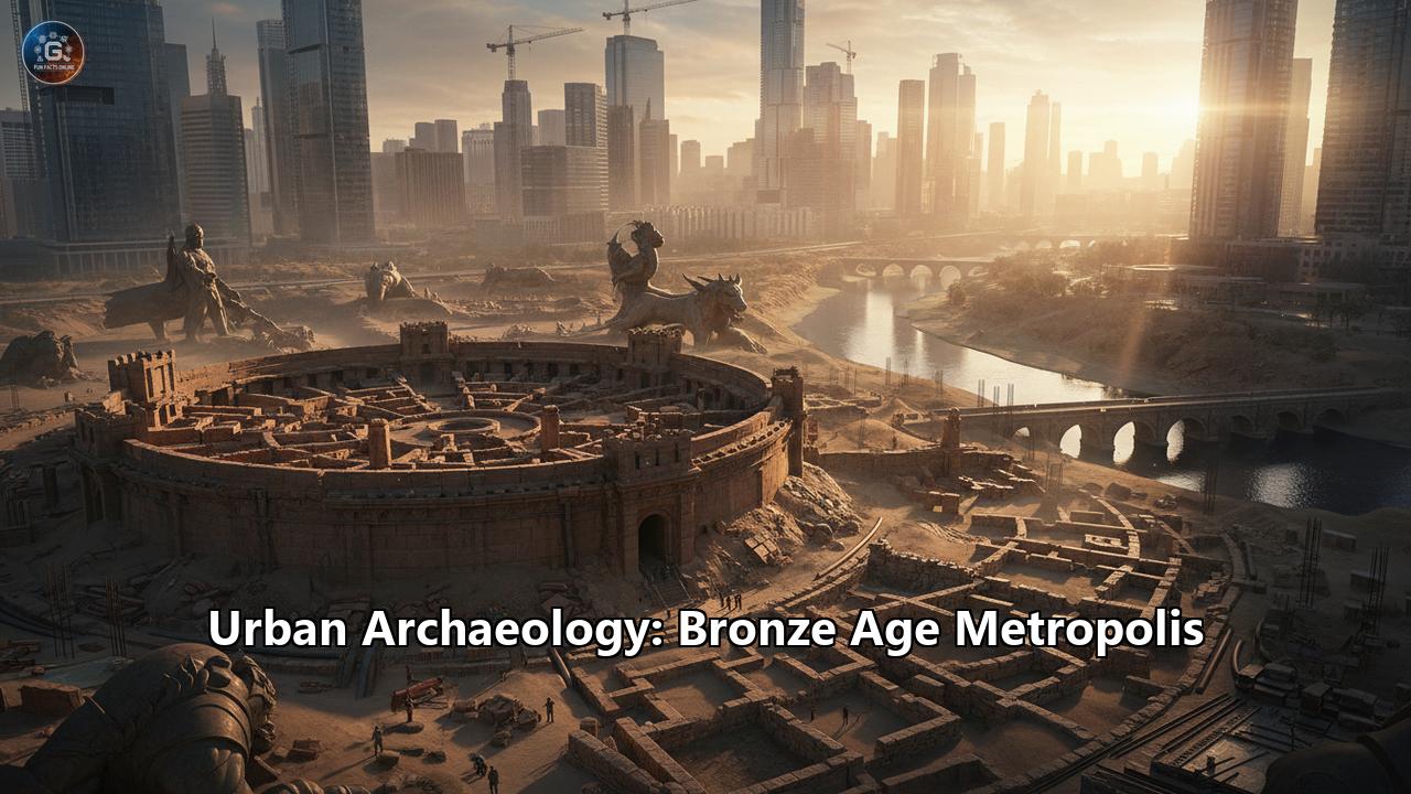
Beneath the bustling streets and quiet fields of the modern world lie the spectral remains of forgotten empires and the ghosts of the first great cities. For the urban archaeologist, these buried landscapes are not merely ruins but complex archives of human ingenuity, ambition, and eventual collapse. The Bronze Age, a period stretching roughly from 3300 to 1200 BCE, was a pivotal chapter in this urban story. It was an era of revolutionary technologies and burgeoning global networks, a time when humanity, for the first time in many parts of the world, began to build and live in cities on a grand scale. These were not just overgrown villages; they were true metropolises, centers of power, culture, and innovation that laid the foundations for civilizations to come.
The study of these Bronze Age urban centers is a journey into the very heart of what it means to be urban. It reveals how ancient peoples organized themselves, structured their societies, and reshaped their environments. From the labyrinthine palaces of Crete to the meticulously planned grids of the Indus Valley and the newly discovered proto-cities on the Eurasian steppe, each site offers a unique window into a world that was both surprisingly familiar and profoundly different from our own. This is the story of the Bronze Age metropolis, a tale of rising walls, bustling streets, and the enduring quest to build a collective future, all unearthed by the patient work of urban archaeology.
The Dawn of Urbanism: What Made a Bronze Age Metropolis?
The transition from scattered agricultural villages to teeming urban centers was not a singular event but a sprawling, multifaceted process that archaeologists term the "urban revolution." This revolution, most famously articulated by scholar V. Gordon Childe, was not necessarily rapid but was indeed revolutionary in its consequences. It was driven by a potent combination of factors: agricultural surplus, technological innovation, and new, complex social structures. The ability to produce more food than immediately needed freed a segment of the population from agricultural labor, allowing for the rise of specialized professions: artisans, priests, soldiers, traders, and administrators.
At the heart of this transformation was the mastery of bronze. An alloy of copper and tin, bronze was harder and more durable than the stone and pure copper tools that preceded it. This new metal transformed society. Bronze plows could break tougher soil, increasing agricultural yields, while bronze weapons offered a decisive military advantage, enabling the rise of powerful elites and the expansion of territories. However, the production of bronze itself fueled another key element of urbanism: long-distance trade. Copper was relatively common, but tin was scarce, with major sources located in places like modern-day Afghanistan, Cornwall, and Spain. The need to secure this critical resource spurred the creation of vast and complex trade networks that crisscrossed continents, linking nascent urban centers in an early form of globalization.
Archaeologically, these metropolises are identifiable by a set of key characteristics. Monumental architecture, such as temples, palaces, and ziggurats, signaled the power of the ruling and religious elites and served as focal points for the community. Defensive fortifications, from massive city walls to sloping embankments known as glacis, speak to an age of conflict and the need to protect accumulated wealth and populations. We see evidence of sophisticated urban planning in the form of organized street layouts, public spaces, and residential zones. A crucial, and often stunning, feature was the development of advanced water management and sanitation systems, including covered drains and public baths. Finally, the presence of a writing system, such as cuneiform in Mesopotamia or Linear B in Mycenaean Greece, was a clear indicator of a state-level society, essential for record-keeping, administration, and managing a complex palace economy. These elements, taken together, paint a picture of dynamic, organized, and interconnected societies that were truly urban in their scale and complexity.
Heartland of Cities: Mesopotamia and the Levant
The fertile plains of Mesopotamia, the land between the Tigris and Euphrates rivers, are often called the "cradle of civilization," and for good reason. It was here, in ancient Sumer, that some of the world's first true cities emerged during the 4th millennium BCE. The Uruk period, in particular, saw the rise of urban life, with cities like Uruk itself growing to unprecedented size, housing tens of thousands of people. Daily life for the inhabitants of cities like Ur and Babylon revolved around a strict social hierarchy. At the top were the king and priests, followed by scribes, merchants, and artisans, with farmers and laborers forming the base of society. Homes were typically multi-storied structures made of sun-dried mudbrick, built along narrow, winding streets. In the heat, life often spilled onto the flat rooftops, which were used for cooking, socializing, and even sleeping. Religion was deeply integrated into every aspect of existence; the city's central ziggurat was not just a temple but the literal and symbolic heart of the community, the home of the city's patron deity.
Further west, in the Levant, a vibrant network of city-states blossomed, deeply connected to the great powers of Egypt and Mesopotamia through trade. Among the most remarkable of these was Ebla, in modern-day Syria. At its peak in the third millennium BCE, Ebla was a major political and economic power, controlling a vast territory. Its rediscovery by Italian archaeologists in the 1960s was revolutionary, particularly the unearthing of the Royal Palace G archives in 1975. Here, miraculously preserved by the fire that destroyed the palace, lay over 17,000 cuneiform tablets. This extraordinary library recorded the city's administration, trade, diplomatic treaties, and even its own language, now known as Eblaite. The tablets reveal a sophisticated economy based on agriculture (barley, wheat, olives) and animal husbandry, as well as control over trade routes that brought in silver and timber. Ebla’s influence was so great that it vied with the mighty Akkadian Empire, whose rulers Sargon and Naram-Sin both claimed to have destroyed the city around 2300 BCE.
In the southern Levant, two other cities stand out: the ancient bastion of Jericho and the recently uncovered megalopolis of En Esur. Jericho, one of the oldest continuously inhabited cities in the world, underwent a major transformation at the start of the Bronze Age. Around 3000 BCE, it was enclosed by a formidable wall of yellowish mud-bricks on stone foundations. The settlement was terraced, with a main north-south street dividing distinct quarters, and a temple was constructed on the hill overlooking the life-giving spring, which was itself incorporated within the city's defenses. By the Middle Bronze Age, Jericho had become a prosperous regional hub, its wealth derived from intensive agriculture in the oasis. This prosperity is reflected in its complex, stratified society and evidence of strong trade links with Egypt, indicated by imported luxury goods like eye makeup palettes.
Perhaps even more stunning is the discovery of En Esur in modern-day Israel, a site that has dramatically reshaped our understanding of early urbanization in the region. Revealed during road construction in 2017, En Esur was a massive, planned city from the Early Bronze Age (around 5,000 years ago) that spanned some 160 acres and was home to an estimated 6,000 people. Dubbed the "New York of the Early Bronze Age" by archaeologists, it was far larger than other contemporary Levantine cities like Megiddo and Jericho. The city boasted a sophisticated layout with public and residential areas, a network of stone-paved streets, massive food silos, and impressive fortifications. At its heart stood a monumental temple, outside of which were found huge stone basins weighing up to 15 tons, a testament to the immense collective effort invested in the city's construction. The discovery of pottery from as far away as the Jordan Valley and Egypt confirms that En Esur was a major player in the region's trade networks. Even more remarkably, this metropolis was built atop an even older, 7,000-year-old Chalcolithic settlement, indicating a long history of human activity at this strategic location.
Cities Beyond the Heartland: A Global Phenomenon
While Mesopotamia and the Levant were critical hubs, the urban explosion of the Bronze Age was a global phenomenon, with unique and sophisticated cityscapes emerging in regions as diverse as the Indus Valley, the Aegean, and China.
The Indus Valley Civilization: Masters of Urban PlanningFlourishing from around 2600 to 1900 BCE, the Indus Valley Civilization (or Harappan Civilization) produced some of the most impressively planned cities of the ancient world. The great urban centers of Mohenjo-Daro and Harappa, located in modern-day Pakistan, were home to tens of thousands of people and stand as testaments to an astonishingly advanced understanding of civil engineering and public welfare.
The hallmark of Harappan urbanism was its meticulous grid-plan layout. Main streets ran north-south and east-west, intersecting at right angles to divide the city into large rectangular blocks. This uniformity, seen across multiple Harappan sites, suggests a powerful centralized authority and a "plan first" approach to construction. Cities were typically divided into two main sections: a raised, fortified "citadel" to the west, which likely housed administrative and religious buildings, and a larger "lower town" where the general populace resided.
What truly set these cities apart was their revolutionary water management and sanitation systems. Almost every house, regardless of size, had its own bathroom and was connected to a city-wide network of covered drains made of baked brick. These drains ran along the streets, complete with soak pits and inspection holes, ensuring an unparalleled level of public hygiene. The use of standardized, fire-baked bricks (in a consistent 4:2:1 ratio) for construction ensured durability and uniformity in buildings, many of which were multi-storied and built around a central courtyard. Major public structures included the massive granaries at Harappa for storing surplus food and the famous "Great Bath" at Mohenjo-Daro, a large, waterproofed tank that likely served a ritual purpose. Despite their sophistication, Harappan cities are notably lacking in the kind of monumental palaces or temples that dominate Mesopotamian or Egyptian landscapes, suggesting a different social and political structure, the nature of which remains a tantalizing mystery due to their still-undeciphered script.
The Aegean: Palaces and CitadelsThe Bronze Age Aegean was home to two successive and brilliant civilizations: the Minoans on the island of Crete and the Mycenaeans on the Greek mainland.
The Minoan civilization (c. 3100–1100 BCE) is often regarded as Europe's first civilization, known for its vibrant art and monumental architecture. Minoan urbanism was centered on vast, complex structures that archaeologists named "palaces," although their exact function is still debated. These were not merely royal residences but sprawling hubs that combined administrative, religious, and economic activities. The most famous of these is the Palace of Knossos, a multi-storied, labyrinthine complex covering nearly five acres. Built around a large central courtyard, the palace was a maze of rooms, corridors, grand staircases, and light wells designed to provide air and illumination to the interior. It featured dedicated areas for storing agricultural surplus in massive jars (pithoi), workshops for artisans, and chambers for religious rituals, like the lustral basins for purification. The palace walls were adorned with vibrant frescoes depicting scenes of nature, ritual, and the famous bull-leaping spectacle. Unlike their contemporaries, Minoan palace-cities were largely unfortified, suggesting a period of relative peace and dominance of the seas, a "Pax Minoica."
Around 1450 BCE, Minoan dominance waned, and power shifted to the Greek mainland, where the Mycenaean civilization (c. 1600–1100 BCE) had risen. Mycenaean urbanism presents a stark contrast to the Minoan model. Their centers, such as Mycenae, Tiryns, and Pylos, were heavily fortified citadels, built in strategic, defensible locations. They are renowned for their massive "Cyclopean" walls, constructed from enormous, unworked limestone blocks that later Greeks believed could only have been built by the mythical one-eyed giants.
At the heart of a Mycenaean palace was the megaron, a large rectangular hall with a central hearth that served as the throne room and administrative center. Access to these citadels was controlled by monumental gateways, the most famous being the Lion Gate at Mycenae, an imposing structure topped with a relief sculpture of two lionesses, symbolizing royal power. The Mycenaeans also left behind spectacular tombs, from the deep "shaft graves" filled with golden treasures to the magnificent corbel-vaulted tholos tombs, like the "Treasury of Atreus." The discovery of thousands of clay tablets inscribed with Linear B, an early form of Greek, has provided invaluable insights into the highly organized and bureaucratic nature of the Mycenaean palace economy.
Bronze Age China: The Rise of ErlitouIn the Yellow River valley of China, the Erlitou culture (c. 1900–1500 BCE) marks the transition to the Bronze Age and the emergence of China's first state-level society. The type site, Erlitou, located in Henan province, was a major urban center that many scholars associate with the legendary Xia dynasty, China's first dynasty. At its peak, Erlitou covered an area of 300 hectares and may have had a population of up to 24,000 people.
Archaeological work has revealed a planned city with a ceremonial core. This includes the earliest palace complex found in China, with large rammed-earth foundations and buildings arranged along a central axis. Surrounding this palatial core was a network of roads, workshops, and residential areas. Erlitou was a major center for bronze production, monopolizing the creation of ritual bronze vessels, including the earliest ding (a type of tripod vessel) cast in China. The presence of specialized workshops for bronze, turquoise, and pottery indicates a society with a high degree of craft specialization and elite control over the production of high-status goods. The discovery of elite burials within the palace courtyards, containing jade and bronze artifacts, further underscores the social stratification present in this early Chinese metropolis.
Fringes of the Urban World: Semiyarka and Al-NatahRecent archaeological discoveries are expanding the map of Bronze Age urbanism into regions previously thought to be inhabited solely by mobile pastoralists. The discovery of Semiyarka in northeastern Kazakhstan has transformed our understanding of life on the Eurasian steppe. Dating to around 1600 BCE, this vast settlement spanned an incredible 140 hectares (346 acres), making it the largest of its kind in the region. Nicknamed the "City of Seven Ravines" for its strategic position overlooking a network of valleys and the Irtysh River, Semiyarka was a planned, permanent settlement. It featured a regular layout of enclosed, multi-room houses, a large central building likely used for governance or rituals, and a dedicated industrial zone for large-scale copper and tin-bronze production. This discovery challenges the traditional view of steppe communities as purely nomadic, demonstrating that they were capable of building and sustaining sophisticated, organized urban centers centered on metallurgy and trade.
In another landscape once thought to be the domain of nomads, the desert of northern Saudi Arabia, archaeologists have uncovered the walled Bronze Age town of Al-Natah. Occupied from around 2400 to 1500 BCE at the Khaybar Oasis, Al-Natah represents a fascinating example of "low-level urbanization." Smaller than the megalopolises of Mesopotamia, it covered about 1.5 hectares and housed around 500 residents. Yet, it was a fortified, planned settlement with a central district, a residential area, and a surrounding necropolis containing tower tombs with high-status goods like metal weapons. The existence of fortified oases like Al-Natah suggests a transitional stage between pastoralism and full-scale urban life, a slower, more modest path to urbanization that was uniquely adapted to the Arabian environment and likely laid the groundwork for later trade routes like the famous Incense Road.
Life Within the Walls: Society, Technology, and Trade
Life inside a Bronze Age metropolis was a study in contrasts. For the ruling elite—kings, priests, and high-ranking officials—it was a world of unprecedented wealth and power, lived out in sprawling palaces and monumental buildings. For the majority of the population, however, daily life was one of labor, whether in the fields surrounding the city, in bustling artisan workshops, or on massive state-run construction projects.
A World of SpecialistsUrbanization brought with it a dramatic increase in labor specialization. Freed from the necessity of producing their own food, city dwellers pursued a wide variety of occupations. In Mesopotamia, men and women worked as builders, potters, carpenters, weavers, and metallurgists. Scribes, almost exclusively male, held a position of high respect, as literacy was the key to administration, religion, and commerce. Society was distinctly hierarchical. In Mesopotamia, a typical day began with a simple breakfast of porridge or soup with bread and beer, the staples of the diet. After a day's work, the evening meal might consist of a vegetable stew or fish, with meat reserved for special occasions. The family was the core social unit, and evenings might be spent listening to music or stories.
This social stratification is visible in the very layout of the cities and the remains people left behind. The grand palaces of the Minoans and Mycenaeans, the elite burials filled with gold and bronze at Erlitou, and the larger, more elaborate houses in the city centers of Mesopotamia all point to a powerful ruling class. In the Indus Valley, while the lack of obvious palaces is intriguing, the variation in house sizes still suggests a hierarchical society.
The Engine of Innovation: Bronze Age TechnologyThe Bronze Age was defined by its technological advancements, which were both a cause and a consequence of urban growth. The most important of these was metallurgy. The process of creating bronze required several sophisticated steps: smelting to extract copper and tin from their ores, and then alloying them in precise ratios. Metalworkers developed several casting techniques to create tools, weapons, and ritual objects. Early methods involved simple open stone molds, but these evolved into more complex two-piece clay molds and the highly advanced lost-wax casting method, which allowed for the creation of intricate, detailed objects. The discovery of workshops, crucibles, slag (a byproduct of smelting), and finished bronze goods at sites like Semiyarka and Erlitou provides direct evidence of these industrial-scale operations.
Other key innovations included the wheel, which revolutionized transportation with the development of carts and war chariots, and the plow, which, when tipped with bronze, became a far more effective agricultural tool. Writing systems, from cuneiform to hieroglyphs, were a transformative intellectual technology, enabling everything from the recording of tax receipts and trade contracts to the preservation of epic literature. The impressive architecture of the era also relied on significant engineering knowledge, from the construction of massive ziggurats and Cyclopean walls to the sophisticated hydraulics behind the drainage systems of Harappa and the plumbing at Knossos.
An Interconnected World: Global Trade NetworksThe need for raw materials, especially tin for bronze, and the desire of elites for exotic luxury goods fueled the creation of the first truly international trade networks. These routes, spanning both land and sea, connected the great civilizations of the era in a complex web of exchange.
The Eastern Mediterranean was a particularly vibrant hub of maritime trade. The Uluburun shipwreck, discovered off the coast of Turkey and dating to the late 14th century BCE, provides a stunning snapshot of this interconnected world. Its cargo was a multicultural treasure trove, containing copper ingots from Cyprus, tin from Afghanistan, cobalt blue glass ingots from Egypt or the Levant, Canaanite jars filled with resin, Mycenaean pottery, and even a golden scarab bearing the name of the Egyptian queen Nefertiti. Such discoveries reveal that raw materials like copper, tin, gold, and ivory, as well as finished goods like pottery, textiles, wine, and olive oil, flowed between Egypt, the Levant, Anatolia, and the Aegean.
These networks extended far beyond the Mediterranean. Mesopotamian cylinder seals and Harappan carnelian beads found in each other's territories attest to a robust trade link between these two great river valley civilizations, likely through maritime routes in the Persian Gulf. The recent discovery of a Gulf-style seal in Kalba, UAE, combining Harappan and local Arabic symbols, further highlights the role of Arabian ports as crucial intermediaries in this trade. These extensive trade routes did not just move goods; they also facilitated the exchange of ideas, technologies, and cultural styles, creating a cosmopolitan and interconnected Bronze Age world.
The Cataclysm: Understanding the Late Bronze Age Collapse
Around the year 1200 BCE, the vibrant, interconnected world of the Late Bronze Age came to a sudden and violent end. In a relatively short period, great empires fell, major cities were burned to the ground, trade routes were severed, and entire writing systems vanished. The Hittite Empire in Anatolia disintegrated, the Mycenaean palaces in Greece were destroyed, and the great Canaanite coastal cities like Ugarit were left as smoldering ruins. Egypt, though it repelled the invaders, was left permanently weakened and entered a long period of decline. This widespread cataclysm, known as the Late Bronze Age Collapse, remains one of the greatest mysteries in archaeology.
For decades, the leading explanation centered on the invasions of a mysterious confederation of tribes known to the Egyptians as the "Sea Peoples." Inscriptions from the temple of Ramesses III at Medinet Habu vividly depict Egypt’s desperate battles against these seaborne marauders around 1177 BCE. These texts, combined with archaeological layers of destruction found at sites across the Levant and Anatolia—some littered with arrowheads and unburied skeletons—paint a picture of a violent wave of destruction. The Philistines, one of the Sea Peoples mentioned in Egyptian records, ultimately settled on the southern coast of Canaan, and their distinct pottery and cultural practices are archaeologically visible.
However, most scholars today believe that the Sea Peoples were not the sole cause of the collapse, but rather a symptom of a larger, systemic crisis. The collapse was likely the result of a "perfect storm" of multiple, interlocking calamities that overwhelmed the civilizations of the time.
One of the most compelling factors now believed to have played a major role is severe and prolonged climate change. Analysis of ancient pollen grains and lake sediments from the Eastern Mediterranean has revealed evidence of a significant drought that began around 1250 BCE and lasted for centuries. This "megadrought" would have led to widespread crop failures, famine, and social unrest. Letters found at Ugarit speak of a desperate famine in the Hittite lands, with the king of Ugarit sending shipments of grain to try and stave off disaster. With their agricultural base collapsing, populations would have been forced to migrate in search of food and resources, potentially becoming the "Sea Peoples" themselves—climate refugees turned raiders.
Adding to the instability, geological research has pointed to a series of major earthquakes, sometimes called an "earthquake storm," that struck the region between 1225 and 1175 BCE. Evidence of earthquake destruction is visible at sites like Mycenae and Tiryns. The fragile, interconnected nature of the Bronze Age world, so dependent on international trade, may have been its ultimate undoing. As cities fell to famine, invasion, or earthquakes, critical trade routes for tin and other essential goods were disrupted. This would have created a domino effect, or a "systems collapse," where the failure of one part of the network led to the breakdown of the entire system. The loss of administrative centers also meant the loss of literacy in many regions; the Mycenaean Linear B script, used exclusively by palace scribes for economic records, disappeared entirely, plunging Greece into a "Dark Age" from which it would take centuries to emerge. The Bronze Age collapse was a stark reminder that even the most sophisticated and powerful urban civilizations are vulnerable to the combined pressures of environmental change, social upheaval, and the fragility of their own complex systems.
Unearthing the Metropolis: The Archaeologist's Toolkit
The reconstruction of these ancient urban worlds is a monumental task, made possible by the ever-evolving toolkit of the urban archaeologist. For centuries, the primary method was excavation—the careful, systematic removal of layers of earth to uncover buried remains. Archaeologists use stratigraphy, the principle that deeper layers are older, to piece together the history of a site, from its foundation to its final abandonment or destruction. Every artifact, from a simple pottery sherd to a golden dagger, and every feature, from a house wall to a hearth, is meticulously recorded in its specific context, because its location and relationship to other objects are crucial for interpretation.
However, excavation is inherently destructive; once a layer is dug, it is gone forever. Recognizing this, modern archaeology has increasingly turned to a suite of non-invasive techniques that allow researchers to "see beneath the soil" without lifting a trowel. These methods are especially vital in urban archaeology, where ancient cities can be vast and often lie beneath modern development.
Geophysical survey is one of the most powerful of these tools. Techniques like magnetometry can detect subtle variations in the Earth's magnetic field caused by buried features. A fired brick wall, a kiln, or a ditch filled with organic material will have a different magnetic signature than the surrounding soil, allowing archaeologists to map the layout of hidden buildings and streets. Ground-penetrating radar (GPR) works by sending electromagnetic pulses into the ground and recording the echoes that bounce back. It can create detailed 3D images of what lies beneath, revealing the depth and shape of floors, walls, and even voids like tombs or tunnels. Electrical resistivity measures how easily an electrical current passes through the soil; compacted floors or stone foundations are more resistant than loose soil, making them stand out in the data. These methods were instrumental in revealing the true scale and layout of sites like Semiyarka in Kazakhstan. Remote sensing technologies provide a bird's-eye view. Satellite imagery and drone photography help map visible surface features and variations in vegetation that might indicate buried structures. LiDAR (Light Detection and Ranging) is a revolutionary technique that uses laser pulses to create highly detailed topographical maps of the ground surface, capable of digitally "seeing" through dense forest canopies to reveal the faint outlines of ancient settlements.Once excavation begins, bioarchaeology offers profound insights into the lives of a city's inhabitants. The study of human skeletal remains can reveal information about diet, disease, physical activity, and cause of death. Chemical analysis of bones and teeth can even indicate where a person grew up, providing direct evidence of migration. The study of animal bones (zooarchaeology) and plant remains (paleoethnobotany) helps reconstruct the ancient environment, diet, and agricultural practices.
By combining these high-tech surveys with targeted excavation and detailed laboratory analysis, urban archaeologists can piece together the complex story of Bronze Age metropolises. They can map their growth and decline, understand how their inhabitants lived and worked, and explore the vast networks that connected them to the wider world. Each discovery, whether a grand palace or a humble cooking pot, adds another crucial piece to the puzzle, bringing these lost cities back to life.
Legacy of the Bronze: Echoes in Eternity
The world that emerged from the ashes of the Late Bronze Age collapse was a changed one. The grand, centralized palace economies were gone, international trade had dwindled, and many regions had entered a "Dark Age" characterized by smaller, more isolated communities and a loss of literacy. Yet, the legacy of the Bronze Age metropolis was not erased. It endured in the stories that were told, in the technologies that were passed down, and in the very idea of the city itself.
The epic poems of Homer, the Iliad and the Odyssey, composed centuries after the collapse, preserved the memory of the great Mycenaean citadels, of "golden" Mycenae and its powerful kings. These tales, which influenced Western literature for millennia, were long thought to be pure myth until archaeologists like Heinrich Schliemann began to unearth the very cities described by the poet. The myths, legends, and religious practices of the Canaanite cities in the Levant had a lasting impact on the later cultures of the region, including the Israelites.
Technological innovations from the Bronze Age formed the bedrock for subsequent developments. The principles of metallurgy, agriculture, and craftsmanship were not lost but were refined and adapted in the succeeding Iron Age. The concept of urban planning, so brilliantly demonstrated at sites like Mohenjo-Daro, would re-emerge in later civilizations. The Phoenicians, who rose to prominence in the power vacuum left by the collapse, built upon the maritime traditions of the Bronze Age to create their own vast trading empire across the Mediterranean.
Perhaps the most enduring legacy of the Bronze Age metropolis is the very concept of urban living as a catalyst for human progress. These early cities were crucibles of innovation, where the concentration of people and resources led to unprecedented advancements in technology, art, and social organization. They were the first to grapple with the challenges and opportunities of large-scale, complex societies—problems of governance, public health, resource management, and social inequality that are still with us today.
The work of urban archaeology continues to push back the horizons of our knowledge, revealing that the story of the city is older, more widespread, and more diverse than we ever imagined. Discoveries like Semiyarka and En Esur force us to redraw the map of the ancient world and reconsider our assumptions about the capabilities of "nomadic" or "pastoral" societies. They show that the impulse to build, to organize, and to create complex communities is a fundamental part of the human story, expressed in a remarkable variety of forms across diverse landscapes. The Bronze Age metropolises, in all their ruined grandeur, stand as a powerful testament to this enduring human drive. They are a reminder that the cities of today are built upon the foundations, both literal and metaphorical, of these first great urban experiments, their echoes still resonating through the millennia.
Reference:
- https://www.history.com/articles/bronze-age-collapse-causes
- https://emergingtrends.stanford.edu/files/original/5598ae21e7d784ab54c09792c17ac989b091529a.pdf
- https://www.penn.museum/sites/expedition/mesopotamian-city-life/
- https://pmc.ncbi.nlm.nih.gov/articles/PMC3743901/
- https://twocents.space/insight/the-history-of-technology-the-bronze-age-2220/
- https://www.flagfen.com/invented-during-the-bronze-age
- https://artsandculture.google.com/story/the-bronze-age/yQWBHPul6gHBkw?hl=en
- https://www.youtube.com/watch?v=up3NSIUohdc
- https://nuttersworld.com/ancient-trade-routes-mediterranean-sea/bronze-age-networks/
- https://fiveable.me/the-archaeology-of-southeast-asia/unit-3/bronze-age-trade-networks/study-guide/dgbuttYntdAkobjo
- https://www.studysmarter.co.uk/explanations/archaeology/arcaheology-of-trade/bronze-age-commerce/
- https://fiveable.me/ancient-mediterranean/unit-5/bronze-age-trade-networks-international-relations/study-guide/pcbBRCN3oAWyhUY8
- https://www.google.com/search?q=time+in+CN
- https://www.youtube.com/watch?v=R7wkSj9krhA
- https://historicengland.org.uk/research/methods/terrestrial-remote-sensing/geophysical-survey/
- https://www.historyonthenet.com/daily-life-in-a-mesopotamian-city
- https://www.worldhistory.org/article/680/daily-life-in-ancient-mesopotamia/
- https://www.youtube.com/watch?v=8XhhmQmoLh4
- https://studyclix.blob.core.windows.net/static/content/file/uploads/6/600a5247-0e82-44c2-bd4e-f3d964f179d3.pdf
- https://fiveable.me/greek-and-roman-cities/unit-1/sources-methods-studying-ancient-cities/study-guide/xFTl7seob1ANuZlB
- https://www.archatlas.org/journal/asherratt/traderoutes/
- https://www.splashtravels.com/guides/bronze-age-collapse-splash
- https://eoxs.com/new_blog/foundations-of-ancient-metalworking-craftsmanship-that-shaped-civilizations-2/
- https://blob-static.studyclix.ie/static/content/file/uploads/2/288f7a5d-89e1-47c4-aa70-a9880e845c95.pdf
- https://retrospectjournal.com/2022/12/04/what-caused-the-collapse-of-the-legendary-bronze-age/
- https://www.quora.com/What-are-some-of-the-inventions-from-the-bronze-age-How-are-they-still-used
- https://www.bronze-age-craft.com/casting.htm
- https://www.biblicalarchaeology.org/daily/news/bronze-age-collapse-pollen-study-highlights-late-bronze-age-drought/
- https://www.youtube.com/watch?v=XRXG2PkmySQ
- https://www.unseenhistories.com/fall-of-civilizations-paul-cooper-excerpt
- https://www.thecollector.com/bronze-age-collapse/
- https://www.ebsco.com/research-starters/anthropology/late-bronze-age-collapse
- https://www.youtube.com/shorts/jVNY18ie8DA
- https://intarch.ac.uk/journal/issue52/4/5.html
- https://www.worldhistory.org/image/14880/late-bronze-age-mediterranean-trade-c-1400-1200-bc/
- https://en.wikipedia.org/wiki/Sea_Peoples
- https://www.youtube.com/watch?v=HZVCNy3hK_4
- https://www.ancientportsantiques.com/wp-content/uploads/Documents/AUTHORS/SeaPeoples/SeaPeoples-Mumford2018.pdf
- https://www.britannica.com/topic/Aegean-civilization/Trade
- https://www.oeaw.ac.at/en/oeai/media/news-archive/news-detail/preserving-world-cultural-heritage-1
- https://en.wikipedia.org/wiki/Late_Bronze_Age_collapse
- https://www.asor.org/anetoday/2016/09/who-sea-peoples/
- https://fiveable.me/greek-and-roman-cities/unit-12/archaeological-excavations-urban-archaeology/study-guide/uQJ7mlwFIMm5ae1N
- https://www.mdpi.com/2571-9408/6/2/52
- https://www.google.com/search?q=time+in+Tikrit,+IQ