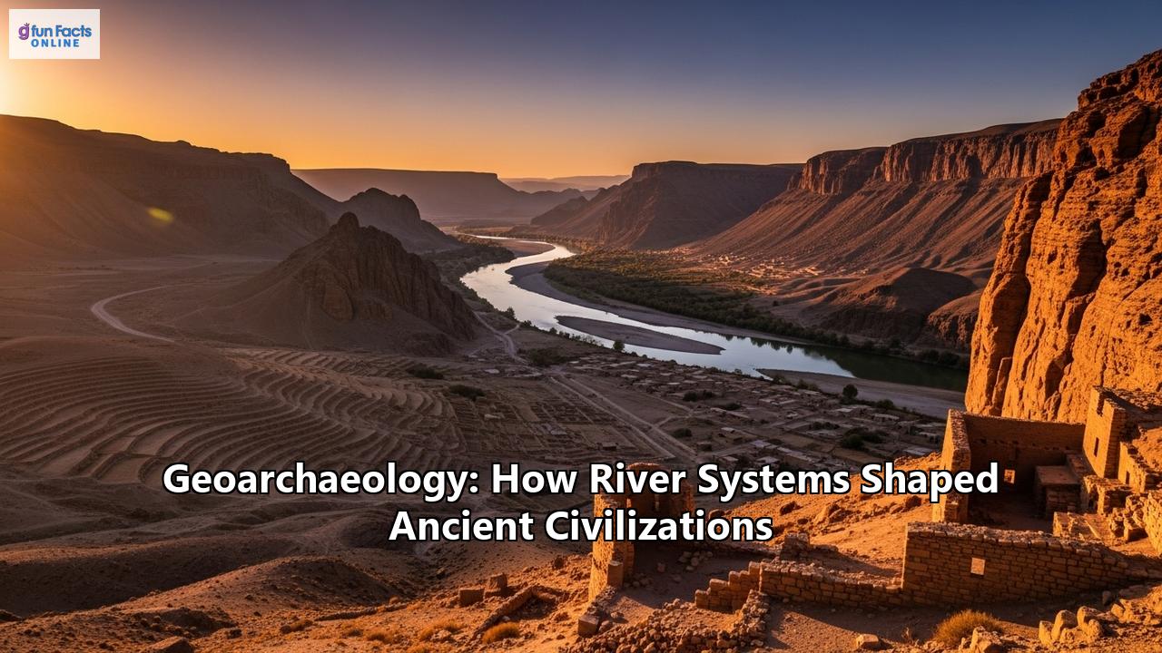
Geoarchaeology: Unearthing How River Systems Forged Ancient Civilizations
The story of human civilization is, in many ways, a story written in water and mud. Long before the rise of sprawling empires and the dawn of the modern age, the first great societies emerged from the fertile embrace of river valleys. These life-giving arteries of the Earth—the Tigris and Euphrates, the Nile, the Indus, and the Yellow River—were the crucibles in which humanity’s future was forged. They offered the essential ingredients for settled life: a reliable source of water, nutrient-rich soil, and natural highways for trade and communication. The dawn of human civilization is inextricably linked to the emergence of these river valley societies, marking a pivotal shift from nomadic hunter-gatherer lifestyles to established agricultural communities. However, these rivers were not merely passive providers; they were dynamic and often destructive forces that demanded ingenuity, adaptation, and resilience.
This profound and complex relationship between ancient peoples and their riverine environments is the focus of geoarchaeology, a discipline that stands at the crossroads of geology and archaeology. By studying the very earth in which civilizations took root—the layers of sediment, the chemical signatures in the soil, and the ghostly traces of long-vanished water channels—geoarchaeologists can reconstruct these ancient landscapes and reveal the intricate dance between humanity and nature. This exploration will delve into the heart of these ancient river valley civilizations, examining the gifts the rivers bestowed, the challenges they presented, and the remarkable ways in which they shaped not only the material world but also the social fabric, religious beliefs, and ultimate destiny of the world's first great societies. Through the lens of geoarchaeology, we can unearth the epic tale of how river systems served as the cradles of civilization, leaving an indelible mark on human history.
Part 1: The Foundations of Riverine Life: Gifts of the Water
The transition from small, scattered settlements to bustling, complex societies was a monumental leap in human history, made possible by the immense agricultural potential unlocked by river systems. These waterways were the engines of early civilization, providing the sustenance and surplus necessary for population growth, specialization of labor, and the rise of cities.
The Gift of Silt and Fertile Soil
At the heart of the river's gift was the annual flood, a cyclical event that was both feared and revered. With almost calendrical precision in some regions, these rivers would swell their banks, inundating the surrounding plains. When the waters receded, they left behind a thick blanket of silt—a dark, nutrient-rich sediment carried from the river's headwaters. This annual renewal of the land's fertility was the bedrock of agricultural success.
In Egypt, the Nile's predictable and gentle inundation was so central to life that the Greek historian Herodotus famously called Egypt "the gift of the Nile." The black silt, originating from the Ethiopian highlands, created a ribbon of incredibly fertile "black land" (Kemet) through the arid desert, allowing for bountiful harvests of wheat and barley.
In Mesopotamia, the "land between the rivers," the Tigris and Euphrates also deposited fertile alluvium. However, their floods were far more unpredictable and violent than the Nile's, a characteristic that would profoundly shape Mesopotamian society and worldview.
The Indus River sustained the Harappan civilization with its life-giving waters, though its floods were also less predictable than the Nile's. The fertile plains of the Punjab and Sindh regions were ideal for the cultivation of wheat, barley, and other crops.
In China, the Yellow River, so named for the enormous quantities of loess (a fine, yellowish silt) it carries, created a vast and fertile floodplain. This soil was exceptionally rich but came at the cost of the river's notoriously destructive and unpredictable floods.
A Reliable Source of Water for Agriculture
The presence of a constant water source was a powerful magnet for early farmers. This allowed for the revolutionary practice of irrigation, the artificial application of water to land, which freed agriculture from the constraints of rainfall and dramatically increased crop yields. The need to organize and manage these large-scale water projects is believed to have been a major catalyst for the development of centralized governance and social hierarchies, giving rise to what historian Karl Wittfogel termed "hydraulic empires." In these societies, power was consolidated in the hands of those who controlled the water.
- Mesopotamia: Engineering an Oasis: The Sumerians, Akkadians, and Babylonians became master hydraulic engineers out of sheer necessity. Faced with a hot, dry climate and capricious rivers, they constructed a complex and sophisticated network of canals, some stretching for miles, to divert water from the Tigris and Euphrates to their fields. Levees and embankments were built to protect their settlements and farmlands from floods. To lift water from the canals to the fields, they employed the shaduf, a simple but effective crane-like device that is still in use in some parts of the world. This intensive irrigation, however, came with a long-term consequence: salinization. The constant evaporation of irrigation water left behind dissolved salts, which gradually poisoned the soil and forced a shift from wheat to more salt-tolerant barley.
- Egypt: Harmonizing with the Nile: The Egyptians developed a more passive but remarkably sustainable form of water management known as basin irrigation. They built a grid of earthen walls to trap the Nile's floodwaters, allowing the water to stand for about 45 days, fully saturating the soil and depositing its rich silt. Once the soil was soaked, the excess water was drained away, and crops were planted. This system was so effective that it required no additional watering for a winter yield and sustained Egyptian civilization for millennia without the severe salinization problems that plagued Mesopotamia.
- Indus Valley: Masters of Water Management: The cities of the Indus Valley Civilization, such as Mohenjo-Daro and Dholavira, display a startlingly advanced understanding of hydraulics. They constructed not only irrigation canals but also impressive water storage systems. Dholavira, located in an arid region, featured a series of 16 large, stone-cut reservoirs to capture and store monsoon rainwater. Perhaps most remarkably, these cities had the world's first known urban sanitation systems, with covered drains running along the streets, and even private toilets in some houses that flushed into this network. This high level of planning speaks to a sophisticated and organized society that placed a great emphasis on public health and resource management.
- Ancient China: Taming the "River of Sorrow": Early Chinese civilization along the Yellow River was a constant struggle to balance the need for irrigation with the existential threat of flooding. The desire to control the frequent and deadly floods was a major impetus for the unification of tribes into a single kingdom. Legends credit the founding of the Xia dynasty to the hero Yu the Great, who organized massive efforts to control the river's waters. Early efforts focused on building levees and dredging channels, a practice that would continue and intensify for thousands of years.
Rivers as Highways of Trade and Communication
In a world without paved roads, rivers served as the first great highways. They provided an efficient means to transport heavy and bulky goods, such as grain, timber, stone, and metals, over long distances. This facilitated not only economic prosperity but also the exchange of ideas, technologies, and cultural practices.
- In Egypt, the Nile was the primary transportation route, uniting Upper and Lower Egypt and allowing for the movement of the massive stone blocks needed to construct the pyramids and temples.
- Mesopotamia's network of rivers and canals connected its powerful city-states and facilitated trade with regions as far away as the Indus Valley, from which they imported precious materials.
- The Indus River was central to the Harappan civilization's extensive trade network, which is evidenced by the discovery of Indus seals and beads in Mesopotamian cities.
- The development of writing itself was closely tied to the administrative needs of these riverine societies. In Mesopotamia, cuneiform script emerged to keep track of agricultural surplus and trade transactions. In Egypt, hieroglyphs developed for royal and religious purposes, with the Nile's papyrus reeds providing a convenient medium for writing.
A Bounty of Resources
Beyond the essentials of water and fertile soil, rivers provided a wealth of other resources. They teemed with fish and attracted waterfowl, supplementing the agricultural diet. The reeds that grew along their banks were a vital raw material. In Egypt, the papyrus reed was used to make everything from paper and boats to sandals and baskets. In Mesopotamia, reeds were used in construction and for making a variety of everyday objects. The clay deposited by the rivers was the basic building material for bricks, pottery, and the cuneiform tablets that would preserve their history for millennia.
Part 2: The Double-Edged Sword: Challenges of Riverine Life
While rivers were the source of life and prosperity, they were also agents of chaos and destruction. The very forces that created fertile floodplains could also wipe out entire cities, destroy harvests, and plunge societies into turmoil. This duality of creation and destruction profoundly shaped the technologies, social structures, and even the spiritual beliefs of ancient civilizations.
The Wrath of the Gods: Catastrophic Floods
The character of a river's flood had a direct impact on the civilization that depended on it. The contrast between Egypt's predictable Nile and Mesopotamia's volatile Tigris and Euphrates is stark.
- Egypt's Predictable Blessing: The Nile's annual inundation was so regular that the ancient Egyptians based their calendar on its three seasons: Akhet (the inundation), Peret (the growing season), and Shemu (the harvest season). While an unusually low flood could lead to famine and an unusually high one could damage infrastructure, the overall predictability of the Nile fostered a sense of stability and order.
- Mesopotamia's Violent Floods: In contrast, the floods of the Tigris and Euphrates were erratic and often catastrophic. A sudden, violent flood could destroy entire cities and wipe out a year's worth of agricultural labor. This constant threat of destruction is believed to have contributed to a more pessimistic and fatalistic worldview among Mesopotamians compared to the Egyptians.
- Connecting Myth to Mud: The Mesopotamian Flood Story: The pervasive fear of floods is immortalized in Mesopotamian literature, most famously in the Epic of Gilgamesh. This ancient text tells the story of a great flood sent by the gods to destroy humanity, with a hero named Utnapishtim surviving by building a great ark. Scholars have long noted the striking parallels to the biblical story of Noah. Geoarchaeological research has provided a fascinating context for these myths. Excavations at several ancient Mesopotamian cities, including Ur and Shuruppak (the legendary home of the flood hero), have revealed thick layers of sterile river sediment separating layers of human occupation. While these flood deposits date to different periods and do not point to a single, global flood, they provide clear evidence of devastating local inundations that would have seemed like the end of the world to the people who experienced them. These events were likely caused by river avulsion, a sudden shift in a river's course, a common occurrence in the Tigris-Euphrates system.
Case Study: The Yellow River - "China's Sorrow"
No river exemplifies the destructive power of nature more than the Yellow River in China, often called "China's Sorrow." For millennia, its history has been one of devastating floods that have killed millions and toppled dynasties.
- A River on Stilts: The Yellow River carries an immense sediment load. As it flows onto the flat North China Plain, its velocity slows, and it deposits this silt, gradually raising the riverbed. To contain the river, ancient Chinese societies began building massive levees. Research has shown this practice began nearly 3,000 years ago. However, this created a dangerous feedback loop: as the riverbed rose, the levees had to be built ever higher. Eventually, the river was flowing high above the surrounding floodplain, creating a "suspended river."
- Dynasty-Toppling Floods: When a breach inevitably occurred, the results were catastrophic. A massive flood in A.D. 14-17 is believed to have killed millions and contributed to the collapse of the Western Han Dynasty. A flood in 1887 killed an estimated 900,000 to 2 million people, and this disaster helped erode the legitimacy of the Qing Dynasty, which had lost the "Mandate of Heaven" by failing to control the river. The deadliest flood in recorded history occurred in 1931, killing between 3.7 and 4 million people. The constant struggle to manage the Yellow River became a central theme of Chinese political philosophy, with the ruler's ability to control the waters seen as a sign of their divine mandate to rule.
The Shifting Landscape: Channel Avulsion and Migration
Rivers are not static features; they are dynamic systems that can shift their courses over time. A sudden abandonment of an old channel for a new one, a process known as avulsion, could have existential consequences for a riverine settlement. A city that was once on the banks of a major waterway could find itself miles from the new river channel, cut off from its source of water, its trade route, and its agricultural lifeline. Geoarchaeological studies have shown that the spatial evolution of settlements in regions like Mesopotamia was directly correlated with the migration of river channels.
The Unseen Threat: Salinization and Environmental Degradation
While floods were a dramatic and immediate threat, a more insidious danger was slowly accumulating in the soils of Mesopotamia: salt.
- The Poisoning of the Fields: Irrigation water from the Tigris and Euphrates contains dissolved salts. In a hot, arid climate with high rates of evaporation, these salts are left behind in the soil. Over centuries of intensive irrigation, the salt concentration in the fields of southern Mesopotamia built up to toxic levels.
- From Wheat to Barley: Cuneiform texts and archaeobotanical evidence reveal the devastating impact of this salinization. Early on, Mesopotamian farmers grew both wheat and barley. However, as salinity increased, they were forced to abandon wheat, which is less salt-tolerant, and rely almost exclusively on barley. Eventually, even barley yields declined, contributing to economic instability and the southward shift of Mesopotamian power over time.
- The Price of Progress: Beyond salinization, the growth of these large, complex societies put immense pressure on their local environments. Forests in the river headwaters were cleared for timber and fuel, leading to increased soil erosion and a greater sediment load in the rivers, which in turn exacerbated flooding. This highlights a timeless lesson: the very innovations that allow a civilization to prosper can sometimes sow the seeds of its own environmental challenges.
Part 3: Reading the River's Past: The Tools of Geoarchaeology
Much of our knowledge about the intricate relationship between ancient civilizations and their riverine environments would be lost to time if not for the powerful toolkit of geoarchaeology. This interdisciplinary field applies the methods of the earth sciences to archaeological questions, allowing researchers to reconstruct ancient landscapes and understand the environmental context of human history. By analyzing soils, sediments, and landforms, geoarchaeologists can read the story of a river's past—its floods, its droughts, and its ever-changing course—and how humans adapted to it.
Unearthing Buried Landscapes: Remote Sensing and Geophysical Surveys
Many of the clues to ancient river systems are hidden from the naked eye, buried under meters of sediment or obscured by modern agriculture. Remote sensing techniques provide a way to see the "invisible" landscape from above.
- Satellite Archaeology: High-resolution satellite imagery has revolutionized archaeology. By capturing light in different parts of the electromagnetic spectrum (multispectral imaging), satellites can detect subtle variations in vegetation and soil moisture that can reveal the faint outlines of ancient river channels, canals, and even buried settlements. For example, the path of a former canal might retain more moisture, causing the vegetation above it to grow more lushly, creating a "cropmark" visible only from the air. Thermal infrared sensors can detect differences in how the ground retains heat, which can also map buried features. Declassified CORONA spy satellite imagery from the 1960s and 70s has been particularly valuable in regions like Mesopotamia, as it provides a snapshot of the landscape before modern development erased many of these ancient traces.
- LiDAR and GPR: Light Detection and Ranging (LiDAR) uses laser pulses to create incredibly detailed three-dimensional maps of the ground surface, stripping away vegetation to reveal subtle topographical features like the remnant levees of ancient canals. On the ground, techniques like Ground-Penetrating Radar (GPR) send electromagnetic pulses into the earth, which reflect off buried objects and different soil layers, allowing archaeologists to map subsurface features without ever lifting a spade.
A recent study in the Eridu region of southern Mesopotamia showcases the power of this approach. By combining satellite imagery, drone photography, and fieldwork, researchers mapped a vast and remarkably well-preserved network of over 200 primary canals and more than 4,000 smaller branch canals dating back thousands of years. This revealed a highly organized and sophisticated water management system that was far more extensive than previously thought.
The Archives in the Earth: Sediment Coring and Stratigraphy
To understand how a riverine landscape has changed over time, geoarchaeologists turn to stratigraphy—the study of layered deposits. By drilling long, cylindrical samples of sediment, known as cores, from river floodplains, deltas, and lakebeds, they can access a vertical timeline of a region's environmental history.
- Reading the Layers: Each layer in a sediment core tells a story. A thick layer of sand might indicate a major flood event, while a dark, organic-rich layer could signal a period of marshland. Fine layers of clay can suggest a calm, slow-moving body of water. By analyzing the physical properties of these sediments, scientists can reconstruct past river behavior, including changes in flow, flood frequency, and shifts in the river's course.
- Case Study: The Nile Delta: A geoarchaeological study at the famous Karnak Temple in Egypt used 61 sediment cores to reconstruct the site's long-term environmental history. The analysis revealed that before about 2520 BCE, the area was prone to perennial flooding by fast-flowing Nile branches, making it uninhabitable. As the river's channels shifted, a stable island of higher ground formed, providing the foundation for the first phase of temple construction during the Old Kingdom. This research transformed the understanding of Karnak from a static monument to a dynamic institution that evolved in direct response to the changing landscape of the Nile.
The Chemical Echoes of the Past: Soil and Sediment Analysis
The soils and sediments of archaeological sites contain a chemical archive of past human activities. By analyzing their composition, scientists can uncover a wealth of information about how people lived, what they ate, and how they farmed.
- Phosphate Analysis: One of the most common techniques is soil phosphate analysis. Human and animal waste, food refuse, and decomposed organic matter are all high in phosphates. Elevated phosphate levels in the soil can therefore pinpoint areas of ancient settlement, such as houses, garbage pits, and animal pens, even when no structural remains are visible.
- Reconstructing Agriculture: The microscopic remains of plants preserved in soil layers can reveal what crops were grown. These include phytoliths (tiny silica structures from plants), starch grains, and pollen. Finding a high concentration of wheat or barley phytoliths in a particular layer is strong evidence of their cultivation at that time. Chemical analysis can also detect soil amendments, such as manure or ash, which tells us that ancient farmers were actively managing the fertility of their fields. These methods provide a much more detailed picture of ancient agricultural practices than written records alone.
Dating the Past
Tying all this information together requires a solid chronological framework. Geoarchaeologists use a variety of dating techniques to determine the age of sediment layers and the artifacts within them. Radiocarbon dating can be used on organic materials like charcoal, wood, or shells found in the sediment layers. For the sediments themselves, Optically Stimulated Luminescence (OSL) dating is a powerful tool. This technique measures the last time sand grains were exposed to sunlight, effectively dating when they were buried. By dating the different layers of a river's floodplain, archaeologists can create a detailed timeline of floods, channel shifts, and human occupation.
Through this combination of high-tech remote sensing, meticulous excavation, and microscopic analysis, geoarchaeology brings the ancient landscapes of the river valleys back to life. It allows us to move beyond simply studying the artifacts and cities and to understand them within their dynamic environmental context, revealing the fundamental and enduring connection between these great civilizations and the rivers that gave them birth.
Part 4: The River's Imprint on Society and Culture
The constant presence of a great river did more than just shape the physical landscape; it permeated every aspect of life, sculpting the very structure of society, defining the relationship between humanity and the divine, and setting the rhythm of daily existence. The character of the river—whether a predictable provider or a capricious destroyer—was mirrored in the cultures that grew along its banks.
Social Structures and the Rise of Elites
The demands of large-scale irrigation and flood control required unprecedented levels of social cooperation and organization. It was no longer possible for individual families to manage their own subsistence. Building and maintaining canals, levees, and reservoirs was a massive undertaking that necessitated a coordinated workforce and centralized leadership.
This is widely believed to have been a primary driver of social stratification. As societies produced an agricultural surplus, not everyone needed to be a farmer. This allowed for the specialization of labor, with the emergence of artisans, soldiers, merchants, and, crucially, a class of priests and administrators. This elite group often held the power to manage the "hydraulic" infrastructure, controlling the distribution of water and the surplus grain it produced. This control over the very source of life was the foundation of their authority and wealth, leading to the development of hierarchical societies with rulers, nobles, and commoners.
- In Mesopotamia, the constant need to manage the unruly Tigris and Euphrates and to protect against floods fostered the growth of powerful, self-governing city-states, each with its own ruler and bureaucracy.
- In Egypt, the relative ease of basin irrigation and the unifying presence of the Nile may have contributed to the early consolidation of power under a single divine king, the Pharaoh. While local communities managed their own basin systems, the Pharaoh was seen as the ultimate guarantor of the Nile's life-giving flood, a central tenet of his divine authority.
Riverine Religion, Cosmology, and Worldview
Ancient peoples did not see the river as a mere physical entity; they saw it as a divine force, a living being that held the power of life and death. Their worldviews and religious beliefs were a direct reflection of their relationship with the river.
- Egypt: The River as Cosmic Order: The predictable, cyclical nature of the Nile shaped a worldview centered on order (Ma'at), regularity, and eternity. The annual inundation, growth, and harvest was a reassuring demonstration of cosmic balance. The Nile was personified in the god Hapi, depicted as a plump figure with blue or green skin, embodying fertility and abundance. The river was seen not as a threat to be tamed, but as a divine gift to be honored. This optimistic outlook is also reflected in their complex beliefs about the afterlife, which they envisioned as an idealized version of their life along the Nile.
- Mesopotamia: The River as Capricious Power: In stark contrast, the violent and unpredictable floods of the Tigris and Euphrates fostered a more anxious and fatalistic cosmology. Mesopotamians viewed their gods as powerful and often capricious beings who had to be constantly appeased through ritual and sacrifice. The rivers themselves were seen as deities with both life-giving and destructive capabilities. This duality is powerfully expressed in their flood myths, where the gods unleash a deluge to wipe out a noisy and troublesome humanity. These stories reveal a profound anxiety about their precarious existence in a land where the source of their prosperity could, at any moment, become an agent of annihilation.
- China: The River as a Test of Legitimacy: The struggle against the devastating floods of the Yellow River became a central feature of Chinese political and religious thought. The concept of the "Mandate of Heaven" was deeply intertwined with river control. A ruler's ability to tame the river and protect the people from floods was seen as proof of their divine right to rule. Conversely, a catastrophic flood was a sign that the ruler had lost the Mandate of Heaven, often justifying rebellion and the rise of a new dynasty. This fostered a strong emphasis on collective effort, social harmony, and powerful, centralized governance as essential for survival.
The Rhythm of Daily Life
For the vast majority of people in these ancient civilizations—the farmers—daily life was dictated by the rhythm of the river. Their years were measured not just by the sun and moon, but by the rise and fall of the water.
- In Egypt, the agricultural calendar was a direct reflection of the Nile's cycle. During the inundation (Akhet), when the fields were flooded, farmers would work on state building projects, like the pyramids, or repair their tools. When the waters receded, the season of growth (Peret) began, a frantic period of plowing and sowing. The final season, the harvest (Shemu), was a time of intense labor to bring in the grain that would sustain them for the year.
- The life of a farmer in Mesopotamia was one of constant vigilance. In addition to plowing and harvesting, a significant amount of time was dedicated to the grueling work of maintaining the irrigation system: dredging silt from the canals, repairing levees, and operating water-lifting devices.
- A comparison of the daily life of a farmer in Egypt versus the Indus Valley reveals interesting differences. While the Egyptian farmer's life was structured around the single, predictable Nile flood, the Indus farmer likely contended with both the Indus River floods and the biannual monsoon rains, requiring a different set of strategies for water management. The urban layout of Indus cities, with their advanced sanitation and grid-like streets, suggests a level of public infrastructure and daily life that was unique among these early civilizations. Unlike in Egypt and Mesopotamia, there is a conspicuous lack of monumental structures like palaces or grand royal tombs, suggesting a more egalitarian social structure and a different focus for collective labor.
From the structure of their governments to the nature of their gods and the routines of their daily lives, the river was the central organizing principle of these ancient societies. It was a force that commanded respect, inspired awe, and demanded constant adaptation, leaving its indelible imprint on the cultural DNA of the world's first civilizations.
Conclusion: Lessons from the Ancient Rivers
The great rivers of the world were the cradles that nurtured the infancy of civilization. The Tigris, Euphrates, Nile, Indus, and Yellow River provided the essential elements for the monumental shift from scattered farming villages to complex, urbanized societies. They bestowed the gifts of fertile silt and life-giving water, which, when harnessed by human ingenuity, produced the agricultural surpluses that fueled population growth, trade, and technological innovation. They served as the first great highways, connecting communities and fostering the exchange of goods, ideas, and culture.
Yet, as we have seen, this relationship was never simple. The rivers were a double-edged sword, capable of both immense creation and catastrophic destruction. The unpredictable and violent floods of Mesopotamia and the Yellow River bred a sense of anxiety and a need to appease powerful, capricious gods, while the Nile's gentle and reliable inundation fostered a worldview of cosmic order and stability. The struggle to manage these mighty waters—to control floods, build canals, and combat the insidious creep of salinization—spurred the development of sophisticated engineering, complex social structures, and powerful centralized governments.
Unlocking this deep and nuanced history is the work of geoarchaeology. By reading the archives written in sediment cores, analyzing the chemical echoes in the soil, and mapping buried landscapes with cutting-edge technology, geoarchaeologists allow us to understand these ancient civilizations not as static collections of artifacts, but as dynamic societies in constant dialogue with their environments. They reveal how a shift in a river's course could lead to the abandonment of a city, how centuries of irrigation could poison the very land that gave it life, and how ancient flood myths are rooted in the very real geological history of the landscape.
The story of the river valley civilizations is more than just a chapter in ancient history. It is a timeless epic of human resilience, adaptation, and the profound and enduring link between humanity and the environment. It reminds us that our own civilization, for all its technological prowess, is still fundamentally dependent on the planet's natural systems. As we face our own modern challenges of climate change, water scarcity, and environmental sustainability, the lessons learned from the mud and silt of these ancient rivers resonate with urgent clarity. They teach us that understanding and respecting the power of our environment is not just a matter of prosperity, but of survival. The echoes from the riverbanks of Mesopotamia, Egypt, India, and China are a powerful reminder that we, too, are a river valley civilization, living on the floodplain of history.
Reference:
- https://worldrivers.net/2025/04/26/the-role-of-rivers-in-ancient-civilizations/
- https://courses.lumenlearning.com/suny-hccc-worldcivilization/chapter/river-valley-civilizations/
- https://www.quora.com/What-role-do-rivers-play-in-supporting-human-civilizations-and-urban-development
- https://www.thearchaeologist.org/blog/rivers-of-life-the-foundation-of-ancient-civilizations
- https://www.enotes.com/topics/ancient-world/questions/compare-contrast-environmental-factors-mesopotamia-449530
- https://www.thoughtco.com/yellow-river-in-chinas-history-195222
- https://en.wikipedia.org/wiki/River_valley_civilization
- https://hub.edubirdie.com/examples/effect-of-flooding-on-cultures-in-egypt-and-mesopotamia/
- https://discovery.ucl.ac.uk/id/eprint/1412087/
- https://www.google.com/search?q=time+in+%D8%A7%D9%84%D8%B8%D9%87%D9%8A%D8%B1+%D8%A7%D9%84%D8%B5%D8%AD%D8%B1%D8%A7%D9%88%D9%89+%D8%A7%D9%84%D9%88%D8%A7%D8%AF%D9%89+%D8%A7%D9%84%D8%AC%D8%AF%D9%8A%D8%AF,+EG
- https://www.semanticscholar.org/paper/Simulating-the-effects-of-salinization-on-in-Altaweel/431b0f41ed32538137546a3204ed78f6f07ae4bc
- https://laulima.hawaii.edu/access/content/user/millerg/ANTH_151/Anth151Unit3/EndofMeso.html
- https://www.techtimes.com/articles/8920/20140623/yellow-river-flooding-blamed-on-anti-flooding-efforts-by-ancient-chinese.htm
- https://gradesfixer.com/free-essay-examples/the-impact-of-major-river-flooding-on-mesopotamian-and-egyptian-civilizations/
- https://fiveable.me/early-world-civilizations/unit-5/indus-valley-civilization-urban-planning-trade/study-guide/jWb6HD8P6Fs06LcQ
- https://shapespaceassociates.com/urban-planning-of-indus-valley-civilization/
- https://en.wikipedia.org/wiki/Sanitation_of_the_Indus_Valley_Civilisation
- https://lotusarise.com/indus-valley-civilization-town-planning-upsc/
- https://medium.com/@civilyze.blogs/from-streets-to-sewers-the-urban-planning-mastery-of-the-indus-valley-a0c3f78422fc
- https://global.washu.edu/tristram-r-kidder-unearths-ancient-lessons-for-modern-times/
- https://www.sciencedaily.com/releases/2014/06/140619125052.htm
- https://www.youtube.com/watch?v=jAeD_FVB_Dc
- https://brainly.com/question/40737017
- https://ncse.ngo/flood-mesopotamian-archaeological-evidence
- https://www.thetorah.com/article/the-mesopotamian-origin-of-the-biblical-flood-story
- https://en.wikipedia.org/wiki/Gilgamesh_flood_myth
- https://hkupress.hku.hk/image/catalog/pdf-preview/9789888842773.pdf
- https://revistas.pucsp.br/index.php/risus/article/download/60927/43136/203065
- https://en.wikipedia.org/wiki/Agriculture_in_Mesopotamia
- https://pubs.geoscienceworld.org/gsl/books/book/1711/chapter/107563973/Human-environment-interactions-in-the-development
- https://fiveable.me/environmental-history/unit-2/early-river-valley-civilizations-environmental-management/study-guide/HFQJUdCp3sd0JAdj
- https://pdfs.semanticscholar.org/bbdb/e7db389e969a52f57b66c22537ca47b211cf.pdf
- https://www.mdpi.com/2072-4292/10/12/2042
- https://www.researchgate.net/publication/329663745_A_Remote_Sensing_Approach_for_Mapping_the_Development_of_Ancient_Water_Management_in_the_Near_East
- https://scitechdaily.com/ancient-6000-year-old-irrigation-network-discovered-in-mesopotamia/
- https://www.cambridge.org/core/journals/antiquity/article/identifying-the-preserved-network-of-irrigation-canals-in-the-eridu-region-southern-mesopotamia/2B2BE82BACA8A2BEFCB4C43A140419C5
- https://www.anthropology.net/p/the-ancient-lifelines-of-mesopotamia
- https://www.sciencenews.org/article/china-mythical-great-flood-possibly-rooted-real-disaster
- https://www.researchgate.net/publication/258112077_Analysis_of_Soils_in_Agriculture_and_Archaeology_by_NIR_Hyperspectral_Imaging
- https://www.uwlax.edu/mvac/process-of-archaeology/lab-analysis/soil-and-chemical-analysis/
- https://www.youtube.com/watch?v=30uDJcYuphQ
- https://acta.mendelu.cz/artkey/acu-201504-0037_soil-scientific-research-methods-used-in-archaeology-promising-soil-biochemistry-a-mini-review.php
- https://www.youtube.com/watch?v=orXDmir47OQ