Beneath the Ice: Unearthing Antarctica's Ghostly Rivers and Waterways
Imagine a continent-sized time capsule, sealed for over 30 million years. This is Antarctica, a land we perceive as a desolate expanse of ice, but beneath its frozen facade lies a lost world. Hidden from sight, preserved in pristine darkness, are the ghosts of vast river systems, sprawling coastal plains, and immense lakes that once defined the continent's landscape. The story of their discovery is a testament to human ingenuity and our relentless quest to understand the Earth's deep past. This is the story of the paleohydrology of Antarctica, a journey back in time to a greener, wetter continent.
For decades, the land beneath Antarctica's colossal ice sheets was as mysterious as the surface of another planet. Scientists could only speculate about the topography that lay hidden under kilometers of solid ice. But with the advent of groundbreaking technologies, the veil has slowly been lifted, revealing a world that is far from the flat, featureless plain many had imagined.
Peering Through the Ice: The Technology of Discovery
Uncovering Antarctica's subglacial secrets has been a monumental challenge, requiring a suite of sophisticated techniques to "see" through the ice. The primary tool in the paleohydrologist's arsenal is ice-penetrating radar (IPR), also known as radio-echo sounding (RES). This powerful technique involves transmitting radio waves from an aircraft, which penetrate the ice sheet and reflect off the underlying bedrock. By analyzing the returning echoes, scientists can create detailed maps of the subglacial topography, revealing ancient valleys, mountains, and plains with remarkable precision. These radar surveys have been instrumental in creating comprehensive datasets like Bedmap, which provides a detailed picture of Antarctica's hidden landscape.
However, radar alone doesn't tell the whole story. Seismic surveys are crucial for confirming the presence of liquid water and determining its depth. By creating small, controlled explosions on the ice surface and recording the resulting sound waves as they travel through the ice and water, researchers can identify the distinct signatures of subglacial lakes and the sediments they contain.
In recent years, satellite remote sensing has revolutionized the study of Antarctica's hidden water systems. Satellites equipped with radar and laser altimeters can detect subtle changes in the elevation of the ice surface. These fluctuations can indicate the presence of large subglacial lakes, as the ice sheet rises and falls with the filling and draining of water beneath it. Furthermore, gravity measurements from space can help to unveil the large-scale geological structures beneath the ice.
The vast amounts of data generated by these methods are now being analyzed with the help of machine learning and artificial intelligence. Sophisticated algorithms can sift through the data to identify patterns and features that might be missed by the human eye, accelerating the pace of discovery and providing even more detailed insights into the continent's subglacial world.
A Lost Water World: Ancient River Systems and Subglacial Lakes
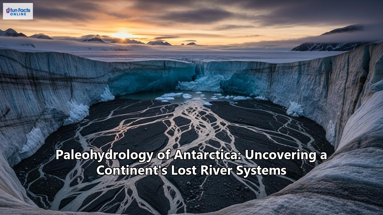
The application of these technologies has led to a series of stunning discoveries that have rewritten our understanding of Antarctica's history. One of the most significant has been the identification of a vast, ancient coastal plain hidden beneath the East Antarctic Ice Sheet. This remarkably flat landscape, stretching for over 3,500 kilometers, is believed to have been carved by large rivers between 80 and 34 million years ago, before the continent was encased in ice. This ancient river-carved terrain has remained largely intact, preserved for over 30 million years.
These ancient riverbeds and plains now play a crucial role in the behavior of the modern ice sheet. The troughs carved by the ancient rivers act as channels for fast-flowing glaciers, while the flatter, elevated areas appear to slow the flow of ice towards the ocean. Understanding the layout of this ancient drainage system is therefore critical for predicting how the Antarctic ice sheet will respond to a warming climate and its potential contribution to future sea-level rise.
Beyond the river systems, scientists have discovered a vast network of over 400 subglacial lakes hidden beneath the ice. These are not small ponds, but in some cases, immense bodies of water. The most famous of these is Lake Vostok, located in East Antarctica. It is one of the largest lakes in the world, with a surface area of about 12,500 square kilometers and a depth of over 500 meters. For a long time, it was believed that the water in Lake Vostok had been isolated for millions of years, but more recent estimates suggest its water is replaced by the slow melting and freezing of the overlying ice sheet roughly every 13,000 years.
Some of these subglacial lakes are "active," meaning they fill and drain over time, creating a complex subglacial plumbing system that can influence the speed of the glaciers above them. This dynamic hydrological system is a key area of research, as the movement of water at the base of the ice sheet can lubricate its flow, potentially accelerating its journey to the sea.
A Greener Past: The Climate and Life of Ancient Antarctica
The existence of extensive river systems is irrefutable evidence that Antarctica was not always the frozen continent it is today. To understand its watery past, we must journey back in time to an era when its climate was far more hospitable.
For much of its geological history, Antarctica was part of the supercontinent Gondwana, alongside what would become South America, Africa, India, and Australia. During the Mesozoic Era, the age of dinosaurs, Antarctica was located at a high latitude but enjoyed a temperate or even tropical climate. The concentration of carbon dioxide in the atmosphere was much higher than it is today, creating a greenhouse effect that kept the planet warm.
Around 180 million years ago, Gondwana began to break apart. Antarctica's final separation from Australia and South America occurred around 34 million years ago. This was a pivotal moment in the continent's climatic history. The opening of the Drake Passage between South America and the Antarctic Peninsula allowed for the formation of the Antarctic Circumpolar Current, a powerful ocean current that circles the continent, isolating it from warmer waters to the north. This, combined with falling global CO2 levels, plunged Antarctica into a deep freeze, leading to the formation of its massive ice sheets.
Before this deep freeze, however, Antarctica was a land of flowing water and flourishing life. Fossil evidence reveals that "polar forests" once grew at latitudes as high as 85°S. In the McMurdo Dry Valleys, a region that is now one of the most inhospitable places on Earth, scientists have found evidence that the area was once warm and wet enough to support liverworts, mosses, and even shrubby trees. This vegetation persisted until about 14 million years ago, with liquid water present for even longer, up to about six million years ago.
The Legacy of a Lost World: Implications for Our Future
The study of Antarctica's paleohydrology is more than just a fascinating journey into the Earth's past. It holds crucial clues for our future. The ancient river systems and coastal plains that lie beneath the ice are not just geological relics; they are active components of the Earth's climate system. As noted earlier, their topography influences the flow of the ice sheet, and therefore, its stability in a warming world.
By incorporating the detailed maps of this subglacial landscape into computer models, scientists can create more accurate predictions of how the Antarctic ice sheet will respond to climate change and how much it will contribute to sea-level rise. The East Antarctic Ice Sheet alone holds enough water to raise global sea levels by a staggering 52 meters.
Furthermore, the subglacial lakes of Antarctica are seen as unique analogues for extraterrestrial environments. The study of life in these dark, cold, high-pressure environments could provide insights into the potential for life to exist on other icy worlds in our solar system, such as Jupiter's moon Europa or Saturn's moon Enceladus.
The exploration of Antarctica's hidden past is an ongoing endeavor. Major international research collaborations continue to deploy cutting-edge technology to map this unseen world in ever-greater detail. The next frontier will likely involve drilling through the ice to collect rock and sediment samples from these ancient riverbeds and lakebeds. Such samples would provide direct evidence of the past environment and could contain preserved organic matter, offering an unprecedented window into the lost world of a green Antarctica.
The ghostly rivers of Antarctica, silent for millions of years, are now speaking to us. They tell a story of a dynamic and ever-changing planet, reminding us that the frozen continent at the bottom of the world was not always so, and that its deep past holds vital lessons for our planet's future. The once-lost river systems of Antarctica are, in a very real sense, a roadmap to understanding the future of our world.
Reference:
- https://www.antarcticglaciers.org/glaciers-and-climate/observing-and-monitoring-glaciers-and-ice-sheets/mapping-the-glacier-bed/
- https://bgo.ogs.it/sites/default/files/pdf/bgta46.2.3_PICOTTI.pdf
- https://www.mdpi.com/2072-4292/11/10/1253
- https://www.antarcticglaciers.org/glacier-processes/glacial-lakes/subglacial-lakes/
- https://www.bas.ac.uk/project/seismic-investigation-of-a-subglacial-lake/
- https://www.researchgate.net/publication/390182604_Seismic_Acquisition_Modelling_and_Data_Analysis_of_Antarctic_subglacial_lakes
- https://scar.org/~documents/policy/antarctic-treaty/atcm-xlv-and-cep-xxv-2023-helsinki-finland/atcm45-ip049?layout=default
- https://www.researchgate.net/publication/258491307_The_Identification_and_Physiographical_Setting_of_Antarctic_Subglacial_Lakes_An_Update_Based_on_Recent_Discoveries
- https://www.esa.int/ESA_Multimedia/Images/2018/11/GOCE_map_of_Antarctica_on_bedrock_topography
- https://openaccess.wgtn.ac.nz/articles/thesis/The_subglacial_landscape_and_hydrology_of_Antarctica_mapped_from_space/14956062
- https://www.numberanalytics.com/blog/advances-in-paleohydrology-research
- https://www.mdpi.com/2072-4292/15/2/363
- https://egusphere.copernicus.org/preprints/2025/egusphere-2025-646/egusphere-2025-646.pdf
- https://www.bas.ac.uk/data/our-data/publication/ice-surface-and-bedrock-topography-in-coats-land-and-part/
- https://cresis.ku.edu/antarctica