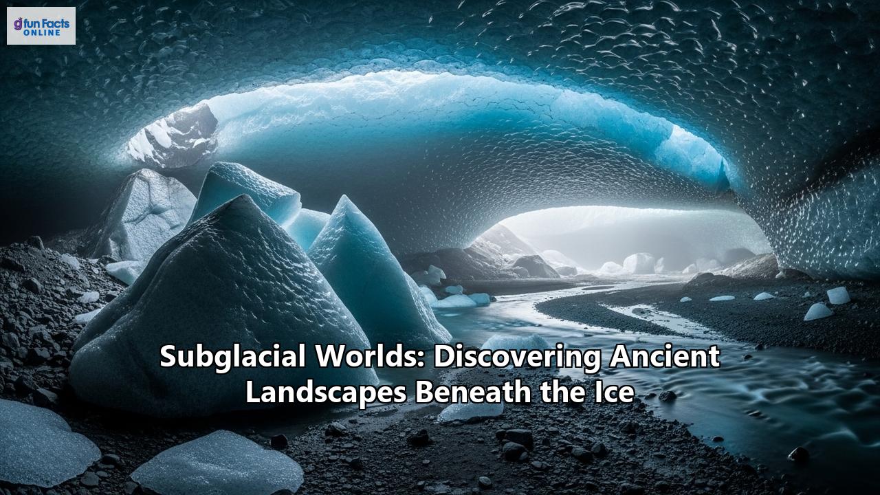
An air of desolate tranquility hangs over Antarctica. It is a continent of superlatives: the coldest, driest, windiest, and highest on average. From space, it appears as a colossal white expanse, a seemingly featureless cap of ice dominating the bottom of our world. For much of human history, this was our entire understanding of the landmass—a static, frozen desert. But this perception of a placid, dormant continent is a grand illusion. Beneath the immense weight of an ice sheet kilometers thick lies a hidden world of staggering scale and dynamism, a realm of towering mountains, vast canyons, and liquid lakes that has been shielded from sight and sun for millions of years.
This is not the realm of science fiction. It is a world that scientists, through ingenuity and perseverance, have begun to unveil. They have discovered landscapes carved by ancient rivers when Antarctica was a verdant part of a supercontinent, and mountain ranges as grand as the European Alps, flash-frozen in time. In the profound, crushing darkness beneath the ice, they have found a lost world of water, a network of hundreds of lakes and rivers, some of which are teeming with life. These discoveries are not just geographical curiosities; they are rewriting the history of our planet. They hold the secrets to Earth's past climates, keys to understanding the future of our rising seas, and tantalizing clues in the search for life on other worlds. This is a journey into the last great wilderness on Earth, an exploration of the subglacial worlds hidden beneath the ice.
Peering Through the Ice: The Dawn of Subglacial Exploration
The first inklings of a world beneath the ice were fleeting and speculative. In the 1960s, pilots flying over the vast interior of the East Antarctic Ice Sheet reported noticing unnervingly flat areas in the ice, describing them as "lakes" with imagined "shorelines." These observations were initially dismissed by many, but they planted a seed of curiosity. Around the same time, theoretical calculations by glaciologists like Igor A. Zotikov suggested that the immense pressure of the overlying ice, combined with geothermal heat radiating from the Earth's crust, could keep water in a liquid state at the base of the ice sheet, even as surface temperatures plummeted to the lowest ever recorded on Earth.
These early ideas remained largely in the realm of theory until the advent of a technology that would revolutionize polar science: ice-penetrating radar (IPR). The principle behind IPR is elegantly simple. An aircraft flying over the ice sheet emits pulses of radio waves downward. Ice, being relatively transparent to these waves, allows them to pass through until they hit a boundary—such as the bedrock beneath, or a layer of liquid water. The waves reflect off this boundary and travel back to a receiver on the aircraft. By measuring the time it takes for the echo to return, scientists can calculate the thickness of the ice with remarkable precision.
The echoes, however, contain far more information than just depth. A strong, bright, and mirror-like reflection indicates a very flat and smooth surface, the kind formed by liquid water. A more scattered and uneven echo suggests rough, rocky terrain. Suddenly, scientists had a way to "see" through the ice. Beginning in the late 1960s and early 1970s, pioneering airborne radar surveys began to reveal the first confirmed evidence of subglacial lakes.
Alongside radar, other geophysical methods added layers of detail to this emerging picture. Seismic surveys, which involve creating small, controlled explosions or vibrations at the surface and recording the sound waves that travel through the ice and rock, provided a different way to map the subglacial interface. Later, the incredible precision of satellite altimetry—using satellites to measure the height of the ice surface with millimeter accuracy—revealed subtle dips and bumps on the vast, seemingly flat ice sheet. Scientists realized these were expressions of the topography far below; a massive mountain range would cause a gentle swell in the ice surface, while a large subglacial lake would create a distinct depression. Armed with this suite of remote-sensing technologies, the scientific community was poised to map a new continent, one hidden beneath a veil of white.
The "Ghost" Mountains: Unveiling the Gamburtsev Range
One of the first and most enigmatic discoveries to emerge from this new era of exploration was a phantom mountain range located deep in the heart of East Antarctica, directly beneath the ice sheet's highest point, Dome A. During the International Geophysical Year in 1958, a Soviet Antarctic Expedition traversing this desolate region detected a massive subglacial highland using seismic soundings. They named it the Gamburtsev Subglacial Mountains, after the Soviet geophysicist Grigoriy A. Gamburtsev. The discovery was deeply puzzling. The mountains were vast, comparable in size to the European Alps, with peaks estimated to reach 2,700 meters (8,900 feet) and sharp, rugged features typical of a much younger range.
This presented a geological conundrum. Major mountain ranges are typically formed by the collision of tectonic plates, but the Gamburtsev range was situated in the middle of an ancient and tectonically stable part of the continent. How could such a massive and seemingly youthful mountain range exist in the heart of an old craton? The mystery of the "ghost mountains" persisted for decades, buried under more than 600 meters of ice at their shallowest and up to 3 kilometers at their deepest.
The answer, pieced together by a major international effort during the International Polar Year (2007-2009), revealed a geological history of epic proportions, a story of repeated birth, erosion, and rejuvenation. Using aircraft equipped with advanced ice-penetrating radar, gravimeters, and magnetometers, scientists mapped the hidden range in stunning detail. They discovered that the Gamburtsev's story began a billion years ago, during the formation of the supercontinent Rodinia. A collision between two plates forged an initial mountain range, leaving behind a thick, dense crustal "root" that extended deep into the Earth's mantle.
Over hundreds of millions of years, these ancient mountains were completely eroded away, but the cold, deep root remained. Then, between 250 and 100 million years ago, as the supercontinent Gondwana began to break apart, the crust near this ancient root started to stretch and rift. This process warmed and rejuvenated the dormant root, giving it the buoyancy to lift the land upwards once more, creating a new massif. Rivers and later alpine glaciers carved deep, sharp valleys into this uplifted plateau, sculpting the jagged peaks and troughs that resemble the modern Alps.
The final act in this geological drama was the mountains' preservation. Around 34 million years ago, as global temperatures plummeted, glaciers began to form in the highlands of the newly reformed Gamburtsevs. This was the genesis of the colossal East Antarctic Ice Sheet. The growing ice sheet expanded with astonishing speed, effectively "flash-freezing" the alpine landscape and protecting it from further erosion. The Gamburtsev Mountains, once a cradle of glaciers, became entombed by their own progeny. This discovery was profound, identifying the Gamburtsevs not just as a geological marvel, but as the primary birthplace of the largest ice sheet on Earth.
A Landscape Frozen in Time: Ancient Rivers and Rift Valleys
The revelation of the Gamburtsev Mountains was just the beginning. As mapping technologies improved, an even more extensive and ancient world began to emerge from beneath the ice. Scientists discovered that Antarctica's warmer, pre-glacial past was not just hinted at by mountains, but was etched into the very bedrock in the form of vast, preserved river systems.
Recent studies, analyzing radar data across thousands of kilometers of East Antarctica, have uncovered extensive landscapes that were shaped by rivers at least 14 million years ago, and possibly even before the continent was covered in ice 34 million years ago. These are not small streams, but continent-spanning drainage basins. A team led by Durham University identified a 32,000 square kilometer area of ancient valleys and ridges, a terrain bearing a striking resemblance to the glacially modified landscapes of North Wales. Another discovery revealed an ancient river system, stretching for approximately 1,500 kilometers, that once flowed across West Antarctica before being deposited into the Amundsen Sea.
These findings paint a vivid picture of a very different Antarctica. Before the great glaciation, the continent was part of the supercontinent Gondwana and experienced a temperate climate. Dense forests thrived, and a vast network of rivers wound their way across the landscape, carving valleys and depositing sediment. The discovery of a molecule characteristic of freshwater cyanobacteria in sediment cores from the Amundsen Sea provides direct evidence for these once-mighty river systems. The remarkable preservation of these river-carved plains suggests that the ice sheet formed rapidly and, in many areas, froze to the bed, acting as a protective shield rather than an erosive force.
This ancient topography has a profound influence on the present. The deep troughs carved by these prehistoric rivers now act as channels for some of Antarctica's largest and fastest-flowing glaciers. Ice streams, like massive frozen rivers, are guided by this underlying plumbing, which funnels ice from the continent's interior towards the ocean.
Adding another layer of complexity to this hidden world is the presence of active volcanism. West Antarctica, in particular, has been identified as one of the most extensive volcanic provinces on Earth. In 2017, researchers identified 91 previously unknown volcanoes buried beneath the West Antarctic Ice Sheet, with some rising to nearly 4,000 meters in height. This subglacial volcanism, concentrated along the West Antarctic Rift System, provides a significant source of geothermal heat, melting the base of the ice sheet and contributing to the formation of subglacial lakes and the lubrication of ice flow. The interplay between this volcanic heat and the overlying ice is a critical factor in the stability of the West Antarctic Ice Sheet, which is considered particularly vulnerable to climate change.
The Lost Worlds of Water: Antarctica's Great Subglacial Lakes
The combination of geothermal heat from below and the immense, insulating pressure of the ice from above creates one of the most astonishing features of the subglacial world: liquid water. For decades, scientists have known that beneath the Antarctic ice sheet lies the largest wetland on our planet, an enormous, interconnected system of rivers and lakes. To date, over 400 subglacial lakes have been discovered, ranging from small ponds to bodies of water the size of inland seas.
The crown jewel of this hidden hydrological system is Lake Vostok. Located in the heart of East Antarctica, buried beneath nearly four kilometers (2.5 miles) of solid ice, Lake Vostok is one of the largest lakes in the world. It is roughly the size of North America's Lake Ontario, and its existence was first suspected by Russian pilot R. V. Robinson in the 1960s and later confirmed by seismic and radar surveys in the 1990s.
The confirmation of Lake Vostok's existence ignited the scientific community. Here was a body of water that had been completely isolated from Earth's atmosphere and sunlight for an estimated 15 million years. It represented a potential time capsule, its waters and sediments holding an undisturbed record of ancient climate and its ecosystem a possible evolutionary experiment conducted in utter isolation. The central question was tantalizing: could life exist in such an extreme environment—perpetual darkness, immense pressure, low nutrients, and frigid temperatures?
This question drove one of the most ambitious and controversial drilling projects ever undertaken. For two decades, Russian scientists at the Vostok Station painstakingly drilled through the overlying ice sheet. The project was fraught with challenges, not least the fear of contaminating the pristine lake with drilling fluids like kerosene and Freon. Finally, in February 2012, the drill bit breached the ice sheet and entered the lake. Under immense pressure, lake water shot up the borehole and froze, creating a plug that the Russian team said prevented widespread contamination.
Initial analyses of the frozen lake water retrieved from the borehole were contentious. Some studies reported finding DNA from a diverse range of organisms, including bacteria, fungi, and even more complex life. However, concerns about contamination from the drilling process led many scientists to view these early results with skepticism. The quest to definitively sample and study this ancient, isolated world was far from over, but Lake Vostok had proven that vast, liquid water environments were a fundamental, if hidden, feature of the Antarctic continent.
The Quest for Life: Drilling into the Darkness
The challenges at Lake Vostok underscored a critical requirement for subglacial exploration: the need to access these pristine environments without contaminating them. This spurred the development of "clean drilling" technologies, designed to melt through the ice while ensuring that no surface microbes could be introduced into the isolated ecosystems below. The most successful of these has been the hot-water drill. This method uses a jet of scalding, sterilized water to bore through the ice, with the drill water itself being filtered and treated with UV radiation to be cleaner than hospital operating rooms.
This technology paved the way for the Whillans Ice Stream Subglacial Access Research Drilling (WISSARD) project, an American-led mission with a clear goal: to be the first to cleanly and directly sample the water and sediments of a subglacial lake. Their target was Lake Whillans, a much smaller and shallower lake than Vostok, lying beneath 800 meters (2,625 feet) of ice in West Antarctica. Unlike the isolated Lake Vostok, Lake Whillans is part of an active hydrological network, a lake that regularly fills and drains, connecting it to other subglacial environments.
In January 2013, the WISSARD team successfully drilled into Lake Whillans. The samples they retrieved provided the first definitive proof of a thriving ecosystem in a subglacial lake. This was a landmark discovery. The dark, cold waters were not sterile; they were alive. Subsequent analysis revealed that Lake Whillans is home to a diverse community of nearly 4,000 species of microbes.
So how does life survive in a world without sunlight, the energy source that powers almost all life on Earth's surface? The answer is chemosynthesis. Instead of photosynthesis, the microbes of Lake Whillans derive their energy from chemical reactions, essentially "eating" the minerals and chemical compounds found in the water and the ancient marine sediments at the lake bottom. Scientists found that the most abundant organisms in the lake are archaea that oxidize ammonium for energy. Others metabolize iron and sulfur compounds. In essence, they are rock-eaters, opportunists that have evolved to utilize every available scrap of chemical energy in their cold, dark, and nutrient-poor world. The discovery showed that life could flourish in one of the most extreme environments on the planet.
This finding was not an anomaly. Following the success of WISSARD, the Subglacial Antarctic Lakes Scientific Access (SALSA) project drilled into Lake Mercer in 2018. Here too, they found a vibrant microbial community, reinforcing the idea that these subglacial aquatic environments represent a significant and widespread biome on our planet. Antarctica's hidden waters, once thought to be barren, were now understood to be a vast, living wetland.
Echoes of Other Worlds: Astrobiological Implications
The discovery of life thriving in the dark, cold, high-pressure environments beneath the Antarctic ice has profound implications that extend far beyond our own planet. For astrobiologists—scientists who study the potential for life elsewhere in the universe—Antarctica's subglacial lakes are a revelation. They are our planet's closest analogues to the subsurface oceans that are believed to exist on several of the icy moons in our outer solar system.
Astronomical observations have provided strong evidence that Jupiter's moon Europa and Saturn's moon Enceladus both harbor vast oceans of liquid water beneath their thick, frozen shells. These alien oceans are considered some of the most promising places to search for extraterrestrial life. The conditions there are strikingly similar to those in Lake Vostok or Lake Whillans: a liquid water ocean in direct contact with a rocky core, sealed off from the surface by a thick layer of ice, with no access to sunlight but with potential energy sources from hydrothermal vents or chemical reactions with the rock.
Before the discoveries in Antarctica, the idea that life could exist in such a place was purely theoretical. Now, there is a proof of concept on Earth. The fact that entire ecosystems of extremophiles can sustain themselves by "eating" rocks and chemicals in the perpetual darkness of a subglacial lake strengthens the scientific case that life could potentially arise and persist in the hidden oceans of Europa or Enceladus.
The exploration of Antarctica's subglacial worlds also serves as a crucial technological and procedural dress rehearsal for future missions to these icy moons. The immense challenges of drilling cleanly through kilometers of ice, deploying instruments without contamination, and analyzing samples for signs of life in a low-biomass environment are precisely the hurdles that a future mission to Europa will face. Every lesson learned from projects like WISSARD and the attempts at Lake Vostok informs the design and strategy for the robotic explorers that may one day search for life in these distant, watery worlds.
A World of Influence: Subglacial Realms and Our Planet's Future
The world beneath the ice is not a static museum piece; it is an active and influential component of the Earth system that has a direct impact on our planet's climate and future sea levels. The subglacial topography—the ghost mountains, ancient river valleys, and vast basins—is the template upon which the Antarctic ice sheets rest and move.
This hidden landscape acts as a steering mechanism for ice flow. The deep troughs and canyons carved by ancient rivers now serve as expressways for fast-flowing ice streams, channeling ice from the vast interior of the continent out towards the ocean. In contrast, large mountain ranges like the Gamburtsevs can act as a stabilizing barrier, pinning the ice and slowing its advance.
Furthermore, the extensive network of subglacial water acts as a lubricant. Water at the base of the ice sheet reduces friction, allowing the ice to slide more easily over the bedrock. Scientists have observed that the draining of large subglacial lakes can cause the overlying glaciers to suddenly accelerate, surging forward for a period before slowing down again. This dynamic interplay between water and ice is a critical, yet poorly understood, variable in the overall behavior of the ice sheet.
Understanding these subglacial processes is of paramount importance in the context of a warming climate. The stability of the West Antarctic Ice Sheet, much of which is grounded on bedrock that lies below sea level, is a major concern for scientists predicting future sea-level rise. If warming ocean waters intrude beneath the ice shelves and accelerate melting, the lubricating effect of increased subglacial water could potentially trigger a more rapid and widespread loss of ice. Accurately forecasting Antarctica's contribution to global sea-level rise, therefore, requires a deep understanding of the world beneath the ice.
These hidden realms also hold the promise of becoming invaluable climate archives. The sediments at the bottom of ancient, isolated lakes like Vostok could contain a high-resolution, multi-million-year record of Antarctica's climate and ice sheet history, a record obtainable nowhere else on Earth. Drilling into these sediments could provide unprecedented insights into how the continent responded to past periods of global warmth.
The Final Frontier on Earth: Challenges and the Future of Exploration
Exploring the world beneath the Antarctic ice sheet is arguably the last great terrestrial exploration. The challenges are monumental, rivaling those of space exploration in their complexity. The environment is the most hostile on Earth, with extreme cold and logistical hurdles that test the limits of human endurance and technology. The sheer thickness of the ice—kilometers deep in many places—requires immense power and sophisticated drilling equipment.
The overriding challenge, however, remains the ethical and scientific imperative to explore without contaminating. These subglacial ecosystems have been isolated for eons, and the introduction of surface microbes could irrevocably alter them before they can even be studied. This has led to rigorous international protocols and the development of the painstaking clean-access technologies. The difficulty of this work is underscored by setbacks, such as the initial British attempt to drill into Lake Ellsworth in 2012, which had to be abandoned due to technical issues after years of planning.
Despite the difficulties, the future of subglacial exploration is bright. Scientists are developing more advanced technologies, including autonomous underwater vehicles (AUVs) that could be deployed through boreholes to explore the vast expanses of lakes like Vostok. The Rapid Access Ice Drill (RAID) project is developing a mobile system designed to quickly drill through deep ice and retrieve bedrock cores, which could be used to map the geology and search for ancient ice across the continent. International collaboration remains key, as the scale and expense of these projects often exceed the capabilities of any single nation.
Conclusion: The Unveiled Continent
The story of subglacial discovery has transformed our vision of Antarctica. The image of a static, lifeless continent has been shattered and replaced by a far more complex and dynamic reality. We now know that beneath the ice lies a ghost continent, a hidden world of mountains, canyons, and ancient riverbeds that have been preserved like a photograph from a bygone geological era. We have discovered a lost world of water, a vast network of lakes and rivers that harbor unique ecosystems, alive and thriving in the crushing darkness.
This journey of discovery has been a testament to human ingenuity and the unyielding spirit of exploration. By peering through kilometers of solid ice, scientists have not only mapped a new frontier on our own planet but have also found a mirror reflecting the possibilities of life on distant, icy worlds. The secrets of this subglacial realm are inextricably linked to our own future, holding keys to understanding the stability of our climate and the fate of our coastlines. Antarctica, the white continent, is slowly unveiling its true face, reminding us that even in the 21st century, our own planet still holds profound and breathtaking secrets, waiting to be discovered.
Reference:
- https://www.bas.ac.uk/media-post/gamburtsev-mountains-enigma-unraveled-in-interior-east-antarctica/
- https://en.wikipedia.org/wiki/Gamburtsev_Mountain_Range
- https://thedebrief.org/hidden-beneath-antarctic-ice-for-eons-a-deeply-puzzling-soviet-era-discovery-finally-reveals-its-secrets/
- https://www.sciencedaily.com/releases/2011/11/111116132906.htm
- https://www.researchgate.net/publication/26265284_The_Gamburtsev_Mountains_and_the_origin_and_early_evolution_of_the_Antarctic_Ice_Sheet
- https://www.independent.co.uk/news/science/antarctic-mountain-range-gamburtsev-subglacial-ice-b2759881.html
- https://news.climate.columbia.edu/2011/11/17/researchers-unravel-origins-of-antarcticas-ice-covered-mountains/
- https://www.antarcticglaciers.org/glacial-geology/antarctic-ice-sheet/geophysical-surveys/
- https://www.researchgate.net/publication/260726214_Early_East_Antarctic_Ice_Sheet_growth_recorded_in_the_landscape_of_the_Gamburtsev_Subglacial_Mountains
- https://www.smithsonianmag.com/science-nature/thousands-microbe-species-live-buried-antarctic-lake-180952415/
- https://www.sciencealert.com/scientists-discover-ancient-river-system-hidden-under-antarctic-ice
- https://from.ncl.ac.uk/how-we-discovered-an-ancient-river-landscape-beneath-the-ice
- https://www.kurdistan24.net/en/story/395488/Ancient-river-system-discovered-beneath-West-Antarctica%27s-ice-sheet
- https://economictimes.indiatimes.com/news/international/us/scientists-discover-river-system-that-flowed-40-million-years-under-ice-in-antarctica/articleshow/111193207.cms?from=mdr
- https://www.earth.com/news/vast-river-landscapes-discovered-beneath-antarcticas-thick-ice-sheet/
- https://www.researchgate.net/publication/317255865_A_new_volcanic_province_An_inventory_of_subglacial_volcanoes_in_West_Antarctica
- https://blogs.ed.ac.uk/rbingham/wp-content/uploads/sites/971/2025/07/20180101_GSSP_VanWykdeVries_WAIS_volcanoes.pdf
- https://worldoceanreview.com/en/wor-6/the-arctic-and-antarctic-natural-realms-at-the-poles/a-brief-history-of-the-polar-regions/a-volcanic-landscape-hidden-below-the-ice/
- https://www.lyellcollection.org/doi/10.1144/m55-2019-3
- https://ntrs.nasa.gov/citations/19930022712
- https://en.wikipedia.org/wiki/Lake_Vostok
- https://science.howstuffworks.com/environmental/earth/geophysics/lake-vostok.htm
- https://www.thoughtco.com/lake-vostok-4156596
- https://www.theguardian.com/world/2012/feb/06/russian-scientists-drill-antarctic-lake
- https://news.climate.columbia.edu/2012/02/09/scientists-drill-2-miles-down-to-ancient-lake-vostok/
- https://grist.org/climate-energy/scientists-drill-into-ancient-burie-lake/
- https://ictnews.org/archive/russian-scientists-may-have-drilled-down-to-antarcticas-lake-vostok-buried-for-14-million-years/
- https://nora.nerc.ac.uk/id/eprint/528235/
- https://www.bas.ac.uk/data/our-data/publication/development-of-a-clean-hot-water-drill-to-access-subglacial/
- https://www.bas.ac.uk/media-post/antarctic-ghost-mountains-preserved-by-ice-sheet-2/
- https://royalsocietypublishing.org/doi/10.1098/rsta.2014.0304
- https://www.cambridge.org/core/journals/annals-of-glaciology/article/development-of-a-clean-hot-water-drill-to-access-subglacial-lake-cecs-west-antarctica/45061AECF33ECA77845418FFFA83BAD0
- https://www.livescience.com/47461-lake-whillans-species-antarctica-life.html
- https://royalsocietypublishing.org/doi/10.1098/rsta.2014.0466
- https://www.sci.news/biology/science-microbial-ecosystem-antarctic-subglacial-lake-whillans-02110.html
- https://www.frontiersin.org/journals/microbiology/articles/10.3389/fmicb.2016.01457/full
- https://pmc.ncbi.nlm.nih.gov/articles/PMC5081474/
- https://www.researchgate.net/publication/326551895_Antarctic_Subglacial_Lake_Exploration_first_results_and_future_plans
- https://icedrill.org/sites/default/files/BRADDOCK_2024_lessons-learned-from-shallow-subglacial-bedrock-drilling-campaigns-in-antarctica_0.pdf
- https://www.cambridge.org/core/journals/antarctic-science/article/antarctic-subglacial-hydrology-current-knowledge-and-future-challenges/78173D306E451862DE0590D53EC6E9A6
- https://www.cambridge.org/core/journals/journal-of-glaciology/article/rapid-access-ice-drill-a-new-tool-for-exploration-of-the-deep-antarctic-ice-sheets-and-subglacial-geology/C74644A3559BC2408CB9527537A577C3