In the remote, frozen expanses of the Arctic and Antarctic, the weather does not behave as it does in the temperate zones. Here, massive storms can spin up from nothing in a matter of hours, unleashing hurricane-force winds and blinding snow. These are "Polar Lows," often called "Arctic Hurricanes," and for decades they have been the ghosts of meteorology—appearing suddenly, wreaking havoc on shipping lanes and coastal communities, and vanishing before traditional satellites could get a second look.
For forecast centers in Europe and North America, the poles have long been a blind spot. Geostationary satellites, which stare unblinkingly at the equator and mid-latitudes, see the poles only at an extreme, unusable angle. Polar-orbiting satellites offer a clear view, but they are few and far between; a single satellite might only pass over a specific Arctic location twice a day. In the twelve-hour gap between passes, a storm can be born, mature, and begin to die, entirely unobserved.
Enter EPS-Sterna.
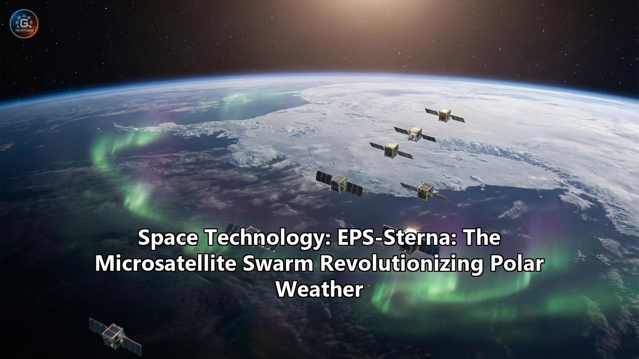
EPS-Sterna (EUMETSAT Polar System - Sterna) represents a paradigm shift in how humanity monitors the planet. Moving away from the era of "battlestar" satellites—massive, multi-ton buses carrying dozens of instruments—EPS-Sterna embraces the philosophy of the "swarm." It is a constellation of agile microsatellites designed to encircle the globe in three distinct orbital planes, providing a refresh rate that makes the invisible visible.
Named after the Arctic Tern (Sterna paradisaea), a bird famous for its pole-to-pole migration and incredible endurance, this mission is set to revolutionize our understanding of polar weather, improve global numerical weather prediction (NWP), and offer unprecedented insights into the rapidly changing climate of the high latitudes. This article delves deep into the technology, the science, and the future impact of this groundbreaking European mission.
1. The Blind Spot: Why We Need a Swarm
To understand the necessity of EPS-Sterna, one must first understand the limitations of the current Global Observing System (GOS).
The Geostationary Gap
Most of the weather images seen on the evening news come from geostationary satellites (like Meteosat or GOES) parked 36,000 kilometers above the equator. From this vantage point, they orbit at the same speed as the Earth turns, providing a continuous "movie" of weather patterns. However, due to the curvature of the Earth, these satellites cannot see effectively beyond 60 degrees latitude. The Arctic and Antarctic regions are essentially flattened into a blur on the horizon.
The Polar Orbiter Limitations
To see the poles, we rely on Low Earth Orbit (LEO) satellites like Europe’s MetOp series or America’s JPSS. These fly over the poles at an altitude of around 800 km. As the Earth rotates underneath them, they scan the entire globe.
- The Problem: A single polar satellite only revisits the same spot roughly every 12 hours.
- The Consequence: In the Arctic, weather systems are smaller and faster than their mid-latitude cousins. A "Polar Low" can develop, intensify, and create 10-meter waves in less than 6 hours. Current satellites often miss the most critical intensification phase of these storms, leaving mariners and residents with little to no warning.
The Sterna Solution: Temporal Resolution
EPS-Sterna solves this not by building a better camera, but by building more cameras. By launching a constellation of six small satellites (initially) spread across three different orbital planes, Sterna reduces the "revisit time"—the gap between observations—from 12 hours down to nearly 3 hours in the polar regions. In some configurations, the system can achieve a 90% global coverage in under 5 hours. This high "temporal resolution" allows meteorologists to watch polar storms evolve in near-real-time, capturing the rapid fluctuations in humidity and temperature that drive severe weather.
2. The Technology: Anatomy of a Microsatellite
EPS-Sterna is a triumph of "New Space" engineering—the philosophy of using smaller, standardized components to build cheaper satellites faster, without sacrificing the rigorous reliability required for operational weather forecasting.
The Platform: Small but Mighty
Unlike the MetOp satellites, which are the size of a bus and weigh over 4,000 kg, an EPS-Sterna satellite is roughly the size of a large washing machine or a small refrigerator.
- Mass: Approximately 135 kg to 150 kg.
- Dimensions: Roughly 1.0m x 1.0m x 0.8m (bus volume).
- Manufacturer: The satellite platforms are built by OHB Sweden, a leader in microsatellite propulsion and platform design.
- Power & Avionics: The "brain" and "heart" of the satellite are provided by AAC Clyde Space, utilizing their SIRIUS avionics and STARBUCK power systems. These are commercial-off-the-shelf (COTS) components adapted for high-reliability space missions, drastically reducing cost.
The Payload: Seeing the Invisible
The sole instrument on each Sterna satellite is a Passive Microwave Radiometer (MWR). Unlike optical cameras that are blinded by clouds or darkness (a major issue in the polar winter), microwave radiometers can "see" through clouds to measure the temperature and moisture of the atmosphere layers beneath.
Technical Specifications of the MWR:- Channels: 19 spectral channels.
- Scan Type: Cross-track scanning (whiskbroom), rotating at 45 RPM.
- Swath Width: Approx. 1,870 km.
- 50–60 GHz (V-band): These channels measure oxygen emissions. Since oxygen is uniformly mixed in the atmosphere, variations in brightness temperature here relate directly to the physical temperature of atmospheric layers. This allows the satellite to build a 3D temperature map of the atmosphere (profiling).
- 89 GHz & 165 GHz: These are "window" channels used to detect surface properties, precipitation, and cloud water.
- 183 GHz (G-band): The water vapor absorption line. By measuring slightly off-peak frequencies here, the instrument profiles humidity at different altitudes. This is crucial for predicting where clouds will form and how much energy is available for storms.
- The "Secret Weapon" - 325 GHz:
This is the game-changer. EPS-Sterna (and its precursor AWS) introduces novel channels around 325 GHz.
Purpose: Previous sensors topped out at 183 GHz. The 325 GHz frequency is highly sensitive to ice particles.
Why it matters: In the Arctic, clouds are often composed of ice crystals rather than liquid water droplets. Traditional sensors struggle to quantify these "ice clouds" accurately. The 325 GHz channels allow Sterna to measure the ice water path inside cirrus clouds and polar storm tops, providing critical data for precipitation forecasts in cold climates.
3. Scientific Use Cases: From Medicanes to Arctic Rivers
The high revisit rate and specific frequency selection of EPS-Sterna unlock new capabilities for monitoring specific, dangerous weather phenomena.
Forecasting "Polar Lows"
Polar lows are intense mesoscale cyclones that form over open water during cold air outbreaks. They are notoriously difficult to forecast because they fall through the cracks of the current observing network.
- The Mechanism: A polar low creates a "warm core" similar to a tropical hurricane.
- Sterna's Role: With its 50 GHz temperature sounding channels, Sterna can penetrate the cloud tops of a developing system to detect this warm core structure. The 3-hour revisit time allows forecasters to see the "spin-up" phase, providing hours of extra warning time for fishing fleets and oil platforms in the Barents and Norwegian Seas.
Tracking "Medicanes" (Mediterranean Hurricanes)
While the mission is named for the Arctic, its polar orbit covers the whole globe. It will be particularly effective over the Mediterranean.
- The Phenomenon: Occasionally, Mediterranean storms take on tropical characteristics, developing an eye and a warm core. These "Medicanes" can cause devastating flooding and wind damage (e.g., Medicane Ianos in 2020).
- Sterna's Role: The microwave sounder allows for the diagnosis of the warm core structure even when the eye is obscured by cirrus clouds. The high-frequency passes help track the storm's rapid intensification, which is often driven by convection that geostationary satellites can see but cannot profile in 3D.
Mapping "Atmospheric Rivers"
Moisture intrusions, often called "Atmospheric Rivers," are narrow corridors of water vapor that travel from the tropics to the poles. They are responsible for up to 90% of the poleward moisture transport.
- Climate Impact: When these rivers hit the Arctic, they don't just bring snow; they bring heat. The moisture acts as a blanket (greenhouse effect), trapping heat and accelerating sea ice melt.
- Sterna's Role: The 183 GHz humidity channels will provide a continuous 3D visualization of these rivers as they flow into the polar cap. Understanding them is key to predicting sea ice decline and Arctic amplification.
4. The Mission Structure: A European Partnership
EPS-Sterna is not just a satellite; it is a complex international program involving multiple agencies and industrial partners.
- EUMETSAT (European Organisation for the Exploitation of Meteorological Satellites): The owner and operator of the system. They define the requirements, manage the ground segment, and distribute the data to National Meteorological Services (like the Met Office, DWD, or Météo-France).
- ESA (European Space Agency): The procurement and development agent. ESA manages the technical development of the satellites and contracts the industrial teams to build them.
- The Precursor: Arctic Weather Satellite (AWS): Before committing to the full billions-of-Euros constellation, Europe launched a prototype. The Arctic Weather Satellite launched in August 2024 on a SpaceX Falcon 9. It is the "pathfinder," proving that the 135kg microsatellite can deliver data quality comparable to the massive MetOp satellites. Its success paved the way for the full Sterna approval.
- Launch Timeline:
AWS (Prototype): Launched August 2024.
EPS-Sterna (Full Constellation): The first batch of 6 satellites is scheduled for launch in 2029.
Replenishment: The mission is designed to operate until 2042. Since small satellites have shorter lifespans (approx. 5 years) than large ones, the program includes a "replenishment" strategy, launching new satellites to replace old ones, ensuring a continuous 13-year data record.
5. The Economic and Societal Value
Why spend millions on weather satellites? The return on investment (ROI) for weather infrastructure is historically high, but Sterna sets a new standard.
- Benefit-Cost Ratio: Economic studies commissioned by EUMETSAT estimate a benefit-cost ratio of 51:1. For every Euro spent on Sterna, the European economy gains €51 in avoided damages and improved efficiency.
- Total Value: The program is projected to generate over €30 billion in socio-economic benefits over its lifetime.
- Sectors Benefited:
Shipping: Improved polar wind and wave forecasts save fuel and prevent loss of cargo.
Renewable Energy: Accurate humidity and temperature profiles improve wind energy forecasts (icing on turbine blades) and solar forecasts (cloud cover).
Disaster Management: Earlier warnings for floods and storms save lives.
Aviation: The 325 GHz channel improves the detection of high-altitude ice crystals, which can cause engine flameouts.
6. Conclusion: The Future is Small
EPS-Sterna represents the maturation of the "CubeSat" and "New Space" revolution. It proves that scientific-grade, operational weather data does not always require billion-dollar, school-bus-sized spacecraft. By cooperating to launch a swarm of smaller, smarter sensors, Europe is securing its independent access to critical weather data while closing the gap in our observation of the poles.
As the Arctic warms at three times the global average, the data from EPS-Sterna will be the definitive record of this transformation. It will be the eyes that watch the storms at the top of the world, ensuring that no matter how wild the weather becomes, we will never again be blind to it.
Reference:
- https://www.youtube.com/watch?v=7sLepwvmvOA
- https://www.researchgate.net/publication/327924670_Time_Evolution_of_the_Cloud_Response_to_Moisture_Intrusions_into_the_Arctic_during_Winter
- https://pdfs.semanticscholar.org/48a7/1c07469b241c57fe60c18140096db252fb32.pdf
- https://scispace.com/pdf/observation-of-polar-lows-by-the-advanced-microwave-sounding-2hf7fg1nxa.pdf
- https://www.mdpi.com/2072-4292/15/11/2838
- https://www.nsf.gov/news/atmospheric-rivers-shape-arctic-moisture