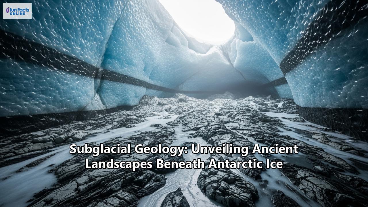
Beneath the Ice: A Vast, Ancient World Is Emerging
An immense continent, shrouded in a colossal ice sheet, Antarctica has long guarded its secrets. For centuries, its surface of blinding white snow and sprawling glaciers was all that humanity could observe. But in recent decades, a revolution in technology has allowed scientists to peer through the ice, unveiling a hidden world of staggering scale and complexity. Beneath the frozen expanse lies a lost continent of towering mountain ranges, vast basins, and ancient river systems, a subglacial geology that is profoundly shaping the behavior of the ice above and holds clues to our planet's past and future.
This is the story of subglacial geology, a field of exploration that is pushing the boundaries of human knowledge and revealing the breathtaking landscapes that have been locked away for millions of years.
A Tale of Two Antarcticas: The Geological Divide
To comprehend the world beneath the ice, one must first understand that Antarctica is not a single, monolithic landmass. It is a continent of two distinct geological personalities: East and West Antarctica, separated by the formidable Transantarctic Mountains.
East Antarctica: The Ancient ShieldEast Antarctica is the elder of the two, a vast and ancient craton, or continental shield, composed of igneous and metamorphic rocks, some of which are over three billion years old. This is a land of immense stability, a geological foundation that has withstood the ravages of time. The East Antarctic Shield is almost entirely buried by the East Antarctic Ice Sheet (EAIS), which reaches thicknesses of up to 4,700 meters.
However, "stable" does not mean featureless. Beneath this thick blanket of ice lies a dramatic topography. The most stunning of these hidden features is the Gamburtsev Subglacial Mountains, a mountain range comparable in size to the European Alps, with peaks reaching heights of around 2,700 meters, all completely submerged in ice. The very existence of the Gamburtsevs was a geological puzzle for decades. Discovered in 1958 by a Soviet expedition, their presence in the middle of a stable craton defied easy explanation. It wasn't until the International Polar Year (2007-2009) that a multinational effort, the AGAP (Antarctica's Gamburtsev Province) project, used ice-penetrating radar, gravity meters, and magnetometers to unravel their story.
The Gamburtsevs are believed to have first formed around a billion years ago during the assembly of the supercontinent Rodinia. Over hundreds of millions of years, they were eroded down, but a deep, cold crustal root remained. Then, about 250 to 100 million years ago, rifting events associated with the breakup of the supercontinent Gondwana warmed and rejuvenated this root, pushing the mountains back up. These rejuvenated peaks were then carved by rivers and glaciers before the entire continent was plunged into a deep freeze. The rapid formation of the East Antarctic Ice Sheet about 34 million years ago effectively flash-froze this alpine landscape, preserving it in stunning detail.
Beyond the Gamburtsevs, East Antarctica is also home to immense subglacial basins, vast depressions in the bedrock that lie far below sea level. The Wilkes Subglacial Basin, for instance, is a massive feature, approximately 1,400 kilometers long and 400 kilometers wide. Another significant feature is the Aurora Subglacial Basin, which is drained by the rapidly thinning Totten Glacier. These basins are of critical importance because their floors are situated below sea level, making the ice that rests upon them potentially vulnerable to incursions of warm ocean water.
West Antarctica and the Antarctic Peninsula: A More Dynamic RealmIn stark contrast to the ancient stability of the East, West Antarctica and the Antarctic Peninsula are geologically younger and more dynamic. This region is characterized by the West Antarctic Rift System, a massive and active rift valley that stretches for some 3,000 kilometers, comparable in scale to the Basin and Range Province of the Western United States. This rifting process has thinned the Earth's crust, creating a landscape of deep troughs and volcanic ranges.
Much of the bedrock in West Antarctica lies below sea level, making the West Antarctic Ice Sheet (WAIS) inherently less stable than its eastern counterpart. The region is also a hotbed of volcanic activity, with numerous subglacial volcanoes, some of which are still active. These volcanoes can melt the base of the ice sheet, creating vast quantities of water that can lubricate the flow of glaciers.
The Antarctic Peninsula, an S-shaped chain of mountains extending north towards South America, is essentially a continuation of the Andes Mountains. Its geological history is one of subduction, where oceanic crust has been forced beneath the continental plate, leading to the formation of a volcanic arc. Like West Antarctica, the Peninsula has numerous volcanic features and is a region of complex and varied subglacial topography.
The Great Freeze: How Glaciation Shaped the Hidden World
The Antarctica we see today, a continent of ice, is a relatively recent phenomenon in geological terms. For much of its history, it was a green and temperate land. The transition to a frozen world began around 34 million years ago, a pivotal moment in Earth's climate history driven by a combination of tectonic and atmospheric changes.
The separation of Antarctica from Australia and South America led to the formation of the Antarctic Circumpolar Current, a powerful ocean current that isolated the continent from warmer waters to the north, plunging it into a deep freeze. The initial growth of the ice sheets was not a uniform process. Glaciers first began to form in the high mountain regions, like the Transantarctic Mountains and the Gamburtsev Subglacial Mountains, which acted as nucleation points for the expanding ice.
The weight of the accumulating ice had a profound effect on the underlying landmass. The immense pressure caused the Earth's crust to sag, a process known as isostasy. In the thickest parts of the ice sheet, the bedrock has been pushed down by as much as 500 meters.
The glaciers themselves were powerful agents of erosion and deposition. As they grew and flowed, they scoured the landscape, carving deep valleys and fjords. In some areas, particularly where the ice was warm-based and able to slide over the bedrock, erosion was intense, creating features like the deep troughs that now channel many of Antarctica's fastest-flowing glaciers. In other areas, where the ice was cold-based and frozen to the bed, erosion was minimal, allowing for the remarkable preservation of ancient, pre-glacial landscapes.
This process of selective erosion and preservation has created a subglacial world of dramatic contrasts: ancient, river-carved plains lying alongside deeply incised glacial troughs.
A Window to a Watery Past: The Discovery of Paleo-River Systems
One of the most exciting discoveries in recent years has been the identification of vast, ancient river systems hidden beneath the ice. Using ice-penetrating radar, scientists have mapped extensive, remarkably flat surfaces stretching for thousands of kilometers along the coast of East Antarctica. These surfaces are believed to be the remnants of a vast coastal plain that was carved by large rivers between 80 and 34 million years ago, before the continent was covered in ice.
These ancient fluvial landscapes, remarkably preserved for over 30 million years, offer a tantalizing glimpse into a warmer, wetter Antarctica. They tell a story of a time when rivers flowed across the continent, carrying sediment to the sea and shaping the land in much the same way that rivers do today. The discovery of these paleo-river systems is not just a matter of geological curiosity; it has profound implications for our understanding of the Antarctic Ice Sheet's behavior. The flat, ancient riverbeds appear to act as a brake on the ice flow, slowing the movement of the glaciers that pass over them. In contrast, the deep troughs that separate these plains channel the fastest-flowing ice streams.
In some areas, such as the western Ross Sea, researchers have even been able to map a fossilized river system that was active as recently as 15,000 years ago, revealing how water drained from subglacial lakes to the ocean as the ice sheet retreated after the last Ice Age. These discoveries highlight the critical role that subglacial hydrology plays in the dynamics of the ice sheet.
The Tools of Discovery: How We See Through the Ice
Peering through kilometers of solid ice is a monumental technological challenge. Scientists have developed a sophisticated toolkit of geophysical methods to map the hidden world beneath the Antarctic ice sheet.
Ice-Penetrating Radar (Radioglaciology): The All-Seeing EyeThe workhorse of subglacial exploration is ice-penetrating radar, also known as radio-echo sounding (RES). This technique involves transmitting radio waves from an aircraft or a ground-based system. These waves travel through the ice and reflect off the bedrock below, as well as off any internal layers within the ice or bodies of water. By measuring the time it takes for the echoes to return, scientists can create detailed maps of the ice thickness and the topography of the land beneath. The strength and character of the reflected signal can also reveal information about the nature of the bed, such as whether it is hard rock, soft sediment, or water. Unusually strong and flat reflections were the first clues to the existence of subglacial lakes.
Seismic Surveys: Listening to the Earth's Echoes Seismic surveys provide another way to probe the subglacial environment. This method involves creating a small, controlled explosion or vibration at the surface and recording the sound waves that travel through the ice and rock and are reflected and refracted back. By analyzing the travel times and characteristics of these seismic waves, scientists can determine the depth of the bedrock, the thickness of any overlying sediments, and even the depth of subglacial lakes. Seismic methods are particularly useful for confirming the presence of subglacial lakes and measuring their water depth. Gravity and Magnetic Mapping: Unveiling the Unseen GeologyThe Earth's gravitational and magnetic fields vary depending on the density and magnetic properties of the rocks below. By flying aircraft equipped with highly sensitive gravimeters and magnetometers, scientists can create detailed maps of these variations. These maps provide crucial information about the underlying geology, helping to distinguish between different rock types, such as dense volcanic rocks and lighter sedimentary rocks. This allows geologists to map out major geological structures like sedimentary basins and volcanic provinces, even when they are completely hidden by ice.
Satellite Altimetry: Measuring the Ice Surface from Space Satellite altimetry uses radar or laser pulses from space to precisely measure the height of the ice sheet surface. This technique has been instrumental in the discovery of "active" subglacial lakes. When a subglacial lake fills with water, it pushes up the overlying ice, causing a subtle bulge on the surface. When the lake drains, the surface subsides. By monitoring these changes in surface elevation over time, scientists can track the movement of water in the subglacial environment. Drilling: The Ultimate Ground TruthWhile remote sensing techniques provide a broad overview of the subglacial world, the only way to directly sample the environment is by drilling through the ice. This is an incredibly challenging and expensive undertaking. The most common method is hot-water drilling, which uses a jet of hot water to melt a hole through the ice sheet. Great care must be taken to ensure that the drilling process is sterile to avoid contaminating the pristine subglacial environment. Once a borehole is created, scientists can lower instruments to measure the properties of the water and collect samples of water and sediment from the lake below. These samples provide invaluable information about the chemistry, biology, and geological history of these hidden ecosystems.
Life in the Dark: The Subglacial Biosphere
Perhaps the most astonishing discovery to emerge from the exploration of subglacial Antarctica is the existence of life in these extreme environments. For millions of years, vast lakes of liquid water have been sealed off from the atmosphere, in total darkness, under immense pressure, and at temperatures near or below freezing. Yet, against all odds, life has found a way.
The first definitive evidence of life in a subglacial lake came from Lake Whillans, located beneath the Whillans Ice Stream in West Antarctica. In 2013, the WISSARD (Whillans Ice Stream Subglacial Access Research Drilling) project successfully drilled into the lake and retrieved water and sediment samples. To their amazement, the scientists found a diverse community of microbes, with cell concentrations far higher than they had expected.
Subsequent drilling into Lake Mercer, another subglacial lake in West Antarctica, by the SALSA (Subglacial Antarctic Lakes Scientific Access) project, also revealed a teeming microbial ecosystem. Even more remarkably, the samples from Lake Mercer contained the carcasses of tiny animals, including crustaceans and tardigrades (water bears), suggesting that the subglacial environment may have once supported more complex life.
Life has also been detected in samples from Lake Vostok, the largest and most isolated of Antarctica's subglacial lakes, though the extremely low biomass makes it a challenging environment to study.
So, how do these organisms survive in such a hostile environment? Without sunlight, photosynthesis is impossible. Instead, these ecosystems are based on chemosynthesis, a process in which organisms derive energy from chemical reactions. The microbes in these subglacial lakes are extremophiles, organisms that are adapted to thrive in extreme conditions. Many of them are lithotrophs, meaning they "eat" rocks, deriving energy from the chemical breakdown of minerals in the underlying bedrock. Others are methanotrophs, consuming methane that may be seeping from the sediments below.
The discovery of these vibrant, chemosynthetic ecosystems deep beneath the Antarctic ice has profound implications. It demonstrates the incredible tenacity of life and expands our understanding of the range of environments that can support it. It also has exciting implications for the search for life beyond Earth. The icy moons of Jupiter and Saturn, such as Europa and Enceladus, are thought to have liquid water oceans beneath their frozen surfaces. The subglacial lakes of Antarctica provide a compelling analogue for these extraterrestrial environments, suggesting that life could potentially exist in similar dark, cold, and hidden oceans elsewhere in our solar system.
The Dynamic Duo: How Geology and Ice Influence Each Other
The relationship between Antarctica's subglacial geology and the overlying ice sheet is a dynamic and intricate dance. The underlying topography exerts a powerful control on the flow of the ice, while the ice, in turn, shapes the land beneath it.
As we have seen, the massive Gamburtsev Subglacial Mountains are thought to have acted as a nucleation point for the East Antarctic Ice Sheet, and their rugged topography continues to influence the flow of ice in the continent's interior. The vast subglacial basins, such as the Wilkes and Aurora basins, create low-lying areas where the ice can thicken and where it is more susceptible to melting from below.
The ancient river systems preserved beneath the ice also play a crucial role in regulating ice flow. The flat, smooth plains created by these rivers tend to slow down the glaciers that pass over them, while the deep troughs that separate them act as conduits for fast-flowing ice streams. This means that the pre-glacial landscape has a direct and ongoing impact on how the Antarctic Ice Sheet is responding to climate change.
The presence of subglacial water, in the form of lakes and rivers, is another critical factor. Water at the base of the ice sheet acts as a lubricant, reducing friction and allowing the ice to slide more easily over the bedrock. The sudden drainage of a subglacial lake can cause a rapid acceleration of the overlying glacier, and these events have been observed to cause ice streams to speed up by as much as 10%.
The West Antarctic Rift System, with its thinned crust and active volcanism, is a particularly dynamic region. Geothermal heat from subglacial volcanoes can cause significant melting at the base of the ice sheet, contributing to the formation of subglacial lakes and lubricating the flow of the region's fast-moving ice streams. This makes the West Antarctic Ice Sheet particularly vulnerable to collapse, as a small amount of warming can have a significant impact on the stability of the ice.
The Final Frontier: The Future of Subglacial Exploration
The exploration of Antarctica's subglacial realm is still in its infancy. We have only scratched the surface of this vast and mysterious world. But with each new discovery, our understanding of the continent's past, present, and future grows.
A number of major international research projects are currently underway or in the planning stages, aimed at further unraveling the secrets of the subglacial environment. Projects like the International Polar Year have already yielded a treasure trove of data, and ongoing initiatives like the RINGS (Resolving the INteractions of the Antarctic Ice Sheet and the Southern Ocean with the Solid Earth) project are focused on collecting new data around the Antarctic coast to improve our understanding of subglacial hydrology and its impact on ice discharge.
Future research will focus on a number of key areas. Scientists will continue to use ice-penetrating radar and other geophysical techniques to create more detailed maps of the subglacial landscape, searching for new mountain ranges, basins, and paleo-river systems. There is a pressing need to drill into more of Antarctica's subglacial lakes to study their unique ecosystems and to retrieve sediment cores that could provide a detailed record of the continent's climate history.
A major goal is to better understand the intricate connections between subglacial geology, hydrology, and ice sheet dynamics. By incorporating more detailed information about the subglacial environment into computer models, scientists hope to improve their predictions of how the Antarctic Ice Sheet will respond to a warming climate and what the consequences will be for global sea level rise.
The discovery of a hidden world beneath the Antarctic ice is a testament to the power of human curiosity and ingenuity. It is a story of exploration, of pushing the boundaries of what is possible, and of revealing the profound and often surprising connections that exist between the different components of our planet's systems. The ancient landscapes of Antarctica, locked away for millions of years, are finally beginning to emerge from the shadows, offering us a new and deeper understanding of our planet's past and a clearer vision of its future.
Reference:
- https://www.smithsonianmag.com/smart-news/trove-tiny-ancient-animal-remains-recovered-depths-antarctic-ice-180971316/
- https://pmc.ncbi.nlm.nih.gov/articles/PMC5032586/
- https://www.livescience.com/64501-buried-lake-antarctica-life.html
- https://astrobiology.com/2020/12/hydrogen-supported-life-beneath-antarctic-glaciers.html
- http://biod.pnpi.spb.ru/~bulat/pages_en/WEB-eng.pdf
- https://www.bas.ac.uk/data/our-data/publication/clean-access-measurement-and-sampling-of-ellsworth-subglacial-lake-a/
- https://royalsocietypublishing.org/doi/10.1098/rsta.2014.0292
- https://pmc.ncbi.nlm.nih.gov/articles/PMC4187170/
- https://www.theguardian.com/world/2013/mar/08/scientists-bacterial-life-antarctic-lake
- https://news.mongabay.com/2009/04/extremophiles-discovered-below-antarctic-glacier-are-remnants-of-marine-life/
- https://www.bas.ac.uk/media-post/potential-for-life-in-lakes-isolated-beneath-antarctic-ice/
- https://www.smithsonianmag.com/smart-news/first-signs-of-life-found-in-antarcticas-subglacial-lakes-8095757/
- https://www.innovations-report.com/agriculture-environment/earth-sciences/confirmed-800-meters-beneath-antarctic-ice-sheet-subglacial-lake-holds-viable-microbial-ecosystems/
- https://www.mdpi.com/2073-4441/17/5/696
- https://ftp.soest.hawaii.edu/dkarl/misc/dave/Reprints/1999Science286-2144-2147.pdf
- https://www.theswaddle.com/geologists-discover-new-extremophiles-in-antarctic-ice-shelf
- https://astrobiology.nasa.gov/news/antarcticas-subglacial-lakes-support-prospects-for-life-on-icy-moons/
- https://www.researchgate.net/publication/241296409_Chemotrophic_Ecosystem_Beneath_the_Larsen_Ice_Shelf_Antarctica
- https://salsa-antarctica.org/wp-content/uploads/2018/12/The-hunt-for-life-below-Antarctic-ice.pdf
- https://www.cambridge.org/core/journals/antarctic-science/article/environmentally-clean-access-to-antarctic-subglacial-aquatic-environments/5E24D791FC37E0BDC2924559E9D8AC33
- https://www.researchgate.net/publication/268364364_Microbial_life_in_extreme_subglacial_Antarctic_lake_environments_Lake_Vostok
- https://www.usf.edu/marine-science/news/2023/scientists-describe-carbon-cycle-in-a-subglacial-freshwater-lake-in-antarctica-for-first-time.aspx
- https://www.dri.edu/first-ever-layered-lake-sediment-sample-extracted-from-subglacial-antarctica/
- https://eos.org/articles/a-subglacial-lake-in-antarctica-churns-out-nutrients
- https://astrobiology.nasa.gov/news/life-in-the-extreme-surviving-beneath-a-glacier-part-ii/