For thousands of years, humanity’s quest for gold was a surface-level endeavor. From the ancient Egyptians mining the shallow quartz veins of Nubia to the grizzled prospectors of the California Gold Rush panning riverbeds, the narrative of gold discovery was dictated by what the naked eye could see and what a pickaxe could reach. But the Earth is finite, and the era of "easy gold"—the outcropping veins, the glittering alluvial placers, and the shallow oxide deposits—is effectively over. The low-hanging fruit has been plucked.
Today, the future of mineral exploration lies plunged in perpetual darkness, locked under unimaginable pressure, and buried kilometers beneath our feet. We have entered the era of deep-crust exploration.
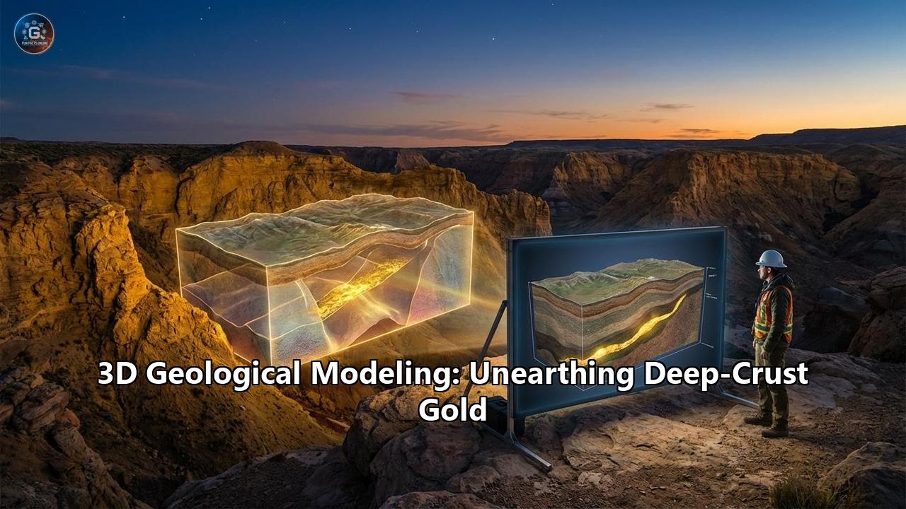
Unearthing deep-crust gold is not merely a matter of drilling deeper; it is a profound scientific challenge that requires us to understand the very architecture of the Earth’s lithosphere. To navigate this subterranean abyss, the modern geologist has traded the paper map and the compass for something vastly more powerful: advanced 3D geological modeling. Driven by exponential increases in computing power, the integration of deep-penetrating geophysics, and the dawn of artificial intelligence, 3D geological modeling has become the ultimate flashlight in the dark, illuminating the hidden plumbing systems of the planet and guiding the drill bit toward giant, undiscovered gold deposits.
This comprehensive exploration delves into the mechanics, the science, and the digital revolution of 3D geological modeling, exploring how it is single-handedly reshaping the hunt for deep-crust gold.
The Anatomy of Deep-Crust Gold: The Orogenic Juggernaut
To understand why 3D modeling is essential, one must first understand the elusive nature of the target. When we speak of "deep-crust gold," we are primarily referring to orogenic gold systems. These are among the most prolific and economically significant sources of gold on the planet, responsible for the vast wealth found in regions like the Yilgarn Craton in Australia, the Abitibi Greenstone Belt in Canada, and the Jiaodong Peninsula in China.
Orogenic gold deposits are birthed in the violent, slow-motion collisions of tectonic plates. During these accretionary events, oceanic crust is subducted, and continental landmasses are crushed together to form mountain ranges (orogenesis). Deep within the crust—often 5 to 15 kilometers below the paleosurface—extreme heat and pressure cause rocks to undergo metamorphism.
This metamorphic process acts as a massive dehydration engine. Water, trapped within the crystal lattices of minerals, is violently expelled. As these superheated, highly pressurized metamorphic fluids rise, they act as universal solvents, scavenging microscopic amounts of gold, sulfur, and silica from the surrounding crustal rocks.
However, gold does not simply pool in large subterranean caverns. The formation of a viable deep-crust gold deposit requires the perfect alignment of three critical elements, often referred to as the Mineral Systems Approach:
- The Source: A deep crustal or mantle-derived source of gold and fluids.
- The Pathway: Deep-reaching crustal-scale faults and shear zones that act as the primary plumbing system, funneling the auriferous (gold-bearing) fluids upward.
- The Trap: A structural or chemical anomaly where the fluids experience a sudden drop in pressure or a chemical reaction, causing the gold to precipitate out of solution and crystallize.
At deep-crustal levels (the mesozonal and hypozonal domains), these traps are highly complex. Fluids are often localized along strain gradients—zones where rocks transition from being heavily compressed to slightly stretched. The gold is typically deposited in second-order or third-order structures, such as dilational jogs (bends in a fault that pull open to create a cavity) or intersections between different shear zones.
Because these systems are geometrically complex, predicting where the fluid flowed and where the gold precipitated millions of years ago is a spatial puzzle of monumental proportions. Attempting to solve a complex, multi-dimensional, deep-crustal structural puzzle using flat 2D paper cross-sections is akin to trying to understand the architecture of a skyscraper by looking only at its shadow. This is the precise challenge that 3D geological modeling was invented to solve.
The Evolution of the Geologist’s Toolkit: From 2D Paper to 3D Cyberspace
For over a century, the standard practice for gold exploration was entirely two-dimensional. Geologists would collect data from surface mapping and drill holes, and then painstakingly draw cross-sections on paper. By laying these 2D cross-sections side-by-side, they would mentally interpolate the space between them to guess where an orebody might go.
This explicit, manual method had severe limitations. First, it was incredibly slow; updating a geological model after a new drilling campaign could take weeks or months of redrawing. Second, human bias was inescapable. The human brain, while powerful, struggles to accurately interpolate complex, twisted, and faulted 3D geometries. A shear zone that dips, bends, and faults at 3,000 meters depth simply cannot be accurately represented on a flat sheet of paper.
The advent of 3D computer modeling in the late 20th and early 21st centuries initiated a paradigm shift. Software platforms originally pioneered by the oil and gas industry (like Petrel and GOCAD) began to be adapted for hard-rock mining, leading to the development of specialized mining software such as Leapfrog Geo, Surpac, Micromine, and Datamine.
The true revolution, however, came with the transition from Explicit Modeling to Implicit Modeling.
In older explicit modeling, a geologist had to manually draw the boundaries of a rock unit or a gold vein on multiple 2D planes on a computer screen, and then manually link those drawings together to form a 3D wireframe. It was essentially digitizing the old paper method.
Implicit modeling, powered by advanced mathematical algorithms like Radial Basis Functions (RBFs), changed everything. In implicit modeling, the geologist does not draw the boundaries. Instead, they feed the raw data (e.g., thousands of drill hole coordinates containing rock types and gold assays) directly into the software. The algorithm then mathematically defines the 3D surfaces that best fit the data. It calculates a continuous volumetric function across the entire 3D space, instantly generating smooth, geologically realistic models of the orebody.
If a new drill hole is completed today, the data can be uploaded tonight, and the 3D implicit model will automatically dynamically update by tomorrow morning. This speed and mathematical objectivity are vital when exploring the deep crust, where every drill hole is immensely expensive, and decisions must be made rapidly.
Building the Subterranean Digital Twin: The Holy Trinity of Data
A 3D geological model is only as good as the data fed into it. To peer into the deep crust, modern geologists construct what is essentially a "Digital Twin" of the Earth's subsurface. This requires the integration of three primary data streams: Geological, Geochemical, and Geophysical.
1. Geological Data: The Ground Truth
The foundation of any 3D model is direct observation. At the surface, this includes structural mapping—measuring the dip and strike of rock foliation, mapping the kinematics of faults, and identifying lithological boundaries.
At depth, this data comes exclusively from diamond drill core. Diamond drilling pulls a solid cylinder of rock from the earth, sometimes from depths exceeding 3,000 meters. Geologists log every centimeter of this core, recording rock types, alteration minerals, fault gouges, and quartz vein densities. In the 3D model, this drill hole is represented as a 3D polyline snaking through cyberspace, color-coded by the logged data. Advanced downhole surveying tools, such as gyroscopes, are used to track the exact deviation of the drill hole, ensuring the spatial accuracy of the data down to the millimeter.
2. Geochemical Data: The Invisible Halos
Gold is rarely visible to the naked eye in deep-crust orogenic deposits. It is often locked inside sulfide minerals like pyrite or arsenopyrite. Therefore, chemical assays are a critical input.
Beyond just the gold grade (measured in grams per tonne), geologists input multi-element geochemical data into the 3D model. When high-pressure hydrothermal fluids travel through crustal faults, they alter the chemistry of the rocks they pass through, creating "alteration halos." By modeling elements like Arsenic, Antimony, Tungsten, or Potassium in 3D, geologists can visualize the ghostly footprint of the ancient fluid pathway, even if the gold itself has not yet been intersected. These geochemical models often resemble vast, 3D temperature maps, pointing like a neon arrow toward the center of the hydrothermal system.
3. Geophysical Data: The Deep-Penetrating Eyes
While drill holes provide exact "ground truth," they are essentially pinpricks in a vast underground volume. Drilling a deep hole is expensive, often costing hundreds of dollars per meter. To see the broader architecture of the deep crust between the drill holes, geologists rely on geophysics.
The integration of 3D geophysical inversions into geological modeling has been one of the most profound leaps forward in deep-crust exploration.
- 3D Seismic Reflection: Originally an oil and gas tool, hard-rock seismic is now used to map deep crustal structures. By sending acoustic waves deep into the earth and measuring their echoes, geologists can image massive crustal faults and the Moho (the boundary between the crust and the mantle). When this data is imported into a 3D model, it reveals the deep "roots" of the gold plumbing system.
- Magnetotellurics (MT): MT uses naturally occurring electromagnetic variations in the Earth's atmosphere to measure the electrical resistivity of the subsurface down to depths of tens of kilometers. Orogenic gold systems often leave behind deep, conductive pathways (due to sulfide deposition or graphite). In a 3D model, MT inversions appear as glowing 3D blobs of conductivity, highlighting the primary conduits where fluids rose from the mantle.
- Gravity and Magnetic Inversions: By measuring minute variations in the Earth's gravitational and magnetic fields, geophysicists can run complex algorithms to create 3D voxel models of rock density and magnetic susceptibility. When a 3D gravity inversion is overlaid with drill hole data, geologists can easily distinguish between lighter sedimentary basins and dense, deep-seated mafic intrusions that often act as structural buttresses, forcing fluids into favorable traps.
When these three datasets—geology, geochemistry, and geophysics—are integrated into a single 3D workspace, the digital twin comes to life. The geologist can virtually fly through the crust, rotate the model, strip away layers of rock, and view the intersection of a deep seismic fault with a geochemical alteration halo.
Structural Targeting in 3D: Finding the Plumbing Systems
The core utility of 3D modeling in deep-crust gold exploration is structural targeting. In orogenic systems, structure is everything. As the old mining adage goes, "Find the fault, find the gold."
However, deep-crustal faults are not straight lines. They are complex, undulating surfaces that branch, merge, and bend. When tectonic stress is applied to these bent surfaces, they behave dynamically.
Consider a crustal-scale shear zone that generally runs north-to-south. If the regional tectonic pressure pushes from the northwest, the straight sections of the fault will simply slide past one another. However, if the fault has a "bend" or a "step-over" in its geometry, that bend will either be compressed tight, or pulled apart.
If the geometry causes the rock to pull apart, it creates a zone of dilation—a sudden area of low pressure. In the highly pressurized deep crust, fluids will instantly rush into this low-pressure void. As the fluid enters the void, the sudden pressure drop causes the fluid to flash-boil, instantly precipitating its dissolved gold payload into massive quartz-gold veins.
Using 3D geological modeling, geologists can mathematically analyze the geometry of these faults. By mapping the exact strike, dip, and curvature of a fault surface in 3D, and then applying simulated tectonic stress vectors (a process known as 3D numerical kinematic modeling), the software can highlight the precise locations of these dilational jogs. The software literally paints the fault surface red in areas of maximum dilation, giving the exploration team a perfectly defined target to drill, even if that target is 2,000 meters below the surface.
This technique has proven incredibly successful. Studies of world-class orogenic deposits have shown that gold ore shoots are almost always located within 10 to 25-degree district-scale jogs in crustal faults, a geometry that is nearly impossible to quantify without 3D modeling.
Geostatistics and Resource Estimation: The Mathematical Gold
Finding the gold is only the first half of the battle. The second half is proving that there is enough of it, at a high enough grade, to justify sinking a multi-billion-dollar mine shaft. This introduces the realm of 3D geostatistics and block modeling.
Once the physical boundaries of the gold deposit are modeled (creating a 3D wireframe shell), the space inside that shell must be quantified. To do this, the 3D modeler fills the wireframe with millions of tiny, digital cubes, known as a Block Model. Each cube (for example, 5x5x5 meters in size) represents a volume of rock.
The challenge is that we only have drill hole data passing through a tiny fraction of these blocks. How do we estimate the gold grade of a block that is 20 meters away from the nearest drill hole?
The answer lies in advanced 3D spatial mathematics, primarily a technique called Kriging (named after South African mining engineer Danie Krige).
Kriging relies on a concept called variography. In 3D space, a variogram measures how the similarity of gold grades changes as the distance between data points increases. In most deep-crust deposits, gold is not distributed evenly; it forms distinct "shoots" that might be elongated vertically but narrow horizontally. The 3D variogram maps this anisotropy (directional bias).
Using the variogram parameters, the Kriging algorithm calculates a uniquely weighted average for every single block in the 3D model. It looks at all the surrounding drill hole data, considers the distance to each data point, and crucially, considers the direction of each data point relative to the known geological continuity.
The result is a fully estimated 3D block model where every cube contains a predicted gold grade, rock density, and metallurgical classification. This allows mining engineers to virtually design stopes, tunnels, and ventilation shafts with extreme precision, mitigating the immense financial risk associated with deep underground mining.
The Next Frontier: Machine Learning and AI in 3D Modeling
While implicit modeling and 3D geostatistics represent the current state-of-the-art, the industry is already accelerating into the next frontier: the integration of Artificial Intelligence (AI) and Machine Learning (ML).
The modern 3D geological model is a prime example of Big Data. A mature exploration project may possess millions of data points across geochemistry, geophysics, structural measurements, and hyperspectral core imaging. The human brain, even aided by 3D software, can only cross-reference a few of these variables simultaneously. Machine learning algorithms, however, can analyze hundreds of variables in 3D space to find hidden, non-linear patterns that lead to gold.
Predictive Mineral Prospectivity Mapping
Traditionally, prospectivity mapping involved a geologist manually assigning weights to different targeting criteria (e.g., "being within 500 meters of a fault is good, having high arsenic is good") and creating a heat map.
Today, Machine Learning transforms this process. Algorithms such as Random Forests, Support Vector Machines (SVM), and Artificial Neural Networks (ANN) are unleashed inside the 3D model. The algorithm is first "trained" on the known locations of gold within the model. It analyzes the specific multi-dimensional signature of that gold—its exact distance to fault intersections, its specific density signature from gravity inversions, the precise ratio of trace elements in the surrounding rock, and the structural curvature of the host rock.
Once the AI learns the complex, 3D "fingerprint" of the gold deposit, it scans the entirety of the unmapped deep crust within the model. It generates a 3D probability volume, essentially creating a subterranean treasure map where every voxel is assigned a probability score from 0 to 100% indicating the likelihood of discovering deep-crust gold.
Automated Core Logging and Real-Time Updating
AI is also revolutionizing data input. Machine learning vision systems now scan drill core as it comes out of the ground, automatically identifying mineralogy, fracture densities, and alteration styles using hyperspectral imaging. This data is beamed directly via cloud computing into the 3D model. As the drill bit spins 2,000 meters below the earth, the 3D model at headquarters dynamically morphs and updates in real-time, allowing geologists to alter the trajectory of the drill hole mid-flight based on AI-driven predictions.
Case Studies of Deep-Crust 3D Targeting
To truly appreciate the power of 3D modeling, we can look at its application in some of the most prolific deep-crust gold districts on Earth.
The Jiaodong Peninsula, China: The Sanshandao Supergiant
The Jiaodong Peninsula is China's most significant gold-producing region. Historically, mining was confined to the shallow parts of the major fault zones. However, as surface resources depleted, geologists turned to 3D modeling to look deeper.
By integrating deep drilling core data, high-precision geophysical methods, and 3D tectonic modeling, researchers realized that several deposits previously thought to be independent were actually connected at depth. Through meticulous 3D numerical modeling of fault kinematics, heat transport, and fluid flow, they identified massive dilational zones localized by fault strike-dip bends plunging deep beneath the Bohai Sea.
The result of this 3D predictive targeting was staggering: the delineation of the Sanshandao supergiant gold deposit. The model successfully tracked the major orebody for nearly 8 kilometers, pushing down to an incredible depth of 2,312 meters below sea level, proving a gold resource of over 1,200 tonnes. This discovery single-handedly validated the necessity of 3D deep-crust modeling, proving that monumental wealth still lies undiscovered at depth.
The Tanami Orogen and Yilgarn Craton, Australia
In the remote deserts of Western Australia, the Tanami Orogen and the Yilgarn Craton host massive Archean and Paleoproterozoic gold systems. Here, 3D modeling has been used on a craton-wide scale.
Geoscience Australia and various mining companies utilized massive datasets of seismic, magnetotelluric, and gravity data to build 3D architectural models of the entire crust, down to the Moho (over 30 km deep). By applying the Mineral Systems Approach in a 3D environment, they mapped the deep cratonic margins where the Earth's crust was thinnest, identifying the deep fluid pathways that tapped into the gold-rich metasomatized mantle.
This macro-level 3D modeling has driven a renaissance in Australian gold exploration, guiding blind drilling through hundreds of meters of barren desert sand to strike deep, high-grade gold mineralization that no surface prospector could ever have found.
Overcoming the Challenges of Deep Exploration
Despite the incredible advancements in 3D modeling, targeting deep-crust gold remains a formidable challenge.
The Resolution Gap:As we model deeper into the crust, our data resolution decreases. Surface mapping is highly detailed; deep seismic data is broad and fuzzy. 3D modeling software must handle the transition from high-resolution, data-dense zones (near drill holes) to low-resolution, data-poor zones (the deep crust). To combat this, modern modelers utilize probabilistic modeling. Instead of generating a single "definitive" 3D model, the software runs Monte Carlo simulations to generate fifty different possible 3D models, allowing geologists to visualize uncertainty. If a deep target appears in 45 out of 50 models, it is considered a low-risk drill target.
Navigational Drilling Constraints:Hitting a target 2,500 meters underground is like trying to thread a needle with a piece of cooked spaghetti from a three-story window. As the drill bit passes through different rock layers, it naturally deviates. 3D models must constantly incorporate real-time downhole survey data to track the drill bit's true path, and drillers must use expensive directional drilling technology (wedging and mud motors) to steer the bit back onto the 3D target.
Extreme Economics:Deep-crust drilling is astronomically expensive. A single deep hole can take months to drill and cost millions of dollars. The primary value of 3D modeling is not just finding gold; it is risk mitigation. By integrating geological, structural, and geophysical data, the 3D model ensures that capital is only deployed on targets with the highest mathematical probability of success. It prevents the costly error of drilling into a "shadow" or a barren fault.
The Future of Deep-Crust Gold Exploration
The evolution of 3D geological modeling is far from over. As we look toward the 2030s, the technology is evolving into new dimensions.
4D Modeling (The Dimension of Time):Geology is a four-dimensional science. The deep-crust faults we model today are the scarred remnants of tectonic events that occurred billions of years ago. The next generation of software is beginning to incorporate "4D forward and backward modeling." This allows geologists to virtually "un-deform" the 3D model, winding the clock back to the exact moment of gold mineralization to understand the paleo-stress and fluid dynamics, before fast-forwarding back to the present day to see where the gold ended up after millions of years of subsequent faulting and folding.
Immersive Technologies (VR and AR):The flat computer screen is becoming a bottleneck for true 3D comprehension. The integration of Virtual Reality (VR) and Augmented Reality (AR) allows exploration teams to physically step inside their 3D geological models. A structural geologist in Toronto, a geophysicist in Perth, and a mine manager in Johannesburg can all put on VR headsets, meet inside the digital twin of a deep-crust gold deposit, and collaboratively point out structural trends and plan drill holes in an immersive, shared holographic space.
Planetary-Scale Cloud Models:As data silos break down, we are moving toward continuous, cloud-hosted regional models. Instead of a single mine site having its own isolated 3D model, entire tectonic belts (like the entire Abitibi Subprovince) will be modeled in a single, seamlessly updated cloud environment, fed continuously by academic research, government geophysics, and private drilling data.
The Ultimate Underground Frontier
The days of stumbling upon a massive gold nugget in a creek bed are relics of history. The future of mineral wealth is guarded by the crushing pressure, extreme heat, and profound darkness of the deep crust.
However, humanity’s ingenuity has always risen to meet the barriers of nature. 3D geological modeling represents the apex of earth sciences, blending the messy, chaotic reality of rocks with the elegant precision of mathematics, algorithms, and artificial intelligence. By building digital twins of the subterranean world, integrating vast datasets of geophysics and geochemistry, and unleashing machine learning to map the invisible, we have illuminated the abyss.
The application of this technology in places like the Jiaodong Peninsula and the Yilgarn Craton proves that the Earth has not run out of gold; it has simply hidden it better. As long as the demand for this timeless metal endures, 3D geological modeling will continue to act as the vanguard of exploration, allowing us to surgically reach into the deep crust and unearth the hidden titans of the subterranean world.
Reference:
- https://www.researchgate.net/publication/323010192_Structural_geometry_of_orogenic_gold_deposits_Implications_for_exploration_of_world-class_and_giant_deposits
- https://api.research-repository.uwa.edu.au/ws/portalfiles/portal/285271543/THESIS_DOCTOR_OF_PHILOSOPHY_RASHIDIFARD_Mahtab_2023.pdf
- https://www.researchgate.net/publication/356856520_Geology_and_mineralization_of_the_Sanshandao_supergiant_gold_deposit_1200_t_in_the_Jiaodong_Peninsula_China_A_review
- https://www.researchgate.net/publication/250083936_3-D_Integrated_Geological_Modeling_in_the_Abitibi_Subprovince_Quebec_Canada_Techniques_and_Applications
- https://scispace.com/pdf/3d-geophysical-and-geological-modelling-for-understanding-4xa0f54xui.pdf
- https://www.youtube.com/watch?v=o9ooAtVKB2I
- https://www.geoexpro.com/wp-content/uploads/2022/11/GEO_ExPro_v13i6.pdf
- https://www.researchgate.net/publication/380738347_3D_Numerical_Modeling_for_Investigating_Structural_Controls_on_Orogenic_Gold_Mineralization_Sanshandao_Gold_Belt_Eastern_China
- https://www.mdpi.com/2075-163X/12/8/935
- https://www.researchgate.net/publication/353500834_Resource_prediction_and_assessment_based_on_3D4D_big_data_modeling_and_deep_integration_in_key_ore_districts_of_North_China
- https://www.researchgate.net/publication/395558581_Multi-scale_3D_modeling_by_machine_learning_and_numerical_simulation_for_potential_magma_conduit_in_the_Kalatongke_district_Xinjiang_China