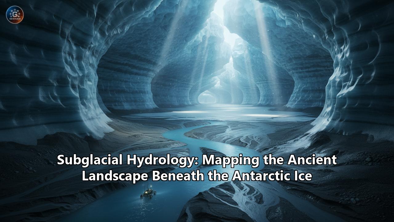
An immense and enigmatic continent, Antarctica lies veiled beneath a colossal ice sheet, a seemingly uniform expanse of white. Yet, beneath this frozen facade lies a hidden world, a complex and ancient landscape of mountains, valleys, and vast liquid water bodies that have been cut off from the sun and atmosphere for millions of years. This is the realm of subglacial hydrology, a field of science that is revolutionizing our understanding of Antarctica's past, present, and future. By mapping the intricate plumbing of this hidden world, scientists are not only uncovering the secrets of our planet's climate history but also exploring the potential for life in one of the most extreme environments on Earth.
The Genesis of an Icy Veil: A Continent Transformed
Before its descent into a deep freeze, Antarctica was a different world. As part of the supercontinent Gondwana, it enjoyed a temperate climate, with flowing rivers, lush forests, and a diverse array of life. This began to change around 34 million years ago as the continent drifted towards the South Pole. Ocean currents isolated Antarctica from warmer waters, triggering a climatic shift that led to the formation of its immense ice sheets. The very mountains that once channeled rivers became the nucleation points for glaciers that would eventually coalesce into the vast East and West Antarctic Ice Sheets.
This immense weight of ice, in some places over four kilometers thick, has profoundly shaped the continent. The tremendous pressure and slow, grinding movement of the ice should have eroded the underlying landscape into a flat, featureless plain. However, in a surprising twist of geophysics, the extreme cold in some regions of East Antarctica has caused the ice to move so slowly that it has inflicted minimal erosion, preserving the ancient landscape beneath in stunning detail.
A Glimpse Beneath the Ice: The Dawn of Subglacial Exploration
For much of human history, the land beneath the Antarctic ice was a complete mystery. The first hints of a world hidden below the ice emerged not from direct observation, but from the keen intellect of scientists and the unexpected behavior of their instruments.
The Theoretical Underpinnings
The concept of liquid water existing beneath thick ice sheets was first proposed by Russian geographer Andrey Kapitsa. He theorized that geothermal heat from the Earth's interior could warm the base of the ice to its melting point, which is lowered by the immense pressure of the overlying ice sheet. This idea was further developed by Russian glaciologist Igor A. Zotikov, who demonstrated the possibility of ice melting at its base.
Early Discoveries and the Birth of Radio-Echo Sounding
The first tangible evidence of a subglacial world came not from a deliberate search, but from a puzzling anomaly. In the 1950s, pilots flying over Antarctica reported that their radar altimeters, designed to measure the distance to the ground, were giving "useless" readings over the ice. This suggested that the radio waves were penetrating the ice, a phenomenon that sparked an investigation by U.S. Army researchers. In 1957, Amory Waite and his colleagues demonstrated that a radar altimeter could indeed measure the thickness of polar glaciers, a discovery that heralded one of the most significant technical advancements in glaciology: radio-echo sounding (RES).
Developed further in the 1960s, RES, also known as ice-penetrating radar, became a powerful tool for peering through kilometers of solid ice to visualize the hidden terrain below. The technique involves transmitting radio waves into the ice and recording the echoes that bounce back from different layers within the ice and, crucially, from the bedrock beneath. These echoes, displayed as a radargram, create a cross-sectional image of the ice sheet and the landscape it conceals.
The first discoveries of subglacial lakes were a direct result of this technology. In the late 1960s, unusually strong, sharp, and continuous reflections in RES data hinted at the presence of liquid water at the base of the ice. The first confirmed subglacial lake was discovered in 1969 beneath Sovetskaya Station in East Antarctica, where a flat subglacial surface was attributed to a "thick layer of water beneath the ice". This was followed by the discovery of several smaller lakes by Gordon Oswald and Robin in 1973, using airborne radar.
Unveiling the Hidden Plumbing: The Arsenal of Subglacial Cartography
The initial discoveries fueled a quest to map this hidden world in greater detail. Over the decades, scientists have developed and refined a suite of sophisticated techniques to penetrate the icy veil and chart the subglacial landscape and its intricate hydrological systems.
Radio-Echo Sounding (RES): The Workhorse of Subglacial Mapping
Radio-echo sounding remains a cornerstone of subglacial exploration. Airborne RES surveys, where radar systems are mounted on aircraft, have been instrumental in creating large-scale maps of the Antarctic bedrock. These surveys have revealed vast mountain ranges, deep canyons, and an extensive network of subglacial lakes and rivers. The principle is simple: the time it takes for the radio waves to travel to the bedrock and back reveals the ice thickness. The strength and character of the reflected signal can also provide information about the nature of the bed itself, with strong, flat reflections often indicating the presence of liquid water.
The evolution of RES technology has been remarkable. Early systems provided basic depth measurements, while modern systems can produce high-resolution, three-dimensional images of the subglacial environment. These advancements have been crucial for identifying potential drilling sites for direct sampling of subglacial lakes and for understanding the complex internal layering of the ice sheet, which holds a record of past climate and ice flow.
Seismic Surveys: Listening to the Earth's Echoes
Complementing RES, seismic surveys provide another powerful method for probing the subglacial environment. This technique involves generating sound waves, often with small explosive charges or specialized vibrating trucks, and recording the reflected and refracted waves with a series of sensors. The way these waves travel through different materials allows scientists to determine the properties of the ice, the thickness of water bodies, and the nature of the underlying rock and sediments.
Seismic reflection is particularly effective for mapping the depth and shape of subglacial lakes. Because sound waves travel through water at a different speed than through ice or rock, the travel times of the echoes can be used to create a detailed bathymetric map of the lake floor. Seismic refraction, which analyzes how sound waves bend as they pass through different layers, can provide information about the geological structure of the subglacial basins.
Satellite Altimetry: Measuring the Icy Pulse
A revolutionary tool in subglacial hydrology has been satellite altimetry. Satellites equipped with radar or laser altimeters, such as NASA's ICESat and ICESat-2, and ESA's CryoSat-2, can measure the height of the ice sheet surface with incredible precision. These measurements have revealed that the surface of the ice sheet is not static. Over time, it rises and falls by several meters in certain areas.
This subtle "breathing" of the ice sheet is a direct consequence of the filling and draining of subglacial lakes. As a lake fills with meltwater, the overlying ice is lifted, causing a slight bulge in the surface. When the lake drains, the surface subsides. By tracking these changes in surface elevation over time, scientists can identify and monitor "active" subglacial lakes, estimate the volume of water being exchanged, and map the pathways of subglacial water flow. Satellite altimetry has been instrumental in the discovery of hundreds of active subglacial lakes, revealing a far more dynamic hydrological system than previously imagined.
Gravity and Magnetic Surveys: Unveiling the Bedrock's Secrets
Airborne gravity and magnetic surveys provide further clues about the geology hidden beneath the ice. Gravity measurements can detect variations in the density of the underlying rock, helping to distinguish between different rock types and identify features like sedimentary basins. Magnetic surveys, on the other hand, map variations in the Earth's magnetic field caused by different types of rock, providing insights into the tectonic history of the continent. When combined with RES and seismic data, these geophysical methods offer a more complete picture of the subglacial landscape and its geological context.
A Lost World Revealed: Major Subglacial Features
The application of these advanced mapping technologies has unveiled a breathtakingly complex and ancient landscape hidden beneath the Antarctic ice.
The Gamburtsev Subglacial Mountains: A Ghostly Range
One of the most astonishing discoveries is the Gamburtsev Subglacial Mountains, a mountain range comparable in size to the European Alps, buried under kilometers of ice in the heart of East Antarctica. Discovered in 1958 by a Soviet expedition, their existence remained a geological puzzle for decades. The mountains exhibit sharp, jagged peaks and deep, V-shaped valleys, features more typical of much younger mountain ranges.
It is now understood that the Gamburtsevs are an ancient mountain range, formed by tectonic plate collisions hundreds of millions of years ago, and later rejuvenated. Their remarkable preservation is attributed to the fact that they were encased in ice before significant erosion could take place. The valleys of the Gamburtsevs are also home to a network of subglacial lakes and rivers. Scientists believe that the Gamburtsev range played a crucial role in the initial formation of the East Antarctic Ice Sheet, with glaciers first forming in its high valleys.
The Great Subglacial Basins: Wilkes and Aurora
In stark contrast to the towering Gamburtsev Mountains are the vast subglacial basins, massive depressions in the bedrock that lie below sea level. The largest of these is the Wilkes Subglacial Basin in East Antarctica, a feature approximately 1,400 kilometers long and 400 kilometers wide. Discovered during the 1959-1960 US Victoria Land Traverse, the origin of this massive basin is still a subject of scientific debate, with theories pointing to a combination of tectonic activity and glacial erosion.
The Wilkes Basin, along with the nearby Aurora Basin, is of particular concern to scientists studying ice sheet stability. Because their beds lie below sea level and slope inwards, they are potentially susceptible to a process known as marine ice sheet instability. If warming ocean waters were to melt the ice shelves that currently buttress the glaciers flowing into these basins, it could trigger a runaway retreat of the ice sheet, with significant consequences for global sea level.
The Hidden Water World: A Network of Subglacial Lakes and Rivers
Perhaps the most dynamic and intriguing aspect of the subglacial environment is its vast and interconnected hydrological system. To date, over 400 subglacial lakes have been identified beneath the Antarctic ice sheet, ranging in size from small ponds to vast bodies of water.
Lake Vostok: A Giant in Isolation
The largest and most famous of these is Lake Vostok, a colossal freshwater lake located deep beneath Russia's Vostok Station in East Antarctica. Roughly the size of Lake Ontario, Lake Vostok has been isolated from the Earth's atmosphere for at least 15 million years. Discovered in the 1970s through a combination of seismic soundings and radar data, it has been a primary target for scientific investigation. The lake water is kept liquid by geothermal heat and the immense pressure of the overlying ice, which lowers the freezing point. Its great age and isolation make it a unique natural laboratory for studying the potential for life in extreme environments and for accessing ancient climate records preserved in its sediments.
The "Active" Lakes of West Antarctica: A Dynamic Plumbing System
In contrast to the apparently stable and isolated nature of Lake Vostok, the subglacial lakes in West Antarctica have been found to be part of a highly dynamic and interconnected system. Satellite observations have revealed that many of these lakes, such as those in the Whillans Ice Stream region, regularly fill and drain, transferring vast quantities of water beneath the ice. This subglacial water acts as a lubricant, influencing the speed at which the overlying ice streams flow towards the ocean.
The Quest for Life in the Darkness: Subglacial Microbiology
The discovery of this vast, dark, and energy-limited world beneath the ice immediately raised a tantalizing question: could life exist in such an extreme environment? For decades, subglacial lakes were considered to be sterile. However, a series of groundbreaking discoveries has overturned this assumption, revealing a hidden biosphere that is rewriting the textbooks on the limits of life.
First Hints of Life
The first clues that subglacial environments might harbor life came from the analysis of ice cores drilled deep into the Antarctic ice sheet. In 1999, genetic material from microbes was found in the "accretion ice" at the bottom of the Vostok ice core – ice that is thought to have frozen from the waters of Lake Vostok itself. While the possibility of contamination from the drilling process could not be entirely ruled out, these findings provided the first tantalizing evidence of a subglacial ecosystem.
Drilling into the Hidden World: Lake Whillans and Mercer Subglacial Lake
To definitively answer the question of subglacial life, scientists needed to directly sample the water and sediments of these hidden lakes. This presented a formidable technological and environmental challenge. Drilling through kilometers of ice without contaminating the pristine environment below required years of planning and the development of specialized "clean-access" hot-water drills.
In January 2013, the Whillans Ice Stream Subglacial Access Research Drilling (WISSARD) project successfully drilled into Subglacial Lake Whillans, an "active" lake in West Antarctica. The water and sediment samples retrieved revealed a diverse microbial community, with thousands of different species of bacteria and archaea. These microbes, deprived of sunlight for photosynthesis, have adapted to survive by "eating" rocks, deriving energy from the chemical reactions of minerals in the water and sediments. They feed on nutrients like ammonium, iron, and sulfide compounds.
More recently, the Subglacial Antarctic Lakes Scientific Access (SALSA) project drilled into Mercer Subglacial Lake in 2018. The findings from Mercer were even more surprising, revealing not only a rich microbial ecosystem but also the remains of crustaceans and tardigrades (water bears), suggesting that the environment may have been connected to the ocean more recently than previously thought. The microbes in Mercer were found to be surviving on ancient carbon left behind by seawater thousands of years ago.
The Challenges of Sterile Sampling
The exploration of subglacial environments is governed by strict protocols to prevent the introduction of surface microbes and contaminants. The Scientific Committee on Antarctic Research (SCAR) has developed a Code of Conduct for the exploration of Subglacial Aquatic Environments (SAEs) to ensure that these unique ecosystems are protected. This includes the use of sterilized drilling equipment, the filtering of drill water, and careful pressure management to prevent the uncontrolled release of lake water. The failed attempt to drill into Lake Ellsworth in 2012, due to technical difficulties with linking boreholes, highlights the immense challenges of working in this extreme environment.
A Global Endeavor: International Collaboration and Future Directions
The exploration of Antarctica's subglacial world is a truly international effort. The immense logistical challenges and the scientific importance of this research have fostered a strong culture of collaboration among nations.
The Role of the Scientific Committee on Antarctic Research (SCAR)
SCAR, an interdisciplinary body of the International Science Council, plays a crucial role in coordinating international research in Antarctica. Through its scientific research programs, such as the Subglacial Antarctic Lake Environments (SALE) program, SCAR has been instrumental in bringing together scientists from around the world to share knowledge, plan expeditions, and develop the ethical and environmental guidelines for subglacial exploration.
Major International Projects
The history of subglacial exploration is marked by major international collaborations. The International Polar Year (2007-2009) saw a significant push in subglacial research, including the AGAP (Antarctica's Gamburtsev Province) project, a multinational effort to map the Gamburtsev Mountains. The successful drilling into Lake Whillans and Mercer Subglacial Lake were also the result of large, international teams of scientists and engineers.
The Future of Subglacial Exploration
The discoveries made so far have only scratched the surface of what lies beneath the Antarctic ice. Many fundamental questions remain. What is the full extent of the subglacial hydrological network? How does it influence ice sheet dynamics and contribute to sea-level rise? What is the diversity of life in these hidden ecosystems, and what are the unique adaptations that allow it to survive?
Future research will likely focus on:
- Continued Mapping: Expanding the mapping of the subglacial landscape using advanced radar and satellite technologies to create a more complete picture of the continent's hidden topography and hydrology.
- Direct Access and Sampling: Carefully planned drilling projects to access and sample a wider variety of subglacial environments, including the massive and ancient Lake Vostok and other isolated lakes in East Antarctica.
- Long-Term Monitoring: Deploying long-term observatories in subglacial environments to monitor changes in water pressure, temperature, and chemistry, providing crucial data for understanding the dynamics of the system.
- Astrobiological Significance: The study of life in Antarctica's subglacial lakes has profound implications for the search for life on other icy worlds in our solar system, such as Jupiter's moon Europa and Saturn's moon Enceladus, which are thought to harbor liquid water oceans beneath their icy shells.
The exploration of Antarctica's subglacial world is a journey into the unknown, a journey that is pushing the boundaries of scientific discovery and technological innovation. As we continue to peel back the layers of this frozen continent, we are not only uncovering a lost world and its secrets but also gaining a deeper understanding of our own planet and our place within the cosmos. The echoes from this hidden landscape are just beginning to be heard, and they promise to reveal a story of immense geological time, remarkable biological resilience, and a future that is inextricably linked to the fate of the ice.
Reference:
- https://www.mdpi.com/2073-4441/16/8/1111
- https://en.wikipedia.org/wiki/Gamburtsev_Mountain_Range
- https://scar.org/~documents/policy/antarctic-treaty/atcm-xxxiv-and-cep-xiv-2011/atcm34-ip033?layout=default
- https://en.wikipedia.org/wiki/Lake_Vostok
- https://scripps.ucsd.edu/news/what-lies-beneath-west-antarctica
- https://earthzine.org/a-brief-history-of-radio-echo-sounding-of-ice-2/
- https://www.livescience.com/microbes-life-subglacial-lakes.html
- https://www.antarcticglaciers.org/glaciers-and-climate/observing-and-monitoring-glaciers-and-ice-sheets/mapping-the-glacier-bed/
- https://www.lyellcollection.org/doi/full/10.1144/SP461.5
- https://en.wikipedia.org/wiki/Radioglaciology
- https://epic.awi.de/id/eprint/51360/1/five_decades_of_radioglaciology(1).pdf.pdf)
- https://blogs.egu.eu/divisions/cr/2024/12/16/uncovering-antarcticas-hidden-subglacial-lake-network-with-satellite-altimetry/
- https://svs.gsfc.nasa.gov/4913/
- https://ieeexplore.ieee.org/iel8/4609443/4609444/10661298.pdf
- https://sciencehub.esa.int/projects/using-satellite-altimetry-and-numerical-modelling-to-characterise-subglacial-hydrology-beneath-the-antarctic-ice-sheet/
- https://www.bas.ac.uk/data/our-data/publication/the-subglacial-geology-of-wilkes-land-east-antarctica/
- https://www.britannica.com/place/Gamburtsev-Mountains
- https://www.bas.ac.uk/media-post/antarctic-ghost-mountains-preserved-by-ice-sheet-2/
- https://www.iflscience.com/a-giant-mountain-range-has-been-hidden-under-antarcticas-ice-for-millions-of-years-79186
- https://www.researchgate.net/publication/272004709_Origins_of_Antarctica's_Wilkes_Subglacial_Basin
- https://en.wikipedia.org/wiki/Wilkes_Basin
- https://par.nsf.gov/biblio/10488349-wilkes-subglacial-basin-ice-sheet-dependence-geology-tectonics-widget
- https://www.smithsonianmag.com/science-nature/thousands-microbe-species-live-buried-antarctic-lake-180952415/
- https://www.ebsco.com/research-starters/environmental-sciences/lake-vostok
- https://pubmed.ncbi.nlm.nih.gov/10591642/
- https://science.howstuffworks.com/environmental/earth/geophysics/lake-vostok.htm
- https://www.fondriest.com/news/lake-whillans-like-wetland-fed-ice-melt.htm
- https://www.livescience.com/54756-lake-whillans-antarctica-secret-underworld.html
- https://www.dri.edu/hidden-life-beneath-antarctic-ice-microbial-diversity-and-survival-strategies-revealed/
- https://www.sciencenews.org/article/lake-antarctica-ice-microbes-carbon
- https://icedrill.org/library/scars-code-conduct-exploration-and-research-subglacial-aquatic-environments
- https://antarctic-logistics.com/project/sub-glacial-lake-ellsworth-project/
- https://en.wikipedia.org/wiki/Lake_Ellsworth_(Antarctica))
- https://scar.org/
- https://scar.org/~documents/policy/antarctic-treaty/atcm-xxvii-and-cep-vii-2004/atcm27-ip100?layout=default