Synthetic Aperture Radar: Mapping Earth's Pulse from Orbit
In the vast theater of space, hundreds of miles above our heads, a fleet of sophisticated satellites silently choreographs a complex dance. They are not watching us in the conventional sense, with lenses and mirrors like the optical satellites we are most familiar with. Instead, they are actively reaching out, piercing through clouds, darkness, and smoke to feel the very pulse of our planet. This is the world of Synthetic Aperture Radar (SAR), a revolutionary technology that has fundamentally transformed our ability to observe and understand the intricate workings of Earth.
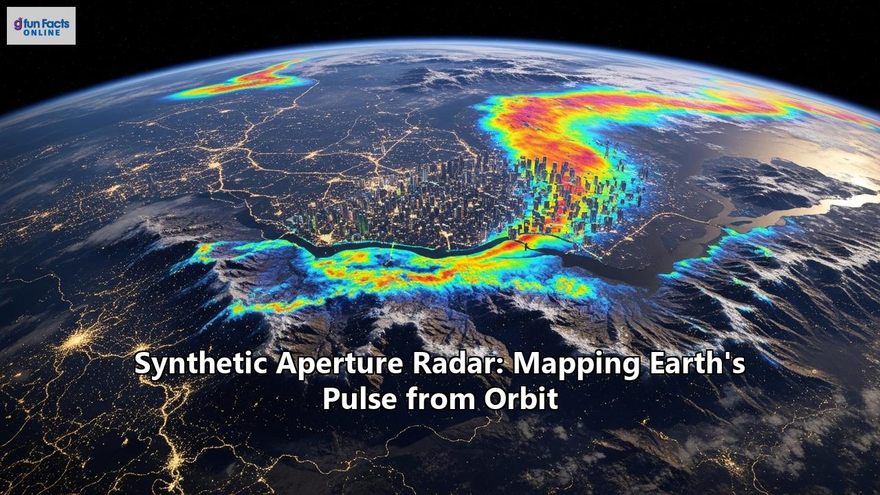
From the subtle rise and fall of a city breathing to the catastrophic lurch of an earthquake, SAR provides an unparalleled, all-weather, day-and-night capability to map and monitor our world. It is a technology born from military necessity that has blossomed into one of the most versatile tools in the arsenal of Earth scientists, disaster responders, and environmental guardians. This is the story of how human ingenuity synthesized an antenna in the sky, unlocking a new dimension of sight and a deeper connection to our dynamic planet.
The Genesis of a Revolutionary Idea: A History of SAR
The story of Synthetic Aperture Radar begins not in the sterile cleanrooms of a space agency, but in the fertile mind of a mathematician during the height of the Cold War. In June 1951, Carl A. Wiley, then working at the Goodyear Aircraft Company, conceived of a way to overcome a fundamental limitation of radar technology. The U.S. military was seeking an aerial reconnaissance tool that could operate 24 hours a day and see through cloud cover, a clear advantage over traditional optical surveillance. Radar, with its ability to penetrate atmospheric obscurity, was the logical choice.
However, there was a significant hurdle. To achieve a high level of detail, or spatial resolution, a radar system required a very large antenna. For an aircraft, and certainly for a future satellite, carrying a physically massive antenna was simply impractical. Wiley’s groundbreaking insight was to use the motion of the radar platform—be it an aircraft or a satellite—to synthesize a much larger antenna than the one it was physically carrying. By transmitting pulses and recording the echoes as the platform moved, a series of snapshots could be computationally combined to create a single, high-resolution image, as if it were taken by a much larger, "synthetic" aperture.
This concept, initially known as "Doppler Unbeamed Search Radar" (DOUSER), was validated with a prototype system in 1952. Independently, researchers at the University of Illinois were exploring similar ideas, recognizing their potential for "greatly improved angular resolution." The subsequent development of SAR was heavily fueled by military investment, with programs like Project Michigan at the University of Michigan playing a crucial role in refining the technology. The first operational SAR system was tested by the U.S. Air Force in the late 1950s, and the technology proved its worth in military reconnaissance.
While the early development of SAR was shrouded in military secrecy, its potential for scientific exploration was undeniable. The launch of NASA's Seasat satellite in 1978 marked a pivotal moment, as it was the first satellite equipped with a SAR instrument for civilian Earth observation. Though its mission was cut short by a power failure, Seasat demonstrated the immense value of SAR for monitoring oceans, ice, and landforms, paving the way for a new era of space-based remote sensing. Subsequent missions, such as the Spaceborne Imaging Radar (SIR) series flown on the Space Shuttle in the 1980s and 1990s, further solidified SAR's role as an indispensable tool for understanding our planet.
How it Works: The Magic of a Virtual Antenna
At its core, Synthetic Aperture Radar is an active remote sensing technology. Unlike passive optical sensors that rely on the sun's illumination, SAR systems provide their own, transmitting pulses of microwave energy towards the Earth's surface and recording the backscattered signals. This inherent advantage allows SAR to operate day or night and, crucially, to "see" through clouds, rain, fog, and smoke, as these are largely transparent to the microwave frequencies used.
The "synthetic aperture" is the ingenious solution to the resolution problem. For a traditional "real aperture" radar, the resolution in the direction of flight (the azimuth direction) is determined by the width of the radar beam, which is in turn dictated by the size of the antenna—a larger antenna produces a narrower beam and thus better resolution. To achieve a resolution of a few meters from orbit would require an impractically large antenna, several kilometers long.
SAR circumvents this by using the motion of the satellite to its advantage. As the satellite orbits the Earth, it continuously sends out pulses and receives their echoes from a specific area on the ground. A single point on the surface is therefore "seen" by the radar from multiple positions as the satellite flies past. Each of these returning echoes is recorded, capturing not just its intensity but also its phase—the precise alignment of the electromagnetic wave.
The key to creating the synthetic aperture lies in the Doppler effect. As the satellite approaches a point on the ground, the frequency of the returning radar waves is slightly shifted higher; as it moves away, the frequency is shifted lower. This Doppler shift changes in a predictable way as the satellite passes over the target. By meticulously processing the phase and Doppler information from all the recorded echoes from a particular point, a computer can effectively reconstruct the signal as if it were collected by a single, very long antenna. The length of this "synthetic" antenna is the distance the satellite travels while the target is illuminated by the radar beam. This allows a satellite with a physical antenna of just a few meters to achieve the resolving power of an antenna hundreds or even thousands of meters long.
The resolution in the other direction, perpendicular to the flight path (the range direction), is determined by the timing of the returning pulses. By measuring the time it takes for a pulse to travel to the ground and back, the radar can precisely determine the distance to different objects within the beam's footprint.
The Language of Radar: Interpreting SAR Images
At first glance, a SAR image can be disorienting. It is not a photograph but a monochrome depiction of the Earth's surface as seen through the "eyes" of microwave energy. The brightness of each pixel in a SAR image corresponds to the intensity of the radar signal scattered back to the sensor from that particular spot on the ground. This "backscatter" is governed by several factors:
- Surface Roughness: Smooth surfaces, like calm water or paved runways, act like mirrors to the radar signal, reflecting the energy away from the satellite. These areas consequently appear dark in a SAR image. Conversely, rough surfaces, such as forests or choppy water, scatter the radar energy in many directions, with a portion of it returning to the sensor. These areas appear bright.
- Geometric Effects: The side-looking geometry of SAR systems can introduce distortions. Slopes facing the radar will appear bright as they reflect a strong signal back to the satellite, while slopes facing away will be in "radar shadow" and appear dark. This effect can be used to generate detailed topographic maps.
- Dielectric Properties: The electrical properties of a material, particularly its moisture content, significantly influence how it interacts with radar waves. Wet soil, for instance, will appear different from dry soil, and this property is exploited in applications like agricultural monitoring and flood mapping.
One of the most characteristic features in urban or built-up areas is "double-bounce" scattering. When a radar pulse hits a vertical surface, like the wall of a building, it can bounce off and then reflect off the horizontal ground before returning to the satellite. This double reflection concentrates the energy, causing buildings and other man-made structures to appear as very bright points in the image. This is particularly useful in applications like disaster assessment, where identifying intact structures or the debris from collapsed ones is critical.
A Spectrum of Vision: SAR Frequencies
SAR systems operate at different microwave frequencies, typically referred to by letters such as X, C, and L-band. The choice of frequency is not arbitrary; it determines the radar's wavelength and, consequently, how the signal interacts with the surface and what it can "see."
- X-band (approx. 3 cm wavelength): With its shorter wavelength, X-band SAR is highly sensitive to surface roughness and is capable of producing very high-resolution images. It is excellent for detailed mapping, identifying small objects like vehicles, and monitoring subtle surface textures. However, its shorter waves are less able to penetrate dense vegetation canopies.
- C-band (approx. 6 cm wavelength): C-band offers a compromise between the high-resolution detail of X-band and the penetration capabilities of L-band. It is widely used for a variety of applications, including maritime surveillance, sea ice monitoring, and tracking land surface changes. The Sentinel-1 mission of the European Space Agency is a prominent example of a C-band system.
- L-band (approx. 24 cm wavelength): The longer wavelength of L-band SAR allows it to penetrate deeper into vegetation canopies, making it invaluable for forest monitoring, biomass estimation, and assessing soil moisture. The upcoming NASA-ISRO Synthetic Aperture Radar (NISAR) mission will utilize L-band (along with S-band) to systematically map Earth's changing ecosystems and land surface.
The Power of the Pair: Interferometric SAR (InSAR)
One of the most powerful techniques to emerge from SAR technology is interferometry, or InSAR. This method uses two or more SAR images of the same area, taken from slightly different positions, to detect subtle changes in the Earth's surface. By comparing the phase of the radar waves from the two images, scientists can measure tiny movements of the ground, often with centimeter- or even millimeter-scale precision.
This has opened up a vast array of applications:
- Mapping Earthquakes and Volcanoes: InSAR can create detailed maps of ground deformation caused by an earthquake, revealing the exact location and extent of the fault rupture. It can also detect the subtle swelling of a volcano as magma accumulates beneath the surface, providing a crucial early warning of a potential eruption.
- Monitoring Infrastructure: The gradual sinking of cities (subsidence) due to groundwater extraction or the imperceptible sag of a bridge can be tracked with InSAR, allowing for proactive maintenance and risk assessment.
- Glacier and Ice Sheet Dynamics: The flow of glaciers and the melting of ice sheets are key indicators of climate change. InSAR provides a comprehensive view of these movements, helping scientists to understand the processes driving sea-level rise.
The Space Shuttle Radar Topography Mission (SRTM) in 2000 used InSAR to produce the first near-global, high-resolution digital elevation model of the Earth, a dataset that remains a fundamental resource for countless scientific and commercial applications.
A World of Applications: SAR in Action
The ability of SAR to provide reliable, high-resolution imagery, regardless of weather or time of day, has made it an indispensable tool across a wide range of fields.
- Disaster Management: When natural disasters strike, rapid and accurate information is paramount. SAR can peer through the smoke of wildfires to map their extent, penetrate the clouds of a hurricane to delineate the boundaries of flooding, and assess the damage to buildings after an earthquake. In search and rescue missions, the unique signature of man-made objects can help locate crash sites in remote and obscured areas.
- Environmental Monitoring: SAR is at the forefront of monitoring our planet's health. It provides consistent data on deforestation, tracking illegal logging in remote rainforests. It is used to monitor oil spills, as the oil smooths the sea surface and creates a dark patch in SAR imagery. It also helps in studying soil moisture levels, the health of vegetation, and the impacts of climate change on ecosystems.
- Agriculture and Food Security: By monitoring soil moisture, farmers can optimize irrigation and improve crop yields. SAR can also be used to classify different crop types and monitor their growth throughout the season, providing valuable information for agricultural management and forecasting.
- Defense and Security: The all-weather, day-night capabilities of SAR make it a powerful asset for military reconnaissance, surveillance, and target detection. It can be used for border surveillance, monitoring maritime activity, and identifying hidden infrastructure.
- Oceanography and Maritime Surveillance: SAR is used to monitor ocean currents, measure wave heights, and track sea ice. It is also a vital tool for maritime domain awareness, capable of detecting ships at sea to help combat illegal fishing and smuggling.
- Urban Planning and Infrastructure: The detailed images from SAR help urban planners track land use changes and monitor the health of infrastructure like roads, bridges, and dams. Techniques like InSAR provide early warnings of potential vulnerabilities, contributing to the development of more resilient cities.
The Future is Bright and Active
The field of Synthetic Aperture Radar is more dynamic than ever. Once the exclusive domain of government space agencies and the military, the technology has become more accessible. A new generation of commercial companies is launching constellations of smaller, more agile SAR satellites, dramatically increasing the frequency of observations and driving down the cost of data. This "New Space" revolution is democratizing access to SAR imagery, empowering a wider range of users in business, research, and humanitarian aid.
Upcoming missions like the NASA-ISRO Synthetic Aperture Radar (NISAR) promise to usher in a new era of Earth observation. NISAR will systematically scan nearly all of Earth's land and ice surfaces every 12 days, using two different radar frequencies to create an unprecedented record of our planet's changes. From the slow creep of tectonic plates to the seasonal rhythms of agriculture and the rapid devastation of natural disasters, NISAR will provide a time-lapse view of Earth's pulse.
Synthetic Aperture Radar is more than just a clever application of physics and engineering. It is a testament to our enduring curiosity and our quest to understand the world around us. From its origins as a tool of Cold War espionage to its current role as a guardian of our global environment, SAR has consistently expanded our vision. It has given us the ability to look beyond what is visible to the naked eye, to peer through the veil of clouds and darkness, and to measure the subtle yet profound rhythms of our living planet. As the silent dance of these remarkable satellites continues in orbit, they are not just mapping the surface of the Earth; they are charting its very heartbeat, providing us with the knowledge we need to navigate the challenges and opportunities of the future.
Reference:
- https://en.wikipedia.org/wiki/History_of_synthetic-aperture_radar
- https://www.geofem.com/post/who-invented-synthetic-aperture-radar-sar
- https://ethw.org/Synthetic_Aperture_Radar
- https://ursaspace.com/blog/the-origins-of-sar/
- https://www.iceye.com/blog/beginners-guide-to-synthetic-aperture-radar-sar-technology
- https://scispace.com/papers/introduction-to-synthetic-aperture-radar-sar-23diybvbk2
- https://www.researchgate.net/publication/241233447_History_of_SAR_at_Lockheed_Martin_previously_Goodyear_Aerospace
- https://www.youtube.com/watch?v=6Fp3eHE-keQ
- https://gisgeography.com/synthetic-aperture-radar-examples/
- https://www.capellaspace.com/blog/sar-101-an-introduction-to-synthetic-aperture-radar
- https://descanso.jpl.nasa.gov/SciTechBook/series2/02Chap1_110106_amf.pdf
- https://science.nasa.gov/mission/nisar/get-to-know-sar/
- https://en.wikipedia.org/wiki/Synthetic-aperture_radar
- https://dragonflyaerospace.com/seven-applications-of-sar/
- https://www.capellaspace.com/blog/innovative-applications-of-synthetic-aperture-radar-technology
- https://www.nv5geospatialsoftware.com/Company/Events/Webinar/Webinar-Detail/the-applications-and-benefits-of-synthetic-aperture-radar-sar-1