Atmospheric Hydrology: The Science Behind "Megaflash" Lightning and Shifting Rain
Our planet's weather is a symphony of immense power and intricate subtlety, a constant dance of energy and water. Within this grand performance, two phenomena are drawing increasing attention from scientists and the public alike: the breathtaking spectacle of "megaflash" lightning, bolts that stretch for hundreds of miles across the sky, and the deeply consequential shifts in global rainfall patterns that can bring devastating floods or crippling droughts. These are not isolated curiosities. They are deeply intertwined, both rooted in the profound principles of atmospheric hydrology—the study of water in the atmosphere—and both are potent indicators of our planet's changing climate.
To comprehend these dramatic events, we must journey into the heart of storms, explore the invisible rivers of moisture in the sky, and uncover the complex feedback loops that connect a single drop of water to the global climate system. This article will delve into the science behind these electrifying displays and life-altering precipitation changes, revealing a story of a planet in flux and the powerful forces that shape our world.
The Dazzling Fury of Megaflash Lightning: A New Frontier in Atmospheric Science
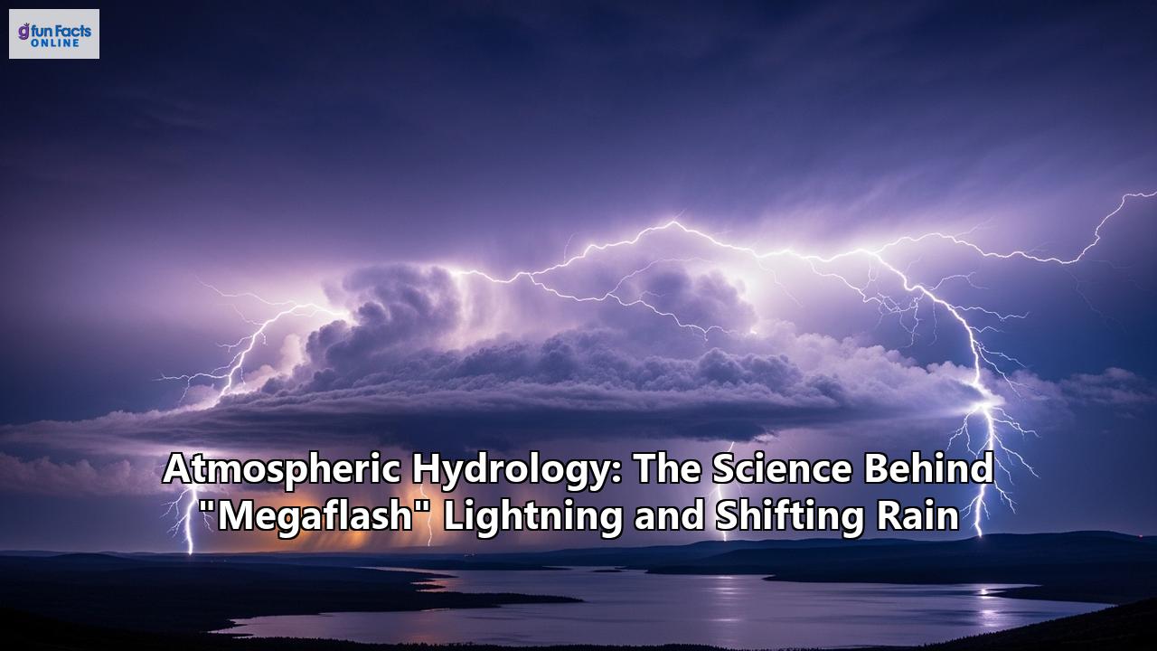
For most of human history, our understanding of lightning was limited to what we could observe from the ground: the brilliant, fleeting flashes that dart from cloud to ground or between clouds. But with the advent of advanced satellite technology, we have entered a new era of discovery, one that has revealed a class of lightning so immense it defies previous conceptions. This is the realm of the megaflash.
A megaflash is formally defined as a horizontal lightning discharge that spans a distance of 100 kilometers (about 62 miles) or more. These are not your typical lightning bolts. While an average flash might travel less than 10 miles, megaflashes are in a league of their own. In recent years, the World Meteorological Organization (WMO) has certified some truly staggering records that underscore the sheer scale of these events.
One such event, which occurred on October 22, 2017, stretched an incredible 829 kilometers (515 miles) from eastern Texas to near Kansas City, Missouri. To put this in perspective, this single flash of lightning covered a distance that would take a commercial jet about 90 minutes to traverse. This record was only confirmed years later, a testament to the power of re-analyzing vast datasets from geostationary satellites. These satellites, such as the National Oceanic and Atmospheric Administration's (NOAA) GOES series, are equipped with Geostationary Lightning Mappers (GLM) that can continuously monitor entire continents for lightning activity, documenting the precise start time, duration, and extent of each flash to the millisecond. This technology represents a monumental leap from the older ground-based antenna networks, which were limited in their ability to detect the full horizontal expanse of these massive discharges.
Another record-breaking megaflash, this one for duration, was recorded over Uruguay and northern Argentina on June 18, 2020, lasting for a remarkable 17.1 seconds. These discoveries have not only shattered previous records but have also opened up new avenues of research into the extreme capabilities of thunderstorms.
The Engines of Megaflashes: Mesoscale Convective Systems
Megaflashes do not arise from ordinary, isolated thunderstorms. They are the progeny of something far larger and more organized: Mesoscale Convective Systems (MCSs). An MCS is a sprawling complex of thunderstorms that becomes organized on a scale much larger than individual storms, often persisting for several hours or even more than a day. These behemoth systems can cover an area the size of a state like New Jersey and are responsible for a significant portion of the rainfall in many regions, particularly in the tropics and mid-latitudes.
The hotspots for the formation of these megaflash-producing MCSs are few, with the Great Plains of North America and the La Plata Basin in South America being two of the most prominent. These regions provide the perfect cocktail of atmospheric ingredients for these massive storms to thrive.
The formation of a megaflash is contingent on the unique electrical structure of an MCS. A typical thunderstorm has a vertical dipole structure, with a main positive charge region in the upper part of the cloud and a negative charge region in the middle. However, MCSs develop extensive, horizontally layered charge regions, particularly in their trailing stratiform areas—the widespread, less intense precipitation zones that follow the main convective line. These vast layers of separated positive and negative charge can act as a massive, natural battery.
The unique structure of these storms, particularly a robust trailing stratiform region with deep reservoirs of electrical charge, is critical for enabling such a massive discharge. A megaflash typically initiates at a high altitude within the main convective line and then propagates horizontally for hundreds of miles through these stratified charge layers, sometimes branching down to the ground multiple times along its path. The record-breaking 2017 megaflash, for instance, produced over 100 cloud-to-ground strikes along its 515-mile journey. The ability of these flashes to travel such extreme distances highlights the immense and continuous charge separation occurring within the parent storm system.
The study of these megaflashes is more than just a pursuit of meteorological records. Researchers believe that understanding the conditions that produce megaflashes can serve as a diagnostic tool for comprehending the behavior and potential severity of massive storm systems. The occurrence of a megaflash is a clear indicator of a highly organized and electrically active storm, which often carries other threats such as torrential rain, large hail, and strong winds.
The Global Pulse of Water: Understanding Shifting Rain Patterns
While megaflashes are a dramatic and visible manifestation of powerful atmospheric processes, the more subtle and long-term shifts in rainfall patterns are having a far more profound and widespread impact on human societies and natural ecosystems. These changes are a core focus of atmospheric hydrology and are driven by a complex interplay of factors, with climate change emerging as the dominant force.
Recent research has provided clear evidence that rainfall patterns are becoming more volatile globally. A landmark study published in the journal Science revealed that human-induced warming has increased rainfall variability over 75% of the Earth's land area in the past century, with day-to-day rainfall variability increasing by 1.2% per decade. This increased variability means that rain is distributed more unevenly over time, leading to longer dry spells punctuated by more intense downpours—a pattern that can lead to a rapid succession of droughts and floods.
The Primary Drivers of Shifting Precipitation
1. Climate Change and a Warmer, Wetter Atmosphere:The fundamental physics of a warming planet dictates that the atmosphere can hold more moisture. For every 1°C increase in temperature, the atmosphere's capacity to hold water vapor increases by about 7%. This supercharged atmosphere is a key ingredient for more extreme precipitation events. Warmer oceans lead to higher rates of evaporation, loading the air with more water. When storm systems develop, they have access to this larger reservoir of moisture, resulting in heavier rainfall and snowstorms.
Projections from climate models indicate that as the planet continues to warm, this intensification of the water cycle will continue, leading to increased precipitation in some regions, particularly at high latitudes, while subtropical areas are expected to become drier. The northern United States, for instance, is projected to become wetter, while the South, especially the Southwest, is expected to face increasing aridity.
2. Altered Atmospheric Circulation:The Earth's atmosphere has vast, intricate circulation patterns that are influenced by temperature, pressure, and the planet's rotation. Climate change is disrupting these patterns, which in turn affects where and when precipitation falls.
One of the most significant of these patterns is the El Niño-Southern Oscillation (ENSO), a natural cycle of warming and cooling in the tropical Pacific Ocean. The two opposite phases, El Niño (a warming of the ocean surface) and La Niña (a cooling of the ocean surface), can dramatically alter global weather. El Niño events, for example, can shift rainfall patterns, bringing drought to regions like Indonesia and northern Brazil while causing heavier rainfall in the central Pacific, Central America, and parts of South America. As global temperatures rise, there is ongoing research into how the frequency and intensity of ENSO events themselves may change, further complicating future precipitation predictions.
Another critical feature of atmospheric circulation is the phenomenon of "atmospheric rivers." These are long, narrow corridors of concentrated water vapor that transport vast amounts of moisture from the tropics to the mid-latitudes, much like rivers in the sky. A single atmospheric river can carry a volume of water vapor equivalent to the flow of the Mississippi River. When these moisture-laden systems make landfall, they can produce extreme rainfall and snowfall, leading to flooding and landslides. Climate change is expected to make atmospheric rivers more intense, as warmer air will allow them to carry even more moisture. The succession of powerful atmospheric rivers that hit California in the winter of 2022-2023, causing widespread flooding, is a stark example of the power of these systems.
3. The Complex Role of Aerosols:Aerosols are tiny solid or liquid particles suspended in the atmosphere. They can be of natural origin (like dust or sea salt) or anthropogenic (from the burning of fossil fuels and biomass). These microscopic particles play a surprisingly complex and significant role in shaping weather and climate, particularly in influencing cloud formation and precipitation.
Aerosols serve as the nuclei around which water vapor condenses to form cloud droplets, known as cloud condensation nuclei (CCN). The concentration and type of aerosols can dramatically alter the properties of clouds and their ability to produce rain.
In some cases, an increase in aerosols, particularly from pollution, can lead to clouds with a greater number of smaller droplets. These smaller droplets are less likely to collide and merge to form raindrops, which can suppress precipitation and prolong the life of the cloud. This is known as the "aerosol indirect effect."
However, the story is not that simple. Under certain conditions, aerosols can actually invigorate storms. The addition of aerosols can lead to the formation of taller, more robust convective clouds that are more likely to produce lightning and heavy downpours. The type of aerosol also matters. Dark, absorbing aerosols like black carbon (soot) can warm the surrounding air, causing cloud droplets to evaporate and suppressing precipitation in what is known as the "semi-direct effect."
The dual role of aerosols in both suppressing and enhancing rainfall makes them one of the largest sources of uncertainty in climate projections. However, there is growing consensus that human-produced aerosols have been a dominant factor in causing large-scale shifts in tropical rainfall patterns during the latter half of the 20th century.
4. Land-Use Change:The way we use land can have a profound impact on local and regional weather patterns. Urbanization and deforestation are two of the most significant ways humans are altering the landscape, and both have consequences for rainfall.
The replacement of natural vegetation with impervious surfaces like concrete and asphalt in cities creates what is known as the "urban heat island" effect, where urban areas are significantly warmer than their rural surroundings. This localized heating can enhance atmospheric instability and trigger or intensify convective storms and rainfall over and downwind of cities.
Deforestation, on the other hand, can lead to decreased rainfall. Trees play a vital role in returning water to the atmosphere through a process called evapotranspiration. When forests are cleared, this crucial part of the water cycle is diminished, which can lead to reduced regional precipitation.
The Intersection: How Megaflashes and Shifting Rain are Connected
Megaflash lightning and shifting rain patterns are not just two parallel stories of a changing atmosphere; they are deeply interconnected, primarily through the powerful storm systems that give birth to them. The key to understanding their relationship lies in the Mesoscale Convective Systems (MCSs) and the broader climatic forces that are making these systems more frequent and intense.
The same MCSs that produce the vast, horizontally extensive charge structures necessary for megaflashes are also responsible for a huge proportion of regional precipitation. In many tropical and mid-latitude regions, MCSs can account for over 50% of the total rainfall. Therefore, any change in the frequency, intensity, or characteristics of MCSs will have a direct and significant impact on rainfall patterns.
Climate model projections suggest that a warming world will see an increase in the frequency and intensity of the most extreme MCSs. A warmer atmosphere, supercharged with moisture and instability (measured as Convective Available Potential Energy, or CAPE), provides more fuel for these storms. Studies predict that in a warmer climate, MCSs will become larger, last longer, and produce more intense precipitation, particularly in their convective cores. This intensification is driven by the combined effect of increased atmospheric moisture and greater instability.
This leads to a direct, though perhaps not causal in the strictest sense, link between megaflashes and shifting rain:
- Common Origin: Both phenomena are products of the same highly organized, moisture-rich, and electrically active storm systems (MCSs). The conditions that favor the development of the vast electrical architecture needed for megaflashes are also the conditions that support extreme rainfall.
- A Symptom of a More Intense Hydrological Cycle: An increase in the frequency of megaflashes can be seen as a symptom of a more energetic and intensified hydrological cycle. Research has shown a strong correlation between lightning flash rates, CAPE, and precipitation rates. As global warming drives up both CAPE and atmospheric moisture, it is expected to lead to an increase in both lightning activity and extreme precipitation events. Some models predict that lightning strikes in the United States could increase by about 50% over this century due to warming.
- The Role of Aerosols as a Common Influencer: As discussed, aerosols have a complex influence on both cloud electrification and precipitation. By altering the microphysics of clouds, aerosols can affect the size and number of both liquid droplets and ice particles. This not only influences precipitation efficiency but also the charge separation processes that lead to lightning. Studies have shown that increased aerosol concentrations can, up to a certain point, lead to more vigorous updrafts, more ice-phase particles, and consequently, enhanced storm electrification and lightning. This provides a physical mechanism through which pollution can simultaneously impact both the electrical output and the rainfall characteristics of a storm.
- Feedback Loops in the Global Electric Circuit: The global atmospheric electric circuit, maintained by thunderstorms worldwide, creates a downward current in fair-weather regions. There is emerging evidence that this electrical current can, in turn, influence cloud microphysics by affecting how aerosol particles are scavenged by cloud droplets. This suggests a complex feedback loop where the increased thunderstorm activity associated with a warming climate could have far-reaching effects on cloud properties and precipitation even in areas far from the storms themselves.
Conclusion: A More Energetic and Extreme Future
The science of atmospheric hydrology reveals a world where the tiniest water droplet and the most immense lightning flash are part of a single, interconnected system. Megaflash lightning and shifting rainfall patterns are not just isolated weather events; they are powerful signals of a fundamental change in the Earth's climate system. They tell a story of an atmosphere that is becoming warmer, wetter, and more energetic, leading to weather that is increasingly extreme and unpredictable.
The awe-inspiring power of a 500-mile lightning bolt is a dramatic reminder of the immense forces at play in our atmosphere. The subtle, yet relentless, shifts in where and how rain falls are a more insidious threat, with the potential to reshape economies, displace populations, and alter ecosystems on a global scale.
Understanding the deep connections between these phenomena is more than an academic exercise. It is essential for building a more resilient future. By improving our understanding of the atmospheric processes that drive these extremes, we can enhance our ability to forecast them, mitigate their impacts, and adapt to the new realities of a changing climate. The electrifying dance of megaflashes and the shifting cadence of global rain are a call to action, urging us to listen to the messages being written in the sky and on the land by the powerful forces of atmospheric hydrology.
Reference:
- https://romps.berkeley.edu/papers/pubdata/2014/lightning/14lightning.pdf
- https://www.researchgate.net/publication/343603774_Extreme_weather_and_climate_events_in_northern_areas_A_review
- https://earthobservatory.nasa.gov/features/Aerosols/page4.php
- https://ignited.in/index.php/jast/article/view/2101/4023
- https://www.researchgate.net/publication/228627667_The_global_atmospheric_electric_circuit_and_its_effect_on_cloud_microphysics
- https://www.bas.ac.uk/data/our-data/publication/solar-wind-atmospheric-electricity-cloud-microphysics-connections-to-weather-and-climate/
- https://www.researchgate.net/publication/228363820_On_the_relationships_between_lightning_frequency_and_thundercloud_parameters_of_regional_precipitation_systems
- https://nora.nerc.ac.uk/id/eprint/512140/1/Solar%20wind-atmospheric%20electricity-cloud%20microphysics%20connections%20to%20weather%20and%20climate%20AAM.pdf
- https://www.semanticscholar.org/paper/The-Severe-Thunderstorm-Electrification-and-Study-Lang-Miller/f039c9654a900a57355cb25a060050e83a118a55
- https://www.ndtv.com/science/892-kilometres-megaflash-from-texas-to-kansas-shatters-world-record-for-longest-lightning-strike-8992978
- https://ca.news.yahoo.com/world-longest-megaflash-lightning-streak-171643170.html
- https://journals.ametsoc.org/abstract/journals/clim/38/2/JCLI-D-24-0251.1.xml
- https://radarmet.atmos.colostate.edu/pdf//augLang.pdf
- https://journals.aps.org/pr/abstract/10.1103/PhysRev.71.181
- https://www.researchgate.net/publication/237245927_The_Severe_Thunderstorm_Electrification_and_Precipitation_Study
- https://thefrontiermanipur.com/usa-sets-megaflash-lightning-record/
- https://www.osti.gov/pages/biblio/1972198
- https://stories.tamu.edu/news/2022/03/02/megaflash-explained-a-texas-am-scientist-witnessed-the-record-setting-lightning-strike/
- https://newatlas.com/environment/megaflash-lightning-record/
- https://pmc.ncbi.nlm.nih.gov/articles/PMC7447144/
- https://www.weather.gov/safety/lightning-science-electrification
- https://www.britannica.com/science/thunderstorm/Thunderstorm-electrification
- https://www.abovethenormnews.com/2025/07/31/new-lightning-megaflash-record-confirms-515-mile-bolt-across-the-u-s/
- https://repository.library.noaa.gov/view/noaa/61133/noaa_61133_DS1.pdf
- https://www2.atmos.umd.edu/~zli/PDF_papers/Li_et_al_Oxford_Encyclopedia.pdf
- https://news.un.org/en/story/2025/07/1165455
- https://acp.copernicus.org/articles/21/14141/2021/acp-21-14141-2021.pdf
- https://www.researchgate.net/publication/268282603_Climate_change_Projected_increase_in_lightning_strikes_in_the_United_States_due_to_global_warming
- https://journals.ametsoc.org/view/journals/bams/89/7/2007bams2352_1.pdf
- https://www.frontiersin.org/journals/environmental-science/articles/10.3389/fenvs.2024.1375623/full
- https://medium.com/@paul_15500/how-do-urbanization-and-land-use-changes-influence-the-impact-and-frequency-of-storm-surges-f5164ae2c9cd
- https://www.tandfonline.com/doi/full/10.1080/10962247.2021.1942319
- https://www.geogsci.com/EN/10.1007/s11442-019-1610-5
- https://repository.library.noaa.gov/view/noaa/50891/noaa_50891_DS1.pdf
- https://news.berkeley.edu/2014/11/13/lightning-expected-to-increase-by-50-percent-with-global-warming/
- https://pmc.ncbi.nlm.nih.gov/articles/PMC9918523/
- https://www.mdpi.com/2413-8851/9/8/295
- https://arxiv.org/abs/2406.10410