In the dense, verdant heart of Mexico’s Yucatán Peninsula, the jungle keeps its secrets well. For over a millennium, the tangled roots of mahogany and ceiba trees have wrapped themselves around the bones of a lost civilization, concealing stone titans beneath a canopy of green. For centuries, archaeologists have hacked through this undergrowth with machetes, battling heat, insects, and exhaustion, hoping to stumble upon a remnant of the ancient Maya.
But the greatest discovery of the 21st century didn’t happen with a machete. It didn’t happen on a sweaty expedition in the rainforest. It happened in a climate-controlled room in New Orleans, on page 16 of a Google search results page.
This is the story of Valeriana, a lost megalopolis that has rewritten the history books. It is a story of how modern technology—specifically LiDAR—is stripping away the veil of the jungle to reveal a world far more crowded, complex, and urban than we ever dared to imagine. It is a story that proves we have not yet found everything; in fact, we are only just beginning to see.
Part I: The Google Search That Changed History
The narrative of archaeological discovery is often romanticized as a physical conquest—the explorer hacking through vines to reveal a moss-covered temple. However, the discovery of Valeriana belongs to a new era of "digital archaeology."
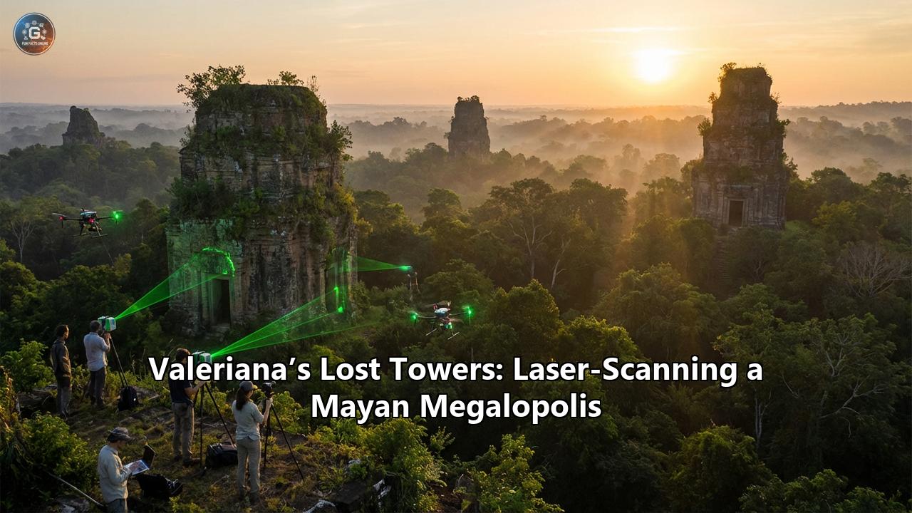
In 2013, a consortium of environmental scientists and forestry engineers conducted a massive survey of the Campeche region in Mexico. Their goal had nothing to do with ancient history; they were measuring carbon emissions and monitoring forest density. To do this, they used LiDAR (Light Detection and Ranging), a remote-sensing technology that fires billions of laser pulses from an aircraft to the ground. These pulses penetrate the gaps in the canopy, bounce off the earth, and return to the sensor, creating a highly detailed 3D map of the forest floor.
For a decade, this data sat on a server, its potential for archaeology completely unrecognized. It was merely a dataset for carbon monitoring.
Enter Luke Auld-Thomas, a PhD student at Tulane University. Auld-Thomas was researching Maya settlements and was hunting for LiDAR data, which is notoriously expensive to commission. On a hunch, he began scouring the internet for existing surveys.
"I was on something like page 16 of Google search," Auld-Thomas later recounted. Deep in the search results, he found the forgotten environmental survey. It was a file that thousands of people had likely scrolled past, but Auld-Thomas looked at it with an archaeologist’s eye.
When he processed the data to filter out the vegetation—a technique known as "digital deforestation"—the screen didn't show a random forest floor. It showed geometry. It showed right angles, causeways, reservoirs, and pyramids. It showed a ghost city the size of a modern capital, hiding in plain sight.
Part II: Anatomy of a Megalopolis
The city, which the team named Valeriana after a nearby freshwater lagoon, is not merely a collection of huts. It is a sprawling, sophisticated urban center that rivals the most famous Maya sites like Tikal and Calakmul.
1. The Scale of the Beast
Valeriana covers approximately 16.6 square kilometers (6.4 square miles). Within this area, the laser scans revealed a staggering density of settlement. The team identified over 6,764 structures. To put this in perspective, this density suggests that at its peak—roughly between 750 and 850 CE—Valeriana was home to 30,000 to 50,000 people. This population is larger than the number of people currently living in the entire region today.
2. The Two Monumental Precincts
The city is anchored by two major monumental centers, separated by about two kilometers but linked by a continuous web of settlement.
- The Political Core: The larger of the two precincts bears all the hallmarks of a Classical Maya political capital. It features enclosed plazas, broad causeways (sacbeob), and temple pyramids rising up to 15 meters (50 feet) high.
- The Ritual Spaces: The scans revealed an E-Group assemblage, a specific architectural alignment used by the Maya to track astronomical events like solstices and equinoxes. This suggests the city wasn't just a place of residence, but a center of high ceremonial importance and astronomical observation.
3. Infrastructure of an Empire
What makes Valeriana a "megalopolis" is not just the big temples, but the infrastructure that supported the daily life of its thousands of inhabitants:
- The Ball Court: A classic Mesoamerican ball court was identified, indicating a vibrant cultural and religious life where the ritual ballgame was played—a sport that often held cosmic significance involving life, death, and the movement of the sun.
- Water Management: The Maya were masters of hydraulics. Valeriana features a dammed reservoir, crucial for survival in a region with a porous limestone bedrock that does not retain surface water easily.
- Agricultural Terracing: Surrounding the urban core are extensive terraces and landscape modifications, proof that the Maya had engineered their environment to feed a massive population.
- The Amphitheater: Perhaps one of the most unique finds is a structure described as a curved amphitheater, a feature not commonly seen, suggesting unique acoustic or ceremonial gatherings.
Part III: The Technology Behind the Magic
To understand the magnitude of this discovery, one must understand the tool that made it possible. LiDAR has been described as the "Hubble Telescope of Archaeology."
How It Works
LiDAR works on the principle of echolocation, similar to a bat. A sensor mounted on an airplane or drone flies over a target area, firing hundreds of thousands of laser pulses per second.
- The Pulse: The laser beam travels to the ground.
- The Return: It hits an object—a leaf, a branch, or a stone—and bounces back.
- The "Point Cloud": The sensor records the time it takes for the light to return, calculating the distance.
- The Filter: Most pulses hit the trees. But in a forest, even a dense one, there are tiny gaps between leaves. A small percentage of the lasers hit the dirt floor and bounce back. By using software to "delete" the data points that represent trees, archaeologists are left with a "bare earth" model.
The Result
Suddenly, the jungle is gone. What remains is a topographical map of the ground surface, stripping away centuries of vegetation to reveal the scars of human modification. A hill that looked like a natural mound on foot is revealed to be a square pyramid. A dip in the ground becomes a canal. A ridge becomes a causeway.
In the case of Valeriana, the resolution was sharp enough to identify individual house platforms—the stone foundations where commoners would have built their perishable wooden homes. This allows researchers to count the population not just by guessing, but by literally counting the houses.
Part IV: Shattering the "Empty Tropics" Myth
For much of the 20th century, a prevailing theory in archaeology was that the Maya Lowlands were a place of low-density, slash-and-burn agriculture. The tropics, it was argued, were a harsh environment where "civilizations went to die," incapable of supporting massive urban populations due to poor soil and disease.
Valeriana drives a final nail into the coffin of that theory.
The discovery proves that the Maya landscape was heavily urbanized. Valeriana wasn't an isolated outpost; it was part of a dense network. The area surveyed showed a settlement density of 55.3 structures per square kilometer. This is comparable to the density of modern semi-urban environments.
This was not a civilization living "in" the jungle; this was a civilization that had tamed the jungle. They had transformed the landscape into a garden city, a managed environment of terraced fields, reservoirs, and stone highways that connected rural hamlets to massive urban cores.
"We found a large city with pyramids right next to the area's only highway," Auld-Thomas noted in an interview. "People have been actively farming among the ruins for years."This irony highlights how blind we are without the right tools. Modern farmers were ploughing fields literally on top of ancient plazas, unaware that beneath their feet lay the second-densest Maya site ever discovered.
Part V: The Collapse and the Lesson
The architecture of Valeriana suggests it flourished during the Classic Period (250–900 CE), with its peak population occurring just before the famous Maya Collapse (around 800–900 CE).
The sheer density of Valeriana offers a chilling new context for that collapse. When we look at a map of Valeriana, we see a landscape that is "full." Every available inch of arable land was terraced. Every drop of water was managed.
This lack of "slack" in the system suggests that when the great droughts of the 9th century arrived, the Maya of Valeriana had nowhere to go. There was no empty land to move to; their neighbors were just as crowded. The environmental stress, combined with the rigidity of such a high-density system, likely contributed to a rapid and devastating unraveling of their society.
It is a lesson that resonates with uncomfortable clarity in our modern world of 8 billion people, facing our own climate crises and resource limits.
Part VI: The New Age of Exploration
The discovery of Valeriana is not an ending; it is a beginning. The survey that revealed it covered only 122 square kilometers. The Maya Lowlands cover thousands of square kilometers.
If a city the size of a modern capital can hide in a random dataset found on page 16 of Google, what else is out there?
- The Unexcavated Future: The reality is that we will likely never excavate Valeriana. There are too many structures and too few archaeologists. The cost of clearing the jungle and restoring 6,000 buildings is prohibitive. Valeriana may remain a "digital city," explored primarily through screens and data.
- Crowdsourced Archaeology: This discovery democratizes exploration. It suggests that the next great discovery might not be made by a professor with a grant, but by a student with an internet connection and a curious mind.
Conclusion: The City That Waits
Valeriana stands as a testament to human ingenuity. It reminds us that the Americas were not a sparsely populated wilderness before European arrival, but a bustling, engineered, and sophisticated landscape of millions.
Today, the monkeys still howl from the trees covering the Temple of the Sun in Valeriana. The roots still grip the stones of the ball court. The city sleeps, as it has for a thousand years. But it is no longer lost. Through the light of a laser and the curiosity of a student, the ghost city has risen again, challenging us to look closer at the world we think we know.
The towers of Valeriana are not just stone; they are data points in a rapidly expanding map of human history, proving that even in the 21st century, our planet still has the power to surprise us.
Reference:
- https://www.sci.news/archaeology/maya-city-valeriana-13406.html
- https://www.gim-international.com/content/news/major-mayan-city-discovered-thanks-to-lidar-data
- https://hypebeast.com/2024/10/student-accidentally-discover-ancient-mayan-city
- https://bigthink.com/strange-maps/lidar-finds-valeriana/
- https://www.ladbible.com/news/uk-news/student-discovery-maya-city-mexico-valeriana-505926-20241029
- https://archaeologymag.com/2024/10/lasers-uncover-lost-maya-city-in-mexico/
- https://www.smithsonianmag.com/smart-news/found-dataset-reveals-lost-maya-city-hiding-in-plain-sight-beneath-a-mexican-forest-180985354/
- https://www.youtube.com/watch?v=S2l7eHehyhA
- https://www.jpost.com/archaeology/archaeology-around-the-world/article-826833
- https://news.artnet.com/art-world/lidar-reveals-lost-mayan-city-valeriana-2561336
- https://english.elpais.com/culture/2024-10-30/valeriana-the-ancient-mayan-city-found-thanks-to-laser-imaging.html
- https://www.heritagedaily.com/2024/10/study-reveals-thousands-of-previously-unknown-maya-structures-and-a-lost-city/153764
- https://www.youtube.com/watch?v=uXVL395hvfA
- https://en.wikipedia.org/wiki/Valeriana_(archaeological_site))
- https://diply.com/student-stumbles-on-ancient-mayan-city-that-could-spark-major-worldwide-change/
- https://matadornetwork.com/read/valeriana-ruins-discovered/