In the grand theater of human history, we often ascribe the fall of civilizations to the thunder of hooves, the clash of bronze, and the burning of palaces by conquering armies. We imagine the end as a singular, violent event—a sack, a siege, a usurper on the throne. Yet, the most potent destroyer of worlds has rarely been a sword-wielding barbarian. Instead, it has been the silent, invisible, and inexorable shifting of the winds and waters that sustain life.
This is the story of hydro-climatic shifts—sudden, often imperceptible changes in the delicate balance of precipitation and evaporation that have brought mighty empires to their knees. It is a chronicle not of battles, but of dried riverbeds, silted canals, and the terrifying silence of rain that never comes, or the roar of floods that never cease.
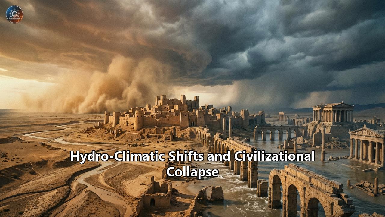
From the sun-baked plains of Mesopotamia to the steamy jungles of the Yucatan, from the orderly brick cities of the Indus to the golden spires of Angkor, the history of civilization is fundamentally a history of water. When the water systems that underpin complex societies fail, the collapse that follows is total, systemic, and often permanent. This article delves into the mechanisms of these shifts, the forensic evidence unearthed by modern science, and the harrowing stories of societies that faced the ultimate test of resilience—and failed.
Part I: The Mechanics of Doom – How the Climate Turns
To understand why a civilization collapses, we must first understand the engine that drives its prosperity. For the vast majority of ancient societies, this engine was the hydrological cycle. Agriculture, the bedrock of all sedentary society, is a gamble on the consistency of nature. It relies on the assumption that the rains of tomorrow will mimic the rains of yesterday. Hydro-climatic shifts shatter this assumption.
The Inter-Tropical Convergence Zone (ITCZ)
The primary driver of rainfall for the tropical and subtropical world—where most early civilizations arose—is the Inter-Tropical Convergence Zone. This is a band of low pressure girdling the Earth where the trade winds from the Northern and Southern Hemispheres collide. This collision forces warm, moist air upwards, creating the massive rain bands we know as monsoons.
Historically, the ITCZ is not stationary. It migrates north and south with the seasons. However, over centuries, it can permanently shift its average position due to changes in solar irradiance (the amount of energy from the sun) or volcanic forcing (particles blocking sunlight).
- The Mechanism: If the ITCZ shifts southward, the summer monsoons that water the crops of China, India, and Africa fail to reach their northernmost extent. The result is a "megadrought" in the northern latitudes of the tropics, while areas further south might experience catastrophic flooding.
- The Impact: This is not a simple dry spell. It is a systemic failure of the atmospheric moisture pump. For a civilization like the Indus Valley or the Maya, which depended on these seasonal rains to fill their reservoirs and flood their fields, an ITCZ shift is a death sentence.
Teleconnections: The Global Web
We now know that the Earth’s climate is a deeply interconnected web. A cooling in the North Atlantic Ocean can trigger a drought in the Middle East. This phenomenon, known as teleconnection, explains how localized climate events become global catastrophes.
- The North Atlantic Oscillation (NAO): When the surface temperatures of the North Atlantic cool, it alters the westerly wind patterns that carry moisture from the Mediterranean into the Middle East. A cooling event in the Atlantic can effectively shut off the tap for the Tigris and Euphrates watershed.
- El Niño Southern Oscillation (ENSO): The warming and cooling of the Pacific Ocean affects weather patterns globally. Intense El Niño events have been linked to river failures in Egypt (the Nile) and simultaneous floods in Peru.
The 4.2 Kiloyear Event
Perhaps the most studied and terrifying of these mechanisms is the "4.2 ka event," a massive, abrupt global aridification that occurred around 2200 BCE.
- The Evidence: It is visible in speleothems (cave stalagmites) in Italy, ice cores in the Andes, and dust layers in the Gulf of Oman.
- The Result: It caused a simultaneous crisis in Old Kingdom Egypt, the Akkadian Empire in Mesopotamia, the Liangzhu culture in China, and the Indus Valley Civilization. It serves as the ultimate proof that civilization is fragile when the planetary thermostat flickers.
Part II: The Curse of Akkad – The First Empire’s Thirst
Around 2334 BCE, Sargon of Akkad forged the world's first true empire. He united the disparate city-states of Sumer and Akkad, stretching his rule from the Persian Gulf to the headwaters of the Euphrates. It was a bureaucratic marvel, fed by the "breadbasket" of northern Mesopotamia—the rain-fed agricultural plains of the Khabur Triangle.
Yet, less than two centuries later, the empire evaporated. For decades, historians blamed the "Gutian barbarians" for the collapse, citing ancient texts that described invasions. But the dirt tells a different story.
The Forensic Evidence: Tell Leilan
In the 1990s, excavations at Tell Leilan, a major Akkadian provincial capital in Syria, revealed a shocking stratigraphy.
- The Dead City: Archaeologist Harvey Weiss found a layer of occupation rich with pottery and walls, followed abruptly by a "hiatus" layer—a meter of wind-blown dust and sand, devoid of human habitation, lasting nearly 300 years.
- The Shards of Glass: Within this dust, soil micromorphology revealed traces of volcanic glass, hinting that a volcanic winter might have triggered a sudden drying of the atmosphere.
- Marine Cores: In the Gulf of Oman, hundreds of miles downwind, deep-sea cores showed a massive spike in dolomite dust around 2200 BCE. This dust could only have come from Mesopotamia. The winds had stripped the fertile topsoil of the Akkadian breadbasket and dumped it into the sea.
The "Curse of Akkad"
Ancient texts, once dismissed as metaphor, suddenly read like reportage. The Curse of Akkad, a poem written a century after the collapse, vividly describes the effects of this hydro-climatic shift:
"The large fields and acres produced no grain / The flooded fields produced no fish / The watered gardens produced no syrup and wine / The gathered clouds did not rain... He who slept on the roof, died on the roof / He who slept in the house, had no burial / People were flailing at themselves from hunger."
The "Curse" describes inflation—"Grain for one shekel was only half a litre"—and the breakdown of social order. The collapse was not just agricultural; it was a total societal disintegration. As the northern plains dried up, refugees flooded the south, overwhelming the irrigation systems and leading to conflict that the weakened state could not control. The Gutians didn't destroy the empire; they merely walked into the ruins of a house already destroyed by the wind.
Part III: The Maya – The Water Trap
Across the ocean, nearly three millennia later, the Classic Maya civilization of the Yucatan lowlands reached a zenith of artistic and architectural sophistication. They built Tikal, Calakmul, and Palenque—cities of stone in a jungle environment that is deceptively water-poor.
The Maya lived on a "karst" landscape—a porous limestone shelf where rainwater instantly drains into underground aquifers, inaccessible to ancient technology. They were entirely dependent on surface reservoirs and the regularity of the rainy season. They had engineered their way out of water scarcity with massive, plaster-lined cisterns. But this engineering created a "rigidity trap."
The Stalagmite Records
In the Yok Balum cave in Belize and the Tzabnah cave in the Yucatan, scientists have analyzed oxygen isotopes in stalagmites. These mineral formations grow layer by layer, trapping the chemical signature of the rainwater that formed them.
- The Data: The isotopes reveal a series of "megadroughts" between 800 and 1000 AD. Rainfall decreased by 40-50% for decades at a time, with peak reduction up to 70%.
- The Timing: These droughts align perfectly with the dates carved onto the last monuments of the Maya kings. One by one, the cities stopped writing their history.
Poisoned Wells: The Tragedy of Tikal
At Tikal, the collapse was visceral. The city's reservoirs, vital for survival during the dry season, turned into toxic traps.
- Mercury and Algae: Recent chemical analysis of reservoir sediments found dangerous levels of mercury (likely leached from the cinnabar pigment the Maya used to paint their temples and ceramics red) and toxic cyanobacteria (blue-green algae).
- The Scenario: As the droughts deepened, water levels dropped, concentrating the pollutants. The water became undrinkable. The "Life-Giving Waters" that gave the King his legitimacy turned into poison. A king who could not bring rain was useless; a king who provided poisoned water was an enemy. The archaeological record shows palaces burned and the elite class violently overthrown or vanishing before the jungle reclaimed the stone.
Part IV: The Indus Valley – The Peaceful Retreat
Not all collapses are violent. The Indus Valley Civilization (or Harappan Civilization), which spanned modern-day Pakistan and India, offers a fascinating counter-narrative of resilience through de-urbanization.
Between 2600 and 1900 BCE, the Harappans built the world's most sophisticated cities. Mohenjo-Daro and Harappa featured grid streets, standard brick sizes, and the world's first urban sanitation systems with flush toilets. They had no palaces, no temples, and no glorification of warfare.
The Monsoon Shift
The Indus civilization flourished during a period when the summer monsoons were strong enough to feed the river systems but not so strong as to cause destructive flooding. Around 1900 BCE, the ITCZ shifted eastward and southward.
- The Drying of the Ghaggar-Hakra: This shift caused the summer monsoon rains to dry up over the Indus basin. The Ghaggar-Hakra river, once a mighty waterway supporting hundreds of settlements, became ephemeral and then vanished.
- Winter Rain Reliance: The population was forced to rely on the less predictable winter rains.
The Great De-Urbanization
Unlike Akkad, there are no layers of ash or mass graves at most Indus sites. Instead, we see:
- Pottery devolution: The "Late Harappan" pottery becomes coarser, less standardized, and more localized. The unified "Indus style" breaks down.
- Migration: The population didn't die out; they moved. Maps of settlement patterns show a massive drift from the large river cities toward the Himalayan foothills and the Ganges plain to the east.
- Ruralization: They traded their great brick cities for smaller, resilient villages. They abandoned the "high culture" of writing and standardized weights to survive as smaller agricultural units.
The Indus civilization didn't "collapse" in the sense of extinction; it disassembled itself. The city was a luxury they could no longer afford, so they let it go. It is a lesson in scaling down to survive—a strategy of "simplification."
Part V: Liangzhu – The Drowning of the Jade Kings
While drought is the most common killer, the Liangzhu culture in the Yangtze Delta (c. 3300–2300 BCE) teaches us that too much water is equally deadly.
Liangzhu was "China’s Venice of the Stone Age." It was a civilization of immense hydraulic capability, pre-dating the legendary dynasties. They built a massive peripheral water control system—dams and levees—that protected their city and allowed for the cultivation of rice on a grand scale. Their elites were buried with thousands of finely carved jade "cong" cylinders, evidence of immense wealth.
The Clay Layer
For years, archaeologists were puzzled by the site's abrupt abandonment. The city walls were preserved, but the civilization vanished.
- The Flood: Recent excavations found a thin, uniform layer of yellow clay covering the ruins. This was not wind-blown dust; it was flood sediment.
- The Mechanism: Isotope analysis of stalagmites from nearby caves indicates a period of extreme precipitation—an intensified East Asian Summer Monsoon combined with El Niño anomalies.
- The Failure: The very dams and levees that allowed Liangzhu to flourish eventually failed. A series of catastrophic floods or storm surges overwhelmed the system. The yellow clay layer represents the moment the water control system was breached, burying the rice paddies and the city in silt. The civilization was literally washed away, and the region remained uninhabited for centuries, too swampy for human resettlement.
Part VI: Angkor – The Fragility of Complexity
The Khmer Empire (9th–15th century) was the largest pre-industrial city in the world. Angkor was a "hydraulic city," a sprawling low-density urban complex defined by its massive reservoirs (barays) and canals. The West Baray alone held 53 million cubic meters of water. This network stabilized the rice harvest, smoothing out the peaks and troughs of the monsoon.
But complexity breeds vulnerability.
The Tree Ring "Megadroughts"
Dendrochronology (tree-ring study) of the Fokienia hodginsii cypress in Vietnam provided the smoking gun for Angkor's fall.
- The Swing: The rings reveal a decades-long "megadrought" in the mid-1300s, followed by intense, biblical monsoons, and then another drought in the early 1400s.
- Infrastructure Shock: The drought lowered the water levels in the barays, allowing sediment to settle and clog the canals. When the intense rains finally returned, they didn't save the city—they destroyed it. The hardened, silted canals couldn't handle the sudden volume of water.
- Cascading Failure: The water smashed through the diversion structures. Archaeologists have found the "Great North Canal" filled with coarse sand and breached dykes. The system that managed the water began to cannibalize itself. To fix the breaches would have required massive labor, but the population was likely weakened by famine and disease.
- The Abandonment: The infrastructure became a burden rather than an asset. The ruling center moved south to Phnom Penh, closer to the trading opportunities of the coast, leaving the stone temples of Angkor to the forest.
Part VII: The Ancestral Puebloans – Social Fragility
In the American Southwest, the Ancestral Puebloans (formerly called Anasazi) built the spectacular cliff dwellings of Mesa Verde and the great houses of Chaco Canyon. Around 1276–1299 AD, a "Great Drought" hit the region.
However, the Puebloans had survived droughts before. Why did this one lead to the permanent abandonment of the Four Corners region?
The Violence of the End
Recent archaeology suggests that social rigidity made the environmental stress lethal.
- Chaco’s Reach: The Chacoan system was a complex hierarchy where outlying communities sent food and tribute to the central "Great Houses." This system relied on the belief that the elites could mediate with the gods for rain.
- Delegitimization: When the rain stopped for 23 years, the religious mandate of the elites evaporated.
- Conflict: We find evidence of extreme violence—burned kivas (religious chambers) and unburied bodies with signs of trauma. It appears that the people didn't just leave; they revolted against the system that failed them.
- Reorganization: They migrated south to the Hopi mesas and the Rio Grande, forming new, more egalitarian societies. They rejected the hierarchy of Chaco. The collapse was a social revolution triggered by climate stress.
Part VIII: Lessons for the Modern World
The parallels between these ancient catastrophes and our current trajectory are chilling. We are currently inducing a hydro-climatic shift of unprecedented speed.
- The Fragility of Complexity: Like Angkor, our modern cities rely on rigid, massive infrastructure (dams, aqueducts, levees) that is designed for a specific climate niche. If the variance of rainfall exceeds the design parameters of this infrastructure (e.g., the Hoover Dam water levels), the system can fail catastrophically.
- The Threat Multiplier: Climate change is rarely the sole killer. It acts as a "threat multiplier." It exacerbates existing social tensions (inequality, political polarization), just as it did for the Puebloans and the Akkadians. A hungry population loses faith in its institutions.
- Migration as Adaptation: In almost every historical case, the ultimate adaptation was mass migration. The Indus people moved; the Maya moved; the Puebloans moved. Today, borders and nation-states make this traditional survival mechanism incredibly difficult, turning a survival strategy into a geopolitical crisis.
- The "Squatter" Phase: At Tell Leilan, the glorious temples were eventually occupied by squatters who built rough ovens in the palaces. This image—of survivors living in the ruins of a high-energy society they can no longer maintain—is a potent warning against hubris.
Conclusion
Civilizations are not fortresses; they are bubbles floating on a sea of climate stability. When that sea turns rough, the bubble pops. The ruins of Akkad, Angkor, and Tikal are not just tourist destinations; they are data points. They remind us that the earth’s systems are powerful, volatile, and indifferent to our monuments. Survival depends not on the height of our walls, but on the flexibility of our societies and our respect for the water that sustains us.
Reference:
- https://www.youtube.com/watch?v=lim6cp00cA4
- https://leilan.yale.edu/sites/default/files/publications/article-specific/weiss_et_al_2012_tell_leilan_imperialization_collapse_14c_seven_generations_pp_163-192.pdf
- https://en.wikipedia.org/wiki/Late_Bronze_Age_collapse
- https://english.elpais.com/science-tech/2025-08-13/the-mayan-civilization-experienced-44-years-of-drought-in-its-last-two-centuries.html
- https://mythicremembering.com/books/the-curse-of-agade/
- https://popular-archaeology.com/article/extreme-droughts-did-not-always-coincide-with-mayan-abandonment-of-sites-such-as-chichen-itza/
- https://coloradoencyclopedia.org/article/cliff-palace
- https://www.angkor-temples-in-cambodia.com/west-baray.html
- https://www.youtube.com/watch?v=_A5qylkJKiM
- https://www.smithsonianmag.com/smart-news/maya-abandoned-city-tikal-researchers-may-now-know-why-180975242/
- https://www.researchgate.net/figure/Structures-of-some-of-the-key-sites-at-the-Liangzhu-City-A-Excavation-of-the-rock-base_fig5_321505754
- https://npshistory.com/series/archeology/bae/bul/51/sec11.htm
- https://leilan.yale.edu/about-project/excavations/acropolis-northeast-temples
- https://www.worldhistory.org/article/748/the-curse-of-agade-naram-sins-battle-with-the-gods/
- https://www.smithsonianmag.com/smart-news/climate-change-was-culprit-in-collapse-of-ancient-chinese-culture-180979149/
- https://www.pnas.org/doi/10.1073/pnas.1710516114
- https://www.ancient-origins.net/news-history-archaeology/liangzhu-culture-0016119
- https://www.pnas.org/doi/10.1073/pnas.1111282109