Cyclone Genesis: The Science of How Major Storms Form
From the vast, sun-drenched expanse of tropical oceans, a monster is born. It begins as a whisper, a gentle disturbance in the atmosphere, but under the right conditions, it can grow into a colossal, swirling vortex of wind and rain—a cyclone. These powerful storms, known as hurricanes in the Atlantic and Northeast Pacific, and typhoons in the Northwest Pacific, are some of the most destructive forces in nature. But how do these behemoths of the atmosphere come into being? The science of cyclone genesis is a complex interplay of ingredients and stages, a dramatic story of energy transfer from the warm ocean to the sky.
The Essential Ingredients for a Cyclone's Birth
For a cyclone to form, a specific set of atmospheric and oceanic conditions must align, creating a perfect storm of circumstances. There are six key ingredients necessary for tropical cyclogenesis, the process of a tropical cyclone's formation and intensification.
1. Warm Ocean Waters: The primary fuel for a cyclone is warm, moist air. This is why these storms only form over tropical oceans where the sea surface temperature is at least 26.5°C (79.7°F) to a depth of at least 50 meters. This warm water provides the energy needed to create and sustain the storm. 2. Atmospheric Instability: The atmosphere must be unstable, meaning that a parcel of air, if given an upward push, will continue to rise. This allows for the development of the towering thunderstorms that are the building blocks of a cyclone. This instability is often created when there is a significant difference in temperature between the warm, moist air at the surface and the cooler, drier air above. 3. High Humidity: A deep layer of moist air is crucial for cyclone formation. High humidity in the lower and middle levels of the troposphere provides the necessary water vapor that will later condense and release latent heat, which is the primary energy source for the storm. 4. The Coriolis Effect: The rotation of the Earth imparts a spin to the atmosphere, a phenomenon known as the Coriolis effect. This force is what gives a cyclone its characteristic rotation—counter-clockwise in the Northern Hemisphere and clockwise in the Southern Hemisphere. For this reason, cyclones rarely form within 5 degrees of the equator, where the Coriolis effect is too weak to initiate the necessary spin. 5. A Pre-existing Disturbance: Cyclones don't just appear out of nowhere. They need a pre-existing low-level weather disturbance to act as a "seed." This can be a tropical wave, a trough of low pressure, or a cluster of thunderstorms. These disturbances provide the initial focus for the convergence of warm, moist air. 6. Low Vertical Wind Shear: Vertical wind shear is the change in wind speed and direction with height in the atmosphere. For a cyclone to form and strengthen, there must be low vertical wind shear. High wind shear will essentially "tear the storm apart" by tilting its vertical structure and preventing the organized circulation from developing.The Life Cycle of a Cyclone: From Whisper to Roar
The journey from a gentle disturbance to a monstrous major storm is a fascinating and often rapid process, marked by distinct stages of development.
Stage 1: The Tropical Disturbance
The very beginning of a cyclone's life is as a tropical disturbance, a cluster of thunderstorms with a slight atmospheric circulation. At this early stage, there are no closed isobars (lines of equal pressure) around the area of low pressure. These disturbances are common in the tropics and are often associated with cloudy skies and some rainfall. Many of these disturbances dissipate without ever developing further.
Stage 2: The Tropical Depression
If the conditions are favorable, the tropical disturbance can become more organized. As the pressure in the center of the storm drops, winds begin to circulate more strongly around a central point. When sustained wind speeds reach at least 20 knots (23 mph), the disturbance is upgraded to a tropical depression. A key characteristic of this stage is the presence of at least one closed isobar.
Stage 3: The Tropical Storm
As the storm continues to intensify and draw more energy from the warm ocean waters, its wind speeds increase. Once sustained winds reach 35 knots (39 mph), the tropical depression is upgraded to a tropical storm and is given a name. The storm becomes more organized, with a more defined circular shape and the beginnings of spiral rainbands. At this point, the storm is considered "self-sustaining," meaning it no longer needs external factors to maintain its structure and can even intensify on its own.
Stage 4: The Hurricane, Typhoon, or Cyclone
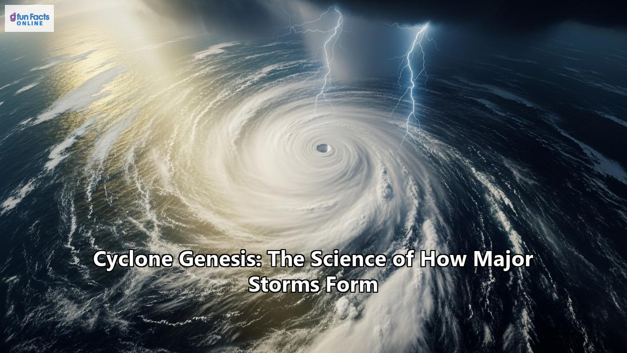
When sustained wind speeds exceed 64 knots (74 mph), the storm officially becomes a hurricane, typhoon, or cyclone, depending on its location. A pronounced rotation develops around a central core, and the storm's structure becomes highly organized. The iconic eye of the storm, a calm and often clear area at the center, begins to form. Surrounding the eye is the eyewall, a ring of intense thunderstorms where the strongest winds and heaviest rainfall are found.
The intensification to a major storm, classified as Category 3 or higher on the Saffir-Simpson Hurricane Wind Scale, is a dramatic process. As the central pressure of the storm continues to drop, the pressure gradient between the eye and the eyewall steepens, causing the winds to accelerate. The release of latent heat from condensation in the towering cumulonimbus clouds of the eyewall fuels this intensification, creating a powerful and destructive engine.
Where Cyclones Are Born: The World's Storm Basins
Tropical cyclones form in seven distinct ocean basins around the world. These basins provide the necessary warm water and atmospheric conditions for storm development. The names given to these storms vary by region.
- North Atlantic Basin: This basin includes the North Atlantic Ocean, the Caribbean Sea, and the Gulf of Mexico. Storms here are called hurricanes. The hurricane season officially runs from June 1 to November 30, with a peak in activity around September 10. Many of the more intense Atlantic hurricanes are "Cape Verde-type" storms, which form off the coast of Africa.
- Northeast Pacific Basin: This is the second most active basin in the world and has the highest number of storms per unit area. The hurricane season runs from May 15 to November 30. Storms that form here are also called hurricanes.
- Northwest Pacific Basin: This is the most active tropical cyclone basin on Earth, accounting for about one-third of all tropical cyclone activity. Storms in this basin, called typhoons, can form year-round, but the main season is from July to November.
- North Indian Basin: This basin is the least active worldwide, with only four to six storms per year. It has a double peak in its season, with one in April and May and another in October and November. Storms here are called cyclones.
- Southwest Indian Basin: Storms in this basin, also called cyclones, typically form between late October and May.
- Southeast Indian/Australian Basin: The season for these cyclones runs from late October to May.
- Australian/Southwest Pacific Basin: Similar to the other Southern Hemisphere basins, the cyclone season here is from late October to May.
The typical paths of cyclones are influenced by the prevailing winds. In the tropics, they are generally steered westward by the trade winds. As they move poleward, they often encounter the westerly winds of the mid-latitudes, which can cause them to recurve and track eastward. High-pressure systems, such as the Bermuda High in the Atlantic, also play a significant role in steering these storms.
The Unseen Forces: Factors that Inhibit Cyclone Development
While the right ingredients can create a powerful storm, there are also factors that can hinder or even prevent a cyclone's formation and intensification.
- High Vertical Wind Shear: As mentioned earlier, strong vertical wind shear is a major inhibitor of cyclone development. It disrupts the vertical structure of the storm, preventing it from organizing and strengthening.
- Dry Air Intrusion: Dry air can be drawn into a developing cyclone, which suppresses the formation of thunderstorms and weakens the storm by reducing the release of latent heat.
- Cooler Sea Surface Temperatures: If a storm moves over cooler waters, it loses its primary source of energy and will begin to weaken.
- Landfall: When a cyclone makes landfall, it is cut off from the warm, moist air of the ocean that fuels it. The increased friction over land also helps to disrupt the storm's circulation. As a result, cyclones rapidly weaken and dissipate after moving over land.
The Watchful Eye: How We Forecast and Track Cyclones
Predicting the path and intensity of a cyclone is a complex and crucial task. Meteorologists use a variety of sophisticated tools and technologies to monitor these storms from their inception to their decay.
Satellites: Geostationary and polar-orbiting satellites are the workhorses of cyclone tracking. They provide continuous, real-time imagery of the storms, allowing forecasters to monitor their development, movement, and changes in intensity. Infrared imagery is particularly important, as it shows the temperature of the cloud tops, which can be used to estimate the storm's strength. Aircraft Reconnaissance: "Hurricane hunter" aircraft are flown directly into storms to collect vital data. These planes are equipped with instruments called dropsondes, which are released into the storm to measure temperature, humidity, pressure, and wind speed. This data provides a detailed, three-dimensional picture of the storm's structure and intensity. Radar: As a cyclone approaches land, coastal Doppler radar is used to track its movement and to provide detailed information on its rainfall and wind fields. Computer Models: A wide array of computer models are used to forecast the future track and intensity of cyclones. These models can be broadly categorized into two types:- Dynamical Models: These are complex models that use sophisticated mathematical equations to simulate the physics of the atmosphere. They require powerful supercomputers to run but are generally the most accurate, especially for forecasting a storm's track.
- Statistical Models: These models use historical data on past storms to predict the future behavior of a current storm. They are less computationally intensive and can be run on personal computers.
Forecasters often use a "consensus" approach, combining the output of multiple models to create a more reliable forecast. Visualizations like "spaghetti plots" show the predicted tracks from various models, giving a sense of the uncertainty in the forecast.
A Changing Climate, A Fiercer Storm
The science of cyclone genesis is not static. Our planet's climate is changing, and this is having a profound impact on these powerful storms. While there is still some debate about whether the overall number of cyclones is increasing, there is a growing consensus that the storms that do form are becoming more intense.
- Warmer Oceans, Stronger Storms: As the oceans warm due to climate change, there is more energy available to fuel cyclones. This is leading to an increase in the proportion of major hurricanes (Category 4 and 5).
- More Rain, More Flooding: A warmer atmosphere can hold more moisture. This means that cyclones are producing more rainfall, leading to an increased risk of devastating inland flooding.
- Higher Storm Surges: Global sea level rise, driven by the melting of ice sheets and the thermal expansion of ocean water, is making coastal storm surges more dangerous. A higher baseline sea level means that the same storm surge can penetrate further inland, causing more widespread flooding.
- Rapid Intensification: There is evidence to suggest that climate change is contributing to more frequent instances of rapid intensification, where a storm's wind speeds increase dramatically in a short period. This makes it more difficult to forecast a storm's intensity and gives coastal communities less time to prepare.
Lessons from the Past: Historical Cyclones
Throughout history, major cyclones have left an indelible mark on human societies. Studying these storms provides valuable insights into their destructive power and helps us to better prepare for future events.
- The Great Bhola Cyclone (1970): This devastating cyclone struck present-day Bangladesh and is considered the deadliest tropical cyclone in recorded history, with an estimated death toll of 300,000 to 500,000 people. The storm's catastrophic storm surge, estimated at up to 10.5 meters (35 feet), inundated the low-lying coastal areas.
- Hurricane Katrina (2005): Katrina was one of the costliest natural disasters in U.S. history, causing an estimated $125 billion in damages. While it made landfall as a Category 3 hurricane, its massive size and earlier intensity generated a huge storm surge that breached the levees protecting New Orleans, leading to widespread flooding.
- Typhoon Tip (1979): Tip holds the record for the largest tropical cyclone ever observed, with a diameter of over 2,200 kilometers (1,380 miles). It also had the lowest central pressure ever recorded, at 870 millibars.
- Hurricane Patricia (2015): This powerful storm set the record for the highest sustained wind speeds in the Western Hemisphere, at 215 mph.
- Hurricane Harvey (2017): Harvey demonstrated the devastating potential of extreme rainfall from a slow-moving hurricane. It stalled over Texas, dropping more than 60 inches of rain in some areas, leading to catastrophic flooding.
The science of cyclone genesis is a testament to the immense power of our planet's climate system. From the intricate dance of atmospheric and oceanic conditions that give birth to these storms to the cutting-edge technology we use to track them, the study of cyclones is a field of constant discovery. As our world continues to warm, understanding the science behind these major storms will be more critical than ever in our efforts to mitigate their impact and protect vulnerable communities around the globe.
Reference:
- https://www.hurricanescience.org/science/forecast/models/modelswork/index.html
- https://wmo.int/content/tropical-cyclone-forecasting
- https://www.thoughtco.com/most-powerful-hurricanes-and-typhoons-in-world-history-3443613
- https://publicsafety.ieee.org/topics/hurricane-tracking-technology-advancements-and-opportunities/
- https://www.britannica.com/science/tropical-cyclone/Tracking-and-forecasting
- https://en.wikipedia.org/wiki/Tropical_cyclone_forecast_model
- https://www.13newsnow.com/article/weather/hurricane/hurricane-fast-facts-how-hurricane-models-work/291-71b35f2f-807d-4b5d-b1a4-b2eb58196545
- https://aussieanimals.com/conservation/environmental/biggest-cyclones-in-history/
- https://www.wunderground.com/hurricane/articles/deadliest-tropical-cyclones
- https://www.mdpi.com/journal/atmosphere/special_issues/2YAIE601HM
- https://www.hurricanescience.org/science/forecast/models/index.html
- https://en.wikipedia.org/wiki/List_of_the_deadliest_tropical_cyclones
- https://ayokasystems.com/news/harnessing-tech-to-predict-and-prepare-for-hurricanes-like-never-before/
- https://en.wikipedia.org/wiki/Tropical_cyclone_observation
- https://science.howstuffworks.com/nature/climate-weather/storms/spaghetti-models.htm
- https://www.britannica.com/science/10-Deadliest-Cyclones-in-History
- https://www.hurricanescience.org/history/storms/index.html
- https://en.wikipedia.org/wiki/List_of_tropical_cyclone_records
- https://collectiveweather.com/worldwide-hurricane-records/